Avata in the Watershed: A Mountain Coastline Case Study
Avata in the Watershed: A Mountain Coastline Case Study in Smarter Hydrology Imaging
META: A field-based case study on using Avata for hydrology monitoring along mountain coastlines, covering reservoir measurement, river observation, terrain challenges, and why agile aerial sensing matters for water resource teams.
When people talk about drones in water management, the conversation often drifts toward generic aerial views. That misses the point. In the field, especially where mountain terrain collides with coastline conditions, the real value is not simply seeing more. It is seeing sooner, reaching places crews cannot easily access, and turning fast-moving visual data into useful hydrology decisions.
That is where Avata becomes interesting.
I approached this case study through the lens of a photographer, but the setting was not built around cinematic flying for its own sake. The assignment centered on a mountain-coast watershed corridor: steep slopes feeding narrow streams, runoff crossing damaged access tracks, and a reservoir system that needed frequent visual checks after unstable weather. The brief was practical. Capture the waterline. Document upstream and downstream conditions. Produce imagery that could support later inspection mapping. Do it without slowing the field team.
Those priorities line up closely with what hydrology drone operations actually need. The reference material behind this article makes that clear: UAVs have become valuable because they improve the outdoor working efficiency of water-resource survey teams, help generate accurate water-area measurements and geographic information, and support later production of inspection maps. That combination matters more than flashy specs. It means one flight can contribute to immediate situational awareness and to the recordkeeping that follows.
Why this environment challenges conventional aerial monitoring
A mountain coastline creates a messy operational picture. Wind shifts off ridges. Moisture hangs over inlets. Access roads disappear into washouts. A crew trying to inspect a reservoir, dam area, or river reach from the ground spends too much time getting into position and not enough time collecting usable data.
Traditional methods have obvious limits. Satellite imagery may lack timing and local resolution when conditions change quickly. Manned aircraft can cover large areas, but they are not always suited to tight terrain, short-notice missions, or repeated low-altitude observation runs. The source material explicitly points out that UAV aerial remote sensing helps compensate for the shortcomings of satellite remote sensing and crewed aviation. In practice, that is not an abstract advantage. It is the difference between waiting for data and making decisions while the scene is still unfolding.
With Avata, the strength is not that it replaces a full survey platform in every mission. It does something else well: it gets into constrained visual corridors quickly, carries a stable camera into irregular terrain, and captures real-time imagery in places where hesitation usually costs time.
The field mission: reservoir edge, river color, and an unexpected bird pass
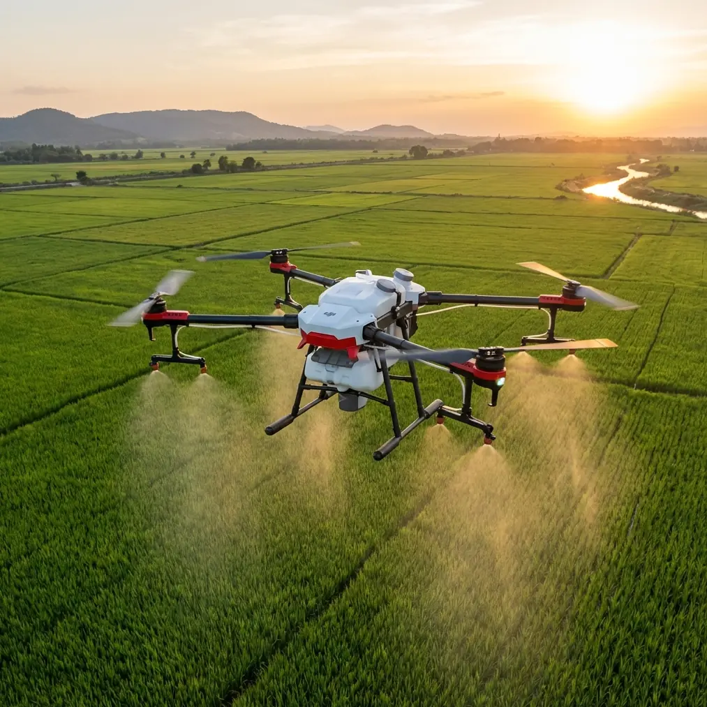
The most revealing part of the day came near a reservoir shoulder where the mountain dropped sharply toward a narrow river channel. We needed a clean sequence showing the current storage condition, then a low pass tracking discoloration downstream after runoff entered from a disturbed slope. That sounds straightforward until you factor in trees leaning over the cut, gusting wind, and the fact that the access path below was partially washed out.
This is where agile flying starts to matter. The drone had to move from broad contextual framing into close terrain-following passes without repeated resets. During one run, a large coastal bird cut across the flight line from the cliff side. Avata’s sensing and collision-aware design gave me enough margin to break off the line cleanly, hold control, and re-route without turning the encounter into a crash or a blind evasive guess. That kind of moment is easy to romanticize, but operationally it reinforces a serious point: obstacle awareness is not just for protecting equipment. In dense or irregular water-management terrain, it helps preserve continuity of the mission.
If your goal is documenting a reservoir embankment, a vulnerable river bend, or erosion near hydraulic infrastructure, a forced landing or broken shot sequence means more than a missed photo. It can delay the survey team and break the chain of visual evidence they need for assessment.
What Avata contributed beyond image capture
In civilian water-resource work, visual speed has value only if it leads to usable interpretation. The source document highlights several concrete monitoring goals: quickly and accurately measuring reservoir storage conditions, observing upstream and downstream river water quality conditions, and strengthening real-time monitoring over reservoirs and dam work zones.
Each of those tasks benefits from a different flight style.
For reservoir storage condition, I used elevated orbiting passes and repeatable edge-angle compositions. The point was not to create dramatic perspective. It was to record shoreline position, exposed bank, and inflow context in a way that could be reviewed later against prior imagery. QuickShots-style movement patterns are often treated as creative tools, but in this kind of work they can also help produce consistent visual geometry across multiple visits.
For river quality observation, the lower and more controlled runs mattered more. Water color shifts, suspended sediment plumes, and surface disturbance patterns become easier to interpret when the camera path is steady and the angle is deliberate. D-Log capture helps here. Not because a water bureau needs “cinematic color,” but because a flatter profile can preserve tonal detail in bright reflections and dark banks, which is useful when reviewing footage under harsh contrast.
For dam-zone or reservoir-side work monitoring, real-time transmission is the feature nobody appreciates until the team needs it. The reference material emphasizes the importance of real-time video imagery and notes that UAV systems provide strong immediacy. In the field, that means a supervisor does not have to wait for post-processing to know whether a spillway edge, slope repair zone, or intake-adjacent area deserves a closer look.
The operational significance of mobility
One of the strongest ideas in the reference data is mobility. The document repeatedly stresses that UAV systems are flexible, portable, and less restricted by terrain and landform conditions. That is exactly what defined the mission.
The coastline segment we worked was not long in map distance, but the mountain made it operationally large. To inspect it on foot would have required detours, elevation changes, and at least one area the team considered unsafe for direct approach after rain. Avata cut through that friction. We could launch from a stable overlook, make fast visual runs to the reservoir margin, then transition toward the stream mouth and damaged slope without relocating the whole team each time.
That mobility translated into two practical gains straight from the source material:
- Reduced manual workload.
- Shorter inspection cycles with better timeliness and accuracy.
Those are not just management phrases. They define whether water-resource personnel spend a day collecting information or chasing it.
Erosion and watershed change: where repeat flights become valuable
The source document makes another point that deserves more attention. It states that UAV remote sensing can perform real-time dynamic monitoring of soil erosion causes, intensity, impact range, and even the effects of mitigation measures. For a mountain coastline, that is huge.
These landscapes change in layers. A drainage cut widens. Vegetation cover thins. A construction area alters runoff paths. Sediment reaches downstream zones that did not show stress the month before. Ground teams can identify pieces of that story, but repeated drone flights reveal how the pieces connect.
Avata is not a replacement for larger mapping systems when centimeter-grade survey deliverables are required, but it is highly effective as a nimble documentation tool for interim checks, visual baselines, and terrain storytelling. If a watershed team is tracking whether exposed soil from a slope intervention is affecting lower channels, frequent low-friction flights can catch changes before they become expensive surprises.
In this case, we used Hyperlapse sequences from fixed viewpoints to show shifting cloud shadow, tidal brightness, and runoff movement over time. That produced more than attractive footage. It gave stakeholders a compressed visual record of environmental behavior that would be difficult to absorb from isolated stills alone.
Why “real-time” matters more during weather pressure
Hydrology work is often driven by timing rather than convenience. The reference text explicitly connects UAV usefulness to frequent disasters and difficult weather impacts, including floods and droughts. It also notes that drones can reach hazardous zones for real-time on-site detection.
That is the piece many readers underestimate. During unstable conditions, the question is rarely “Can we get aerial content?” The question is “Can we get reliable visual information before the field picture changes again?”
In mountain-coast water systems, that window is short. River color can shift in an hour. Surface debris can collect around structures and move on. Access that is barely possible in the morning may be blocked in the afternoon. An Avata deployment is valuable because it lowers the threshold for action. Teams do not need a major aerial campaign to answer targeted questions about a basin edge, downstream channel, or worksite exposure.
About the “creative features” everyone asks about
Yes, people searching for Avata often want to know about ActiveTrack, subject tracking, obstacle avoidance, and automated modes. In a hydrology context, these are not novelty items. They become useful when carefully translated into inspection workflow.
Obstacle avoidance supports safer low-altitude work near trees, rock faces, and utility-side structures.
Subject tracking principles can help when following a moving inspection boat or documenting a field crew’s relation to shoreline conditions, though this should always be done within site safety and privacy protocols.
QuickShots can create repeatable flight motions that make before-and-after comparison easier.
Hyperlapse can compress environmental changes into a readable timeline.
D-Log helps preserve detail for footage review in contrast-heavy scenes.
The key is discipline. Water-resource imaging is not better because the drone has more modes. It is better when those modes reduce ambiguity.
A photographer’s takeaway from a hydrology job
What struck me most in this assignment was how little separation exists between “good visual work” and “useful operational work” when the tool is deployed correctly. The same stable framing that makes footage readable also helps a survey team compare bank exposure. The same low, precise pass that creates immersion also reveals sediment spread beneath a cliff runoff point. The same fast setup that suits a short creative session also helps a water team inspect more ground before weather closes in.
That is why the reference claim about UAVs being “irreplaceable” for certain survey and mapping support tasks does not feel exaggerated in context. When a field team needs fast, accurate visual coverage for water-area assessment, water-related geographic information, and later inspection map production, the practical advantages stack up quickly.
If you are planning a similar mountain-coast operation and want to discuss flight approach, imaging settings, or how to structure a civilian watershed documentation workflow, you can message the field coordination desk here.
The broader lesson for Avata users in water environments
Avata makes sense in hydrology not because it turns infrastructure inspection into entertainment, but because it fits the rhythm of real field work. Portable launch. fast repositioning. useful real-time imagery. enough agility to work around terrain that slows everyone else down.
The source material lays out the bigger institutional reason: water management increasingly depends on information systems that support planning, construction, monitoring, and management. Drones help bridge the gap between the field and those systems. In mountain watersheds, reservoir corridors, and river inspection routes, that bridge needs to be quick, accurate, and dependable.
That was the story of this shoot. Not a glamour flight. A work flight. A reservoir edge documented before light shifted. A downstream discoloration recorded before it dispersed. A bird avoided without losing the mission. A watershed team moving faster because the aerial layer finally matched the terrain’s demands.
Ready for your own Avata? Contact our team for expert consultation.