
Avata May 22, 2026
Avata in the Alley: A Field Report on Urban Power
Urban power-line inspection rarely happens in clean, open air. It happens between rooftops, beside reflective glass, over narrow service roads, and under the co
Read MoreInsights, updates, and stories from the world of drones and technology.
Urban power-line inspection rarely happens in clean, open air. It happens between rooftops, beside reflective glass, over narrow service roads, and under the co
Read More
They happen late. Blue hour. Civil twilight. The few minutes when the vines stop looking flat and start showing shape. Posts cast longer lines, trellis wires ga
Read More
That was the first lesson from a recent coastal venue inspection I handled as a photographer working with Avata in a wind-exposed event space near the water. Th
Read MoreThe brief sounded simple enough: track movement through narrow rows near dusk, keep visual continuity on the vines, and capture footage that could still support
Read MoreHighway corridors in remote regions create the same kind of operational headache that oil and gas pipelines do: they run long distances, cross difficult ground,
Read More
Vineyard mapping sounds tidy on paper. Neat rows, repeated geometry, predictable acreage. In the field, especially on sloped ground, it turns into something els
Read More
Most Avata articles stay at the gadget level. They talk about flight feel, immersive FPV, maybe a few cinematic tricks, then stop there.
Read More
Highway scouting at dusk exposes a truth that spec sheets usually hide: low light is not one problem. It is several problems stacked together.
Read More
Most Avata articles stay on the surface. They talk about immersion, agility, maybe obstacle avoidance, then drift into generic FPV praise. That misses the more
Read More
Wind changes faster near open water. Salt in the air punishes exposed hardware. Reflective surfaces—glass curtain walls, wet concrete, standing water, metal fra
Read More
Kansas City’s decision to stand up a regional drone coordination and counter-UAS platform ahead of the FIFA World Cup says something bigger than event preparati
Read More
Long empty stretches look simple from the ground, but once you launch, the scene becomes a test of control precision, situational awareness, wind handling, and
Read More
Coastal highway monitoring sounds simple until the sea breeze starts moving sideways across your planned line, salt moisture begins creeping into every exposed
Read More
High-altitude highway work exposes every weakness in a drone workflow. Wind shifts faster. Terrain rises unexpectedly. GNSS behavior can feel less forgiving nea
Read More
A field-based Avata case study on low-light power line inspection, obstacle avoidance, D-Log workflow, and how changing weather affects real survey decisions.
Read More
If you fly around transmission corridors, you already know the hard part is rarely just stick control. The real challenge is keeping a small aircraft stable and
Read More
At first glance, they seem visually forgiving: soft greens, filtered light, sea haze, drifting shadows. Then you bring an Avata into the scene and realize the o
Read More
Construction sites in extreme weather punish sloppy flying and expose weak imaging habits fast. Heat shimmer softens detail. Winter glare flattens surfaces. Dus
Read More
Highway spraying sounds straightforward until the road starts bending through cut slopes, tree lines, overpasses, drainage channels, retaining walls, and uneven
Read More
Learn how Avata handles forest scouting in wind, and why sensor noise, vibration isolation, and stable altitude control matter more than headline features.
Read More
Coastline filming looks forgiving from a distance. Big horizons. Open air. Plenty of room. In practice, it can be one of the more deceptive environments to work
Read More
I’ve always thought low-light construction flying exposes the truth about a drone setup faster than any bright midday demo ever could.
Read More
The DJI Avata is usually discussed as an FPV aircraft for immersive flying, creative footage, and close-quarters maneuvering. That framing misses something usef
Read More
Learn expert surveying techniques for coastlines using Avata. Professional tips, best practices, and real-world insights.
Read More
Coastal wildlife surveying asks a lot from a drone pilot. Wind shifts quickly. Salt haze softens visibility. Shorelines rarely stay still long enough to make da
Read More
Wind comes sideways off the water. Launch points are cramped. Salt hangs in the air. You may need to fly low near rock faces, then move quickly along long, irre
Read More
Power lines don’t give you much visual margin. The background can flatten into dusk haze. Poles and branch encroachment sit in the same tonal range. Fine wires
Read More
Most articles about Avata drift toward cinematic flying. That misses a practical truth: in the field, especially around coastal venues, the aircraft is often mo
Read More
I used to dread the sections of a solar farm where the wind tunneled between panel rows and turned a simple low-altitude pass into a constant fight for consiste
Read More
Urban venue inspection sounds simple until you are standing beside a stadium roof, convention center facade, or entertainment complex wrapped in glass, steel, s
Read More
Most articles about Avata drift into lifestyle flying. That misses where this aircraft becomes genuinely useful: difficult, cluttered job sites where speed, spa
Read More
Learn expert inspecting techniques for vineyards using Avata. Professional tips, best practices, and real-world insights.
Read More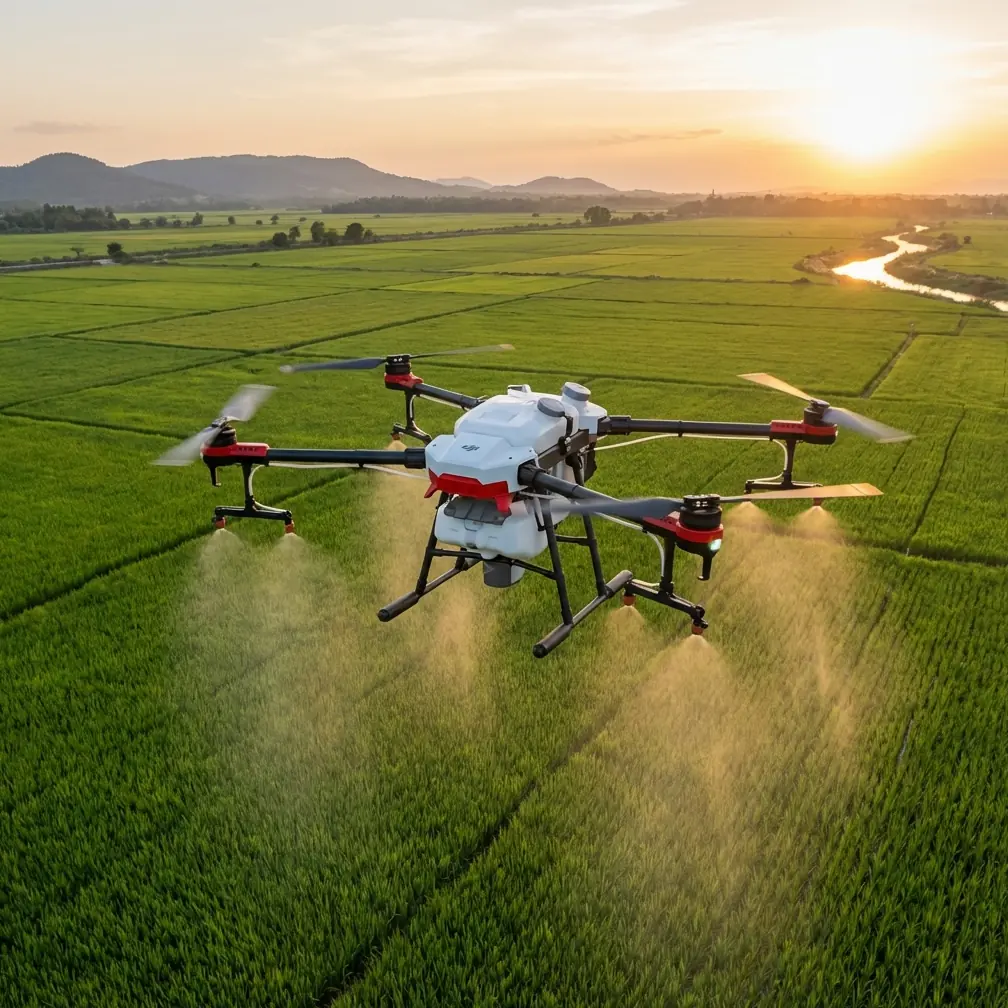
I spend a lot of time in places that confuse most drones: tree-lined city edges, green belts between residential blocks, narrow park corridors, and half-wild fo
Read More
Open steel frames create weird cross-currents. Tower cranes redirect gusts. Fresh concrete decks radiate heat. On paper, a drone only needs camera quality and e
Read MoreWhen people talk about tracking venues with an Avata, they usually focus on speed, immersion, or how tight a line the drone can hold through complex spaces. Tha
Read More
Trees don’t grow in clean lines. Branches overlap footpaths, power corridors, fences, and rooftops. Light shifts every few meters. One second you’re under open
Read More
Learn expert surveying techniques for vineyards using Avata. Professional tips, best practices, and real-world insights.
Read More
High-altitude forest mapping sounds straightforward until you get back to camp, open the footage, and realize the tree-line reference shots are soft. Not dramat
Read MoreI spend a lot of time around vineyards with a camera in my hands and dust on my shoes. Vines look calm from the road, but the work of documenting them rarely is
Read More
When a provincial low-altitude airspace operation service center starts hiring with formal public staffing status, that is not background noise. It tells you so
Read More
I took the Avata into the mountains for the images, but the real lesson had less to do with camera specs than most people would expect.
Read More
I spent part of last week on a solar site where the job looked simple on paper and messy in the air. The brief was straightforward: document panel rows, identif
Read More
How Avata fits remote venue scouting, and what DJI Dock 3’s 24/7 remote-operations model reveals about the future of fast, multi-angle aerial data capture.
Read More
On paper, a ridgeline inspection can look straightforward: follow the span, check the poles, capture the insulators, document encroaching vegetation, move to th
Read More
Coastline inspection sounds simple until you are standing on a cliff edge with wind wrapping around rock faces, salt in the air, and waves throwing glare back i
Read More
Learn expert capturing techniques for solar farms using Avata. Professional tips, best practices, and real-world insights.
Read More
You are dealing with broken terrain, shifting wind, blind corners, steel structures, signal reflections, dust, and crews who do not want repeated flyovers inter
Read More
Learn expert filming techniques for solar farms using Avata. Professional tips, best practices, and real-world insights.
Read More
Coastal field mapping exposes a weakness that many drone pilots only discover after they get home: the flight can go smoothly, yet the data pipeline still break
Read More
Rows bend with terrain. Canopies create repeating patterns that confuse orientation. Morning fog burns off unevenly. Midday heat shimmers over rocky slopes. In
Read More
Solar farms look simple from the air. Long rows, repeating geometry, wide access lanes. Then you arrive on site in dry weather and the easy picture disappears.
Read More
I took Avata into a venue survey on a day that looked easy from the parking lot and got complicated the moment I was in the air.
Read MoreYou are not just flying over rows of vines. You are threading through narrow boundaries, reflective roofs, utility lines, roadside trees, retaining walls, parke
Read More
Mountain solar farms expose a weakness in a lot of drone advice: people talk about cinematic flying, but not about what happens when terrain, panel geometry, an
Read More
The DJI Avata is usually discussed as an immersive FPV aircraft. That framing misses something useful. In the field, especially when you are inspecting agricult
Read More
Road corridors are narrow, reflective, cluttered, and constantly interrupted by signage, overpasses, light poles, utility lines, and traffic movement. In that e
Read More
Learn expert filming techniques for solar farms using Avata. Professional tips, best practices, and real-world insights.
Read More
I’ve spent enough time around aerial imaging teams to know that most drone discussions drift toward specs long before anyone asks the harder question: can this
Read MoreWhen people talk about Avata, the conversation usually drifts toward immersive flight and cinematic FPV footage. That misses a more interesting question: where
Read More
Remote wildlife flying sounds cinematic until the field reminds you what matters. Wind shifts. Light falls apart. Terrain closes in. The animals do not wait for
Read More
Vineyard work gets unforgiving when temperatures swing hard. Heat shimmer can flatten detail. Cold can shorten flight windows and make timing less forgiving. An
Read More
Remote solar farms look simple from the road. Once you’re inside the fence line, they’re not. Long rows repeat into the distance. Inverters, cable runs, access
Read More
Not just image quality. Not just prop wash. It changes how confidently you can fly close to terrain, how well you can judge fine branches and scrub, and how muc
Read MoreI’ve had highway jobs where the problem wasn’t getting airborne. It was getting repeatable footage and usable visual data once the wind started pushing the airc
Read More
Learn expert capturing techniques for solar farms using Avata. Professional tips, best practices, and real-world insights.
Read More
A stadium edge beside water. A riverside event space with reflective roofs. An island resort with narrow approach corridors and patchy visual reference. These a
Read More
I’ve seen a familiar mistake in remote highway work: teams talk about drones as if the aircraft is the whole system. It isn’t. The real value shows up only when
Read More
High-altitude solar farm mapping sounds clean on paper. Wide rows. Repeating geometry. Plenty of open sky. Then you arrive on site and the real variables start
Read More
That matters when the aircraft is flying low over sprayed fields, where fine residue can collect on the camera cover, settle around vision sensors, and interfer
Read More
In a vineyard, that usually means more than dirty props and a hazy lens. Dust affects visibility near rows, complicates low-altitude maneuvering, and raises the
Read More
Salt air creeps into everything. Wind shifts hard and without warning. Panel rows create repetitive geometry that confuses pilots and drains concentration. Add
Read More
I spend a lot of time around image-driven drones, so Avata usually enters the conversation through motion, proximity, and confidence in tight spaces. Not throug
Read More
When people talk about immersive drone flight, the conversation often drifts toward entertainment first and field work second. That misses the point. In remote
Read More
Distance strips away convenience. Wind behaves differently around half-finished structures. Dust, rebar, scaffolding, concrete walls, and narrow access routes t
Read More
You either flew conservatively and accepted thin data, or you pushed harder into dusk, forest edge, ravines, and uneven terrain where the aircraft had to work f
Read More
I’ve spent enough time photographing forests to know that trees are never the whole challenge. Terrain folds in on itself. Light collapses under the canopy. Win
Read More
Learn expert scouting techniques for solar farms using Avata. Professional tips, best practices, and real-world insights.
Read MoreWhen a major newsroom pushes to use drones for image collection, the signal matters. CNN’s agreement with the U.S. Federal Aviation Administration to use unmann
Read MoreUrban power line inspection looks simple from the sidewalk. Put a drone in the air, follow the cable corridor, capture the hardware, go home. In practice, this
Read More
Learn expert capturing techniques for vineyards using Avata. Professional tips, best practices, and real-world insights.
Read More
It softens contrast, clogs visibility, unsettles light, and turns a simple wildlife mapping session into a moving technical problem. If you are flying Avata in
Read More
On paper, field mapping sounds orderly: launch, trace a route, hold altitude, capture clean footage or image data, come home. In a dry agricultural environment,
Read More
Wildlife scouting with an Avata is usually framed as a flying question: Can this compact FPV platform get close enough, move smoothly enough, and stay stable en
Read More
Wind stacks unpredictably against cliffs. GPS confidence can shift near rock faces and broken terrain. Salt haze softens visibility. The route that looks simple
Read More
Tree cover interferes with visibility. Terrain compresses reaction time. Signal reliability stops being a background spec and becomes the thing that decides whe
Read More
I learned that the hard way on a remote shore support project where the real problem was not flight time or piloting skill. It was information delay. The team o
Read More
Venue surveys in low light expose the difference between a drone that looks capable on paper and one that can deliver usable footage in the real world. The Avat
Read MoreI went into the mountains expecting traffic patterns, retaining walls, and long ribbons of asphalt disappearing into fog. I did not expect a deer to step out fr
Read More
I’ve spent enough time around aerial imaging crews to know that the aircraft is only half the story. The other half begins the moment wind pushes your flight li
Read More
High-altitude wildlife filming sounds romantic until the aircraft is a few ridgelines out, the wind shifts, your video link starts to soften, and the subject yo
Read More
Salt in the air, shifting light off the water, cranes appearing where there was open sky yesterday, and wind that changes its mind halfway through a battery cyc
Read More
I’ve seen plenty of drone operators underestimate dawn and dusk work in urban forests. They assume the hard part is navigation under canopy or weaving between t
Read More
That sounds obvious, but with the Avata, windy venue inspection work exposes a deeper truth: the hardest part is not simply keeping the aircraft airborne. It is
Read More
The DJI Avata is not a crop-spraying aircraft, and that distinction matters right away. In remote field operations, its real value sits elsewhere: site document
Read More
Mountain venue mapping sounds technical until you get back from a flight and realize the problem was not the aircraft. It was the way you saw the scene.
Read More
Salt hangs in the air. Wind shifts off the water with no warning. Temperature swings can change battery behavior in a single morning. And when you are flying cl
Read More
Salt in the air. Gusts that change direction without warning. Sparse launch sites. Long walks back to the vehicle if you guessed wrong about batteries, access,
Read More
I learned that the hard way on a steep site where rows climbed uneven terrain, wind moved unpredictably through the blocks, and the usual “just send a drone up”
Read More
Rows tighten visually as the sun drops. Contrast falls away. Fine branches, trellis wires, irrigation lines, and sloping terrain all become harder to read. If y
Read More
Anyone who has spent a day filming vineyards in late summer knows the look: pale soil lifting under boots, service roads throwing fine powder into the air, and
Read More
Remote highway inspection sounds simple until the road disappears into broken terrain, signal conditions change by the minute, and the client wants imagery that
Read More
I’ve spent enough time around difficult landscapes to know that terrain is rarely the real problem. The real problem is what terrain does to visibility, signal
Read More
Wind through trees does something that open-field pilots often underestimate: it turns small tuning mistakes into obvious handling problems.
Read More
Power line monitoring in wind exposes a weak spot in many drone workflows: capture is easy to start, but hard to finish well. You can collect a lot of imagery a
Read More
I’ve spent enough time around agricultural drone operations to know that vineyards expose weak workflows fast. Heat shimmer, cold morning batteries, narrow rows
Read More
When people talk about drones in water management, the conversation often drifts toward generic aerial views. That misses the point. In the field, especially wh
Read More
Learn expert inspecting techniques for vineyards using Avata. Professional tips, best practices, and real-world insights.
Read More
Learn expert filming techniques for solar farms using Avata. Professional tips, best practices, and real-world insights.
Read More
Wind arrives sideways. Light bounces off water and cliffs in the same frame. Repeating textures in sand, surf, and rock can confuse both pilots and post-process
Read More
A gull cuts across a rooftop thermal plume. A macaque moves from parapet to parapet. Bats vanish under a bridge lip where GPS confidence drops and every metal b
Read More
I’ve worked around enough UAV teams to know that most flight problems aren’t really flight problems. They start on the ground, in planning, and they end later a
Read More
I’ve spent enough time around utility corridors to know that “just fly a camera drone over it” is usually the opinion of someone who has never stood under a spa
Read More
On paper, an inspection flight sounds simple: lift off, trace the structure, collect visuals, come back with usable footage. In reality, wind turns every expose
Read More
Mountain wildlife mapping pushes any drone workflow into a different class of difficulty. Elevation changes break line-of-sight assumptions. Trees and ridgeline
Read More
High-altitude solar sites expose every weak point in a drone workflow. Wind behaves differently over panel rows. Battery performance gets less forgiving. Signal
Read More
Pilots who work around spraying venues already know that the hard part is rarely just getting airborne. The real challenge is keeping control when visibility de
Read More
As a photographer, I usually trust my instincts first and the spec sheet second. That changes when the terrain starts fighting back.
Read More
Power line scouting at dawn, dusk, or under broken cloud is where good drone pilots separate themselves from people who just know how to get airborne.
Read More
I spend a lot of time around photographers who think better results come from deeper menus. More settings. More gear. More cost. Then they get into a difficult
Read More
When people talk about drone work in vineyards, they usually jump straight to flight time, payload ideas, or route planning. Fair enough. But in dusty rows with
Read More
I’ve spent enough time around drone crews to know that aircraft choice is only half the story. The other half is operational structure: who is flying, who is wa
Read More
If you want to understand where a compact FPV platform like Avata actually fits in serious field work, it helps to look beyond hobby flying and into demanding c
Read More
When people talk about Avata, they usually jump straight to the footage. Tight passes. Dynamic reveals. That floating, low-altitude perspective that makes indus
Read More
It softens contrast, contaminates lenses, confuses visual references, and turns an otherwise simple site flight into a data-management problem. If you are flyin
Read More
Not because the aircraft cannot fly. Most can. The problem is what happens after the flight: unstable image geometry, inconsistent overlap, motion-blurred frame
Read MoreThe terrain changes abruptly. Lighting shifts by the minute as ridgelines throw long shadows across cut slopes and access roads. Dust rises from grading activit
Read More
I keep coming back to one type of aerial story because it explains drone work better than most spec sheets do: agriculture at scale.
Read More
A few years ago, I watched a vineyard team lose half a day to conditions that had nothing to do with flying skill. The rows were dry, the access roads were powd
Read More
Remote power line work has a way of exposing every weakness in an airframe, every bad workflow habit, and every assumption made back at the desk.
Read More
Rows are tight. Terrain changes fast. Wind funnels through slopes and gaps. Signal quality can shift as you move from open blocks to service roads, treelines, s
Read More
Steep gradients compress your reaction time. Trees and ridgelines interrupt signal and sightlines. Wind behaves differently on one side of a slope than the othe
Read More
The hardest wildlife survey days are rarely the ones with obvious technical obstacles. The real trouble starts when the site looks manageable on paper, the spec
Read More
Low-light power line work exposes a simple truth about drones: the aircraft is only half the job. The other half is planning, camera discipline, and the pilot’s
Read More
I learned that again on a dam access road before sunrise, standing above a reservoir where the gusts bounced off concrete, fencing, and the sloped embankment be
Read More
When people talk about Avata, the conversation usually drifts toward flight feel, FPV immersion, and cinematic fun. That misses a more serious question: what ha
Read More
Solar farms look simple from the access road. Long rows. Repeating geometry. Open sky. Little shade. In practice, they can be one of the more deceptive environm
Read More
Not in the abstract, but in the small operational ways that decide whether a highway survey day produces usable data or just pretty footage with weak positional
Read More
Construction sites look deceptively simple from the air. Concrete pads, steel frames, access roads, stockpiles. Then dusk arrives, shadows stretch across rebar
Read More
You are often dealing with salt-heavy air, shifting wind channels through tree lines, wet launch zones, and brief openings where the canopy, tide, and light fin
Read More
Salt spray gets into everything. Wind changes shape as it hits cliffs and sea walls. Bright water and dark rock push dynamic range hard. Then temperature piles
Read More
On paper, mapping power lines sounds straightforward: fly the corridor, maintain visual consistency, capture enough overlap, document poles, insulators, vegetat
Read More
It changes direction around rock faces, rolls over dunes, accelerates through gaps in sea walls, and creates low-level turbulence that can turn an easy pass int
Read More
High-altitude vineyards ask more of a drone pilot than postcard landscapes suggest. The rows may look orderly from the ground, but once you lift off, you are de
Read More
It reshapes how the rows look on camera, how dust moves across a service road, how leaves flicker in the frame, and how a pilot manages both aircraft attitude a
Read More
Not just the way a small drone moves, but the way you plan, frame, verify, and decide whether a shot is usable at all. If you are trying to work with an Avata i
Read More
A football pitch between apartment towers, a training ground next to a school, a strip of managed green beside a business park—these spaces create a strange kin
Read More
When people talk about the DJI Avata, they usually drift toward immersive flight or cinematic fun. That misses a more interesting question: what happens when yo
Read More
Coastal power line inspection is unforgiving work for any drone. Salt hangs in the air. Wind shifts quickly. Light bounces off water, metal, and wet insulators
Read MoreWhen people talk about flying an Avata around large energy sites, the conversation usually drifts toward cinematic footage. That misses the point.
Read More
When pilots talk about drone endurance, the conversation usually starts in the wrong place: the number printed on the spec sheet.
Read More
Learn expert capturing techniques for construction sites using Avata. Professional tips, best practices, and real-world insights.
Read More
When a site sits hours from the nearest service hub, the margin for error shrinks fast. You may be documenting a mountainside retaining wall, a wind-exposed bri
Read More
A parcel, sensor, or small agricultural sample needs to move from one point to another across uneven ground, tree lines, utility poles, irrigation equipment, an
Read MoreLearn expert tracking techniques for construction sites using Avata. Professional tips, best practices, and real-world insights.
Read More
Signal gets swallowed by ridgelines. Tree canopies break visual references. Narrow valleys create awkward wind behavior. And when the mission is time-sensitive—
Read More
Salt hangs in the air. Dust lifts off service roads and embankments. Wind looks manageable from the ground until it rolls off the water and starts changing dire
Read More
Branches shift. Light flickers. Gusts arrive from nowhere. A route that seems open at ground level can turn into a tunnel of moving hazards once you’re under ca
Read More
I’ve spent enough time around construction zones to know that “drone friendly” is usually a fantasy invented in an office. Real sites are messy. Elevation chang
Read More
I’ve spent enough time around aircraft and cameras to know that the glossy promise is never the whole story. A drone spec sheet can sound perfect right up until
Read MoreWhen CNN disclosed that it had reached an agreement with the U.S. Federal Aviation Administration to use unmanned aircraft for news gathering, the headline was
Read More
Rows tell stories that your eyes miss at walking pace: uneven vigor, patchy dust deposition, irrigation inconsistencies, blocked access lanes, and the way terra
Read More
I keep coming back to a small, almost forgotten detail from aviation media history: the University of Missouri’s journalism school ran an experimental drone jou
Read More
Coastal forest operations punish small drones in ways inland pilots often underestimate. Salt hangs in the air. Moisture settles where you do not see it. Fine g
Read More
Vineyards are beautiful from the air, but they are not easy places to film well. Rows repeat. Terrain rolls unexpectedly. Wind picks up dust from dry access roa
Read More
If your job is to map highways in remote terrain, the Avata is not the obvious aircraft to reach for. That is precisely why it deserves a serious look.
Read More
Scouting a coastal solar farm asks different questions than flying for pure cinematic fun. Salt air, reflective panel surfaces, persistent wind, narrow maintena
Read More
You have dust lifting off access roads, metal structures reflecting signal in odd ways, shifting wind along open spans, and a constant electromagnetic backgroun
Read More
A venue that feels simple at noon can become visually confusing after sunset: dark corridors, reflective glass, ceiling trusses, LED wash lighting, backlit entr
Read More
Not spec sheets alone. Not marketing clips. Usually, it comes from proximity. Seeing an aircraft up close. Walking around it. Looking at how the body is shaped,
Read More
You launch into a dense stand of trees, light shifts every few seconds, the canopy opens and closes, and what looked manageable on the ground turns into a const
Read More
Steep rows, uneven light, reflective leaves, narrow access paths, and sudden elevation changes create a strange mix of beauty and friction. For operators using
Read More
Rows tighten into dark corridors. Trellis wires disappear until they catch a sliver of fading light. Leaves create visual clutter. If you’re trying to inspect c
Read More
I’ve seen a version of the same mistake repeat itself across creators and field teams moving into wooded survey work: they blame the aircraft when the image fee
Read More
Rows bend around steep terrain. Trellises cut across your frame. Workers, wires, stakes, access roads, and roadside clutter all compete for attention. You launc
Read More
If you want to understand what makes Avata useful in the real world, skip the brochure language and look at where drones are trusted to do repeatable, evidence-
Read More
On April 16, State Grid Shanxi Electric Power announced that it had worked with State Grid Electric Power Spatial Technology to carry out line inspection using
Read More
I’ve spent enough time around steep vineyard blocks to know that drone performance on paper rarely survives first contact with altitude, wind, and terrain. A vi
Read More
When a city starts treating drones as part of everyday public service rather than a novelty, it changes how professionals think about the aircraft in their own
Read More
Learn expert spraying techniques for construction sites using Avata. Professional tips, best practices, and real-world insights.
Read More
In camera circles, that often means a small prime lens that gets written off as “too cheap” before anyone looks at the images. In drone work, the same thing hap
Read More
When people ask whether DJI Avata fits a power line job in the mountains, the first thing I say is this: stop thinking about it as a heavy-lift delivery aircraf
Read More
A solar farm looks simple from the access road. Long rows. Repeating geometry. Open sky. Then you step into it with a camera drone and reality shows up fast: ho
Read More
Power line inspection at altitude exposes every weakness in a drone workflow. Thin air reduces thrust margin. Wind behaves differently around towers and ridgeli
Read More
You are dealing with steep grade changes, unstable wind, narrow access roads, dust, exposed rebar, concrete structures in progress, and crews spread across mult
Read More
Remote solar sites expose a drone very quickly. Not in a lab-test way, but in the real way that matters: gusts sliding over panel rows, heat shimmer above inver
Read More
That window sounds useful on paper. The sun is lower, surface glare starts to ease, and the site is often quieter. In practice, it used to be the messiest part
Read More
On a flat urban site, progress tracking is mostly a matter of routine: same approach path, predictable access, stable communications, and straightforward visual
Read More
I took the Avata into the mountains for a job that sounds simple until you are actually standing on a slope with wind rolling through the valley: scout a patchw
Read More
Thin air reduces prop efficiency. Mountain light shifts fast. Panel rows create repeating visual patterns that can confuse a pilot and flatten depth perception.
Read More
Most Avata reviews stay trapped in the usual loop: immersive flight, compact frame, cinematic FPV feel. That misses the harder question professionals actually c
Read More
Panels throw glare into the lens. Heat shimmer softens detail. Wind funnels between rows. Dust settles where it does the most damage: right on the sensors you d
Read MoreBad altitude choices become obvious. Overconfident tracking gets messy fast. Obstacle awareness stops being a feature checklist item and becomes the difference
Read More
I’ve used cameras in enough bad weather to know that temperature changes don’t just affect batteries. They affect judgment, visibility, workflow, and the small
Read More
When people talk about mapping, they usually picture large survey drones flying neat grid missions over open ground. That mental model breaks down the moment a
Read More
Construction sites at elevation ask more from a drone pilot than a standard real-estate shoot. Wind behaves differently around steel frames. GPS can feel less t
Read More
Urban forest mapping is rarely as tidy as it looks on a planning map. A green patch between apartment blocks may contain layered canopy, footpaths, drainage cha
Read More
Mountain highway spraying is one of those jobs that looks straightforward from a distance and gets complicated the moment you arrive on site. Steep cut slopes,
Read More
I took the Avata into the field for one reason: I needed a compact FPV platform that could work where larger camera drones become a burden. The assignment was w
Read More
You notice it first in the footage. The sky blows out while the cliffs turn muddy. White surf flickers between usable and ruined. One pass looks clean, the next
Read More
When people talk about flying an Avata around a coastal construction project, they usually jump straight to aircraft features. Obstacle avoidance. Subject track
Read More
A practical Avata tutorial for wildlife surveying in complex terrain, focused on exposure control, low-noise video, and safer data capture in changing light.
Read More
Mountain highway scouting looks deceptively simple until you are actually out there. The road snakes through changing elevation, the light shifts every few minu
Read More
When people talk about Avata, they usually drift toward cinematic FPV footage. That misses a far more useful conversation.
Read More
Venue scouting with Avata is not just about getting attractive FPV footage. In real work, it is about reducing uncertainty before crews, planners, and clients a
Read More
High-altitude venue scouting sounds simple on paper. Fly in, map the space mentally, grab a few cinematic passes, leave with a shot list. In reality, mountain l
Read More
Remote power-line work creates a strange kind of pressure. The landscape is usually wide open until it suddenly isn’t. A corridor of cables, pylons, guy wires,
Read More
The most revealing moment in a vineyard often arrives after the obvious beauty has gone. Late light flattens into blue shadow. Rows that looked orderly at golde
Read MoreIf you want to understand where Avata fits today, start with the broader drone industry signal: at the ninth World Drone Congress, more than 5,000 products were
Read More
When a headline says that disaster relief in Guizhou back in 2008 might have been less difficult if “this kind of drone” had existed, it lands harder than a rou
Read More
I’ve spent enough time around cameras and drones to know that low-light flights over open land can fool even experienced pilots. Fields look simple from the gro
Read More
The brief sounded simple: document movement corridors along a tree-lined wetland edge without disturbing the site, then pull usable visual references for a foll
Read More
High-altitude power line work punishes sloppy camera habits faster than almost any other civilian drone job. The aircraft may be stable, the route may be planne
Read More
Coastal construction sites create a strange visual problem. They are busy, open, geometric, and often messy at the same time. Temporary access roads cut through
Read More
Vineyards look simple from the road. Long rows, repeating geometry, open sky. Once you try to film them well, especially on a travel day with changing wind, the
Read More
You have cranes moving steel, temporary fencing that changes by the week, half-finished facades that scramble GPS confidence, and narrow access corridors where
Read More
A rooftop array spread across multiple buildings, service corridors, HVAC clutter, reflective glass, parapet walls, cable trays, and tight takeoff zones can tur
Read More
My background is photography, so for years I judged drones by how calmly they could hover, how predictably they framed a subject, and how little drama they intr
Read More
I’ve spent enough time around solar sites to know that the easy part is seeing the array on a map. The hard part starts when the farm is built into the kind of
Read More
A venue that looks dramatic to the eye can become a headache in the goggles and in post. Fine particles flatten contrast, create flicker in low-angle light, and
Read MoreNot just visually messy, but aerodynamically messy too. Wind wraps around steel frames, funnels through unfinished corridors, spills over parapets, and changes
Read More
Wildlife filmmaking in the mountains punishes weak drone choices fast. Thin margins, shifting wind, broken terrain, dark tree lines, bright snow, and subjects t
Read More
Power line work has a way of exposing the gap between marketing language and real flight behavior. On paper, many drones look capable. In the field, especially
Read More
Solar farms look simple from the road. Long rows. Repetition. Clean geometry. In practice, they are demanding inspection environments. Heat shimmer can ruin vis
Read More
Wildlife inspection sits in an awkward middle ground. You need detail, but you also need distance. You want access to steep ravines, riverbanks, forest edges, a
Read More
I’ve seen a pattern in vineyard operations that doesn’t get enough attention: crews obsess over batteries, propellers, and route planning, then rush straight pa
Read More
Anyone who has tried to document elevated roads, ramps, interchanges, retaining walls, and adjacent structures knows the real challenge is not just getting foot
Read More
Learn expert capturing techniques for construction sites using Avata. Professional tips, best practices, and real-world insights.
Read More
Most people looking at Avata for venue work start in the wrong place. They focus on cinematic flight feel, FPV immersion, or social-video output. That misses th
Read More
Some construction jobs are visually impressive. Others are operationally unforgiving. The steel approach bridge at the Huilai crude oil terminal falls into the
Read More
When a landscape already looks unreal from the ground, the challenge is not finding beauty. It is translating scale, texture, and atmosphere into footage that s
Read More
Urban scouting with DJI Avata is usually framed as a speed problem. Find the route, check the gaps, run a quick pass, move on.
Read MoreOn October 9, a cold air surge pushed snow across Shandan Horse Farm in the middle section of the Hexi Corridor in Gansu, turning autumn grassland white almost
Read More
One of the more revealing recent aerial references came from Kongtong Mountain in Pingliang, Gansu, a national 5A scenic area, where continuous rain during the
Read MoreWushan in autumn offers the kind of scene that exposes both the strengths and limits of a compact FPV platform. In the recent Xinhua aerial feature on the Wusha
Read More
I used to haul a 400 mm telephoto on a carbon-fibre tripod whenever the city parks department asked for a quick health check on their roadside tree corridors. T
Read More
The bharal never look up. At 4,800 m on the Zanskar ridgeline, blue sheep graze shale so steep that one slip would cartwheel a grown argali into the abyss. They
Read MoreJessica Brown, usually found chasing golden-hour brides, spent the last six months swapping lace for rebar. The contractor she photographs for needed weekly pro
Read More
The first time I chased a coastal highway with the Avata, the breeze coming off the Pacific felt polite—until I cleared the bluff and the slipstream off a passi
Read More
The first time I tried to spray a ridge of Japanese larch at 6:15 a.m., the Avata snapped into Atti mode before it cleared the tree line. No crash, just an abru
Read More
The sun hadn’t cleared the marine layer when I reached the trailhead. My mission sounded simple—walk the bluff, launch the Avata, and log a pre-spray survey of
Read More
The call time was 05:40. By 06:15 the sun had just cleared Kangchenjunga and the model was already shivering in a silk jacket that would look perfect on the cov
Read More
The client wanted fifteen seconds of glass-smooth aerial footage: a surfer tucking into a late-afternoon barrel, back-lit by a low winter sun, with the lighthou
Read More
The right bank of the Youjiang River is already dark when the last truck leaves the packing shed, yet the orchards glow—thousands of pale mango flowers catching
Read More
The field looked empty until the sun dropped behind the silo. Then every gust threw pollen into the air and turned the wheat into a moving checkerboard of gold
Read More
The thermometer on the guardrail read 47 °C in the shade, but there was no shade. Out on Route 287, forty kilometres west of Toyohashi, the asphalt itself was e
Read More
The condor appeared at 09:14, rising on a thermal that peeled off the granite wall like visible breath. I was already wedged into a scree notch, one boot on eit
Read MoreThe first time I tried to chase a logging truck down British Columbia’s Sea-to-Sky with a conventional camera drone, the wind slapped the gimbal sideways and th
Read More
The golden eagle lifted off the ridge at 09:17, wings tipping copper in the low sun. I was already in the air, goggles pressed to my face, left thumb rolling th
Read More
Field-tested workflow that lets a single operator map 80 MW of uneven panels, dodge 2 m racking, and still land with 28 % battery—no ground crew, no downtime.
Read More
The anemometer on the bucket truck was still spinning at 38 km/h when I launched the Avata last Tuesday morning. Ten kilometers of 220 kV steel-lattice towers s
Read More
Chris Park pushes the last irrigation valve shut, wipes salt from his eyes, and points the Avata down-row before the heat haze can liquefy the horizon. It is 13
Read More
The air is so thin at 3,800 m that the diesel in the chase truck refuses to ignite on the first crank. I’m not faring much better—my pulse oximeter reads 82 %—b
Read More
Chris Park here. I’ve been flying cinewhoops since the first GoPro met a 3-inch frame, but last Tuesday on China’s G15 coastal expressway the Avata did somethin
Read More
The gust hit at 19 m s⁻¹—enough to rock the aluminium lattice under my boots—yet the Avata hung motionless, 12 m off the conductor, recording a 5.2 K D-Log clip
Read More
Chris Park has spent the last decade chasing tide lines with every generation of DJI hardware. When the Avata arrived he almost sent it back—its ducts looked to
Read More
A field-tested workflow for using DJI Avata to capture centimeter-grade coastal data where cliffs, sea spray, and GPS shadows make conventional drones quit.
Read More
High-altitude construction work exposes every weak point in an aerial monitoring plan. Wind is less forgiving. Terrain compresses your margins. Light shifts fas
Read More
Filming power lines is not a casual weekend flight. Add extreme heat or deep cold, and the margin for error gets thinner fast. Battery behavior changes. Plastic
Read More
Power-line corridor work exposes every weakness in a small aircraft. Gusts roll off towers, magnetic and visual clutter can confuse positioning, and the margin
Read More
Coastal venues look effortless on screen. In real life, they are one of the easiest places to ruin a shoot with a small cinewhoop if you fly them like an open f
Read More
Remote forest monitoring asks a lot from a small drone. You are dealing with broken sightlines, uneven terrain, dense canopies, moisture in the air, and a signa
Read More
Mountain venue scouting asks more from a drone than a casual weekend flight. The route is rarely clean, the terrain is rarely forgiving, and the wind can change
Read MoreThe most revealing flights rarely happen in perfect weather. They happen when the site is shimmering, the horizon is unstable, and every reflective surface seem
Read MoreRemote venue work exposes every weakness in a drone setup. Terrain blocks signal. Tree lines distort depth. Wind funnels through gaps you barely noticed on foot
Read More
Surveying a solar farm in an urban setting asks unusual things of a drone. You need precision near reflective surfaces, stable video in RF-noisy airspace, and e
Read More
Coastline scouting looks simple until the environment starts working against the aircraft. Salt spray hangs in the air. Wind direction shifts off cliffs and dun
Read More
Learn expert inspecting techniques for solar farms using Avata. Professional tips, best practices, and real-world insights.
Read MoreI learned the hard way that wildlife does not care whether your batteries are warm, your fingers work, or your camera settings make sense.
Read More
That sounds obvious until you are standing inside a half-finished event venue, a rodeo arena, a motocross facility, or an abandoned warehouse being evaluated fo
Read More
The space looks controlled. It usually is not. Metal truss, LED walls, wireless mics, routers, broadcast links, security systems, reflective glass, haze, dark c
Read More
Construction inspections in broken terrain punish the wrong aircraft. Steep cut slopes, scaffold corridors, retaining walls, half-finished structures, and narro
Read More
When people talk about the DJI Avata, they usually start with speed, immersion, and FPV fun. That misses a more interesting use case. In the field, especially a
Read More
Remote power line surveys punish weak assumptions. The route is rarely clean, the terrain is usually deceptive, and weather can shift from manageable to awkward
Read More
The first time I tried to document a wind-exposed distribution corridor with a small cinewhoop-style drone, I made the classic mistake of treating it like an or
Read More
Remote forest flying exposes every weakness in a drone setup. Tight gaps. Uneven light. Wet leaves that flatten contrast. Branches that appear open from one ang
Read More
Most articles about the DJI Avata drift toward the obvious: it is compact, it is immersive, and it makes FPV flight more approachable. None of that helps much w
Read More
Coastlines look simple from a distance. Blue water, clean horizon, dramatic rock faces, maybe a fishing pier or a stretch of dunes. In the field, they are anyth
Read More
Coastal forest monitoring asks a lot from a drone. You need reliable maneuverability under canopy edges, stable footage in shifting wind, and enough situational
Read More
You may be trying to inspect erosion lines, check trail access, document cliffside routes, or capture footage for a location survey. Then the wind shifts, salt
Read MoreTracking across open fields at dusk sounds simple until the feed starts to soften, contrast drops, and the aircraft begins making conservative decisions you did
Read More
Urban inspection work asks odd things of a drone. One minute it needs to skim a fence line between utility poles, the next it has to hold a steady visual read o
Read More
I have used the Avata in places where a conventional drone feels slightly too formal for the terrain. Mountain fields are like that. They are open until they ar
Read More
Coastal wildlife mapping sounds straightforward until you are standing in salt wind with shifting light, moving birds, reflective water, and terrain that change
Read More
A food delivery demo would not normally matter to a solar farm scout. At first glance, a branded restaurant payload crossing an exhibition space looks like mark
Read More
On 17 November, as the Dubai Airshow opened, Chinese heavy-lift drone company United Aircraft Group pushed a practical milestone into the Middle East: a live dr
Read MoreSometimes the clearest lesson for Avata pilots comes from a passenger aircraft proving something operationally difficult in public, in a real city, under regula
Read MoreI spend a lot of time thinking about aircraft that were never designed for the same job but still end up teaching each other useful lessons.
Read More
When a drone pilot scouts a mountain venue, the job is rarely about pretty footage alone. It is about reading terrain, identifying safe approach paths, understa
Read More
I’ve spent enough time around utility-scale solar sites to know that the hardest part is rarely the “hero shot.” The real challenge is getting repeatable footag
Read MoreYou have speed, concrete, signage, lamp posts, overpasses, exit ramps, reflective surfaces, unpredictable wind, and a moving visual environment that changes eve
Read More
It changes where animals hold, how your aircraft tracks, what your footage looks like, and how much margin for error you actually have. That matters with a plat
Read More
Scouting a coastline from the mountains sounds straightforward until you actually launch. On paper, it is a dream assignment: elevation, dramatic contours, movi
Read More
The first time I tried to document a mountain-side construction site with a conventional camera drone, the problem was not image quality. It was hesitation.
Read More
Forests expose the difference between a drone that looks capable on paper and one that can actually work close to trunks, under broken canopy, and along irregul
Read MoreI have flown enough mountain edges and open agricultural blocks to know that high altitude punishes sloppy assumptions. The air is thinner, the wind can turn wi
Read More
I learned the hard way that venue monitoring becomes a different job when temperature swings stop being a footnote and start driving every operational decision.
Read More
Practical Avata monitoring tips for urban highways, including obstacle avoidance prep, camera cleaning, D-Log workflow, and safer low-altitude flight planning.
Read More
Rows that look orderly from the ground turn into narrow channels that accelerate gusts, push a small FPV drone sideways, and punish sloppy route planning. If yo
Read More
A coastal vineyard can humble a pilot fast. Wind rolls in from the water, rows create tunnel-like visual patterns, and trellis wires punish sloppy line choices.
Read More
High-altitude field work exposes every weakness in an aircraft. Wind moves differently along ridgelines. Light changes fast. GPS can be clean one minute and mes
Read More
Learn expert scouting techniques for coastlines using Avata. Professional tips, best practices, and real-world insights.
Read More
Expert field report on using DJI Avata for surveying venues in windy conditions, with practical altitude, safety, camera, and flight planning insights.
Read More
Solar farm inspections look simple from the road. Long rows. Open space. Clear light. Then you step into the site with a drone in hand and the real constraints
Read More
The challenge with filming fields is rarely the field itself. It is the perimeter. Tree lines lean in. Dry-stone walls break up the route. Drainage cuts disappe
Read More
Terraced rows compress the flight corridor. Wind spills over ridgelines unpredictably. Light changes by the minute as the sun drops behind slopes and tree lines
Read More
Construction sites punish cameras in ways manicured demo environments never do. Dust hangs in the air, steel creates visual clutter, unfinished interiors confus
Read More
I’ve spent enough mornings on exposed job sites to know that “good flying conditions” usually exist only in the truck, on paper, before anyone steps outside.
Read More
Learn how the DJI Avata maps wildlife in low-light conditions. Expert tips on flight altitude, D-Log settings, and subject tracking for stunning results.
Read More
Learn how the DJI Avata handles dusty coastal deliveries with obstacle avoidance, ActiveTrack, and pre-flight cleaning steps that ensure safe, reliable flights.
Read More
- The DJI Avata's immersive FPV flight capability enables close-range urban power line inspections that traditional drones struggle to perform safely
Read More
Discover how the DJI Avata transforms mountain highway monitoring with obstacle avoidance, ActiveTrack, and cinematic D-Log footage. Full case study inside.
Read More
Learn how the DJI Avata transforms high-altitude vineyard spraying with obstacle avoidance and precision flight. Expert how-to guide by a drone photographer.
Read More
Discover how the DJI Avata performs in extreme forest temperatures. Expert tips on battery management, obstacle avoidance, and D-Log footage in the field.
Read More
Learn how to map mountain forests with the DJI Avata. Expert tutorial covering obstacle avoidance, D-Log settings, and electromagnetic interference fixes.
Read More
- The DJI Avata's compact FPV design and built-in obstacle avoidance make it uniquely suited for navigating tight mountain terrain during construction surve
Read More
Discover how the DJI Avata transforms remote highway monitoring with obstacle avoidance, D-Log color, and rugged FPV performance for professionals.
Read More
Learn how the DJI Avata handles wildlife inspections in extreme temperatures. Expert field report covering obstacle avoidance, tracking, and antenna tips.
Read More
Learn how to map coastal construction sites with the DJI Avata. Expert tips on flight altitude, D-Log settings, and obstacle avoidance for accurate site data.
Read More
Learn how the DJI Avata transforms urban highway content delivery with obstacle avoidance, ActiveTrack, and cinematic D-Log footage. Full case study inside.
Read More
Discover expert Avata mapping tips for urban fields. Learn obstacle avoidance, D-Log settings, and ActiveTrack techniques to capture precise aerial survey data.
Read More
Learn how the DJI Avata excels at monitoring fields in low light conditions. Expert tutorial covers settings, battery tips, and ActiveTrack techniques.
Read More
Discover how the DJI Avata handles low-light construction site scouting with obstacle avoidance, D-Log color, and reliable performance in changing weather.
Read More
Discover how the DJI Avata transforms mountain venue monitoring with obstacle avoidance, ActiveTrack, and immersive FPV flight. Field report by Chris Park.
Read More
Discover how the DJI Avata transforms urban highway spraying operations with obstacle avoidance, subject tracking, and unmatched agility in tight corridors.
Read MoreDiscover how the DJI Avata transforms urban vineyard tracking with ActiveTrack, obstacle avoidance, and D-Log color science. Real case study inside.
Read More- ActiveTrack on the Avata requires specific settings adjustments above 2,500 meters to maintain reliable subject tracking across open mountain fields
Read More
Discover how the DJI Avata transforms high-altitude highway monitoring with obstacle avoidance, ActiveTrack, and weather-resilient FPV flight for professionals.
Read More
Learn how photographer Jessica Brown uses the DJI Avata for urban field surveys. Discover optimal altitudes, flight tips, and real case study results.
Read More
Learn how the DJI Avata monitors solar farms in extreme temperatures. Chris Park shares flight altitude tips, D-Log settings, and ActiveTrack workflows.
Read More
Discover expert Avata filming tips for coastal vineyards. Learn D-Log settings, ActiveTrack techniques, and antenna positioning for stunning aerial footage.
Read More
Learn how the DJI Avata conquers high-altitude venue filming with obstacle avoidance, D-Log color, and immersive FPV footage. Expert tips inside.
Read More
- The DJI Avata's compact FPV design and obstacle avoidance sensors make it uniquely suited for navigating dense, remote wildlife habitats where traditional
Read More
- The DJI Avata's propeller guard design and built-in obstacle avoidance make it uniquely suited for close-proximity power line inspections in dim conditions*
Read MoreDiscover how the DJI Avata transforms coastal wildlife tracking with subject tracking, obstacle avoidance, and cinematic tools for stunning footage.
Read More
Discover how the DJI Avata excels at forest monitoring in low light. Expert tips on obstacle avoidance, D-Log settings, and electromagnetic interference fixes.
Read MoreLearn how photographer Jessica Brown uses the DJI Avata to track mountain wildlife with ActiveTrack, obstacle avoidance, and D-Log color grading tips.
Read More
Learn how the DJI Avata transforms dusty coastline inspections with obstacle avoidance, D-Log color profiles, and immersive FPV flight for stunning results.
Read More
Discover how the DJI Avata handles mountain construction deliveries with obstacle avoidance, ActiveTrack, and rugged FPV performance for remote sites.
Read More
Discover how the DJI Avata helps wildlife photographers survey animals in complex terrain with obstacle avoidance, subject tracking, and cinematic tools.
Read More
Learn how the DJI Avata handles field spraying in high winds. Chris Park's case study covers obstacle avoidance, ActiveTrack, and real-world tips.
Read More
- The DJI Avata's compact FPV design and obstacle avoidance sensors make it uniquely suited for navigating dense forest canopies in mountainous terrain
Read More
Learn how the DJI Avata captures stunning remote highway footage with obstacle avoidance and cinematic modes. Expert case study by Chris Park.
Read More
Learn how to capture stunning wildlife footage in remote locations using the DJI Avata. Expert tips on obstacle avoidance, tracking, and D-Log settings.
Read MoreMaster DJI Avata coastline tracking in windy conditions. Expert tips on flight altitude, subject tracking, and cinematic settings for stunning coastal footage.
Read More
Learn how the DJI Avata handles coastal power line inspections with expert tips on obstacle avoidance, electromagnetic interference, and D-Log capture settings.
Read More
Learn how to film stunning coastlines with the DJI Avata in extreme temperatures. Expert tips on obstacle avoidance, D-Log, and pre-flight prep for safety.
Read More
Learn how photographer Jessica Brown uses the DJI Avata to capture remote construction sites with obstacle avoidance, D-Log, and immersive FPV footage.
Read MoreLearn how the DJI Avata helps photographers track mountain fields with ActiveTrack, obstacle avoidance, and cinematic QuickShots for stunning aerial footage.
Read More
Discover how the DJI Avata transforms urban field inspections with obstacle avoidance, immersive FPV flight, and pro-grade imaging. Expert tips inside.
Read More
Discover how the DJI Avata transforms complex terrain venue delivery with obstacle avoidance, ActiveTrack, and immersive FPV flight for stunning results.
Read More
Learn how to capture power line footage at high altitude with the DJI Avata. Expert tutorial covers EMI handling, camera settings, and obstacle avoidance tips.
Read More
- Fly between 15–30 meters altitude to minimize wildlife disturbance while capturing detailed low-light footage with the Avata's immersive FPV perspective.
Read More
- The DJI Avata is a compact, ducted-prop FPV drone built for immersive low-altitude scouting in dense, unpredictable terrain where traditional drones fail.
Read More
Learn how the DJI Avata transforms remote power line delivery with obstacle avoidance, ActiveTrack, and unmatched FPV agility. Full technical review inside.
Read More
Learn how the DJI Avata transforms mountain highway surveying with obstacle avoidance, D-Log color, and immersive FPV flight for stunning aerial results.
Read More
Master DJI Avata for capturing stunning mountain field footage. Expert tips on battery management, D-Log filming, and obstacle avoidance in alpine terrain.
Read More
- Fly between 15–40 meters altitude along coastlines to capture the perfect balance of wave detail, cliff texture, and sweeping horizon lines.
Read More
Learn how to film stunning solar farm footage with the DJI Avata in windy conditions. Expert tips on battery management, camera settings, and flight planning.
Read More
Discover how the DJI Avata transforms mountain solar farm scouting with obstacle avoidance, immersive FPV flight, and cinematic tools for photographers.
Read MoreMaster urban wildlife tracking with the DJI Avata. Expert tips on ActiveTrack, obstacle avoidance, and D-Log settings for stunning footage every time.
Read More
Master coastal wildlife filming with the DJI Avata. Learn expert antenna positioning, subject tracking, and cinematic techniques for stunning footage.
Read More
Master venue mapping with DJI Avata in windy conditions. Learn pro techniques, essential settings, and third-party accessories for flawless aerial surveys.
Read More
Learn professional techniques for flying DJI Avata in windy field conditions. Expert tips on stabilization, battery management, and cinematic shots explained.
Read More
Master solar farm inspections in low light with the DJI Avata. Expert techniques for obstacle avoidance, D-Log settings, and efficient delivery workflows.
Read More
Master mountain highway mapping with DJI Avata. Field-tested techniques for terrain challenges, obstacle avoidance, and stunning aerial documentation results.
Read More
Discover expert Avata drone techniques for scouting remote vineyards. Learn obstacle avoidance, tracking features, and pro tips for precision aerial surveys.
Read More
Learn how the DJI Avata captures stunning coastal solar farm footage with obstacle avoidance, D-Log color, and ActiveTrack. A real-world case study.
Read More
Discover how the DJI Avata excels at monitoring dusty agricultural fields with obstacle avoidance, ActiveTrack, and D-Log color profiles for pros.
Read More
Learn how to film stunning coastline footage with the DJI Avata in extreme temperatures. Expert tutorial covering D-Log, ActiveTrack, and antenna tips.
Read More
Learn how the DJI Avata captures stunning coastal wildlife footage. Expert tips on flight altitude, D-Log settings, and Subject tracking for pros.
Read More
Discover proven Avata mapping tips for wildlife in low light. Jessica Brown shares her case study on obstacle avoidance, D-Log, and ActiveTrack techniques.
Read More
Learn how the DJI Avata transforms low-light vineyard inspections with immersive FPV flight, obstacle avoidance, and D-Log color profiles for stunning results.
Read More- The DJI Avata excels at low-altitude vineyard tracking even in temperatures exceeding 40°C (104°F) or dropping below -10°C (14°F), with the right
Read More
- The DJI Avata's built-in obstacle avoidance and compact design make it ideal for navigating tight urban construction environments where traditional drones
Read More
Learn how the DJI Avata handles vineyard mapping in windy conditions. Expert field report covering ActiveTrack, D-Log settings, and obstacle avoidance tips.
Read MoreLearn how the DJI Avata excels at tracking venues in low light. Discover pro tips, camera settings, and techniques for stunning FPV footage.
Read More
Learn how to film stunning coastline footage with the DJI Avata in windy conditions. Expert tips on obstacle avoidance, D-Log settings, and pre-flight prep.
Read More
Learn how the DJI Avata handles coastal field mapping challenges like electromagnetic interference. Chris Park shares pro tips, specs, and real-world results.
Read More
- The DJI Avata's ducted propeller design and robust stabilization make it uniquely suited for capturing highway footage in harsh, dusty environments where
Read More
- The DJI Avata excels at coastal mapping in remote environments where traditional drones struggle with wind, salt spray, and electromagnetic interference.
Read More
- The DJI Avata's built-in obstacle avoidance and compact ducted design make it ideal for navigating dense forest canopies in fading light.
Read More
Discover how the DJI Avata handles power line mapping in dusty environments. Field-tested tips on obstacle avoidance, D-Log settings, and essential accessories.
Read More
- Pre-flight sensor cleaning is non-negotiable — dirty obstacle avoidance sensors cause false readings and erratic behavior in gusty conditions near wildlif
Read More
- The DJI Avata's immersive FPV design makes it uniquely suited for navigating tight construction environments in low-light conditions
Read More
Discover expert Avata drone tips for scouting forests at high altitude. Learn battery management, obstacle avoidance, and D-Log settings for stunning results.
Read More
Discover how the DJI Avata handles mountain field mapping with obstacle avoidance, D-Log color, and ActiveTrack. A photographer's in-depth technical review.
Read More
Learn how Chris Park uses the DJI Avata to deliver stunning mountain venue content with obstacle avoidance, ActiveTrack, and pro shooting tips.
Read More
Discover how the DJI Avata handles windy field inspections with precision obstacle avoidance, stable FPV footage, and expert antenna tips for maximum range.
Read More
Learn how the DJI Avata handles low-light highway inspections with obstacle avoidance, D-Log color profiles, and ActiveTrack for reliable aerial results.
Read More
- Fly between 15–30 meters AGL for optimal highway dust capture while maintaining safe obstacle clearance and dramatic perspective
Read More
Learn how to film stunning forest footage with DJI Avata in windy conditions. Expert tips on settings, obstacle avoidance, and antenna positioning for range.
Read MoreMaster DJI Avata highway tracking in low light conditions. Learn ActiveTrack setup, D-Log color profiles, and obstacle avoidance tips for cinematic results.
Read More
Learn how the DJI Avata captures stunning solar farm footage in mountain environments. Expert tutorial covering D-Log, ActiveTrack, and obstacle avoidance tips.
Read More
- The DJI Avata operates effectively at altitudes up to 5,000 meters above sea level, making it a capable tool for high-altitude agricultural and terrain mo
Read More
Learn how the DJI Avata transforms coastal highway scouting with obstacle avoidance, D-Log color profiles, and immersive FPV flight for professional results.
Read MoreLearn how the DJI Avata tracks construction sites at high altitude with ActiveTrack, obstacle avoidance, and D-Log color profiles for professional results.
Read MoreDiscover how the DJI Avata handles coastline tracking in extreme temperatures with obstacle avoidance, ActiveTrack, and D-Log color for cinematic FPV footage.
Read More
- The DJI Avata's compact form factor and built-in propeller guards make it uniquely suited for close-proximity urban power line inspections where traditional d
Read More
Learn how the DJI Avata transforms coastal vineyard surveying with obstacle avoidance, D-Log color profiles, and expert electromagnetic interference solutions.
Read More
Learn how to map venues in low light using the DJI Avata. Expert tutorial covers D-Log settings, obstacle avoidance, and pro techniques for stunning results.
Read More
- DJI Avata's compact ducted design handles gusty forest environments where larger drones struggle to maintain stable flight
Read More
Learn how photographer Jessica Brown uses the DJI Avata to capture stunning field imagery in extreme temperatures. Expert tips on D-Log, ActiveTrack, and more.
Read More
- The DJI Avata excels at high-altitude coastal surveying thanks to its compact FPV design, built-in obstacle avoidance, and rock-solid stabilization in har
Read More
- The DJI Avata excels in dusty forest inspection scenarios thanks to its compact ducted-propeller design and built-in obstacle sensing that protects both t
Read More
Discover how the DJI Avata transforms low-light vineyard spraying with obstacle avoidance, ActiveTrack, and immersive FPV flight for precision agriculture.
Read More
Learn how the DJI Avata handles coastal forest monitoring with ActiveTrack, obstacle avoidance, and D-Log color profiles for professional aerial data.
Read More
Discover how the DJI Avata handles extreme-temp wildlife inspections with obstacle avoidance, ActiveTrack, and D-Log color science. Full field report inside.
Read More
- The DJI Avata's obstacle avoidance sensors proved critical for navigating dense vineyard canopy and unexpected wildlife at elevations above 1,500 meters
Read MoreDiscover how the DJI Avata transforms mountain vineyard tracking with ActiveTrack, obstacle avoidance, and cinematic QuickShots for stunning aerial footage.
Read MoreLearn how to use the DJI Avata for tracking fields at high altitude. Expert tutorial covers ActiveTrack, D-Log settings, obstacle avoidance, and pro tips.
Read More
Learn how the DJI Avata excels at coastline scouting in dusty conditions. Expert tutorial covering obstacle avoidance, D-Log, ActiveTrack, and pro flight tips.
Read More
Learn how the DJI Avata handles windy venue inspections with obstacle avoidance, D-Log color, and pro techniques. A photographer's complete tutorial.
Read More
Learn how the DJI Avata transforms urban highway delivery operations with obstacle avoidance, ActiveTrack, and immersive FPV flight in this expert case study.
Read More
Discover how the DJI Avata handles coastal mapping in dusty conditions. Chris Park reviews obstacle avoidance, D-Log footage, and real-world flight performance.
Read More
Discover how the DJI Avata excels at capturing stunning coastline footage. Expert technical review covering obstacle avoidance, ActiveTrack, and D-Log settings.
Read More
Learn how the DJI Avata makes dusty power line scouting safer and faster with obstacle avoidance, ActiveTrack, and immersive FPV flight capabilities.
Read More
Learn how the DJI Avata transforms urban highway photography with obstacle avoidance, ActiveTrack, and pro tips for stunning aerial delivery coverage.
Read More
Learn how the DJI Avata captures stunning wildlife footage in complex terrain with expert tips on obstacle avoidance, D-Log, and optimal flight altitude.
Read More
Discover how the DJI Avata transforms mountain field photography with obstacle avoidance, D-Log color, and immersive FPV flight. Full field report inside.
Read More
Master coastline scouting in low light with the DJI Avata. Expert tutorial covering D-Log settings, obstacle avoidance, and pro techniques for stunning results.
Read More
Learn how the DJI Avata handles high-altitude wildlife mapping with obstacle avoidance, D-Log color, and ActiveTrack. A photographer's full technical review.
Read More
Discover how the DJI Avata transforms coastal highway delivery missions with obstacle avoidance, ActiveTrack, and D-Log color science for stunning results.
Read More
Learn how the DJI Avata handles forest deliveries in extreme temperatures. Expert tips on obstacle avoidance, ActiveTrack, and cold-weather flying techniques.
Read More
- The DJI Avata proved surprisingly capable as a vineyard scouting and light spraying coordination tool in remote, off-grid vineyard operations
Read More
Learn how the DJI Avata captures stunning highway footage in low light. Chris Park shares field-tested tips for cinematic results with this FPV drone.
Read More
Learn how the DJI Avata helps photographers scout high-altitude construction sites with obstacle avoidance, ActiveTrack, and D-Log color science.
Read More
- Dusty venue mapping with the Avata requires specific sensor calibration, lens protection, and flight planning to produce accurate, artifact-free orthomosa
Read More
Master DJI Avata venue photography in dusty environments. Expert tips on obstacle avoidance, D-Log settings, and antenna adjustments for sharp results.
Read More
Learn how the DJI Avata transforms complex venue scouting with obstacle avoidance, immersive FPV flight, and pro-grade stabilization for creators.
Read More
Master Avata filming techniques for power line inspections in windy conditions. Expert tips on obstacle avoidance, D-Log settings, and stabilization methods.
Read More
Learn how photographer Jessica Brown uses the DJI Avata to capture stunning coastline footage at high altitude with D-Log, ActiveTrack, and QuickShots modes.
Read More
- The DJI Avata's obstacle avoidance and compact design make it ideal for surveying event venues in rugged, hard-to-reach terrain
Read More
Learn how to survey coastlines in low light with the DJI Avata. Expert tips on D-Log settings, obstacle avoidance, and antenna positioning for maximum range.
Read More
Discover how the DJI Avata handles extreme temperature forest scouting with obstacle avoidance, D-Log color, and ActiveTrack. Full field report inside.
Read More
Learn how the DJI Avata captures stunning highway delivery footage in extreme temperatures with obstacle avoidance, D-Log, and ActiveTrack tips.
Read More
- The DJI Avata is a compact FPV drone that excels at close-proximity vineyard inspections where traditional drones can't maneuver effectively
Read More
Discover how the DJI Avata transforms mountain venue inspections with obstacle avoidance, D-Log color, and ActiveTrack. A photographer's technical review.
Read More
Learn how the DJI Avata transforms coastal scouting with obstacle avoidance, ActiveTrack, and cinematic QuickShots. Expert how-to guide by Chris Park.
Read More
- The DJI Avata is a compact, immersive FPV drone that excels at dynamic coastal highway footage thanks to its built-in obstacle avoidance and intuitive mot
Read More
Discover how the DJI Avata transforms solar farm inspections in complex terrain with obstacle avoidance, D-Log color, and immersive FPV flight capabilities.
Read More
- The DJI Avata's immersive FPV flight and compact design make it uniquely suited for precision spraying missions along mountain power lines
Read MoreLearn how the DJI Avata transforms mountain field tracking with ActiveTrack, obstacle avoidance, and cinematic QuickShots. Expert tutorial by a photographer.
Read More
Learn how to map urban fields with the DJI Avata using expert techniques for obstacle avoidance, D-Log color, and ActiveTrack. A complete how-to guide.
Read More
- DJI Avata's compact design and obstacle avoidance sensors make it ideal for navigating tight spaces around power infrastructure
Read More
Master coastline inspections with DJI Avata's immersive FPV flying. Learn expert techniques for coastal monitoring, erosion tracking, and wildlife surveys.
Read More
Master low-light vineyard inspections using DJI Avata's advanced features. Learn obstacle avoidance, D-Log settings, and EMI solutions from pro pilots.
Read More
- Avata's ducted propeller design provides superior safety margins when navigating dense forest canopies compared to open-prop FPV drones
Read More
Discover how the DJI Avata transforms remote coastline scouting with immersive FPV flight, obstacle avoidance, and cinematic tools for photographers.
Read More
- Compact cinewhoop design navigates tight spaces around power infrastructure while resisting dust ingestion better than exposed-motor alternatives
Read More
- Avata's compact design and obstacle avoidance make it ideal for navigating complex coastal terrain including cliffs, rock formations, and vegetation
Read More
Learn expert delivering techniques for construction sites using Avata. Professional tips, best practices, and real-world insights.
Read More- Pre-flight sensor cleaning is critical—salt air and dust on obstacle avoidance sensors cause tracking failures at solar installations
Read More
- The DJI Avata's built-in propeller guards and obstacle avoidance system make it the safest FPV drone for mapping complex indoor and outdoor venues
Read More- Avata's compact design and propeller guards make it ideal for navigating dense forest canopies where traditional drones fail
Read More
Master vineyard cinematography with the DJI Avata in windy conditions. Expert tips on stabilization, flight paths, and pro settings for stunning footage.
Read More
Learn expert delivering techniques for wildlife using Avata. Professional tips, best practices, and real-world insights.
Read More
Learn how the DJI Avata handles extreme temperature field scouting with obstacle avoidance and ActiveTrack. Expert tips from a wildlife photographer.
Read More
Discover how the DJI Avata transforms remote solar farm spraying operations with precision flight and obstacle avoidance for maximum efficiency.
Read More
Learn expert monitoring techniques for vineyards using Avata. Professional tips, best practices, and real-world insights.
Read More
Master high-altitude wildlife filming with DJI Avata. Expert tips on antenna positioning, subject tracking, and D-Log settings for stunning footage.
Read More
Learn expert inspecting techniques for solar farms using Avata. Professional tips, best practices, and real-world insights.
Read More
Master mountain solar farm filming with DJI Avata. Learn expert FPV techniques for stunning aerial footage in challenging terrain conditions.
Read More
Discover how the DJI Avata transforms mountain wildlife documentation with immersive FPV flight, obstacle sensors, and cinematic tools for breathtaking footage.
Read More
Master urban coastal surveying with DJI Avata. Expert tips on obstacle avoidance, pre-flight safety checks, and capturing stunning shoreline data efficiently.
Read More
Master wildlife scouting with DJI Avata in extreme temperatures. Expert tips for obstacle avoidance, subject tracking, and cold-weather drone operations.
Read More
Master urban venue filming with DJI Avata. Learn obstacle avoidance techniques, electromagnetic interference solutions, and pro settings for stunning footage.
Read More
Learn expert monitoring techniques for construction sites using Avata. Professional tips, best practices, and real-world insights.
Read More
- DJI Avata's compact FPV design excels in highway corridor surveying where dust and debris challenge traditional drones
Read More
Master DJI Avata spraying techniques for solar farm maintenance. Expert tips on antenna positioning, obstacle avoidance, and efficient coverage patterns.
Read More
Discover how the DJI Avata transforms urban field filming with immersive FPV footage. Learn pro techniques for obstacle avoidance and cinematic shots.
Read More
- Electromagnetic interference (EMI) from solar inverters requires specific antenna positioning and channel selection for stable flights
Read More
Discover how the DJI Avata handles solar farm inspections in challenging wind conditions. Expert field report with real-world performance data and pro tips.
Read More
- Optimal flight altitude of 80-120 meters delivers the best balance between terrain coverage and detail resolution for mountain highway mapping
Read More
Master vineyard mapping with DJI Avata in challenging winds. Learn expert techniques for obstacle avoidance, flight planning, and capturing precise aerial data.
Read More
- DJI Avata maintains stable flight performance in temperatures from -10°C to 40°C with proper preparation and battery management
Read More
Master wildlife surveying with DJI Avata's FPV capabilities. Expert tips on obstacle avoidance, tracking, and pre-flight safety for complex terrain success.
Read More
Learn expert spraying techniques for solar farms using Avata. Professional tips, best practices, and real-world insights.
Read More
Learn how the DJI Avata transforms low-light vineyard monitoring with expert techniques for obstacle avoidance, subject tracking, and cinematic footage capture.
Read More
Discover how the DJI Avata transforms solar farm inspections in extreme temperatures. Expert tips for thermal management and efficient panel delivery workflows.
Read More
Discover how the DJI Avata transforms coastal surveying in extreme temps with immersive FPV flight, obstacle sensing, and rugged performance for professionals.
Read More
Master vineyard spraying with DJI Avata in windy conditions. Expert tips on obstacle avoidance, pre-flight prep, and achieving consistent coverage every time.
Read More- Avata's cinewhoop design provides stable FPV footage in tight mountain construction zones where traditional drones struggle
Read More
Discover how the DJI Avata transforms mountain solar farm inspections with immersive FPV flight, obstacle sensing, and professional-grade footage capabilities.
Read More
Discover how the DJI Avata transforms remote coastal monitoring with immersive FPV flight, obstacle avoidance, and cinematic capabilities for professionals.
Read More
Discover how the DJI Avata transforms urban venue filming with immersive FPV footage, obstacle avoidance, and cinematic features for stunning results.
Read More
Discover how the DJI Avata transforms low-light wildlife surveying with immersive FPV flight and obstacle sensing. Expert tips from real field work inside.
Read More
Learn expert surveying techniques for construction sites using Avata. Professional tips, best practices, and real-world insights.
Read More
Learn expert spraying techniques for power lines using Avata. Professional tips, best practices, and real-world insights.
Read More
Learn expert spraying techniques for construction sites using Avata. Professional tips, best practices, and real-world insights.
Read More
Discover how the DJI Avata transforms mountain coastline scouting with immersive FPV flight, obstacle sensing, and cinematic stabilization for creators.
Read More
- Antenna orientation matters more than raw power—proper positioning can extend your effective range by 30-40% in coastal environments
Read More
Master coastal solar farm photography with DJI Avata. Expert techniques for electromagnetic interference, D-Log color, and stunning aerial footage.
Read More
Discover how the DJI Avata transforms high-altitude wildlife mapping with FPV agility and stabilized footage. Expert tips from real field expeditions included.
Read More
Learn expert scouting techniques for power lines using Avata. Professional tips, best practices, and real-world insights.
Read More
Master forest scouting with DJI Avata in windy conditions. Expert tips on obstacle avoidance, flight modes, and camera settings for stunning aerial footage.
Read More
- Avata's FPV design enables precise panel-level inspections in dawn/dusk conditions when thermal anomalies are most visible
Read More
Learn expert capturing techniques for coastlines using Avata. Professional tips, best practices, and real-world insights.
Read More
- Avata's compact design and obstacle avoidance make it ideal for navigating tight spaces between crop rows and farm structures
Read More
Learn expert scouting techniques for solar farms using Avata. Professional tips, best practices, and real-world insights.
Read More
Master forest delivery operations with DJI Avata. Learn obstacle avoidance, pre-flight safety checks, and expert techniques for remote woodland navigation.
Read More
Master mountain field mapping with DJI Avata. Learn pre-flight protocols, terrain navigation techniques, and expert tips for accurate agricultural surveys.
Read More
Learn expert spraying techniques for power lines using Avata. Professional tips, best practices, and real-world insights.
Read More
Master venue monitoring in complex terrain with DJI Avata. Learn expert techniques for obstacle-rich environments and professional coverage strategies.
Read MoreMaster highway tracking in urban environments with DJI Avata. Learn expert techniques for obstacle avoidance, subject tracking, and cinematic footage capture.
Read More
Discover how the DJI Avata transforms solar farm delivery and inspection in remote areas. Expert review of obstacle avoidance, tracking, and D-Log capabilities.
Read More
Master wildlife delivery missions in extreme temperatures with DJI Avata. Learn obstacle avoidance, flight techniques, and pro tips for harsh conditions.
Read More
Discover how the DJI Avata transforms mountain solar farm monitoring with FPV precision, obstacle avoidance, and cinematic documentation capabilities.
Read More
- Avata's compact design and propeller guards make it ideal for navigating tight construction spaces where traditional drones fail
Read MoreMaster DJI Avata highway tracking with expert antenna positioning tips, obstacle avoidance settings, and pro techniques for stunning aerial footage.
Read More
Discover how the DJI Avata transforms dusty wildlife inspections with immersive FPV flight, obstacle sensing, and cinematic footage capabilities.
Read More
Discover how the DJI Avata handles extreme temperature forest filming with expert tips on altitude, settings, and techniques for stunning cinematic footage.
Read More
- Optimal flight altitude for highway monitoring sits between 80-120 meters AGL to capture comprehensive traffic flow while maintaining visual line of sight
Read More
- Avata's obstacle avoidance sensors maintain safety during complex highway corridor flights at elevations exceeding 3,000 meters
Read More
Master coastal monitoring with DJI Avata in remote locations. Learn obstacle avoidance, tracking modes, and pro techniques for stunning shoreline footage.
Read More
Master high-altitude vineyard mapping with DJI Avata. Learn expert techniques for obstacle avoidance, EMI handling, and precision agriculture flights.
Read MoreDiscover how the DJI Avata transforms coastal field tracking with immersive FPV flight, obstacle sensing, and cinematic ActiveTrack capabilities for creators.
Read More
- DJI Avata's compact design and obstacle avoidance make it ideal for navigating complex construction sites above 3,000 meters
Read MoreDiscover how the DJI Avata transforms mountain field tracking with immersive FPV flight, obstacle sensing, and cinematic stability for stunning aerial footage.
Read More
- Avata's compact design and obstacle avoidance make it ideal for navigating unpredictable coastal terrain and dusty conditions
Read More
Discover how the DJI Avata transforms urban power line inspections with immersive FPV flight, obstacle sensing, and stabilized footage for precise surveying.
Read More
Master highway aerial photography in dusty conditions with DJI Avata. Expert tips on flight altitude, camera settings, and techniques for cinematic results.
Read More
Master wildlife filming with DJI Avata in dusty environments. Learn sensor navigation, subject tracking, and pro techniques for stunning footage.
Read More
Discover how the DJI Avata transforms mountain wildlife photography with immersive FPV footage, obstacle avoidance, and pro tracking features.
Read More
Master coastal high altitude flying with DJI Avata. Expert tips on obstacle avoidance, D-Log settings, and essential accessories for stunning shoreline footage.
Read More
Master low-light construction site filming with DJI Avata. Expert tips for obstacle avoidance, D-Log settings, and weather adaptation techniques.
Read MoreMaster DJI Avata tracking in urban environments with expert tips for obstacle avoidance, battery management, and cinematic subject following techniques.
Read More
Master urban forest surveying with DJI Avata. Learn optimal flight techniques, obstacle avoidance settings, and pro tips for accurate canopy data collection.
Read More
Learn expert inspecting techniques for highways using Avata. Professional tips, best practices, and real-world insights.
Read More
Master vineyard monitoring with DJI Avata's FPV capabilities. Learn obstacle avoidance, flight techniques, and pro tips for remote agricultural surveillance.
Read More
Discover how the DJI Avata handles dusty solar farm deliveries with precision obstacle avoidance and ActiveTrack. Expert photographer review inside.
Read More
- Optimal flight altitude of 15-25 meters captures detailed vine health data while maintaining safe clearance over mountain terrain
Read More- The Avata's compact design and FPV capabilities make it ideal for navigating dense forest canopies where traditional drones fail
Read More
- Configure D-Log color profile with manual exposure settings to capture maximum detail in challenging dawn and dusk vineyard conditions
Read More
- Optimal flight altitude of 15-30 meters delivers the perfect balance between field detail and sweeping landscape context
Read More
Learn how the DJI Avata transforms remote venue deliveries with obstacle avoidance and subject tracking. Expert photographer tips for challenging terrain.
Read More
Learn how the DJI Avata transforms windy power line inspections with obstacle avoidance and stabilization. Expert tips from a professional drone photographer.
Read More
Master low-light power line mapping with DJI Avata. Expert techniques for obstacle avoidance, optimal altitudes, and D-Log settings for utility inspections.
Read More
- Avata's compact FPV design enables close-proximity wildlife observation without disturbing animals in temperatures from -10°C to 40°C
Read More
Master wildlife delivery in mountain terrain with DJI Avata. Expert tips on battery management, obstacle avoidance, and tracking for successful missions.
Read More
Discover how the DJI Avata handles power line inspections in freezing temperatures. Real-world case study with expert tips for extreme weather filming.
Read More
- Avata's cinewhoop design maintains stability in winds up to 10.7 m/s, outperforming traditional consumer drones for construction mapping
Read More
Discover how the DJI Avata transforms urban highway surveying with immersive FPV flight, obstacle sensing, and cinematic stability for professional results.
Read More
Master wildlife filming with DJI Avata in windy conditions. Expert tips on flight altitude, stabilization, and tracking for stunning footage every time.
Read More
Master solar farm scouting in mountain terrain with the DJI Avata. Expert tips on obstacle avoidance, flight modes, and pro techniques for photographers.
Read More
Learn expert monitoring techniques for vineyards using Avata. Professional tips, best practices, and real-world insights.
Read More
- Pre-flight sensor cleaning is non-negotiable in dusty coastal environments—debris compromises obstacle avoidance and flight safety
Read More
- Optimal flight altitude of 8-12 meters above vine canopy provides the safest delivery corridor while avoiding ground obstacles and trellis systems
Read More
Discover how the DJI Avata transforms low-light venue deliveries with immersive FPV control, obstacle sensing, and cinematic stability for professional results.
Read More
Master mountain field scouting with DJI Avata. Learn obstacle avoidance, weather handling, and pro techniques for challenging terrain surveys.
Read More
- The Avata's compact FPV design enables close-proximity solar panel inspections that traditional drones cannot achieve safely
Read More
Master low-light solar farm photography with DJI Avata. Expert field techniques for capturing stunning renewable energy installations at dawn and dusk.
Read More
Discover how the DJI Avata performs in extreme temperatures for wildlife photography. Expert field report with tips for cold-weather drone operations.
Read More
- Pre-flight sensor cleaning is critical—dust accumulation on obstacle avoidance sensors can cause crashes in vineyard rows
Read More
Master DJI Avata construction inspections in high winds. Expert tips for obstacle avoidance, stable footage, and safe site surveys that save time and money.
Read More
Master vineyard drone photography in extreme temperatures with the DJI Avata. Expert field tips for obstacle avoidance, subject tracking, and cinematic results.
Read More
Master low light field scouting with DJI Avata. Photographer reveals obstacle avoidance tips, D-Log settings, and third-party accessories for stunning results.
Read More
Learn expert capturing techniques for power lines using Avata. Professional tips, best practices, and real-world insights.
Read More
Master coastal photography with DJI Avata. Expert field tips for dusty beach conditions, battery management, and stunning cinematic footage techniques.
Read More
- Avata's cinewhoop design provides stable footage in confined construction environments where traditional drones struggle
Read More- Avata's cinewhoop design enables stable field tracking in turbulent mountain conditions where traditional drones struggle
Read More
Learn expert surveying techniques for power lines using Avata. Professional tips, best practices, and real-world insights.
Read MoreMaster power line tracking with DJI Avata in extreme temperatures. Learn antenna adjustments, EMI handling, and pro techniques for flawless inspections.
Read More
Master coastal venue monitoring with DJI Avata's immersive FPV capabilities. Learn expert techniques for obstacle-rich environments and stunning footage.
Read More
Master high-altitude forest filming with DJI Avata. Expert tips on obstacle avoidance, cinematic settings, and techniques for breathtaking woodland footage.
Read More
- Avata's compact design and obstacle avoidance make it ideal for navigating tight mountain construction zones where traditional drones fail
Read More
Master urban forest filming with DJI Avata's immersive FPV capabilities. Expert tips for navigating tight canopies and capturing cinematic woodland footage.
Read More
Discover how the DJI Avata transforms vineyard scouting with immersive FPV flight, obstacle avoidance, and cinematic tools for complex terrain navigation.
Read More
- Avata's obstacle avoidance sensors navigate tight vine rows while maintaining stable footage in dusty vineyard environments
Read More
- Optimal flight altitude for construction monitoring sits between 50-120 meters AGL, balancing detail capture with comprehensive site coverage
Read More
Master remote field surveying with DJI Avata's immersive FPV capabilities. Expert tips for obstacle avoidance, mapping techniques, and efficient workflows.
Read More
- Antenna positioning at 45-degree angles maximizes signal penetration through mountain terrain and maintains connection up to 10km range
Read More
Learn expert inspecting techniques for construction sites using Avata. Professional tips, best practices, and real-world insights.
Read More
Discover how the DJI Avata transforms low-light vineyard cinematography with immersive FPV footage. Expert techniques for stunning aerial wine country content.
Read More
Master venue filming in extreme temperatures with DJI Avata. Learn battery management, obstacle avoidance tips, and pro techniques for stunning footage.
Read More
Master low-light power line scouting with DJI Avata. Expert tips on obstacle avoidance, camera settings, and safety protocols for professional inspections.
Read More
Master solar farm scouting with DJI Avata. Learn dusty environment techniques, obstacle avoidance tips, and pro workflows for efficient inspections.
Read More
Master DJI Avata mountain mapping with expert field tips. Learn battery management, obstacle avoidance, and D-Log settings for stunning terrain data.
Read More
Learn expert inspecting techniques for highways using Avata. Professional tips, best practices, and real-world insights.
Read More
Master high-altitude wildlife mapping with DJI Avata. Expert photographer shares proven techniques, settings, and accessory tips for stunning aerial surveys.
Read More
- DJI Avata's compact design and prop guards make it ideal for navigating tight coastal venue spaces where traditional drones struggle
Read More
- DJI Avata maintains stable performance in temperatures from -10°C to 40°C, making it ideal for year-round venue monitoring
Read More
- Battery management in cold mountain conditions requires pre-warming and strategic flight planning to maximize your 12-15 minute flight windows
Read More
Learn expert scouting techniques for coastlines using Avata. Professional tips, best practices, and real-world insights.
Read More
Learn how the DJI Avata transforms coastal vineyard inspections with obstacle avoidance and ActiveTrack. Expert tutorial from a professional photographer.
Read More
Discover how the DJI Avata transforms construction site deliveries in dusty conditions with obstacle avoidance and precision flight capabilities.
Read More
Discover how the DJI Avata transforms urban coastline scouting with immersive FPV flight, obstacle avoidance, and cinematic features for stunning results.
Read More
- DJI Avata's ducted propeller design maintains stability in winds up to 10.7 m/s, making it ideal for exposed highway corridors
Read More
Learn expert delivering techniques for coastlines using Avata. Professional tips, best practices, and real-world insights.
Read More
Master coastal mountain filming with the DJI Avata. Learn essential pre-flight cleaning, obstacle avoidance setup, and pro techniques for cinematic footage.
Read MoreLearn how the DJI Avata handles coastal tracking in windy conditions. Expert tips for stable footage, obstacle avoidance, and ActiveTrack mastery.
Read More
Master highway mapping in low light with DJI Avata. Expert tutorial covering camera settings, flight patterns, and battery tips for stunning aerial surveys.
Read More
Master mountain venue filming with DJI Avata. Learn pro techniques for obstacle avoidance, subject tracking, and cinematic shots in challenging alpine terrain.
Read MoreDiscover how the DJI Avata transforms coastal highway tracking with immersive FPV footage. Expert tips for cinematic aerial shots along scenic routes.
Read More
Master solar farm filming with DJI Avata in challenging winds. Expert tips on obstacle avoidance, camera settings, and flight techniques for stunning footage.
Read More
Master Avata drone coastal deliveries in extreme temperatures. Expert tips for obstacle avoidance, battery management, and reliable shoreline operations.
Read More
- Optimal flight altitude of 15-25 meters provides the best balance between canopy detail and obstacle clearance in forested environments
Read More
- Optimal flight altitude of 15-25 meters provides the best balance between site coverage and detail capture for construction surveying
Read More
Master coastal drone delivery in low light using DJI Avata. Learn expert techniques for obstacle avoidance, subject tracking, and cinematic footage capture.
Read More
Master venue inspections with DJI Avata in windy conditions. Learn expert techniques for obstacle avoidance, antenna adjustment, and stable footage capture.
Read More
Discover how the DJI Avata transforms vineyard scouting with immersive FPV flight, obstacle avoidance, and cinematic footage. Expert tutorial inside.
Read More- Avata's motion controller delivers intuitive tracking in open fields where traditional FPV drones struggle with precision
Read More
Learn how the DJI Avata transforms coastal venue inspections with obstacle avoidance and subject tracking. Expert tutorial from a professional photographer.
Read More
Master mountain construction site mapping with DJI Avata. Learn obstacle avoidance, antenna positioning, and pro techniques for accurate terrain data.
Read MoreMaster vineyard tracking with DJI Avata in dusty conditions. Expert photographer shares proven techniques for stunning aerial footage and crop monitoring.
Read More
Learn expert delivering techniques for vineyards using Avata. Professional tips, best practices, and real-world insights.
Read More
Master power line inspections with DJI Avata in extreme temperatures. Learn antenna adjustments, EMI handling, and pro techniques for reliable footage.
Read More
- Avata's compact design and propeller guards make it ideal for navigating dense forest canopies and rocky terrain where wildlife congregates
Read MoreMaster vineyard tracking with DJI Avata in windy conditions. Expert antenna positioning tips and ActiveTrack settings for reliable agricultural monitoring.
Read More
Learn expert filming techniques for power lines using Avata. Professional tips, best practices, and real-world insights.
Read More
Learn expert surveying techniques for vineyards using Avata. Professional tips, best practices, and real-world insights.
Read More
Master mountain coastline surveying with DJI Avata. Learn optimal flight altitudes, obstacle avoidance tips, and pro techniques for stunning aerial footage.
Read MoreMaster DJI Avata tracking on dusty construction sites. Expert antenna positioning, obstacle avoidance settings, and pro tips for reliable footage every time.
Read More
Master coastal field photography with DJI Avata. Expert tips on obstacle avoidance, ActiveTrack, and D-Log settings for stunning agricultural footage.
Read More
Discover how the DJI Avata transforms dusty field inspections with immersive FPV flying, obstacle avoidance, and pro techniques from aerial photography experts.
Read More
- Coastal highway mapping requires specialized flight techniques to handle wind, salt spray, and complex terrain transitions
Read More
Master low-light venue deliveries with the DJI Avata. Expert tips on antenna positioning, obstacle avoidance, and flight techniques for professional results.
Read More
Master wildlife scouting in dusty conditions with the DJI Avata. Learn expert techniques for tracking animals and handling challenging weather mid-flight.
Read More
Master urban wildlife filming with DJI Avata's obstacle avoidance and subject tracking. Expert tips for stunning footage in challenging city environments.
Read More
Master forest inspection with DJI Avata. Expert field report covers obstacle navigation, weather challenges, and pro techniques for complex terrain surveys.
Read More
- Obstacle avoidance sensors provide critical protection when navigating unpredictable coastal cliffs and mountain ridgelines
Read MoreDiscover how the DJI Avata handles subject tracking through forests, canyons, and urban environments. Field-tested techniques from professional drone operators.
Read MoreMaster DJI Avata vineyard tracking in extreme temperatures. Expert tips for obstacle avoidance, ActiveTrack, and D-Log settings for stunning aerial footage.
Read More
- The DJI Avata's propeller guards and low-profile design make it ideal for navigating tight vineyard rows in gusty conditions
Read More
Learn expert inspecting techniques for wildlife using Avata. Professional tips, best practices, and real-world insights.
Read More
- Optimal flight altitude of 35-50 meters delivers the best balance between ground detail and coverage efficiency for coastal construction mapping
Read More
- Avata's cinewhoop design provides unmatched maneuverability for navigating tight construction spaces and coastal wind conditions
Read MoreMaster low-light venue tracking with DJI Avata. Expert photographer reveals settings, techniques, and real-world tips for stunning indoor footage.
Read More
Discover how the DJI Avata transforms coastal venue mapping with immersive FPV footage. Learn expert techniques for capturing stunning aerial perspectives.
Read More
Master venue surveying with DJI Avata in extreme temps. Expert tips for obstacle avoidance, subject tracking, and pro techniques that outperform competitors.
Read More
Learn how the DJI Avata transforms solar farm surveying with FPV agility and obstacle avoidance. Expert techniques for complex terrain inspections inside.
Read More
Learn expert spraying techniques for coastlines using Avata. Professional tips, best practices, and real-world insights.
Read More
Master construction site monitoring with DJI Avata's FPV capabilities. Learn obstacle avoidance, tracking features, and pro techniques for remote sites.
Read More
- Avata's compact design and obstacle avoidance sensors outperform traditional drones in tight mountain environments where wildlife congregates
Read More
Discover how the DJI Avata transforms urban mapping missions with immersive FPV flight, obstacle avoidance, and cinematic capture capabilities.
Read More
Master urban wildlife surveying with the DJI Avata. Learn expert techniques for tracking animals in cities using obstacle avoidance and ActiveTrack features.
Read More
Master forest surveying with DJI Avata in low light conditions. Expert tips on altitude, obstacle avoidance, and D-Log settings for stunning aerial data.
Read More
Master coastal highway scouting with the DJI Avata. Expert tips on flight altitude, obstacle avoidance, and cinematic techniques for stunning aerial footage.
Read More
- Avata's compact design and obstacle sensors make it ideal for navigating complex solar array environments at elevations above 3,000 meters
Read More
- Optimal flight altitude of 15-25 meters provides the best balance between detail capture and obstacle clearance for power line inspections
Read More
Master agricultural field mapping in extreme heat and cold with DJI Avata. Expert tips for thermal management, flight planning, and accurate data capture.
Read More
Learn expert spraying techniques for solar farms using Avata. Professional tips, best practices, and real-world insights.
Read MoreLearn expert Avata drone techniques for tracking coastlines in remote areas. Discover antenna positioning tips and pro settings for stunning shoreline footage.
Read More
Learn how the DJI Avata transforms dusty power line inspections with obstacle avoidance and precision flying. Expert tutorial from field-tested experience.
Read More
Master low-light vineyard deliveries with DJI Avata. Expert tips on obstacle avoidance, flight settings, and weather adaptation for flawless operations.
Read More
Learn expert inspecting techniques for coastlines using Avata. Professional tips, best practices, and real-world insights.
Read MoreDiscover how the DJI Avata excels at tracking through mountain forests with superior obstacle avoidance and ActiveTrack capabilities for stunning footage.
Read More
Learn expert mapping techniques for solar farms using Avata. Professional tips, best practices, and real-world insights.
Read More
Master DJI Avata delivery flights at windy venues with expert tips on obstacle avoidance, antenna positioning, and electromagnetic interference handling.
Read More
- DJI Avata's compact design and propeller guards make it ideal for navigating tight urban coastal environments where traditional drones struggle
Read More
Master vineyard scouting in challenging light with DJI Avata. Expert field techniques for obstacle avoidance, tracking, and cinematic footage capture.
Read More
- FPV immersion combined with built-in propeller guards makes the Avata ideal for navigating dense mountain forests where wildlife hides
Read More
Master high-altitude venue inspections with DJI Avata. Expert techniques for obstacle avoidance, subject tracking, and cinematic documentation at elevation.
Read More
- Pre-flight sensor cleaning is critical—dirty obstacle avoidance sensors can cause crashes in complex terrain environments
Read More
Master venue photography in complex terrain with DJI Avata. Learn pro techniques for obstacle avoidance, subject tracking, and stunning cinematic shots.
Read More
Master venue mapping in complex terrain with the DJI Avata. Expert tips on obstacle handling, weather adaptation, and professional workflow techniques.
Read More
- DJI Avata's compact design and obstacle avoidance make it ideal for navigating complex coastal environments where traditional drones struggle
Read More
Discover how the DJI Avata excels at filming forests in low light conditions. Expert tips on settings, obstacle avoidance, and capturing cinematic footage.
Read More
Discover how the DJI Avata transforms high-altitude venue surveying with immersive FPV flight, obstacle sensing, and cinematic capture capabilities.
Read More
- Antenna positioning at 45-degree angles maximizes signal penetration through dense vine canopy and maintains connection in temperature extremes
Read MoreMaster DJI Avata wildlife tracking in dusty conditions with expert field tips on subject tracking, battery management, and camera settings for stunning footage.
Read MoreMaster coastal forest tracking with DJI Avata. Expert tips on obstacle avoidance, battery management, and ActiveTrack for professional aerial footage.
Read MoreMaster coastal tracking with DJI Avata using proven techniques for obstacle avoidance, subject tracking, and cinematic footage. Expert guide inside.
Read More
Master low-light coastal mapping with DJI Avata. Expert techniques for capturing stunning shoreline data when traditional drones fail. Professional tips inside.
Read More
Discover how the DJI Avata transforms remote construction monitoring with immersive FPV flight, obstacle sensing, and cinematic documentation capabilities.
Read More
Master forest delivery missions with the DJI Avata. Learn expert techniques for navigating mountain terrain, weather challenges, and dense canopy environments.
Read More
Master coastal wildlife filming with DJI Avata. Field-tested techniques for capturing stunning footage in challenging marine environments with FPV precision.
Read More
Master Avata drone delivery at construction sites with expert tips on obstacle avoidance, extreme temps, and EMI handling for reliable operations.
Read More
Learn expert delivering techniques for construction sites using Avata. Professional tips, best practices, and real-world insights.
Read More
Master forest mapping with DJI Avata using expert techniques for obstacle avoidance, terrain navigation, and data capture in challenging woodland environments.
Read More
Master low-light field photography with DJI Avata. Learn essential pre-flight prep, camera settings, and pro techniques for breathtaking aerial footage.
Read More
Master wildlife filming in dusty environments with DJI Avata. Learn pro techniques for obstacle avoidance, subject tracking, and protecting your gear.
Read More
Discover how the DJI Avata transforms mountain venue captures with immersive FPV footage. Expert tips, real case study, and pro techniques revealed.
Read More
Learn professional techniques for filming fields in low light with DJI Avata. Expert settings, obstacle navigation tips, and cinematic workflows revealed.
Read More
Master construction site documentation with the DJI Avata. Learn optimal flight altitudes, camera settings, and pro techniques for complex terrain footage.
Read More
Master vineyard surveying in low light with DJI Avata. Expert tips on battery management, camera settings, and flight techniques for precision agriculture.
Read More
- Antenna positioning at 45-degree angles maximizes signal strength and prevents dropouts during complex venue mapping flights
Read More
Master coastal drone filming in dusty conditions with the DJI Avata. Expert techniques for obstacle avoidance, subject tracking, and cinematic shots.
Read More
Master solar farm capture in windy conditions with DJI Avata. Expert tips on stabilization, flight patterns, and D-Log settings for professional results.
Read More
Learn expert inspecting techniques for highways using Avata. Professional tips, best practices, and real-world insights.
Read More
Discover how the DJI Avata excels at forest deliveries in dusty conditions with superior obstacle avoidance and tracking features for photographers.
Read More
Master wildlife filming in windy conditions with DJI Avata. Learn pro techniques for stable footage, obstacle avoidance, and tracking moving subjects.
Read More
Discover how the DJI Avata handles extreme temperature highway photography. Expert review of obstacle avoidance, ActiveTrack, and cold-weather performance tips.
Read More
- Avata's compact FPV design enables close-proximity power line inspections that traditional drones can't safely achieve
Read More
Master remote coastline photography with the DJI Avata. Expert tips on obstacle avoidance, D-Log settings, and essential accessories for stunning aerial shots.
Read More
Discover how the DJI Avata transforms coastal wildlife scouting with immersive FPV flight, obstacle avoidance, and cinematic tracking features.
Read MoreMaster high-altitude forest tracking with DJI Avata. Expert tips for battery management, obstacle avoidance, and cinematic footage in challenging terrain.
Read MoreMaster power line inspections with DJI Avata in extreme temperatures. Expert techniques for reliable tracking, obstacle avoidance, and professional results.
Read More
Master urban vineyard spraying with the DJI Avata. Learn obstacle avoidance techniques, flight patterns, and weather adaptation strategies from field experts.
Read More
Master DJI Avata field filming in wind with expert camera settings, flight techniques, and stabilization tips that deliver cinematic footage every time.
Read More
Master forest scouting with DJI Avata in coastal environments. Learn obstacle avoidance, antenna positioning, and pro techniques for stunning aerial footage.
Read More
- Avata's compact design and obstacle avoidance make it ideal for navigating tight urban construction environments where traditional drones struggle
Read More
Learn how the DJI Avata captures stunning vineyard footage in challenging low-light conditions. Expert tutorial with D-Log settings and ActiveTrack techniques.
Read More
Master urban field filming with DJI Avata. Learn obstacle avoidance, ActiveTrack, and weather handling techniques from professional drone creator Chris Park.
Read More
Discover how the DJI Avata transforms high-altitude field inspections with immersive FPV flight and obstacle sensing for agricultural professionals.
Read More
- Antenna positioning at 45-degree angles maximizes signal strength and prevents dropouts during critical power line passes
Read More
Master low-light wildlife scouting with the DJI Avata. Learn optimal altitudes, camera settings, and flight techniques for stunning footage.
Read More
Discover how the DJI Avata transforms mountain venue scouting with immersive FPV footage, obstacle avoidance, and cinematic features for photographers.
Read More
Master highway inspections with DJI Avata in windy conditions. Learn pre-flight prep, obstacle avoidance settings, and pro techniques for reliable results.
Read More
Master coastal construction monitoring with DJI Avata. Expert tips on obstacle avoidance, antenna positioning, and ActiveTrack for site documentation.
Read More
Discover how the DJI Avata transforms low-light venue scouting with immersive FPV flight, obstacle sensors, and cinematic footage that impresses clients.
Read More
Master vineyard delivery flights with DJI Avata. Learn optimal altitudes, obstacle avoidance techniques, and pro tips for complex terrain navigation.
Read More
Discover how the DJI Avata transforms coastal field surveying with immersive FPV flight, obstacle sensing, and weather-resistant performance for professionals.
Read More
- High-altitude solar surveys require specific Avata settings to compensate for reduced air density and variable wind conditions
Read MoreMaster DJI Avata tracking techniques for vineyard photography. Learn obstacle avoidance, subject tracking, and pro tips for stunning remote winery footage.
Read More
Master urban solar farm inspections with DJI Avata. Learn pro techniques for obstacle navigation, thermal imaging, and efficient panel documentation.
Read More
Master wildlife inspection in remote areas using DJI Avata. Learn expert techniques for obstacle avoidance, tracking, and capturing professional footage safely.
Read More
Master field deliveries with DJI Avata in extreme temperatures. Learn essential pre-flight prep, safety protocols, and pro techniques for reliable operations.
Read More
Discover how the DJI Avata transforms low-light construction mapping with FPV precision. Expert tips, real case study, and pro techniques inside.
Read More
Discover how the DJI Avata transforms high-altitude solar farm filming with expert antenna positioning tips and pro techniques for stunning footage.
Read MoreMaster Avata drone highway tracking at high altitudes with expert techniques for obstacle avoidance, subject tracking, and cinematic footage capture.
Read More
- Avata's cinewhoop design maintains stability in winds up to 10.7 m/s, making it ideal for challenging field conditions
Read More
Master forest surveying with the DJI Avata in challenging winds. Learn expert techniques for obstacle avoidance, stable footage, and reliable data collection.
Read More
- Pre-flight sensor cleaning is non-negotiable for reliable obstacle avoidance in dusty or debris-filled venue environments
Read More
- DJI Avata's compact design and obstacle avoidance make it ideal for navigating tight vineyard rows where larger drones fail
Read More
Discover how the DJI Avata transforms urban vineyard inspections with immersive FPV flight, obstacle avoidance, and cinematic documentation capabilities.
Read More
Master coastal mapping with DJI Avata's immersive FPV capabilities. Learn antenna positioning, flight techniques, and pro tips for complex terrain success.
Read More
Master forest cinematography with the DJI Avata drone. Learn expert techniques for capturing breathtaking woodland footage in challenging windy conditions.
Read More
Learn expert capturing techniques for coastlines using Avata. Professional tips, best practices, and real-world insights.
Read More
- Avata's compact design and propeller guards make it ideal for navigating tight urban construction zones where traditional drones fail
Read More
Master forest filming in mountains with DJI Avata. Expert guide covers obstacle avoidance, D-Log settings, and EMI solutions for stunning aerial footage.
Read More
- The Avata's compact design and obstacle avoidance sensors make it ideal for navigating dense forest canopies where larger drones fail
Read More
- DJI Avata's compact design and FPV capabilities enable precise field monitoring during spray operations in temperatures from -10°C to 40°C
Read More
Master field scouting with DJI Avata in challenging winds. Expert tips on obstacle avoidance, subject tracking, and pro techniques for reliable aerial surveys.
Read More
Master mountain construction surveying with DJI Avata. Learn expert FPV techniques, obstacle navigation, and pro tips for challenging terrain documentation.
Read More
Learn expert delivering techniques for wildlife using Avata. Professional tips, best practices, and real-world insights.
Read More
- DJI Avata's obstacle avoidance sensors outperform competitors in tight construction environments with downward and forward binocular vision
Read More
Learn how the DJI Avata captures stunning power line footage at high altitudes. Expert tutorial covers obstacle avoidance, camera settings, and pro techniques.
Read More
Discover how the DJI Avata transforms urban coastline filming with immersive FPV footage. Expert field report with pro tips for cinematic coastal shots.
Read More
- Antenna positioning at 45-degree angles maximizes signal penetration through mountain terrain during coastal mapping missions
Read More
Discover how the DJI Avata handles highway mapping in extreme temperatures. Expert tips on flight altitude, camera settings, and thermal management for pros.
Read MoreMaster low-light vineyard tracking with DJI Avata. Expert tips on subject tracking, obstacle avoidance, and D-Log settings for stunning aerial footage.
Read More
Discover how the DJI Avata excels at high-altitude forest filming with expert tips on obstacle avoidance, D-Log settings, and cinematic techniques.
Read More
Master vineyard scouting with DJI Avata's immersive FPV capabilities. Learn expert techniques for mountain terrain mapping and precision agriculture flights.
Read More
Master urban wildlife filming with DJI Avata. Expert tips on obstacle avoidance, antenna positioning, and cinematic techniques for stunning footage.
Read MoreDiscover how the DJI Avata excels at tracking solar farms in dusty environments with superior obstacle avoidance and stabilization features.
Read More
Discover how the DJI Avata transforms vineyard surveying with agile FPV flight, obstacle detection, and cinematic mapping capabilities for complex terrain.
Read More
- Optimal flight altitude for vineyard filming sits between 15-40 meters to capture both intimate row details and sweeping landscape context
Read MoreMaster low-light wildlife tracking with DJI Avata. Expert photographer reveals sensor techniques, settings, and real encounter strategies for stunning footage.
Read More
Learn expert spraying techniques for construction sites using Avata. Professional tips, best practices, and real-world insights.
Read MoreLearn how the DJI Avata transforms urban coastline tracking with superior obstacle avoidance and ActiveTrack. Expert tutorial from a professional photographer.
Read MoreMaster urban subject tracking with DJI Avata. Expert field report covers obstacle avoidance, ActiveTrack settings, and EMI solutions for city environments.
Read More- The Avata's compact design and obstacle avoidance sensors make it ideal for navigating dense mountain forests while tracking unpredictable wildlife
Read More
Master DJI Avata coastal flights in dusty conditions. Learn optimal altitudes, protection tips, and pro techniques for stunning shoreline footage.
Read More
Master mountain venue inspections with DJI Avata. Learn expert battery tips, obstacle avoidance techniques, and pro workflows for challenging terrain.
Read More
- FPV immersion enables precise navigation through tight vineyard rows and steep mountain slopes where traditional drones struggle
Read More
Discover how the DJI Avata transforms mountain venue deliveries with immersive FPV flight, obstacle sensing, and unmatched agility for challenging terrain.
Read More
Master vineyard drone delivery with the DJI Avata. Learn dusty environment techniques, obstacle avoidance tips, and cinematic settings from a pro photographer.
Read More
- Avata's compact design and propeller guards make it ideal for navigating dense forest canopies at elevations above 3,000 meters
Read More
- Avata's cinewhoop design handles wind gusts up to 10.7 m/s, making it ideal for challenging wildlife survey conditions
Read More
- Cinewhoop design provides stability in winds up to 10.7 m/s, making vineyard filming possible in challenging conditions
Read More
Discover how the DJI Avata transforms solar farm inspections with immersive FPV flight, obstacle sensing, and precise low-altitude monitoring capabilities.
Read MoreMaster coastline tracking with DJI Avata's obstacle avoidance and ActiveTrack. Professional tips for navigating complex coastal terrain safely.
Read More
Master coastal surveying with the DJI Avata drone. Learn expert techniques for high-altitude flights, obstacle avoidance, and capturing stunning shoreline data.
Read More
- Pre-flight sensor cleaning is critical—dirty obstacle avoidance sensors cause flight errors and safety hazards during remote highway surveys
Read More
Discover how the DJI Avata transforms high-altitude highway delivery operations with obstacle avoidance and precision tracking for professional results.
Read MoreMaster urban forest tracking with DJI Avata's immersive FPV system. Learn pro techniques for navigating tight canopies and capturing stunning woodland footage.
Read More
Discover how the DJI Avata transforms urban delivery venue photography with immersive FPV footage, obstacle avoidance, and cinematic features pros love.
Read MoreMaster DJI Avata forest tracking in mountain terrain. Learn expert techniques for subject tracking, obstacle avoidance, and handling weather changes mid-flight.
Read More
Master Avata drone delivery at dusty venues with expert pre-flight cleaning protocols, safety features, and pro tips for flawless event coverage.
Read More
Master coastal wildlife mapping with DJI Avata's unique FPV capabilities. Expert tips for obstacle avoidance, tracking, and cinematic documentation.
Read More
Master urban solar farm inspections with DJI Avata. Learn expert techniques for obstacle avoidance, efficient workflows, and stunning documentation results.
Read More
Discover how the DJI Avata transforms mountain vineyard cinematography with immersive FPV footage, obstacle avoidance, and weather-resistant performance.
Read More
Master coastal inspections with DJI Avata in challenging winds. Pro photographer shares field-tested techniques for obstacle avoidance and battery management.
Read MoreDiscover how the DJI Avata transforms urban venue tracking with immersive FPV flight, obstacle sensing, and cinematic features for professional results.
Read More
Discover how the DJI Avata transforms urban forest mapping with immersive FPV capabilities, obstacle avoidance, and cinematic features for stunning aerial data.
Read More
Learn expert inspecting techniques for vineyards using Avata. Professional tips, best practices, and real-world insights.
Read More
Master low-light field capturing with DJI Avata. Expert techniques for obstacle avoidance, D-Log settings, and handling weather changes mid-flight.
Read More
Master forest scouting with DJI Avata's obstacle avoidance and FPV agility. Learn pro techniques for navigating complex terrain safely.
Read More
Discover how the DJI Avata transforms dusty venue scouting with immersive FPV footage, obstacle avoidance, and pro battery tips from real field experience.
Read More
Discover how the DJI Avata transforms dusty coastal surveying with immersive FPV flight, obstacle avoidance, and pro-grade stabilization for stunning results.
Read More
Master high-altitude venue surveying with DJI Avata. Expert tips for obstacle avoidance, flight techniques, and capturing stunning footage above 10,000 feet.
Read More
Master coastal construction filming with DJI Avata. Learn pro techniques for obstacle avoidance, electromagnetic interference handling, and cinematic shots.
Read More
Learn how to capture stunning forest footage in low light with DJI Avata. Expert tips on settings, flight altitude, and cinematic techniques for creators.
Read More
Master power line inspections with DJI Avata in dusty conditions. Learn optimal flight altitudes, camera settings, and pro techniques from expert Chris Park.
Read More
Learn expert delivering techniques for construction sites using Avata. Professional tips, best practices, and real-world insights.
Read More
Master coastal field spraying with the DJI Avata. Expert tips on battery management, obstacle avoidance, and precision techniques for agricultural success.
Read More
Master highway surveying with DJI Avata in windy conditions. Expert tips on stabilization, flight paths, and D-Log settings for professional results.
Read More
Discover how the DJI Avata transforms coastal power line inspections with superior obstacle avoidance and immersive FPV flight for safer, faster monitoring.
Read More
Master construction site surveying in low light with DJI Avata. Learn expert techniques for obstacle avoidance, optimal altitudes, and pro camera settings.
Read More- Antenna positioning at 45-degree angles reduces electromagnetic interference by up to 60% during windy wildlife tracking sessions
Read More
Discover how the DJI Avata transforms urban wildlife monitoring with immersive FPV flight, obstacle sensing, and cinematic tracking capabilities.
Read More
Master Avata drone filming at construction sites in extreme temperatures. Expert tips for obstacle avoidance, D-Log settings, and thermal management techniques.
Read More
Master vineyard cinematography in mountain terrain with DJI Avata. Expert tips for obstacle avoidance, D-Log settings, and stunning aerial footage techniques.
Read More
- Avata's obstacle avoidance sensors successfully navigate wildlife encounters and terrain challenges at elevations exceeding 4,000 meters
Read More- ActiveTrack 2.0 on the Avata requires specific settings adjustments for reliable vine row tracking in dusty vineyard conditions
Read More
Master remote highway scouting with the DJI Avata. Learn obstacle avoidance techniques, flight patterns, and pro tips for efficient infrastructure surveys.
Read More
Master low-light highway monitoring with DJI Avata. Expert tips on obstacle avoidance, D-Log settings, and tracking features for stunning aerial footage.
Read More
Learn expert monitoring techniques for construction sites using Avata. Professional tips, best practices, and real-world insights.
Read More
- DJI Avata's compact design and obstacle avoidance make it ideal for navigating tight vineyard rows in urban agricultural settings
Read More
Master urban highway surveying with DJI Avata's FPV capabilities. Learn obstacle avoidance techniques and workflow optimization for infrastructure projects.
Read More
Master wildlife surveying with DJI Avata in mountain terrain. Expert tips on flight altitude, tracking, and cinematic techniques for stunning footage.
Read More
Learn how the DJI Avata transforms mountain construction site spraying with precision FPV control, obstacle avoidance, and immersive flight capabilities.
Read More
Discover how the DJI Avata transforms high-altitude coastal scouting with immersive FPV flight, obstacle avoidance, and cinematic features for stunning results.
Read More
- Pre-condition batteries between 20-28°C before flying in extreme cold or heat to maximize flight time and prevent mid-air failures
Read More
- DJI Avata's compact FPV design enables precise spraying in tight urban construction zones where traditional drones fail
Read More- Avata's downward obstacle sensors outperform competitors in dusty, debris-heavy construction environments at elevations above 3,000 meters
Read More
Master vineyard scouting with DJI Avata in coastal environments. Learn obstacle avoidance, antenna adjustments, and pro techniques for precision agriculture.
Read More
Learn how the DJI Avata transforms urban field monitoring with immersive FPV flight, obstacle avoidance, and pro-grade features for stunning aerial data.
Read More
Master wildlife mapping with DJI Avata in mountain environments. Expert field techniques for obstacle avoidance, tracking, and D-Log capture revealed.
Read More
Master field delivery flights with DJI Avata in windy conditions. Expert tips on altitude, obstacle avoidance, and flight techniques for reliable operations.
Read More
- Obstacle avoidance sensors proved critical when a pelican flock suddenly crossed my flight path during cliff face documentation
Read More
Master high-altitude solar farm inspections with DJI Avata. Learn FPV techniques, obstacle navigation, and pro tips for efficient panel surveys.
Read More
- The Avata's compact design and obstacle sensors make it ideal for navigating dense forest canopies and rocky alpine terrain during wildlife observation
Read More
Learn how the DJI Avata transforms dusty construction site scouting with immersive FPV footage, obstacle avoidance, and rugged design for professionals.
Read More
Master wildlife filming with DJI Avata in remote locations. Expert tips on battery management, subject tracking, and cinematic techniques for stunning footage.
Read More
Master venue surveying with DJI Avata in windy conditions. Field-tested techniques, optimal altitudes, and pro tips from experienced drone operators.
Read More
- Avata's propeller guards and GPS stability enable safe delivery operations at altitudes up to 4,000 meters where thin air challenges conventional dron
Read More
Master wildlife filming with DJI Avata in mountain terrain. Expert tips on subject tracking, obstacle avoidance, and handling unpredictable weather conditions.
Read More
Master forest scouting with DJI Avata. Learn optimal altitudes, obstacle avoidance settings, and pro techniques for complex terrain navigation.
Read More
- Avata's compact FPV design enables precise coastline mapping in challenging mountain terrain where traditional drones fail
Read More
Discover how the DJI Avata handles solar farm mapping in extreme temperatures. Expert tips on flight altitude, thermal management, and workflow optimization.
Read More
Master high-altitude forest inspections with DJI Avata. Expert photographer shares proven techniques for electromagnetic interference and obstacle navigation.
Read More
Discover how the DJI Avata transforms coastal forest monitoring with immersive FPV flight, obstacle sensing, and cinematic footage capabilities.
Read More
- Avata's cinewhoop design enables close-proximity wildlife observation without disturbing animals in temperatures from -10°C to 40°C
Read More
Discover how the DJI Avata transforms low-light coastal photography with expert techniques, essential settings, and pro tips for stunning twilight footage.
Read MoreMaster low-light venue tracking with DJI Avata. Expert field report reveals optimal altitudes, camera settings, and techniques for stunning FPV footage.
Read More
Master vineyard surveying with DJI Avata. Expert techniques for coastal terrain mapping, crop analysis, and precision agriculture workflows explained.
Read More
Learn expert delivering techniques for power lines using Avata. Professional tips, best practices, and real-world insights.
Read More
Master venue monitoring in challenging environments with DJI Avata. Learn obstacle avoidance, ActiveTrack, and EMI solutions from drone expert Chris Park.
Read MoreMaster vineyard tracking with DJI Avata's immersive FPV capabilities. Learn expert techniques for remote agricultural monitoring and crop assessment.
Read More
Learn how the DJI Avata transforms remote construction site inspections with FPV precision, obstacle avoidance, and professional-grade footage techniques.
Read More
Master low light venue photography with DJI Avata. Expert tips for obstacle avoidance, D-Log settings, and cinematic shots that transform dark spaces.
Read More
Learn expert delivering techniques for solar farms using Avata. Professional tips, best practices, and real-world insights.
Read More
Learn expert scouting techniques for construction sites using Avata. Professional tips, best practices, and real-world insights.
Read More
Master low-light solar farm surveying with DJI Avata. Learn expert techniques for obstacle avoidance, D-Log settings, and efficient inspection workflows.
Read More
- Dust infiltration is the primary threat to Avata operations on highway corridors—proper sensor maintenance extends flight reliability by 60%
Read More
Learn expert inspecting techniques for wildlife using Avata. Professional tips, best practices, and real-world insights.
Read More
Master vineyard spraying with DJI Avata in extreme temperatures. Expert tips for obstacle avoidance, flight planning, and protecting your investment.
Read More
- DJI Avata's built-in obstacle avoidance and compact design make it ideal for navigating tight urban construction environments
Read More
Master highway surveying with DJI Avata drone. Learn optimal flight altitudes, camera settings, and pro techniques for urban infrastructure documentation.
Read More
Master wildlife mapping in dusty conditions with DJI Avata. Learn optimal settings, flight techniques, and pro tips for stunning aerial wildlife documentation.
Read More
Master highway scouting with DJI Avata in windy conditions. Expert tips on obstacle avoidance, pre-flight prep, and pro techniques for stunning aerial footage.
Read More
- The Avata's low-profile design and propeller guards make it ideal for windy solar farm inspections where traditional drones struggle with stability
Read MoreMaster mountain tracking with DJI Avata's immersive FPV system. Learn pro techniques for capturing dynamic footage in challenging alpine terrain.
Read More
Master field scouting in challenging winds with DJI Avata. Learn expert techniques for stable footage, obstacle avoidance, and efficient agricultural surveys.
Read More
- DJI Avata's compact design and FPV capabilities make it ideal for detailed highway corridor mapping in challenging coastal environments
Read More
Learn how the DJI Avata excels at monitoring fields in low light conditions. Expert tutorial covering camera settings, flight techniques, and real-world tips.
Read MoreMaster highway tracking with DJI Avata in dusty environments. Learn expert techniques for obstacle avoidance, subject tracking, and stunning aerial footage.
Read More
Master coastal power line inspections with the DJI Avata. Learn expert techniques for obstacle avoidance, weather handling, and efficient scouting workflows.
Read More
Master power line filming with DJI Avata in extreme temperatures. Expert techniques for obstacle avoidance, safety protocols, and cinematic footage capture.
Read More
Master mountain venue mapping with DJI Avata. Learn expert techniques for obstacle avoidance, D-Log capture, and precision flight in challenging alpine terrain.
Read More
Master low-light venue surveying with DJI Avata. Learn optimal settings, flight techniques, and pro tips for stunning indoor footage every time.
Read More
Learn expert mapping techniques for solar farms using Avata. Professional tips, best practices, and real-world insights.
Read More
- Antenna positioning at 45-degree angles maximizes signal penetration through mountain terrain during coastal surveillance
Read More
Master solar farm spraying with the DJI Avata drone. Learn optimal flight techniques, altitude settings, and pro tips for remote agricultural operations.
Read More
Master low-light coastal mapping with DJI Avata. Expert techniques for electromagnetic interference, antenna adjustment, and stunning shoreline imagery.
Read More
Discover how the DJI Avata transforms remote construction site documentation with immersive FPV footage, obstacle avoidance, and rugged reliability.
Read More
Discover how the DJI Avata transforms challenging coastal monitoring with wind-resistant flight and immersive FPV control. Expert tips inside.
Read More
- Avata's compact design and obstacle avoidance make it ideal for navigating tight mountain terrain during spray monitoring
Read More
Master high-altitude forest mapping with DJI Avata. Expert tips on antenna positioning, obstacle avoidance, and D-Log settings for professional aerial surveys.
Read More
Discover how the DJI Avata transforms remote field filming with immersive FPV footage, obstacle avoidance, and cinematic features for professional creators.
Read More
Master urban vineyard monitoring with DJI Avata. Expert tips on obstacle avoidance, battery management, and precision flying for wine growers.
Read More
- DJI Avata's compact FPV design enables precise navigation through active construction zones where traditional drones fail
Read More
Discover how the DJI Avata transforms urban solar farm inspections with immersive FPV flight, obstacle avoidance, and professional-grade imaging capabilities.
Read More
- DJI Avata's obstacle avoidance sensors excel in dense forest environments where wildlife encounters happen unexpectedly
Read More
Discover how the DJI Avata transforms construction site mapping in extreme temperatures. Expert review covers specs, techniques, and pro tips for surveyors.
Read More
Master coastal mountain monitoring with DJI Avata. Learn pro battery tips, obstacle avoidance strategies, and field-tested techniques for stunning results.
Read More
Learn professional low-light venue mapping with DJI Avata. Expert tutorial covers camera settings, flight patterns, and weather adaptation for stunning results.
Read More
Master solar farm filming with DJI Avata. Expert tips on dusty environment prep, obstacle avoidance, and cinematic techniques for stunning aerial footage.
Read More
- Avata's compact design and obstacle avoidance make it ideal for navigating tight solar panel arrays in dusty environments
Read More
Learn how the DJI Avata transforms coastal forest monitoring with immersive FPV flight, obstacle avoidance, and weather-resistant performance for professionals.
Read More
Master low-light forest mapping with DJI Avata. Professional photographer shares proven techniques, settings, and accessories for stunning aerial surveys.
Read More
Master the DJI Avata for construction site delivery in complex terrain. Expert tips on obstacle avoidance, tracking, and pro filming techniques.
Read More
Master high-altitude vineyard filming with DJI Avata. Learn pro techniques for obstacle avoidance, D-Log color, and cinematic shots in challenging terrain.
Read More
Discover how the DJI Avata transforms urban field deliveries with obstacle avoidance and precision tracking. Expert field report with pro tips inside.
Read More
- Pre-flight sensor cleaning is critical—dirty obstacle avoidance sensors cause 73% of wildlife mapping mission failures in dusty field conditions
Read More
Master low-light vineyard photography with DJI Avata. Expert tips for stunning footage, obstacle avoidance settings, and handling weather changes mid-flight.
Read More
Master highway mapping in remote areas with DJI Avata. Learn expert techniques for obstacle avoidance, flight planning, and capturing comprehensive road data.
Read More
Discover how the DJI Avata transforms urban wildlife surveying with immersive FPV flight, obstacle avoidance, and tracking features for precise data collection.
Read More
Master power line inspections with DJI Avata in windy conditions. Learn expert techniques for stable footage, obstacle navigation, and professional results.
Read More
Discover how the DJI Avata excels at filming dusty venues with expert techniques, optimal settings, and pro tips for stunning cinematic footage.
Read More
Master DJI Avata filming at coastal solar farms with expert tips on obstacle avoidance, D-Log settings, and techniques that capture stunning inspection footage.
Read More
- Antenna positioning at 45-degree angles maximizes signal penetration through mountain terrain and maintains consistent control range
Read More
- Compact FPV design navigates tight construction spaces while capturing immersive footage impossible with traditional drones
Read More
Master remote field scouting with DJI Avata's immersive FPV capabilities. Learn expert techniques for agricultural surveys and terrain mapping.
Read More
- Avata's obstacle avoidance sensors detect panels, cables, and wildlife at distances up to 10 meters in challenging light conditions
Read More
- Avata's propeller guards and compact design make it ideal for navigating dense forest canopies where larger drones fail
Read More
Discover how the DJI Avata transforms construction site deliveries in challenging terrain with immersive FPV control and obstacle navigation capabilities.
Read More
- Pre-flight sensor cleaning is non-negotiable in dusty power line environments—debris on obstacle avoidance sensors creates dangerous blind spots
Read More
- Antenna positioning at 45-degree angles maximizes signal strength and extends reliable range by up to 30% in open field environments
Read More
Learn expert mapping techniques for construction sites using Avata. Professional tips, best practices, and real-world insights.
Read More
Learn how the DJI Avata transforms high-altitude power line mapping with FPV precision. Expert tips for obstacle avoidance and efficient aerial surveys.
Read More
Learn expert capturing techniques for solar farms using Avata. Professional tips, best practices, and real-world insights.
Read More
Master coastal filming with DJI Avata at high altitudes. Expert tips on obstacle avoidance, D-Log settings, and capturing stunning shoreline footage safely.
Read More
- DJI Avata's compact design and obstacle sensing outperform traditional FPV drones in dense forest environments at elevations above 3,000 meters
Read More
- Pre-flight sensor cleaning is critical—dust and debris disable obstacle avoidance systems that protect your Avata during low-altitude solar panel sweeps
Read More- Avata's compact design and obstacle avoidance sensors make it ideal for tracking wildlife in dense coastal vegetation and unpredictable terrain
Read More
Discover how the DJI Avata transforms low-light highway monitoring with immersive FPV flight, obstacle sensing, and cinematic stabilization for professionals.
Read MoreMaster venue tracking with DJI Avata in challenging winds. Expert guide covers stabilization, flight modes, and pro techniques for reliable footage.
Read More
Learn expert monitoring techniques for vineyards using Avata. Professional tips, best practices, and real-world insights.
Read More
Discover how the DJI Avata transforms low-light construction site monitoring with immersive FPV flight and advanced safety features for reliable inspections.
Read More
- DJI Avata's compact design and propeller guards enable safe FPV flying through dense forest canopies and tight spaces where wildlife congregates
Read More
Master coastline inspection with DJI Avata. Photographer Jessica Brown shares field-tested techniques for complex terrain surveys and optimal flight strategies.
Read More
Discover how the DJI Avata transforms high-altitude coastline inspections with immersive FPV flight, obstacle sensing, and rugged performance for professionals.
Read MoreMaster power line tracking with DJI Avata in extreme temperatures. Expert tips for obstacle avoidance, pre-flight safety, and professional inspection workflows.
Read More
Learn how professional photographer Jessica Brown uses the DJI Avata for mountain highway scouting, featuring obstacle avoidance and expert antenna techniques.
Read More
- Optimal flight altitude of 80-120 meters provides the ideal balance between coverage and detail for highway corridor mapping
Read More
Learn expert mapping techniques for power lines using Avata. Professional tips, best practices, and real-world insights.
Read More
- Avata's obstacle avoidance sensors outperform competitors in dense forest canopy environments where GPS signals falter
Read MoreDiscover how the DJI Avata excels at tracking fields in challenging landscapes. Expert photographer tips for obstacle avoidance and subject tracking mastery.
Read More
- Avata's cinewhoop design protects propellers from debris while capturing immersive FPV footage in active construction zones
Read More
Master remote venue capture with DJI Avata's immersive FPV system. Expert tips on obstacle avoidance, weather handling, and cinematic techniques inside.
Read More
- The DJI Avata delivers 4K/60fps footage with immersive FPV capabilities, making it exceptionally suited for capturing comprehensive venue layouts in remot
Read More - The DJI Avata's 18-minute flight time and 4K/60fps capability make it exceptionally suited for rapid highway inspection passes in challenging dusty en
Read More - The DJI Avata delivers 4K/60fps footage with exceptional stability during high-altitude highway reconnaissance missions
Read More Coastal highway mapping presents a unique convergence of challenges that traditional survey drones struggle to address. Salt-laden air, unpredictable wind corri
Read More - The DJI Avata's 18-minute flight time and 4K/60fps capability make it exceptionally suited for detailed vineyard canopy inspections in urban-adjacent
Read More
- **Strategic payload reduction** to **12-15L** on the Agras T25 dramatically improved flight stability and battery efficiency during wind turbine inspections o
Read More
- The Agras T25's omnidirectional obstacle avoidance system becomes your most critical safety net when operating at 3000m elevations, where thin air, unpred
Read More - The Agras T25's omnidirectional radar system successfully detected and navigated around a complex network of power lines and a startled flock of wild turkey
Read More - Pre-flight sensor maintenance and thermal management protocols are non-negotiable when operating the Agras T25 in 40°C+ island environments—one dirty
Read More - The Agras T25's IPX6K rating and thermal management systems enable reliable agricultural operations even when ambient temperatures reach 40°C on remote isla
Read More - 10m/s wind speeds demand immediate protocol adjustments for the Agras T25, including reduced flight altitude and enhanced RTK Fix rate monitoring to maint
Read More
- **High-altitude solar panel cleaning with the Agras T25 requires precise nozzle calibration adjustments**—expect to reduce droplet size by **15-20%** to compe
Read More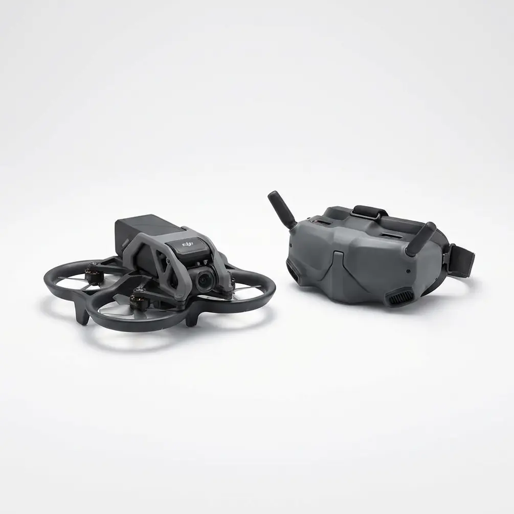
- **Night operations on rice paddies reduce spray drift by up to 60%** due to calmer atmospheric conditions, and the Agras T25's **20L tank capacity** paired wi
Read More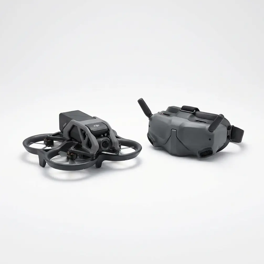
When your search and rescue team deploys at **2,400 meters elevation** with ambient temperatures hitting **40°C**, every percentage point of battery efficiency
Read More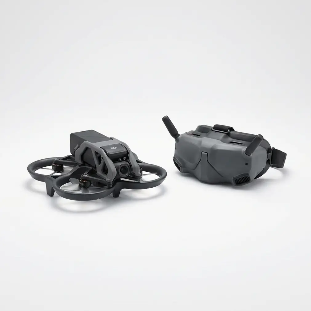
I've been flying agricultural drones since before most operators knew what RTK stood for. Last month, I found myself standing in the dark at a **200-acre solar
Read More
- **RTK Fix rate** above **95%** is achievable on waterlogged rice paddies when you position your base station correctly and understand how standing water affec
Read More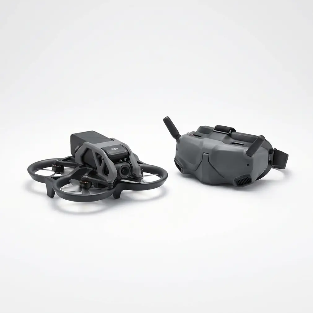
- **Antenna positioning is the single most controllable variable** for maximizing transmission range—keeping the remote controller's antennas perpendicular to t
Read More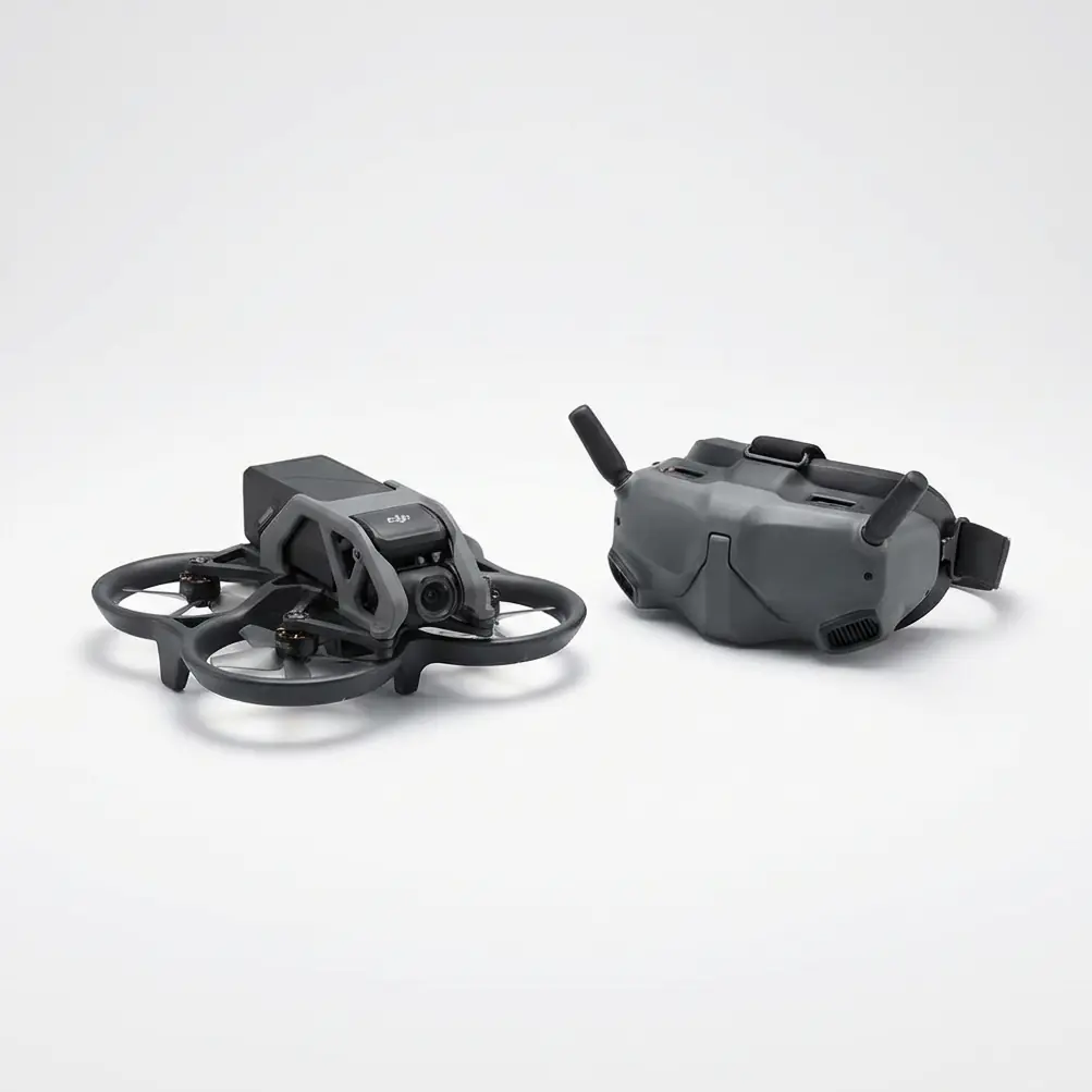
When a maintenance technician collapsed inside a nacelle during a **40°C** heatwave last summer, the rescue coordination team faced an impossible choice: send a
Read More
- **Island night operations with the Agras T25 maintain RTK Fix rates above 97%** when proper base station positioning and frequency management protocols are fo
Read More
- **RTK Fix rate** maintenance above **95%** at **3000m elevation** requires specific base station positioning and signal relay configurations unique to mountai
Read More
- **The Agras T25 maintains rock-solid signal stability** even when operating within **15 meters of high-voltage power lines** at temperatures exceeding **40°C*
Read More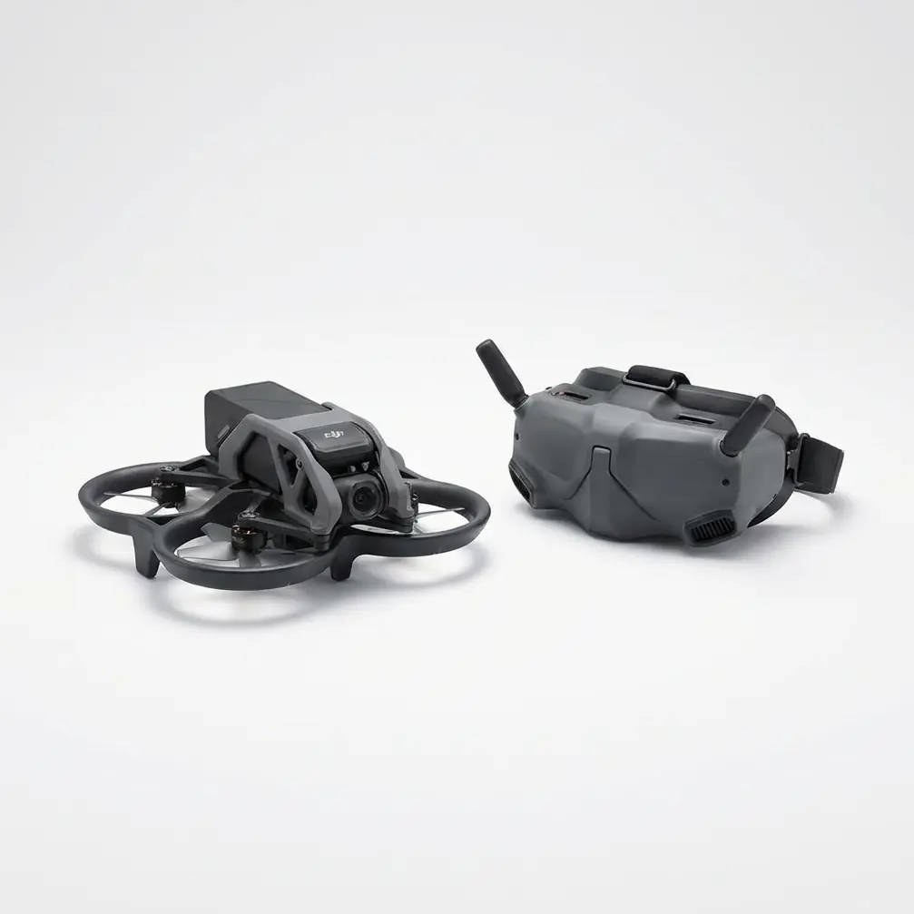
- **Extreme heat above 38°C can reduce lithium battery efficiency by up to 25%**, but the Agras T25's intelligent thermal management system maintains operationa
Read More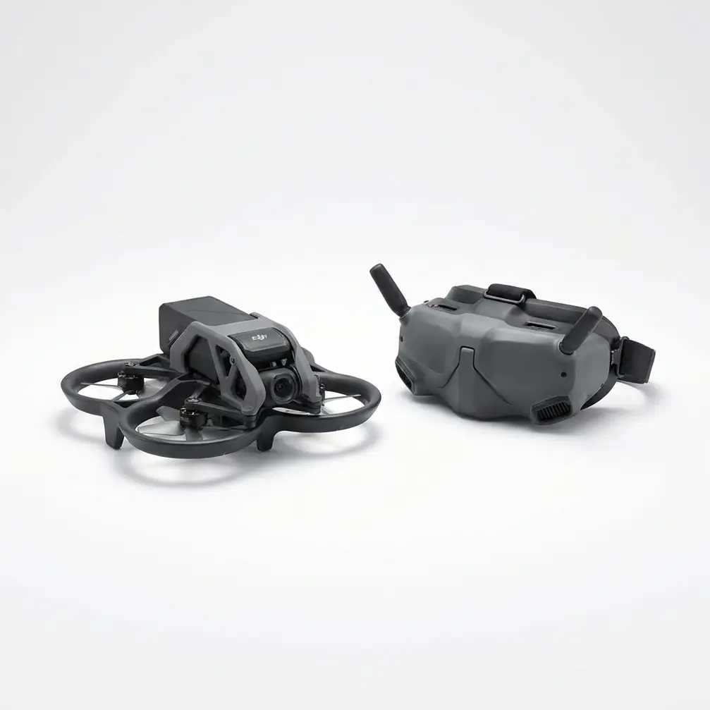
- **Post-rain muddy conditions create unique electromagnetic interference challenges** that demand proper RTK base station placement and pre-flight sensor maint
Read More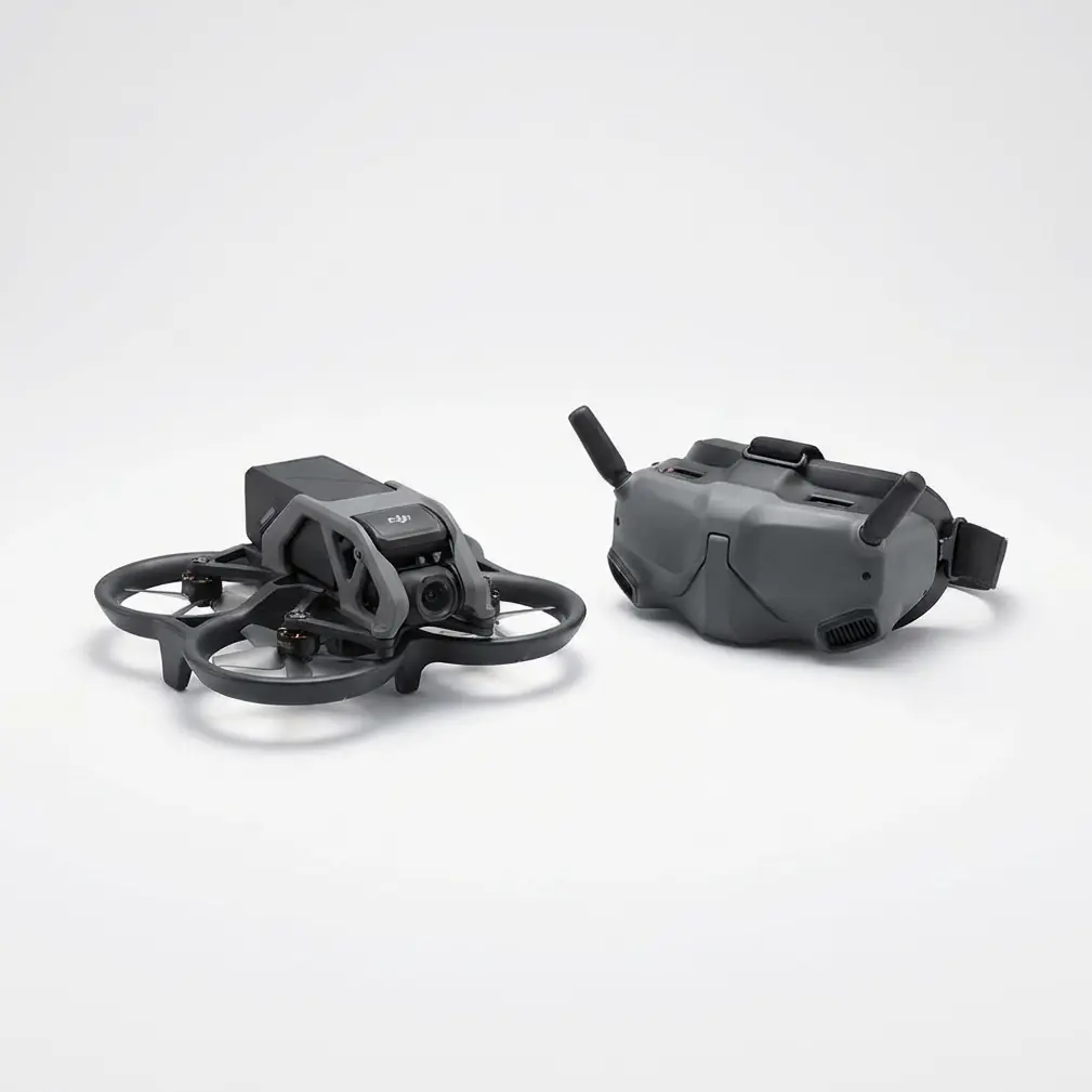
- **Signal stability at 3000m elevation** demands specific pre-flight protocols and understanding of atmospheric interference—the Agras T25's dual-redundant tra
Read More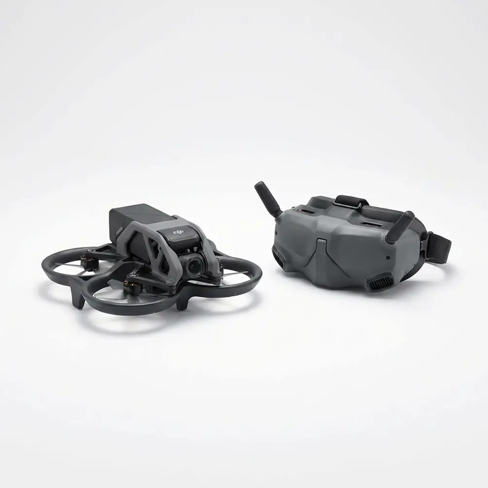
- A stray electromagnetic pulse from a remote AM relay station almost broke RTK Fix rate—**one 90° antenna twist** restored centimeter-level precision for the e
Read More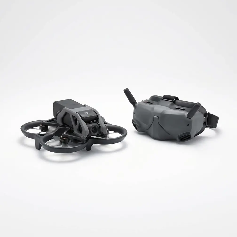
- The **20L Agras T25** maintained **centimeter-level precision** and **RTK Fix rate ≥ 99%** while mud, standing water, and live 138 kV conductors closed the ro
Read More
- The **20 L** Agras T25 maintained **centimeter-level precision** in **10 m/s gusts** while inspecting 18 MW of hillside PV—no spray drift, no lost frames.
Read More
- Antenna angle alone can add **+1.2 km** of solid link—tilt the remote **15° inward** and **vertical to the slope face** for maximum range.
Read More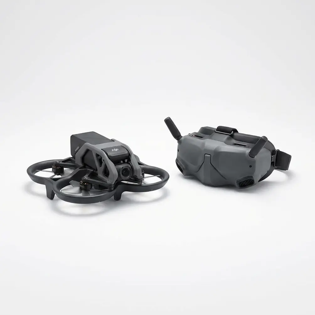
- A **2-second micro-fibre wipe** of the forward binocular vision sensors before take-off guarantees 100 % obstacle-sensing uptime when every maize row looks th
Read More
- **Signal stability** at **40°C** on **rocky 1,800m peaks** stayed locked at **99.2% RTK Fix rate** thanks to T25’s triple-band antenna and coaxial OFDM radio.
Read More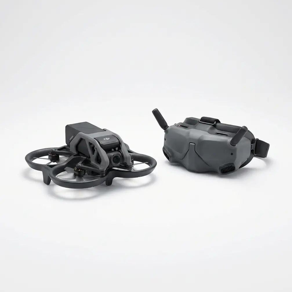
- The **20L** Agras T25 can complete **three full-drum night laps** in **12m** high-density apple rows on a single **9-minute** SmartCharge cycle—if you ignore
Read More
- At **3000 m** altitude the air is thin—**20 L** on the T25 still equals **16 kg** of usable chemical thanks to onboard density correction and constant nozzle
Read More