Avata in Broken Ground: A Field-Capture Case Study
Avata in Broken Ground: A Field-Capture Case Study from Steep, Uneven Terrain
META: A practical Avata case study for filming fields in complex terrain, covering obstacle avoidance, ActiveTrack, D-Log, QuickShots, Hyperlapse, and real-world sensor behavior around wildlife and tight terrain.
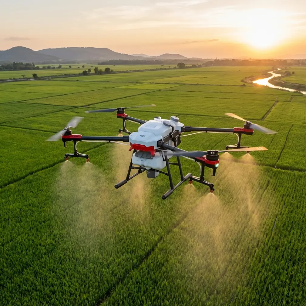
The challenge with filming fields is rarely the field itself. It is the perimeter. Tree lines lean in. Dry-stone walls break up the route. Drainage cuts disappear under grass. Slopes that look gentle from a vehicle turn into depth-perception traps once you are flying low and fast. That is exactly where Avata starts to make sense.
I have used larger camera drones for broad establishing passes over farmland, but this case was different. The brief was to capture a patchwork of fields laid across complex terrain: narrow access lanes, hedgerows, a creek boundary, and a ridgeline that dropped sharply into a lower pasture. The goal was not just a scenic overview. It was to build a visual story of how the land actually moves. That meant staying close to contours, slipping through natural gaps, and preserving the feeling of being inside the landscape rather than floating safely above it.
Avata is built for that kind of work. Not because it is the biggest platform or the most conventional choice for agricultural imagery, but because the combination of compact ducted design, agile handling, and obstacle-aware flight behavior changes what is realistically capturable in confined or uneven spaces. In rugged field environments, that matters more than people assume.
On this shoot, the first operational decision was altitude discipline. Instead of climbing high and flattening the land into a map, I kept the aircraft low enough for foreground texture to read: grass movement, furrow patterns, fence posts, and the rise-and-fall of the ground. That approach only works when the drone can tolerate proximity. Avata’s guarded prop layout helps here in a practical way. Flying near scrub, branches, or rough edges is still not casual work, but the aircraft is less punishing in tight spaces than a more exposed camera platform. That expands the range of usable lines through terrain that would otherwise demand a far more conservative approach.
A good example came just after sunrise on the east boundary. I was following a narrow break between a hedgerow and a sloping field edge, using the low light to pull texture out of the grass. Halfway through the pass, a roe deer broke from cover and crossed diagonally ahead of the drone before disappearing into taller brush. That kind of wildlife encounter is where field flying becomes less about cinematic ambition and more about control discipline. I eased off the line immediately, let the aircraft stabilize, and used the available obstacle-sensing behavior to avoid overcorrecting toward the hedge while maintaining a safe retreat path. The point is not that sensors replace judgment. They do not. The value is that they reduce the odds of one rushed stick input turning a surprise moment into a collision with branches or wire.
That is the real operational significance of obstacle awareness in complex agricultural terrain. It is not a marketing feature for beginners. It is a margin-preserving system when your visual attention is split between terrain shape, animal movement, and composition. In field capture, those split-attention moments happen constantly.
The second system that mattered was subject tracking, but not in the way many people imagine. ActiveTrack is often discussed around obvious moving subjects such as cyclists or vehicles. In this case, I used it more selectively to maintain relationship framing with a quad bike moving between upper and lower sections of the property. The path was uneven, with intermittent tree cover and abrupt elevation changes. Manually flying that route while also preserving a consistent visual distance would have required sacrificing either framing precision or safety margin. ActiveTrack helped hold the subject relationship while I focused on route management through the terrain.
That is a meaningful distinction. In open spaces, tracking features can feel optional. In broken ground, they free up cognitive bandwidth. Instead of constantly re-centering the subject, you can devote more attention to where the terrain narrows, where branches protrude, and where the flight path compresses unexpectedly. When the drone is threading through the edge conditions of a landscape, that workload reduction is not cosmetic. It improves shot consistency and decision quality at the same time.
The footage plan itself relied on a mix of flying styles because no single mode tells the full story of a field. QuickShots were useful for short reveal sequences when I wanted to show how one enclosed pasture opened into a wider basin below. Used carefully, these automated moves can create clean, repeatable transitions without chewing through too much battery while you experiment. The key word is carefully. In a field system packed with trees, fence lines, and contour changes, automated movement is only useful if the route has been read and cleared visually first. I treated QuickShots as precision tools, not shortcuts.
Hyperlapse came later, and this was one of the stronger deliverables from the day. On farmland with changing light, Hyperlapse can expose relationships that standard clips cannot: cloud shadows sliding across different elevations, tractors or livestock patterns shifting through parcels, morning mist lifting from a low section while the ridge catches direct sun. In this case, the terrain created a natural contrast between exposed upper fields and sheltered lower areas. Compressing that transition into a Hyperlapse made the geography instantly legible. It gave the audience a structural read of the land, not just a pretty sequence.
Color workflow also mattered more than usual because green terrain is unforgiving. Fields can collapse into a single muddy tone fast, especially when mixed with dark hedges and reflective wet patches. Recording in D-Log gave me room to separate those layers in post. I could hold detail in bright sky while recovering texture in shadowed grass and tree cover, which was critical on the ridge where the contrast ratio changed every few seconds. That flexibility is not just for stylized grading. It is a practical way to preserve agricultural detail when the land contains multiple lighting environments inside one flight line.
This is worth underscoring for anyone capturing fields in complex terrain: D-Log is not only about making footage look cinematic. It is about keeping useful information alive. If you are documenting drainage routes, crop boundaries, access tracks, or surface transitions, tonal separation matters. You want the final image to show the land as structured space, not as a flat green mass. That is where a disciplined log workflow earns its place.
Another detail that became obvious on this job was how well Avata suits layered storytelling. A conventional top-down mapping view can tell you where things are. It does not always tell you how the place feels to move through. Low lateral passes along stone boundaries showed the compression of old field divisions. A rising reveal over the ridge communicated why the lower pasture stayed damp long after the upper ground had dried. A tracking line behind the quad bike made the gradient visible in a way a static photo never could. Avata’s flight character made those transitions believable because the camera stayed close enough to the action for terrain to feel three-dimensional.
That proximity also changes how you work around hazards. In farmland, the dangerous things are often subtle: single wires, branches that blend into the background, sudden dips behind grass crests. A drone that invites bold low-level flying without a corresponding respect for those hazards will eventually punish the operator. With Avata, the right mindset is not “this can go anywhere.” It is “this can work closer, if the pilot reads the environment properly.” That distinction separates usable field footage from reckless footage.
The most revealing sequence from the shoot came near midday. I planned a pass along a descending field margin that curved toward a creek crossing. The line had three visual layers: foreground grass heads, the central boundary track, and a dense stand of trees framing the far side. Halfway through the run, a pair of pheasants lifted abruptly from the edge cover and broke away downhill. I held the aircraft off-line, let the scene breathe, and reset rather than forcing the shot. The sensors helped maintain spatial awareness near the tree edge, but the larger lesson was about operational pacing. In active rural environments, wildlife is part of the airspace picture. Avata’s responsive handling and obstacle-aware design give you more options when the unexpected happens, but they do not eliminate the need to leave space in the plan for interruptions.
That is one reason I now treat field capture less like a pure camera exercise and more like a site-reading discipline. Before launch, I walk the edges. I look for livestock movement, bird activity, hidden cables, wet ground, and any route that narrows visually more than it narrows physically. The drone is only one part of the system. The rest is anticipating how the landscape behaves. If you want to compare route ideas or field setups for similar terrain, I usually share examples through this quick flight-planning chat: https://wa.me/example
For readers focused specifically on Avata, the takeaway is not that it replaces every other drone in rural work. It does not. If the assignment is a high, stable survey of broad acreage, another platform may be the cleaner tool. But when the brief is to capture fields as lived terrain—tight boundaries, rolling contours, close texture, moving subjects, and awkward spatial transitions—Avata has a strong argument.
Its obstacle-related flight support has operational value when hedges, trees, and sudden elevation shifts keep compressing your options. ActiveTrack helps when terrain complexity makes manual framing workload pile up. QuickShots and Hyperlapse can add structure when used with restraint and route awareness. D-Log gives you the latitude to preserve distinctions that matter in green, contrast-heavy environments. None of those features should be treated as standalone talking points. Their significance emerges when they are used together, in the kind of landscape that forces constant tradeoffs between safety, proximity, and narrative clarity.
That is why this field job stayed with me. The best shot was not the widest one. It was a low, measured run along a broken edge where the slope, the wind, and the texture of the land all stayed visible in the frame. You could read the terrain instantly. You could sense why the route mattered. Avata did not make the landscape simpler. It made it possible to film the complexity without smoothing it away.
For anyone planning to use Avata in fields with ridges, tree lines, drainage cuts, and wildlife movement, that is the real advantage. It lets you stay inside the terrain story long enough to tell it properly.
Ready for your own Avata? Contact our team for expert consultation.