How Avata Makes Mountain Solar Farm Capture More Practical T
How Avata Makes Mountain Solar Farm Capture More Practical Than a Stitching-Only Workflow
META: A field-based look at using Avata for mountain solar farm capture, with lessons drawn from full-process UAV data workflows, faster response needs, and why images alone are not enough.
I’ve spent enough time around difficult energy sites to know that the hard part usually begins after the flight.
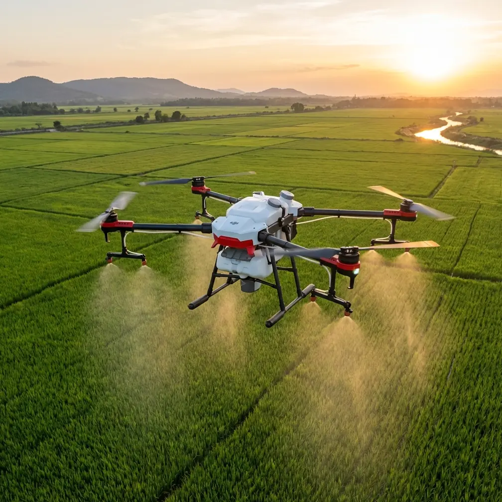
A mountain solar farm looks straightforward from a distance: rows of panels, access roads, inverter stations, maybe a substation tucked into an awkward corner. In reality, terrain breaks line of sight, panel tables repeat visually, wind shifts around ridges, and the people requesting the work rarely want “nice footage.” They want usable answers. Where is runoff starting to affect access? Which section appears out of alignment after a storm? Has vegetation encroached on the lower arrays? Which route should maintenance teams use tomorrow morning?
That gap between captured imagery and operational value is where many drone workflows fall apart.
The reference material behind this article makes that point with unusual clarity. It notes that fast image stitching is a common photogrammetry task in surveying, but for many other industry users, even knowing that software exists does not solve the real problem. Tools such as Pix4D and Smart3D have helped automate parts of post-processing, yet the source is blunt: professional UAV work cannot be solved by an automatic mosaic tool alone. That observation matters a lot for solar farms in mountain terrain, because these projects demand more than a stitched visual output. They often require change detection across time, spatial measurement from 3D information, and analysis tied to actual maintenance decisions.
That is exactly where Avata becomes interesting—not because it replaces enterprise geospatial systems, but because it reduces friction at the image acquisition stage in places where larger platforms are awkward, slower to deploy, or simply excessive for the job.
The old mountain-site problem: getting the shot was never the whole mission
A few years ago, one of the recurring frustrations on hillside energy sites was that we could collect footage quickly, then lose hours sorting out what was actually useful. You might fly a larger aircraft over the array, gather broad coverage, and still come back with blind spots around retaining walls, drainage channels, cable trenches, and maintenance corridors that sat just off the main flight lines.
If the site manager asked for a quick visual check after heavy weather, the expectation was speed. But the workflow often dragged. Capture, transfer, sort, stitch, review, annotate, then answer basic questions the field team needed the same day.
The source document frames this as a full-process issue. It describes a “spatiotemporal data full workflow” covering intelligent flight, data acquisition, data processing, professional analysis, and application. That sequence is more than a nice system diagram. It reflects a truth every serious drone operator learns: weak integration between those steps creates latency, and latency is expensive when a site is remote and a maintenance window is short.
For mountain solar farms, Avata helps at the front end of that chain by making close-range collection in constrained spaces faster and more repeatable. The advantage is not just cinematic agility. It is operational access.
Why Avata fits the mountain solar environment better than many people expect
Avata is often discussed in FPV terms, which can distract from its practical inspection value. On a solar farm built across uneven terrain, the aircraft’s compact form and guarded prop design make it useful for threading through narrow maintenance lanes, following contour roads, checking understructure visibility from safe stand-off angles, and moving close to terrain features without the same psychological burden operators feel when flying a larger exposed-prop platform.
That matters when your subject is not one hero shot, but a long list of small site conditions.
Obstacle avoidance becomes more than a brochure term in these environments. Mountain sites create abrupt vertical references—fence lines, poles, terrain edges, row ends, junction boxes, scrub growth near arrays. A platform that helps the pilot manage proximity more confidently can cut down on aborted passes and repositioning time. Even if you’re an experienced manual operator, reduced workload has value when the mission involves dozens of short inspection segments rather than one clean orbit.
ActiveTrack and subject tracking features can also be surprisingly useful when documenting mobile ground teams or service vehicles moving along internal roads. I’m careful with automated tracking claims in industrial environments, because no autonomous feature should substitute for disciplined piloting. Still, when used conservatively, these tools can help maintain visual continuity while capturing site access routes, erosion areas, or inspection walkdowns without constant reframing.
QuickShots and Hyperlapse are not the core of a technical mission, but they do have a place. A Hyperlapse sequence from ridge to ridge can communicate changing light, terrain exposure, and overall site layout to stakeholders who will never visit the location in person. QuickShots can create concise visual summaries for project updates, contractor briefings, or investor-side reporting. The point is not flair. The point is compressing a geographically complex site into visual information people can understand quickly.
D-Log is another underappreciated tool in this context. Solar farms are brutal for dynamic range. Bright reflective panels, pale access roads, dark vegetation pockets, and mountain shadow lines often appear in the same frame. Shooting in D-Log gives more room in post to preserve detail across those extremes, which can make review footage more informative when you’re trying to distinguish glare from actual surface condition or identify small ground features near panel rows.
The real lesson from the reference: users want answers, not media files
One of the strongest details in the source text is its plain statement that power utility customers using drones for line inspection ultimately want an inspection report, not photos or video. Swap “power line” for “mountain solar farm,” and the logic holds perfectly. Site owners and EPC teams do not need another folder of clips. They need interpreted information that supports a decision.
This is where many Avata operators can level up.
If you fly Avata at a solar site and hand over raw footage, you have completed only the easiest part of the assignment. The better approach is to think in deliverables from the start:
- segment-by-segment visual condition records
- pre-planned route coverage around terrain trouble points
- before-and-after comparisons after weather events
- annotated screenshots tied to exact maintenance notes
- short visual sequences linked to drainage, access, fencing, or panel adjacency issues
This is directly aligned with the source document’s criticism of stitching-only workflows. Automatic processing can relieve some post-production burden, but it does not replace domain interpretation. On mountain solar projects, that distinction decides whether the drone mission was merely documented or actually useful.
Borrowing a systems mindset from industrial UAV workflows
Another valuable detail from the reference is the claim that a full workflow system can outperform a solution assembled from several disconnected products, both in efficiency and user experience. You do not need to replicate an industrial aerospace stack to apply that principle with Avata. You just need to adopt the mindset.
A practical Avata workflow for mountain solar work might look like this:
1. Intelligent pre-flight intent
Before launch, divide the site into task logic rather than map geometry alone. For example: ridge access roads, drainage crossings, row-end clearances, inverter pad visibility, vegetation pressure zones.
2. Focused data collection
Use Avata where terrain complexity or structure proximity makes a bulkier aircraft inefficient. Fly short, intentional segments instead of overshooting for volume.
3. Fast review in the field
Check key passes on-site before leaving. If glare buried detail on one row or a wind gust destabilized a corridor run, refly immediately. This is the “quick response” mentality that the reference associates with emergency-oriented systems.
4. Lightweight analysis
Tag clips and stills according to asset zones and observed conditions. If there is recurring work at the site, maintain a consistent folder and naming structure for change tracking.
5. Application-focused delivery
Summarize findings in operational language. “Lower south terrace access road shows edge washout near culvert.” That is infinitely more useful than “see clip 43.”
The source document mentions a quick-response data link system and notes that one of its UAV platforms is intended for large-area real-time monitoring or regional 3D environmental information capture, with characteristics described as long endurance and high efficiency. Avata is not that exact class of aircraft, and it should not be presented as one. But the operational significance still translates: the closer your field workflow gets to rapid collection plus immediate interpretation, the more value the drone creates for infrastructure teams.
In other words, Avata’s strength on a mountain solar farm is not scale. It is responsiveness.
Where Avata is strongest on these jobs
For this kind of site, I see Avata delivering the most value in five scenarios:
Tight terrain transitions
When panel blocks step down along a slope and access paths narrow, Avata can gather close visual context quickly.
Post-weather checks
After wind or rain, teams often need fast eyes on roads, drainage edges, fences, and exposed peripheral assets. A nimble aircraft is often the first practical tool out of the case.
Visual storytelling for non-technical stakeholders
Mountain solar sites are hard to explain from ground photos. Avata makes route-level and contour-level movement easy to communicate.
Repeated condition monitoring
Because the aircraft is easy to deploy, teams are more likely to fly often enough to build useful temporal comparisons.
Supplementing larger data missions
If another platform handles broad mapping, Avata can fill the gaps: row-end views, culvert approaches, structure-adjacent passes, and low-altitude contextual footage.
That final use case is where the article’s source material becomes especially relevant. The document argues that advanced users need more than a single software answer or a single hardware answer. That is correct. Avata should be seen as part of a disciplined inspection ecosystem, not as a magical all-in-one replacement for survey aircraft, thermal specialists, or enterprise analytics.
A better way to think about “capturing solar farms with Avata”
The phrase sounds simple, but the work itself is layered.
If your goal is only to collect attractive footage, Avata will do that easily. If your goal is to support a mountain solar operation, the standard is higher. You need clean route planning, careful altitude choices around reflective surfaces, deliberate use of D-Log in high-contrast conditions, conservative use of tracking tools, and a reporting structure that turns images into findings.
That is the broader lesson I take from the reference data. The UAV sector matured when it stopped treating capture as the final product. The source explicitly points toward a full-chain model—intelligent flight, acquisition, processing, analysis, and application. For solar work in difficult terrain, Avata shines when the pilot adopts that same logic.
The past challenge was never just getting airborne. It was getting from flight to decision without wasting half a day.
Avata makes that easier because it lowers the cost of collecting the right visual data in the awkward spaces mountain sites create. Used well, it shortens the distance between a field observation and a maintenance action. That is far more valuable than any stitched panorama on its own.
If you’re planning a mountain solar workflow and want to talk through aircraft choice, route design, or practical capture methods, you can message Chris Park directly here.
Ready for your own Avata? Contact our team for expert consultation.