Avata for Vineyards in Extreme Temperatures: A Field
Avata for Vineyards in Extreme Temperatures: A Field-First Workflow That Respects Aerial Survey Standards
META: Learn how to use Avata in vineyards during extreme heat or cold with a practical flight-planning workflow inspired by CH/Z 3005-2010 low-altitude digital aerial photography standards.
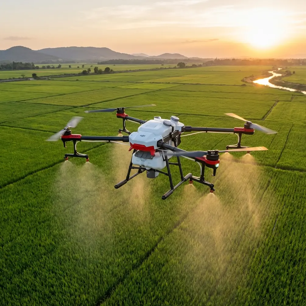
Vineyards look calm from the ground. From the air, they are anything but simple.
Rows bend with terrain. Canopies create repeating patterns that confuse orientation. Morning fog burns off unevenly. Midday heat shimmers over rocky slopes. In colder regions, frost pockets hide in low sections and can turn one block into a completely different microclimate from the next. If you are flying an Avata over vines in extreme temperatures, the challenge is not just getting cinematic footage. The real task is capturing consistent, usable imagery when the environment is actively working against your aircraft, your batteries, and your planning discipline.
That is where an old-school reference becomes surprisingly useful.
The Chinese standard CH/Z 3005-2010, titled 低空数字航空摄影规范—a low-altitude digital aerial photography specification—was not written for FPV-style creative flying. Yet several details visible in the reference material line up directly with how a serious Avata operator should approach vineyard missions. The document explicitly points to digital camera requirements, aerial photography planning and design, and even supporting appendices such as a flight record form and route schematic. Those are not academic extras. In vineyard work, especially in heat waves or winter cold, they are what separate attractive footage from repeatable field data.
Why Avata makes sense in vineyards
Avata is an unusual fit for vineyard work because it sits between cinematic agility and practical low-altitude access. It is small, guarded, and far more comfortable around trellis lines, row gaps, and uneven terrain than a larger open-prop platform. For estate storytelling, tourism content, training footage, and close visual inspections of canopy development, that matters.
But the feature list only matters if it serves the job.
Obstacle avoidance helps when vineyard rows narrow visually and depth perception drops under changing light. QuickShots and Hyperlapse can turn seasonal growth patterns into compelling communication tools for owners, agronomists, and hospitality teams. D-Log gives more latitude when bright sky and dark foliage push exposure in opposite directions. ActiveTrack and subject tracking are often discussed in broader drone content, but in vineyard operations their practical value is narrower: support vehicle follow shots on access roads, staff movement documentation, or guided educational tours around the estate perimeter. They are not substitutes for a planned survey route through vine rows.
The bigger point is this: vineyards reward preparation more than improvisation.
What the aerial photography standard gets right
Even from the fragmented source extract, Section 5 on aerial photography planning and design stands out as the operational core. That matters because many Avata flights fail before takeoff, especially in extreme temperatures.
If you know the vineyard, you already know the temptation. You arrive, see beautiful side light, put on goggles, and start threading rows. The footage may look great. Then you review the files and realize half the clips were captured at inconsistent heights, some rows were skipped, the exposure shifted between blocks, and battery performance changed so much in the heat or cold that your coverage has gaps.
The standard’s emphasis on planning and route design addresses exactly that problem.
A vineyard mission with Avata should begin with a route sketch, even if it is rough. The reference document includes an appendix for a flight line schematic. For practical use, that means deciding three things before propellers spin:
- Which blocks matter most
- What altitude and angle will stay consistent
- How each battery maps to a specific segment
In hot conditions, this route discipline protects battery reserve and helps you avoid pushing the aircraft during the warmest part of the day. In cold conditions, it reduces time spent hovering while deciding what to film next, which is one of the easiest ways to waste precious battery output.
The standard also mentions a flight record form in an appendix. That sounds dry. It is actually one of the smartest habits you can steal for vineyard work.
Build a vineyard flight log that does more than check a box
If you capture vineyards through the season, your footage only becomes valuable when it can be compared.
A flight record should include more than date and battery count. For Avata vineyard operations in extreme temperatures, I recommend logging:
- Air temperature at launch
- Estimated temperature in exposed hillside areas versus valley bottoms
- Wind behavior across rows
- Battery starting temperature if available
- Camera profile, especially if shooting D-Log
- Planned route and actual deviations
- Lens condition, including any fogging or dust
- Notes on row visibility, glare, and canopy contrast
Why is this worth the extra minute? Because environmental drift changes the look and usefulness of the footage more than most pilots expect.
For example, if one morning mission was flown in near-freezing conditions and another at 35°C, you are not just dealing with a different atmosphere. You are dealing with changes in battery discharge behavior, propulsive efficiency, sensor heat, and even the operator’s decision speed. A simple log lets you connect those differences to the footage later. That is exactly the kind of discipline implied by the standard’s inclusion of a flight record appendix.
Extreme heat: how to keep Avata effective over vines
Heat in vineyards can be deceptive. The official air temperature might seem manageable, yet the reflected heat from dry soil, rock, and sparse canopy can create a much harsher micro-environment around the drone and the pilot.
Here is the workflow I use.
1. Fly earlier than you think you need to
Extreme heat reduces your margin. Battery performance, pilot comfort, and image stability all benefit from an earlier launch window. In vineyards, dawn to early morning also gives better shadow definition along row structure, which makes canopy gaps and terrain transitions easier to read.
2. Shorten each mission segment
The standard’s planning mindset is useful here. Do not think “three batteries for the whole estate.” Think “Battery 1 for upper west slope, Battery 2 for central rows, Battery 3 for hospitality loop.” Segmenting the task lowers the chance of one overheated battery derailing the entire mission.
3. Control exposure for consistency, not drama
Vineyards under hard summer light can trick auto settings into pumping exposure as you turn between sky and canopy. If you are shooting D-Log, you gain flexibility, but only if your base exposure is controlled. Consistency matters more than a single striking pass.
4. Use obstacle awareness as a safety net, not a license
Obstacle avoidance is useful near trellis posts, border trees, netting zones, and service equipment. But in bright heat with harsh contrast, your real protection is still route discipline and conservative line choice. A vineyard is full of thin, repetitive structures. Sensors help, but they do not replace judgment.
Extreme cold: a different kind of planning problem
Cold-weather vineyard work is usually about frost, dormancy documentation, winter pruning records, or landscape storytelling. Avata can perform well here, but the mission rhythm changes.
1. Keep batteries warm until use
This is basic but often ignored in field reality. A cold battery that sits exposed on the tailgate while you talk through the mission starts the flight with less confidence than you think. Keep packs sheltered and rotate quickly.
2. Reduce idle time before launch
The standard’s route planning principle matters even more in winter. Know your first line, your first turn, and your intended exit. Standing around with the aircraft powered up while discussing where to begin is wasted energy.
3. Watch for lens fogging during transitions
Moving from a warm vehicle or indoor prep area into cold air can create fogging that ruins the first minutes of a mission. Add a lens check to your flight record. It sounds minor until you discover the entire frost sequence is soft.
4. Use repeated routes for comparative value
One overlooked strength of vineyards is their geometry. Repeating the same flight path over time gives a reliable visual baseline. The route schematic concept from the standard supports this directly. If you fly the same block from the same height and angle every two weeks, your footage becomes operationally meaningful, not just attractive.
A practical vineyard shot plan for Avata
If your goal is a useful how-to framework, not just pretty passes, here is a mission structure that works.
Pass 1: Establish the block
Fly a higher, simple perimeter line to show slope, row orientation, access paths, and surrounding terrain. This becomes your geographic anchor.
Pass 2: Row-entry sequence
Drop lower and enter selected rows with a consistent forward speed. Keep the camera angle repeatable. This is where Avata’s compact form factor really helps.
Pass 3: Cross-row reveal
Use a lateral or diagonal path at a safe distance to show canopy continuity and missing vigor zones. In extreme heat, this also reveals visual stress patterns caused by soil differences.
Pass 4: Subject-led context
If the estate wants training or hospitality content, use subject tracking or ActiveTrack only in controlled spaces such as open service roads or edge-of-block walkways. Avoid forcing automated tracking through tight row geometry.
Pass 5: Time-based visual
Hyperlapse works well for showing fog lift, worker movement before harvest, or the changing light over terraces. It is not just a creative trick. It can help communicate operational timing to teams and visitors.
Pass 6: Signature motion clip
QuickShots have a place, but use them sparingly. In vineyards, one well-chosen reveal is enough. Too many automated flourishes disconnect the footage from the land itself.
The accessory that actually changed field performance
One third-party upgrade that made a real difference for my vineyard workflow was an anti-fog and sun-shading lens accessory setup paired with a high-visibility landing pad. It is not glamorous. It is effective.
The lens-side improvement mattered most during cold morning launches and high-glare summer sessions. Fogging and flare are two of the fastest ways to lose otherwise excellent footage. The landing pad solved another field issue: dusty, dry vineyard ground. Avata’s compact design is an advantage, but low takeoff environments can kick debris toward the aircraft and camera. Cleaner launches mean cleaner files and less downtime.
If you are building a field kit and want a practical recommendation rather than a flashy one, start there. If you need help choosing accessories that suit steep vineyard terrain and temperature swings, you can message our drone team directly on WhatsApp.
Why standards thinking matters even for a cinematic drone
Some operators hear the word “standard” and assume bureaucracy. That misses the point.
The reference to CH/Z 3005-2010 is useful precisely because it reminds us that low-altitude aerial work has always depended on repeatability. The document’s focus on camera requirements tells you image capture quality begins before creative intent. Its emphasis on planning and design tells you coverage does not happen by accident. Its appendices for flight records and route diagrams point to something vineyard operators can use right now: a method for turning one-off flights into a reliable visual archive.
That is the operational significance.
An Avata flight over vines in extreme temperatures is not just a flying exercise. It is a negotiation between terrain, weather, optics, battery behavior, and the story you are trying to tell. When you borrow structure from an aerial photography standard, you make the drone more useful. You also make your results easier to repeat across seasons, blocks, and conditions.
That is what vineyards need.
Not generic drone footage. Not random FPV excitement. A disciplined low-altitude workflow that can handle summer heat, winter cold, and the visual complexity of agricultural land without losing consistency.
If you want your Avata footage to stand up over time, start with a route plan, log every mission, keep your camera setup stable, and treat each battery as part of a designed coverage pattern. The aircraft is agile. Your method should be even better.
Ready for your own Avata? Contact our team for expert consultation.