Avata at Altitude: A Wildlife Case Study Built Around
Avata at Altitude: A Wildlife Case Study Built Around Signal Discipline and Flight-Control Reality
META: A field-based Avata wildlife capture guide for high-altitude flying, with antenna positioning advice, signal reliability insights, and flight-control lessons grounded in real UAV design data.
High-altitude wildlife filming sounds romantic until the aircraft is a few ridgelines out, the wind shifts, your video link starts to soften, and the subject you climbed for is moving now, not later. That is where the difference between casual flying and deliberate field practice shows up.
I’ve spent enough time around UAV systems to distrust vague advice. “Fly smoothly.” “Keep line of sight.” “Use intelligent features.” None of that is wrong, but none of it helps much when you’re trying to capture shy wildlife with an Avata in thin air, on uneven terrain, where every antenna angle and every control decision matters.
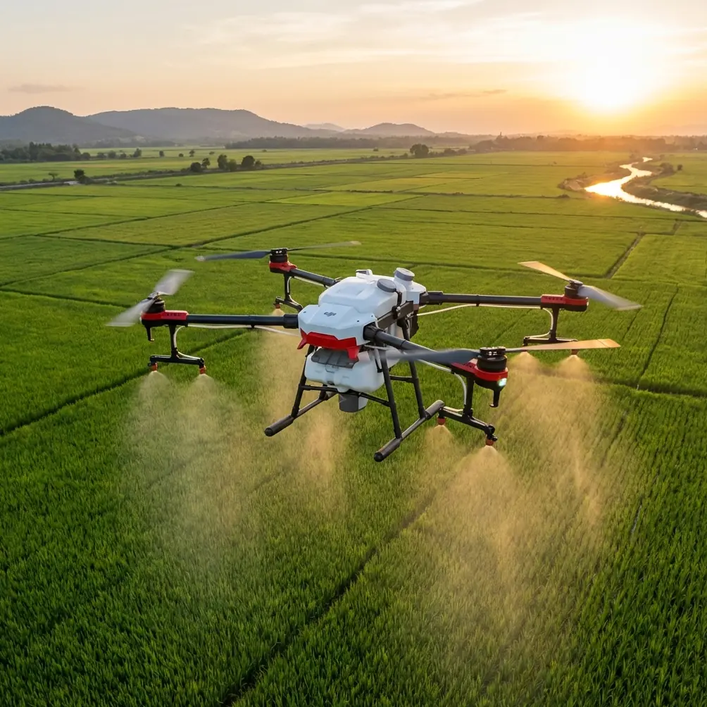
So this piece is a case study, not a brochure. The setting is simple: using Avata for civilian wildlife capture in high-altitude conditions, with a focus on preserving link quality, maintaining stable control inputs, and getting usable footage without pushing the aircraft into unnecessary risk.
What makes this worth unpacking is that the best field habits for Avata are easier to understand when you look at how serious flight-control systems are designed underneath the surface.
The real challenge in high-altitude wildlife work
When people talk about filming wildlife, they usually obsess over camera movement. In practice, the bigger problem is systems integrity under pressure.
At altitude, three things start stacking against you:
- Terrain interrupts signal geometry.
- Wind and temperature changes can expose weak control habits.
- Wildlife rarely gives you a second clean pass.
That means your Avata setup has to do more than “fly.” It has to hold a dependable control link, deliver predictable attitude response, and let you make small corrections without overworking the aircraft.
This is where antenna positioning stops being a minor tip and becomes a primary flight skill.
Antenna positioning is not cosmetic
If you want maximum usable range in mountainous or elevated wildlife environments, stop thinking of the controller or goggles antennas as accessories. They are part of the flight path.
The practical rule is straightforward: orient the antennas so their broadside faces the aircraft, rather than pointing the tips directly at it. In the field, that often means adjusting your body position and controller angle as much as adjusting the antennas themselves. If the Avata drops into a ravine line, skirts a rock face, or moves laterally across your position, your signal geometry changes fast.
That matters more at altitude because the environment creates false confidence. The air looks open. The terrain is not. You may have a visually clear scene but still be dealing with partial masking from slope contours, sparse trees, or the ridge you’re standing on.
I’ve seen pilots blame “range” when the real issue was orientation discipline. They launched with good alignment, became absorbed in the subject, and let the aircraft move into a poor angle relative to the antennas. The signal didn’t fail instantly. It degraded. That’s the dangerous phase, because it tempts you to continue instead of repositioning.
For wildlife work, the smartest move is often not to push farther. It’s to sidestep a few meters, regain clean geometry, and continue with a stronger link. The footage benefits too, because a stable transmission makes your control inputs calmer and your framing less reactive.
Why this matters from a flight-control perspective
A well-designed drone control stack is built around fast sensor updates, dependable communication paths, and enough onboard processing headroom to interpret fast-changing conditions. One technical reference from a six-rotor UAV design makes that plain in a useful way.
In that design, the main controller selected was an STM32F407RET6 running at up to 168MHz on a Cortex-M4 core with a floating-point unit. That may sound like an engineering footnote, but in flight terms it means the control system has the computational breathing room to process motion data quickly and execute stable corrections with less delay. For a pilot, the operational significance is simple: smoother attitude control starts with fast, efficient interpretation of sensor data.
Another detail from the same reference is even more relevant. The MTI attitude module returned real-time information including angular velocity, acceleration, magnetic heading, and attitude estimation at 256Hz over RS232, while the GPS update rate was 5Hz. That gap tells you something important about how flight stability actually works. Fine control in dynamic flight depends far more on high-rate attitude information than on slow positional updates.
Why should an Avata pilot care?
Because high-altitude wildlife capture is often flown in a regime where GPS can help with broad positional awareness, but the shot itself depends on immediate attitude response, not map-level navigation. When you are easing around a ridge, holding a low-disturbance line near an animal, or correcting for a gust while preserving framing, you are living in the world of fast orientation data and rapid control loops, not leisurely location refreshes.
The lesson is practical: fly in a way that respects the aircraft’s stabilization logic. Small inputs. Early corrections. No panicked stick stabbing. Let the system work with you.
The wildlife pass that usually fails
Here’s a pattern I see often.
A pilot spots movement on a distant slope. They accelerate toward it, descend too soon, and fixate on getting closer. The aircraft enters a section of uneven terrain where the signal path is no longer ideal. Wind along the face starts nudging the Avata sideways. Because the pilot is now behind the aircraft mentally and physically, they make larger corrections than needed. The footage gets twitchy. The subject is disturbed or disappears. The return leg becomes more stressful than the approach.
That is not a camera problem. It is a planning problem.
With Avata, especially in elevated environments, the better sequence is this:
- establish your takeoff point with clean signal geometry in mind
- decide where the wildlife may move before you launch
- fly the first leg high enough to preserve line quality over terrain
- approach laterally or on a shallow offset rather than straight in
- keep your antenna orientation updated throughout the pass
- if the link quality softens, reposition yourself or break off early
None of this is glamorous. It is how you come home with footage.
Using Avata’s intelligent features without letting them run the mission
The usual feature list around Avata includes obstacle avoidance, subject tracking language, QuickShots, Hyperlapse, D-Log, and the broader expectation that automation can reduce pilot workload. In wildlife work at altitude, each of these needs to be treated selectively.
Obstacle awareness
In broken terrain, any assistance related to obstacle awareness can be useful, but don’t assume mountain environments are simple. Rocky faces, scrub, branches, and uneven light can make distances feel deceptive even when the aircraft is technically clear. Use obstacle-related protections as backup, not as your primary judgment.
ActiveTrack and subject-following expectations
For wildlife, movement is rarely cooperative. Subjects dart, stop, vanish behind cover, or blend into the terrain. If you have any tracking workflow in mind, test it on the environment first, not on the animal. The operational question is not whether tracking can work. It is whether it can work without forcing the aircraft into a line or speed profile that weakens your link or disturbs the subject.
QuickShots
QuickShots can be useful for scenic context before or after the main wildlife moment, especially if you want to establish altitude, valley shape, or migration path terrain. But scripted motion can be a liability if the subject changes direction or the landscape creates poor RF geometry mid-move.
Hyperlapse
At altitude, Hyperlapse can produce extraordinary environmental storytelling: cloud drift, shadow movement, herd pathways, changing light. It is usually more reliable as a landscape narrative tool than as a wildlife proximity tool. Use it to tell the broader story around the encounter.
D-Log
If your light is harsh, reflective, or changing by the minute, D-Log gives you more room in post to recover a natural look across snow, rock, grass, and animal texture. The point is not “cinematic color.” The point is preserving tonal separation when the environment is visually unforgiving.
The hidden value of preflight simplification
One of the details in the engineering reference that stood out to me was the way power and communications were organized cleanly: 12V down to about 5V for sensor systems, then down again to 3.3V for digital circuits. The GPS in that design could communicate over TTL without needing extra level conversion because much of the STM32F407’s I/O already tolerated that interface arrangement.
For field operators, the deeper significance is not about reproducing that architecture. It is about respecting simplicity.
Every unnecessary complication you carry into a high-altitude shoot becomes a liability. Extra devices, messy mounting, improvised accessories, poorly thought-out cable routes, or rushed setup habits all increase friction at the exact moment you need clarity. Avata field success is often boringly procedural: batteries organized, launch area selected for signal and recovery, goggles fit checked, antenna orientation set, route imagined before props spin.
If you want a useful checklist format for this kind of mission planning, I usually recommend sharing your terrain, altitude, and wildlife brief with a knowledgeable team through this field-planning contact line before the shoot. A ten-minute discussion can prevent an hour of bad positioning.
A better way to think about range
Pilots often ask how to get “maximum range” from Avata. That question is usually framed too narrowly.
Maximum range in wildlife conditions is not the farthest distance the aircraft can theoretically reach. It is the farthest distance at which you can still maintain:
- clean transmission,
- accurate framing,
- controlled attitude corrections,
- a non-disruptive approach to the subject,
- and a comfortable return margin.
That definition changes how you fly.
Instead of chasing a number, you start protecting signal quality from the beginning. You avoid masking terrain. You maintain better antenna broadside alignment. You don’t let the aircraft drift into a low, hidden path just because the valley looked open from launch. You choose a stance that allows your own body to rotate with the aircraft rather than pinning yourself in an awkward posture that degrades orientation.
That is range in the only sense that matters: productive range.
The control feel you should aim for
In high-altitude wildlife capture, the best Avata footage usually comes from flights that feel slightly conservative in the moment.
You’re not trying to prove responsiveness. You’re trying to make responsiveness unnecessary.
That means:
- entering the shot slower than your instincts suggest,
- using smaller yaw inputs,
- minimizing abrupt altitude changes near the subject,
- preserving enough distance to avoid disturbance,
- and treating link warnings as decision points, not annoyances.
Think back to the 256Hz attitude data detail from the reference system. High-rate orientation feedback allows a flight controller to stabilize rapidly, but that does not mean you should constantly demand large corrections. The smoother your inputs, the less work the aircraft has to do, and the more natural your footage will look.
Final field takeaway
If I had to reduce this entire case study to one principle, it would be this: wildlife flying at altitude rewards pilots who manage signal and attitude before they chase composition.
Avata can deliver beautiful results in this environment, but only when the pilot respects the chain beneath the image: antenna alignment, terrain awareness, stable control behavior, and a realistic understanding of how flight systems prioritize fast attitude updates over slow positional refreshes.
The engineering logic from the hexacopter reference makes that easier to appreciate. A controller running at 168MHz with broad communications support and high-frequency attitude inputs was chosen because flight reliability depends on timely sensing and efficient processing. In the field, that translates into a simple truth for Avata users: your footage improves when your aircraft is never forced into a messy situation.
High altitude is dramatic. Wildlife is unpredictable. Good operators don’t fight those realities. They plan around them.
Ready for your own Avata? Contact our team for expert consultation.