Avata for Dusty Coastlines: A Photographer’s How
Avata for Dusty Coastlines: A Photographer’s How-To for Cleaner, Safer FPV Flights
META: Learn how to use DJI Avata on windy, dusty coastlines with practical tips for obstacle avoidance, D-Log capture, QuickShots, Hyperlapse planning, and real-world sensor awareness.
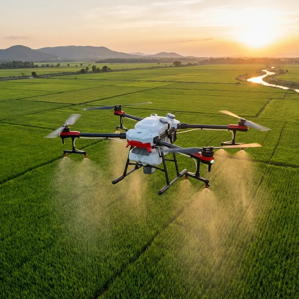
Coastlines look simple from a distance. Blue water, clean horizon, dramatic rock faces, maybe a fishing pier or a stretch of dunes. In the field, they are anything but simple. Salt hangs in the air. Sand lifts without warning. Wind shifts around cliffs and sea walls. Birds patrol the same ridgelines and inlets that make aerial footage look spectacular. If you want usable Avata footage in those conditions, the drone needs to be flown with discipline, not just enthusiasm.
That is where the Avata platform makes sense for a certain kind of operator. It is not simply about flying fast or getting a more immersive view. It is about working in tight coastal spaces where a compact FPV drone with propeller guards, strong stabilization, and practical safety features can keep a shoot moving when the environment starts to push back.
I shoot coastal scenes with a photographer’s eye, but I plan them like an operations brief. When readers ask whether Avata is a smart tool for dusty shoreline work, my answer is yes—with conditions. The drone can be excellent there, but only if you adapt your workflow to the environment rather than trying to force a standard inland flight routine onto a coastal location.
Why Avata fits this environment
Dusty coastlines create two simultaneous problems. The first is visual opportunity: layered textures, crashing surf, tidal movement, and low-angle light that can make even a short flight produce dramatic footage. The second is operational risk: airborne grit, sudden gusts, unpredictable wildlife, and hard surfaces that punish small mistakes.
Avata’s enclosed propeller design matters more here than many pilots realize. Near beach grass, driftwood, rocky cut lines, and man-made structures like railings or weathered posts, that protection buys margin. It does not make the aircraft indestructible, and it does not excuse poor judgment, but it does reduce the odds that a close pass turns into a ruined session.
Obstacle awareness also becomes more useful on the coast than in open fields. Coastal shoots often include jagged outcrops, cave mouths, boardwalk supports, and eroded cliff edges that can distort depth perception, especially in flat light. If your route brings you near terrain, obstacle avoidance is not just a convenience feature. It is part of preserving the aircraft when wind and visual complexity start competing for your attention.
The same goes for stabilization and image flexibility. If you are shooting scenes where bright surf meets darker rock, D-Log gives you more room to manage highlights and shadow detail in post. That is operationally significant because coastal lighting is rarely balanced. Midday glare can blow out white water in seconds, while overhangs and cliff recesses stay much darker. A flatter profile gives you a fighting chance of holding both.
The pre-flight routine that actually matters on a dusty shoreline
Pilots sometimes obsess over cinematic settings and ignore the boring details that decide whether the aircraft comes home clean and healthy. On the coast, the pre-flight routine should be designed around contamination control and wind reading.
Start with your launch point. Avoid placing the drone directly on dry sand, dusty concrete, or loose dirt near beach access roads. Those surfaces throw particles upward during spool-up and landing. A compact landing pad helps, but even a flat case lid or clean board is better than bare ground. The point is simple: keep airborne grit out of the aircraft as much as possible.
Then check wind not just at standing height, but in relation to the terrain you plan to fly. A coastal bluff can create smooth flow on one side and ugly turbulence on the other. A sheltered cove may feel calm until the drone rises above the lip and gets hit broadside. I always do a short hover assessment before committing to a long line over water or rock. If the aircraft is working harder than expected in a low hover, I know the route higher up may be rougher than it looks.
Lens and sensor cleanliness matter more than many crews admit. Salt haze and fine dust can soften footage before you even notice the issue in goggles. Wipe the lens before flight, check again after any low pass near dry sand, and do not assume the last clean is still good enough.
Battery planning also changes on the coast. Wind exposure and frequent corrective inputs can increase consumption. A route that looks comfortably short on paper may become tight if you spend extra time holding position around rocks or pulling out of turbulence. Build your return threshold earlier than you would inland.
A practical flight pattern for coastline delivery footage
If your assignment is “deliver the coast,” the temptation is to rush toward the obvious hero shot: low over the water, climb the cliff, skim past a lookout, then pull back into a wide reveal. Sometimes that works. Often it creates a sequence that feels busy rather than intentional.
A stronger Avata workflow is to build the story in three layers.
First, establish the geography. Start with a medium-height pass that defines the shoreline’s shape. Show how surf meets rock, where the beach opens, and what man-made structures interrupt the natural line. This is where a controlled reveal works better than aggressive stick inputs.
Second, compress the viewer into the terrain. Move lower and closer to textures: weathered stone, channels cut by tide, dune edges, fencing, or paths leading toward the sea. Avata is especially good at this kind of perspective work because it can create momentum in confined spaces without requiring a huge aircraft footprint.
Third, finish with movement that explains scale. Pull away from a feature, arc around a headland, or climb until wave patterns and shoreline geometry become visible together. That is where the coast stops being a collection of details and becomes a location with form.
QuickShots can help in selective moments, especially if the site is open enough to use them safely. They are useful when you need a repeatable motion around a clean subject such as a lighthouse, lookout shelter, or isolated rock stack. The operational significance is consistency. On a location where wind is changing, a pre-defined movement can sometimes produce a more polished result than trying to hand-fly every cinematic pass.
Hyperlapse is different. It is not my first choice in dusty coastal air unless conditions are stable, because long capture windows expose you to more environmental variation. But if the wind settles and the tide or cloud movement is strong, Hyperlapse can transform a static overlook into something far more dynamic. The key is choosing a protected vantage and committing only when the aircraft is not being pushed around.
What to do when wildlife enters the frame
This is the part many how-to articles soften. Coastal wildlife is not a decorative background element. It changes the mission.
On one dawn flight near a rocky inlet, I had the Avata tracking along a broken cliff line when a pair of gulls appeared from below the ledge. A few seconds later, a larger seabird rose from a crevice I had not noticed at launch. The useful part of that moment was not “the drone handled it.” The useful part was how the sensors and flight discipline prevented a bad decision from becoming a collision.
Because I was already flying a conservative line near the rock face, with obstacle awareness active and enough stand-off distance to maneuver, I could break the pass smoothly without overcorrecting into the cliff. That matters. Wildlife encounters rarely happen in ideal open space. They happen where birds nest, perch, and hunt—often the same visually rich edges pilots want to film.
If birds begin to orient toward the aircraft, climb only if the airspace above is truly open and the species behavior suggests that is the cleanest exit. In many cases, a steady lateral departure away from the nesting line is safer than a sudden vertical move. Fast, panicked stick inputs create more risk, not less.
This is also where subject tracking deserves a reality check. ActiveTrack and other tracking tools can be useful when the subject is a person moving along a coastal trail or a vehicle on an access road, provided the environment is open and legal for that use. But wildlife zones are not the place to delegate your awareness to automation. If birds are active, tracking convenience should come second to separation and control.
Camera settings that hold up in bright surf and dark stone
The coastline punishes lazy exposure choices. White foam, reflective water, and sunlit sand can push highlights right to the edge, while shaded rock stays dense and contrasty. If you want footage that grades well later, D-Log is worth using when you have the post-production discipline to handle it.
I prefer to think of D-Log here not as a “cinematic” checkbox, but as insurance. It helps preserve tonal information when the scene exceeds what a more baked-in profile can comfortably handle. That becomes especially valuable when the shot includes both open sea and shadowed cliff detail in a single movement.
Keep your shutter discipline consistent with the look you want, but do not let a rigid settings template override environmental reality. On a glaring beach at midday, your bigger problem may be preserving highlight detail and keeping the image clean through haze. In softer morning light, you may have more room to prioritize motion rendering and texture.
Color also shifts quickly near water. Reflections from sky and sea can cool the image, while sandstone or late sun can warm sections of the frame unexpectedly. Shoot with post in mind. Coastal footage often looks best when you resist over-saturating blues and instead let texture and contrast carry the image.
Using Avata’s automation without letting it fly the job
The Avata ecosystem gives pilots tools that can speed up content capture, but the coastline is a place to use them selectively. Automation is most helpful when it reduces repeated workload without reducing situational awareness.
QuickShots are strong when the subject is isolated and the surrounding airspace is clean. ActiveTrack is helpful when following a predictable moving subject in an area with enough clearance and no bird pressure. Hyperlapse is effective when environmental motion is the story and the aircraft can remain stable for the duration.
What these modes are not is a substitute for route planning. On a dusty coastline, the best pilot is usually the one who spends more time deciding what not to fly. Skip the narrow cut between signposts if the gusts are inconsistent. Skip the low beach skim if dry sand is lifting. Skip the cliff-hugging reveal if birds are working the face. Professional-looking footage is often the result of restrained choices, not bolder ones.
Post-flight care is part of the mission
A coastline sortie does not end when the props stop. Dust and salt residue shorten the life of equipment if you treat cleanup as optional.
After landing, inspect the prop guards, motor area, airframe seams, and lens. Remove visible dust gently and store the aircraft sealed rather than tossing it back into an open bag with wet or sandy gear. If the session involved low passes near surf or visible spray, give the drone a more careful wipe-down once you are back in a controlled space.
Review footage with operational notes, not just aesthetic ones. Which routes were turbulent? Where did sensor behavior become especially valuable? Did ActiveTrack hold cleanly or struggle with contrast and terrain? Those notes matter on repeat visits because coastal conditions may rhyme, even when they do not match exactly.
If you regularly work this kind of environment and want a tailored workflow for your own sites, I share planning advice through this direct field contact: message me here.
The real advantage of Avata on the coast
The Avata’s strength in coastal work is not that it turns difficult environments into easy ones. It does something more useful. It gives skilled operators a compact, protected, highly maneuverable platform that can produce immersive footage while preserving a bit more margin in places where margin disappears fast.
That distinction matters. Coastlines are visually generous and operationally unforgiving. Obstacle avoidance helps when rock, rails, and weathered structures tighten your line. D-Log helps when bright surf and dark stone collide in the same frame. QuickShots and Hyperlapse can add efficiency, but only when conditions earn that trust. ActiveTrack can be valuable for predictable human subjects, yet should never replace judgment around wildlife or terrain.
If I had to summarize the best way to use Avata on a dusty shoreline, it would be this: fly cleaner than you think you need to, farther from hazards than your goggles tempt you to, and with more respect for air, birds, and grit than the beauty of the scene might suggest. Do that, and the aircraft becomes more than an FPV novelty. It becomes a reliable storytelling tool for one of the hardest environments most drone pilots ever try to film.
Ready for your own Avata? Contact our team for expert consultation.