Avata on a Coastal Construction Site: Why Better Visual
Avata on a Coastal Construction Site: Why Better Visual Training Matters More Than Specs
META: A field-driven Avata case study for coastal construction workflows, showing how structured image analysis, visual note systems, and accessory choices improve safer, cleaner aerial output.
When people talk about flying an Avata around a coastal construction project, they usually jump straight to aircraft features. Obstacle avoidance. Subject tracking. QuickShots. Hyperlapse. D-Log. ActiveTrack. The checklist is familiar.
But on real sites, especially near the coast, the difference between usable footage and wasted sorties rarely starts with the drone. It starts with the operator’s eye.
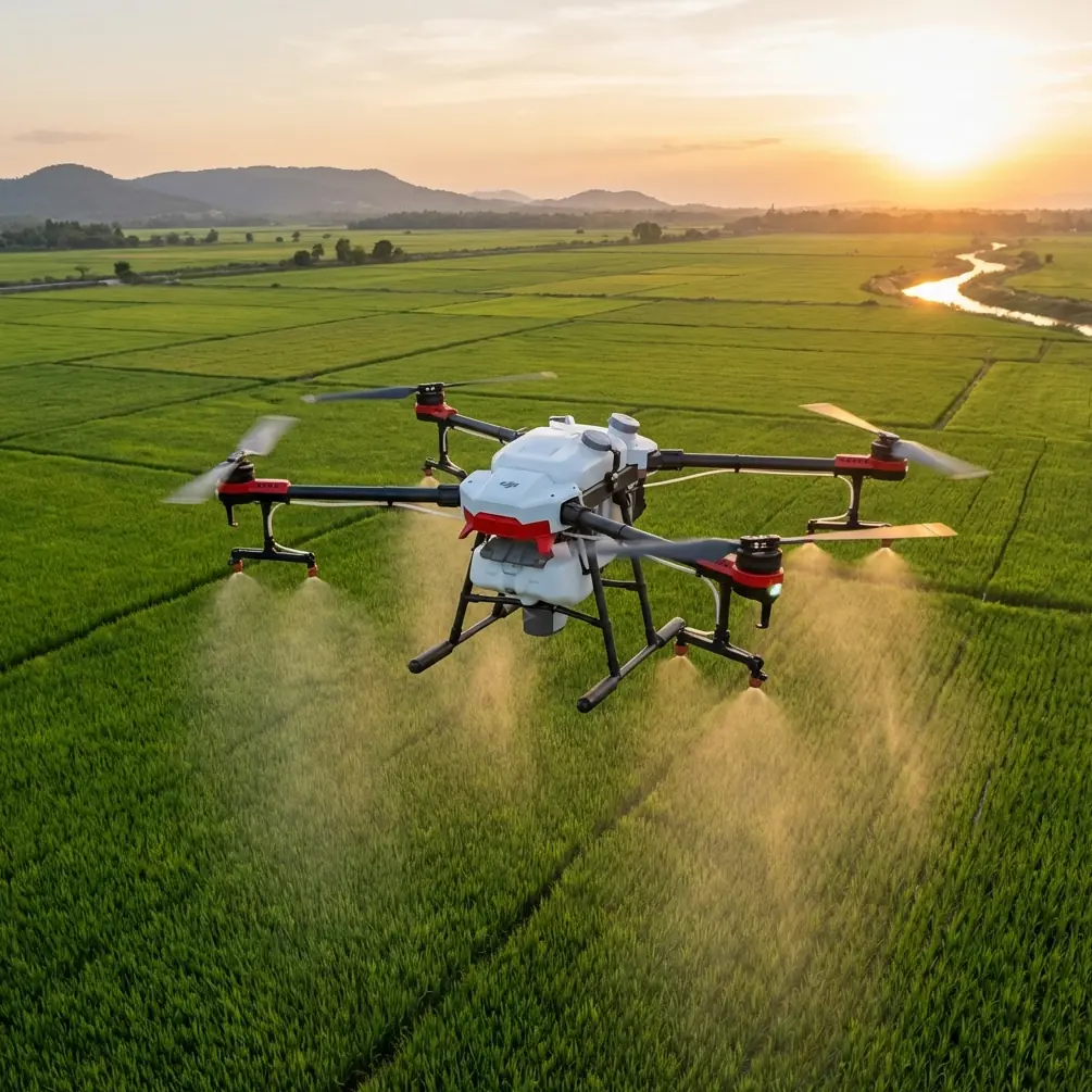
That became painfully clear in a recent workflow I helped shape for a team documenting material movement and progress conditions on a coastal construction build. The brief sounded simple enough: create short, readable aerial sequences showing how the site was receiving, staging, and distributing materials in a wind-exposed environment with changing light, reflective surfaces, and cluttered temporary structures. The aircraft of choice was the Avata, not because it can do everything, but because its flight character and close-in perspective can be genuinely useful when the job requires movement through partially built spaces and tight site corridors.
Still, the biggest improvement did not come from turning on another automated mode. It came from rebuilding how the crew looked at images before they flew.
The real bottleneck was not piloting
The team had enough technical competence to get airborne and bring the aircraft back safely. Their problem was subtler. They were recording, not interpreting.
That distinction matters. A coastal construction site is visually noisy by default. Scaffolding lines compete with crane booms. Wet concrete reflects harsh light. Temporary fencing fractures the frame. Ocean haze can flatten depth. If the operator treats the Avata as a flying recorder, the result is a stack of clips that technically show the site but fail to explain anything about site progress, logistics flow, or operational constraints.
A useful reference point here comes from a recent photography training article that framed photography as both a technical practice and an aesthetic form built around light and shadow. That sounds obvious until you apply it in drone operations. On a construction site, “light and shadow” is not an artistic abstraction. It affects whether rebar textures separate from the slab, whether elevation differences read clearly, and whether the viewer can understand access routes at a glance.
The article also made a stronger point that deserves attention from Avata operators: moving from simple recording to actual creation requires a systematic, measurable training structure. That principle translates directly into drone fieldwork. If a team wants repeatable output on demanding sites, it cannot rely on instinct alone. It needs a training process that can be reviewed, improved, and repeated.
Why this matters specifically for Avata
Avata has a very particular visual personality. It encourages immersive, forward-moving shots and works well where a larger platform may feel excessive or impractical. On a coastal site, that can be a real advantage for documenting routes between prefab staging zones, temporary storage areas, access points, and partially enclosed work sections.
But Avata’s strengths can also amplify weak visual decision-making. If the pilot does not understand composition logic, the aircraft’s agility simply lets them create bad footage from more angles.
That was exactly the issue in this case. Early flights were energetic but vague. The clips skimmed over stockpiles, threaded past barriers, and circled structures, yet they lacked hierarchy. A site manager watching them could not quickly answer practical questions: Where are inbound materials entering? Which paths are clear? How does the edge condition near the coast affect staging? What changed since last week?
Once we looked at the footage critically, the pattern emerged. The problem was not a lack of scenes. It was a lack of visual interpretation.
We borrowed a photographer’s training method and applied it to drone operations
One of the most useful ideas from the reference material was brutally simple: instead of merely “viewing” images, build a habit of “decoding” them. The suggested exercise was to analyze 3 to 5 master works each day, focusing on composition logic, light-shadow relationships, and emotional expression, while maintaining a visual notebook library.
For this Avata project, we adapted that method into a construction-specific preflight discipline.
Each morning, before batteries were loaded, the operators reviewed 3 to 5 reference images or short clips from prior site work and comparable industrial aerials. But we did not ask vague questions like “Do you like this shot?” We broke each frame down using three practical criteria drawn from the source:
Composition logic
What is the frame trying to explain? Is the leading line the haul road, the formwork edge, the shoreline barrier, or the crane swing radius? If the viewer can’t identify the main spatial story in two seconds, the shot is not doing enough.Light and shadow relationship
Is glare hiding surface condition? Are shadows making elevation transitions clearer? On a coastal build, light shifts rapidly, and reflective materials can destroy readability. Thinking in terms of shadow shape and surface contrast made the team much more selective about when to capture certain runs.Emotional expression, translated into operational tone
In commercial work, “emotion” is often misunderstood. We are not trying to make a construction delivery sequence sentimental. We are trying to create a clear tone: orderly, constrained, exposed, efficient, delayed, congested. That tonal reading helps clients understand reality faster.
Then we created a visual notes library, also based on the reference article’s recommendation to build a notebook system. Ours was organized by site conditions: coastal glare, narrow access channels, vertical obstruction zones, concrete pour days, material arrival windows, and sunset edge-light situations. Over time, this became more valuable than any spec sheet.
The measurable shift
Within two weeks, output quality improved in ways that were easy to see.
The team stopped chasing random movement and started flying sequences with intent. They used the Avata to show transitions rather than disconnected moments: from shoreline access road to unloading point, from unloading point to staging grid, from staging grid to active work face. That made the footage immediately more useful for progress review and stakeholder updates.
Just as important, the pilots became more disciplined about what not to shoot. They learned that not every corridor needs an aggressive run, and not every revealing angle is informative. On cluttered coastal sites, restraint is a professional skill.
This is where all the familiar feature talk finally becomes relevant. Obstacle avoidance and similar flight-assist tools are helpful in reducing pilot workload around temporary structures and dense site layouts. QuickShots and Hyperlapse can serve a role when used surgically for periodic progress comparison. D-Log can preserve more flexibility when the light is harsh and contrasty. If a workflow includes tracking moving equipment or personnel paths in a compliant and safe civilian context, subject-following tools such as ActiveTrack-style logic can help frame motion more consistently.
But these functions only become valuable when the operator already understands the image they are trying to build. Otherwise, automation just speeds up indecision.
The third-party accessory that actually helped
The most useful hardware addition in this case was not something glamorous. It was a third-party ND filter set.
On a coastal site, bright sky, reflective surfaces, pale concrete, and water-adjacent haze can make footage look brittle and rushed even when exposure is technically acceptable. Once the team added quality third-party ND filters, shutter control became more predictable, motion rendering improved, and the Avata footage started to feel more intentional. Not cinematic for the sake of it—readable. That distinction is crucial in professional site documentation.
The accessory mattered because it supported the exact visual discipline described earlier. When operators are trained to pay attention to light-shadow relationships, they start noticing when fast shutter rendering makes moving forklifts, suspended loads, or passing workers look visually harsh and harder to interpret. The filter did not create better storytelling on its own, but it gave the trained eye more usable raw material.
That is the pattern I see again and again: accessories are most effective when paired with a clear visual method.
Coastal delivery storytelling is not the same as inland site coverage
The “coastal” part of this project changed almost every creative decision.
Wind patterns were less predictable around unfinished structures. Light bounced differently off exposed surfaces. Open edges introduced stronger depth cues, but also more distractions. The shoreline could either contextualize the project beautifully or pull attention away from the actual construction workflow.
So we built shot plans that used the coast as a framing element, not the subject. A slight reveal of the waterline could explain weather exposure and delivery constraints. Too much of it turned the sequence into scenery.
This is where systematic analysis of reference imagery paid off again. Because the operators had trained themselves to decode composition rather than merely admire it, they became much better at deciding how much environmental context the frame needed.
That sounds like an art-school lesson. On a construction site, it is an operations lesson. A good frame answers a logistical question.
What site teams can learn from this
If you are deploying Avata for coastal construction documentation, training, or internal reporting, do not make the common mistake of treating drone capability as the whole workflow. The aircraft is one part of the system.
The stronger system looks like this:
- Build a repeatable visual training process instead of relying on improvisation.
- Review 3 to 5 strong images or clips daily, as suggested in the photography reference, and break them down by composition, light, and intended meaning.
- Maintain a visual notes library so lessons from one site condition are not lost on the next.
- Use Avata’s agile viewpoint for explanation, not spectacle.
- Add accessories only when they solve a clearly observed image problem.
If your output still feels inconsistent, the answer may not be more flying time. It may be better seeing.
A practical workflow we now recommend
For teams handling coastal construction delivery documentation with Avata, this is the operating rhythm I trust most:
Preflight visual review
Study a small set of reference images or prior mission stills. Keep it to 3 to 5. That number is enough to sharpen attention without creating fatigue.
Define one story per flight
Do not try to capture everything. Pick a single operational question: material arrival path, staging congestion, façade progress, edge protection status, or site circulation.
Match flight path to composition logic
If the goal is to show sequence, use transitions. If the goal is to show condition, use stable reveals. If the goal is comparison, repeat the same route over time.
Watch light like an operator, not just a creator
Harsh light can obscure practical information. Low-angle light can reveal form and texture beautifully. The difference is often the difference between a useful update and an attractive but shallow clip.
Log what worked
A visual notes library sounds academic until you revisit a similar weather window three weeks later and realize you already solved the problem once.
For teams refining this kind of workflow in the field, I’ve found that a quick message exchange is often easier than a long procurement conversation—reach out here if you want to compare setup notes: message Chris directly on WhatsApp.
The larger lesson
The most interesting takeaway from this Avata case study is not about Avata alone. It is that drone operators can learn a great deal from serious photography training principles when those principles are translated into field language.
The source material argued that photography is both technique and aesthetic expression, and that real progress requires a systemized training model rather than casual practice. That is exactly right for aerial work on complex civilian sites. The crews that improve fastest are not always the ones with the most flight hours. Often they are the ones who have learned how to analyze images, build visual memory, and turn that analysis into repeatable decisions.
On a coastal construction project, where site conditions change by the hour and visual clutter is constant, that discipline is what turns Avata from a fun flying camera into a precise communication tool.
And that is the standard worth aiming for. Not just footage that looks active. Footage that explains the work.
Ready for your own Avata? Contact our team for expert consultation.