Avata in Mountain Forest Delivery: What a 5G Drone Control
Avata in Mountain Forest Delivery: What a 5G Drone Control Dashboard Really Tells Us
META: A technical review of using Avata in mountain forest delivery, grounded in real 5G UAV management platform data on mission volume, flight hours, mileage, regional performance, and operational control.
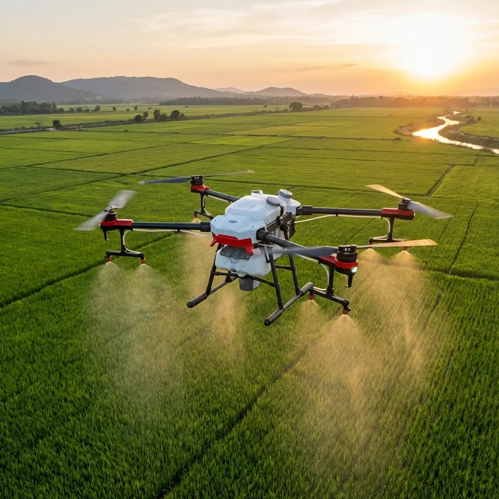
Mountain flying exposes every weak link in a drone operation.
Tree cover interferes with visibility. Terrain compresses reaction time. Signal reliability stops being a background spec and becomes the thing that decides whether a sortie finishes cleanly or turns into a retrieval hike. I learned that the hard way on an early forest logistics test route, where the aircraft itself performed well enough, but the operation around it did not. Pilots had no single view of flight time, route distribution, utilization, or regional workload. We were flying missions. We were not really managing a system.
That distinction matters if you are evaluating Avata for forest delivery in mountain environments.
The most useful reference point here is not a glossy feature sheet. It is a 5G intelligent drone control platform dashboard showing how a real UAV operation gets measured: pilot and device scale, mission completion, annual task distribution, total flight hours, total mileage, branch-level rankings, and service distribution over the last year. Even though the source data is rough, the operational picture is clear. This is what serious drone deployment looks like when it matures beyond hobby-style flight planning.
And that is exactly where Avata becomes interesting.
Avata is not just about flight feel in the woods
People often talk about Avata as though it exists only for immersive FPV flying. In mountain forest delivery, that misses the point. The aircraft’s value comes from how controllable it is in cramped airspace, how predictable it remains when the route is visually noisy, and how well it fits into a monitored, accountable workflow.
The dashboard reference gives us a scale benchmark. It shows 4,311 annual flight sorties, 322 total flight hours, and 1,213 km of total flight distance. Those are not vanity numbers. They are the kind of aggregate metrics you track when you need to understand whether a fleet is productive, underused, regionally imbalanced, or drifting into maintenance-heavy behavior.
For a mountain delivery team using Avata, those same metrics become the backbone of safe repeatable operations.
Why? Because forest delivery is rarely a single dramatic flight. It is repeated short-distance work under changing canopy density, wind behavior, and elevation transitions. Looking only at “can the drone fly this route” is too shallow. You also need to know:
- how many missions a team is really completing,
- which regions consume the most airtime,
- which pilots are carrying the highest workload,
- and how much mileage is being accumulated relative to useful sortie output.
That is where the 5G control layer changes the story.
The real breakthrough is centralized visibility
The dashboard indicates a system tracking 35 units in one equipment and pilot scale view, alongside a total of 89 in another top-level count visible on the panel. Even allowing for OCR noise in the extracted material, the takeaway is obvious: this is multi-asset, multi-operator oversight, not isolated pilot activity.
In mountain forest delivery, centralized visibility solves one of the least glamorous but most expensive problems: hidden inefficiency.
Before we had that kind of oversight, a route that “felt busy” could still be underperforming. A pilot might be overflying due to poor line selection around tree cover. Another region might log fewer sorties but produce better payload completion per hour. Without a dashboard, these patterns stay anecdotal. With one, they become operational decisions.
Avata benefits from this kind of environment because it thrives when deployed deliberately. In a forest corridor, obstacle awareness and close-quarters handling are useful, but their commercial value appears only when operators can compare mission outcomes over time. If your mountain branch is burning flight time without proportional task completion, the issue may not be the drone at all. It may be route design, pilot training, or dispatch logic.
The reference dashboard’s service distribution over the last year points to exactly this kind of cross-region analysis. For companies considering Avata in mountainous forestry support, reforestation logistics, sensor transport, sample delivery, or trail-side supply runs, regional visibility is not optional. Terrain makes every branch operate differently.
Branch rankings reveal how delivery programs actually scale
One of the most revealing parts of the source is the branch ranking data.
It lists branch flight-hour and output leaders such as:
- Guangdong at 98 hours
- Guizhou at 72 hours
- Shanghai at 61 hours
- Shanxi at 60 hours
It also shows branch revenue-style performance figures including:
- Guangxi at 37.2
- Guizhou at 32.5
- Yunnan at 22.5
- Qinghai at 20.5
- Gansu at 19.4
And quantity-style rankings including:
- Shandong at 372
- Henan at 325
- Jiangxi at 225
- Jiangsu at 205
- Fujian at 194
You do not need perfect formatting to understand what this means. Different regions excel in different ways. Some generate more flight hours. Some produce more financial return. Some handle more volume.
That matters for Avata because mountain forest delivery is not one use case. It breaks into several sub-profiles:
Short-hop dense canopy runs
Best measured by mission count and completion efficiency.Longer slope-following routes
Better measured by distance and energy consumption per kilometer.Specialized terrain access tasks
Better measured by pilot skill intensity and risk reduction.Seasonal regional surges
Best measured by dashboard-level branch comparison.
If one branch is logging high hours but modest output, management can investigate whether pilots need tighter route discipline, better use of automated capture modes for documentation, or revised staging points. If another branch achieves high throughput with fewer hours, its workflow may offer a template for other mountain teams.
That is why I see Avata less as a standalone aircraft and more as a node in a disciplined operating system.
Avata’s flight features matter differently in the forest
The context around this article includes familiar feature keywords: obstacle avoidance, subject tracking, QuickShots, Hyperlapse, D-Log, and ActiveTrack. In a mountain forest delivery setting, not all of these carry equal weight.
Obstacle handling is obvious. Forest routes punish drift and hesitation. Avata’s compact format and close-quarters confidence can reduce the stress of navigating confined paths near trunks, branches, and uneven clearings. But the operational significance is not simply “it avoids obstacles.” It is that obstacle-aware flight can cut the cognitive load on pilots who are already managing terrain transitions and signal behavior.
That, in turn, can improve sortie consistency across a team.
ActiveTrack and subject tracking are more situational in delivery work, but they can be useful during route scouting, moving-ground-team support, or follow documentation when crews are establishing mountain access paths. QuickShots and Hyperlapse are not core logistics features, yet they become practical when operations teams need visual reporting for stakeholders, land managers, or infrastructure partners without sending a second media unit into the field.
D-Log is where the commercial case gets understated. In forest delivery projects, especially in environmentally sensitive terrain, image evidence matters. Teams often need to document route conditions, landing zones, canopy gaps, erosion patterns, or site accessibility. D-Log gives more flexibility in post-processing those records so details remain readable across harsh light shifts under canopy and along ridgelines. That is not a filmmaker’s luxury. In some workflows, it is documentation quality control.
5G control changes the mountain equation
A mountain route can go wrong long before the drone reaches a tree line.
Dispatch lag, weak coordination between pilots, uneven battery planning, and poor task visibility create avoidable failure points. The reference platform is explicitly a 5G intelligent control big data dashboard, and that phrase is not just branding. The significance is that modern drone operations are moving from pilot-centric control to network-aware orchestration.
For Avata deployments, that means the aircraft can be part of a broader stack where managers see mission flow in near real time rather than waiting for post-flight reports. In forest delivery, this supports several practical gains:
- route prioritization when weather windows are short,
- remote awareness of aircraft and pilot distribution,
- identification of underused assets,
- and historical analysis of which terrain sectors generate the most operational drag.
The dashboard even includes a monthly-style distribution view across 12 periods, suggesting a year-round cadence rather than isolated project flights. That is exactly how forest delivery programs should be judged. Not by one successful demo, but by sustained monthly performance under changing environmental conditions.
When I look back at the challenge that used to slow us down, this is the biggest difference. We were focused on piloting quality when the harder problem was fleet intelligence. Avata made close-proximity flying easier, yes. The platform model made the operation easier to trust.
Mission completion is the metric that keeps everyone honest
One line in the source references an 86% unfinished-task or completion-related figure, though the extraction is imperfect. Even with that ambiguity, its presence is instructive. Serious UAV systems track not just flights, but task status.
That distinction matters in mountain forest delivery because a successful takeoff does not equal a successful mission.
A route may be flown and still fail operationally if:
- payload transfer is incomplete,
- the landing zone is obstructed,
- the image record is unusable,
- the handoff timing misses the field crew,
- or the aircraft must divert before the final point.
Avata operators working in mountainous forest environments should insist on mission-state visibility at the platform level. If a dashboard can tell you where unfinished tasks are clustering, you can isolate whether the cause is weather exposure, route complexity, pilot training variance, or weak staging discipline.
Without that feedback loop, teams tend to misdiagnose problems. They blame terrain when the real issue is process.
Avata works best when training is measurable
The ranking section of the source also includes pilot-style flight-hour comparisons, with top performers around 99, 90, 81, 79, and 70 hours. That matters because mountain forest work is one of the fastest ways to expose gaps between nominal proficiency and real operational competence.
Avata is forgiving compared with larger, less agile aircraft in tight spaces, but forgiveness should not be mistaken for standardization. One excellent pilot can make a route look easy. A mature operation needs ten average pilots to execute it safely and predictably.
This is where telemetry-backed training becomes powerful. If your top pilots consistently complete forest routes with less wasted airtime and cleaner mission closure, that data can be turned into route templates, training benchmarks, and standard operating practices. The drone is only half the system. The learning loop is the other half.
If you are building or refining this kind of workflow and want to compare deployment approaches, you can message a UAV specialist here to discuss route control, fleet oversight, and mountain operating logic.
My technical verdict
As a pure aircraft discussion, Avata is easy to appreciate. It is nimble, confidence-inspiring in constrained spaces, and well suited to low-altitude route work where visual complexity is high. In mountain forest delivery, those qualities matter every minute.
But after looking at the 5G intelligent control platform reference, I think the more serious lesson is this: Avata becomes far more valuable when it is tied to measurable operational governance.
The source points us to a model built around annual sorties, total hours, total distance, branch comparisons, pilot rankings, monthly trends, and task visibility. Those details are not administrative clutter. They are the framework that turns repeated mountain flights into a manageable delivery program.
The old challenge in forest operations was getting through the route.
The newer challenge is understanding the route as part of a wider network: who flew it, how often, how efficiently, in which region, with what completion outcome, and whether the next branch can reproduce the result.
That is the environment where Avata starts making commercial sense. Not as a flashy woodland flyer, but as a practical front-end aircraft inside a disciplined 5G-managed drone operation.
Ready for your own Avata? Contact our team for expert consultation.