Avata for Coastline Filming: What Actually Matters When
Avata for Coastline Filming: What Actually Matters When Wind, Salt Air, and Interference Start Fighting Back
META: A practical Avata coastline filming guide built around real UAV field constraints, including wind handling, electromagnetic interference, payload thinking, autonomous flight habits, and safer capture strategy.
Coastline filming looks forgiving from a distance. Big horizons. Open air. Plenty of room. In practice, it can be one of the more deceptive environments to work in.
You have crosswinds coming off the water, reflective surfaces that make exposure less forgiving than inland scenes, gusts around cliffs and seawalls, and a surprisingly common technical nuisance: electromagnetic interference near ports, communications infrastructure, utility corridors, and dense tourism facilities. If you are flying an Avata along the coast, the challenge is not simply getting cinematic footage. The real task is keeping image quality, control confidence, and mission efficiency intact while the environment tries to erode all three.
That is where a useful comparison with more traditional survey-class UAV thinking becomes valuable.
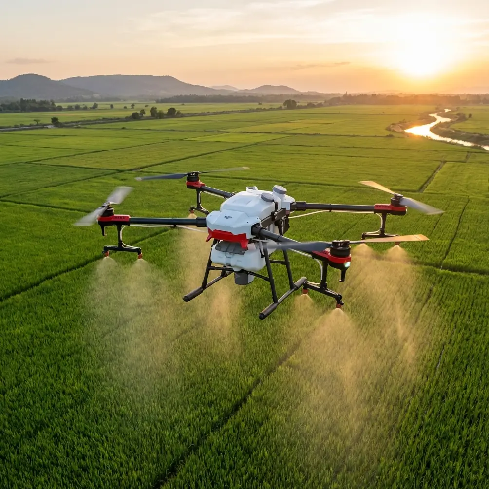
A water-resources drone solution from Tianjin Tengyun Zhihang lays out two aircraft profiles that were built for disciplined field work rather than lifestyle flying: the iFly U3 fixed-wing platform and the iFly D1 multirotor. On paper, they are not Avata substitutes. But their design logic tells us something important about how serious operators approach difficult outdoor missions, and those lessons translate directly to coastline filming with Avata.
Why survey-drone specs matter to an Avata pilot
The iFly U3 fixed-wing platform is described as a fast mapping aircraft built to complete aerial survey work efficiently. Two details stand out immediately: a 90-minute endurance figure and full autonomous takeoff and landing, with setup time listed at 10 minutes. That combination says a lot. In professional field operations, time in the air is valuable, but repeatability is just as valuable. Crews want predictable launch behavior, consistent route execution, and minimum friction on site.
Now compare that mindset to a coastline creator flying Avata.
You are not chasing the same mission profile. You are not mapping a watershed with a Sony A7R payload. But the operational principle still applies: the best coastal footage usually comes from a repeatable plan, not improvisation. Avata’s strengths—tight maneuvering, immersive perspective, low-altitude pathing, and creative modes like QuickShots and Hyperlapse—become much more useful when you borrow that survey mentality. Pre-visualize the line. Define your launch and recovery zone. Know your radio environment before the first pack goes in. Treat each battery as a structured capture window.
That is the difference between returning home with a few lucky clips and returning with a sequence that actually cuts together.
The coastline problem Avata pilots underestimate
Most pilots prepare for wind. Fewer prepare for interference.
Along coastal routes, especially near marinas, bridges, radar-adjacent facilities, hotels, telecom masts, reinforced concrete promenades, and parking structures, signal behavior can become erratic. You may see brief control hesitation, image transmission instability, or a video feed that looks less solid than the apparent open space would suggest. Water can amplify the false confidence because everything feels clear and unobstructed.
It is not always dramatic. Often it starts subtly. The aircraft still flies, but the link quality no longer feels clean. You notice a delay in response. The framing becomes harder to trust. If you keep pushing out over water because the scene looks beautiful, you are making a decision based on aesthetics instead of link discipline.
This is where one small field habit can save a session: antenna adjustment.
Not as an afterthought. As an active management tool.
When I film coastlines, I do not assume my initial controller orientation is still the best one once I reposition down the shoreline. If the transmission starts acting uneven, I stop blaming the location in a vague way and start correcting geometry. I shift my body position. I rotate the controller slightly to improve antenna alignment relative to the aircraft’s path. I reduce the aircraft’s lateral angle to my position instead of continuing the same arc. Sometimes moving a few meters away from metal railings, parked vehicles, or utility boxes cleans up the link more than people expect.
This sounds basic, but in real conditions it is one of the fastest ways to stabilize a flight without sacrificing the shot.
What the iFly D1 teaches about flying near complex environments
The iFly D1, a professional multirotor in the same water-application solution, is built around a different mission logic. It carries a 3 kg payload, uses vertical takeoff and landing, and has a 70-minute endurance figure with a 10 km control radius. It also supports options like infrared and hyperspectral payloads, plus ADS-B airspace monitoring.
Those are not lifestyle features. They are risk-management features and workflow features.
For a coastline Avata operator, the takeaway is not that you need heavy payload capability. The takeaway is that professional UAV work assumes environmental complexity from the start. VTOL capability matters because launch areas are constrained. ADS-B awareness matters because coastal zones often overlap with helicopter traffic, service flights, and tourism operations. Flexible payloads matter because different missions demand different visual information.
Translate that into the Avata world and it becomes surprisingly practical:
- Choose launch spots with recovery in mind, not just scenic value.
- Keep obstacle avoidance and route discipline central when flying around piers, rock walls, beacon poles, and cliff edges.
- Use D-Log when the scene has bright water highlights and darker shoreline textures in the same frame, because preserving grading latitude matters more than getting a punchy preview.
- Use subject tracking or ActiveTrack only when the subject path is truly predictable and the background geometry is not packed with poles, wires, and abrupt elevation changes.
- Reserve QuickShots for segments where the airspace and surroundings are clean enough that automation helps rather than complicates.
Professional drone systems are designed around margins. Avata pilots should think the same way, even when the final output is artistic rather than survey-driven.
The better problem-solution workflow for coastal Avata shoots
Problem 1: Wind looks moderate, but the footage still feels unsettled
Coastal wind is rarely uniform. A calm launch zone can lead into turbulent sections once the aircraft passes a seawall or wraps around a headland. The result is footage that looks busy, especially in lower-altitude passes.
Solution: stop trying to “fight” every gust with constant stick correction. Instead, shorten your shot design. Break a long hero pass into smaller sections with cleaner directional intent. Avata performs best when the pilot is shaping movement deliberately, not continuously rescuing a line that has already fallen apart. Hyperlapse work especially benefits from this approach. Stable segments stitched from controlled legs usually beat one ambitious run through unstable air.
Problem 2: The horizon is beautiful, but your exposure falls apart
Water reflects hard light. Shoreline vegetation, rock, and built structures can sit several stops darker than the sea surface. It is easy to clip highlights or flatten the coast.
Solution: use D-Log when the scene has strong contrast and you want room to recover detail in post. This is not just a color preference. Operationally, it lets you preserve a wider range across sea glare, sky, and land texture, which matters when your shooting window is short and the weather shifts quickly.
Problem 3: The feed weakens in a place that looks wide open
This is the electromagnetic interference issue. It often appears near “developed” coastlines rather than remote ones.
Solution: adjust antenna orientation early, not after the connection has degraded badly. Reposition your body if necessary. Avoid standing immediately beside metal barriers or infrastructure cabinets. If a line over water requires the aircraft to move into a less favorable link geometry, redesign the path so the strongest part of your connection covers the most important section of the shot. If the signal remains inconsistent, do not normalize it. Land, relocate, and start again.
If you need a second opinion on flight setup before heading out, I’d point pilots toward a quick direct planning chat here: message the team on WhatsApp.
Problem 4: You want cinematic automation, but the coastline is cluttered
This is where people over-trust intelligent modes. Subject tracking, QuickShots, and even some semi-automated framing options can work well in open terrain. Coastal environments are often only “open” from one angle. In reality, they contain masts, signs, stair rails, mooring posts, retaining walls, and abrupt elevation shifts.
Solution: use automation selectively. If you are tracking a runner or cyclist on a coastal path, first verify the route has enough clearance for the aircraft’s line, not just the subject’s line. Obstacle avoidance is useful, but it is not a substitute for route design. The cleaner the scene, the more these tools help. The denser the scene, the more manual control tends to outperform them.
Borrowing survey discipline without losing creative freedom
One reason the U3 and D1 details are useful is that they remind us what high-value drone work looks like behind the scenes. The U3’s 20 km control radius, 6-level wind resistance, and operation in temperatures from -20°C to 60°C show a platform built for demanding field reliability. The D1’s removable arm structure and payload flexibility show a system built around adaptability.
For an Avata creator, you are obviously working on a different scale. Still, those numbers underline an operational truth: robust missions come from planning around limits, not pretending limits do not exist.
So if I were designing an Avata coastline shoot the way a professional UAV team would think about it, I would structure it like this:
Recon the site on foot first.
Identify interference sources, likely gust zones, takeoff safety, recovery options, and visual anchors.Build the shoot around battery-specific tasks.
One battery for low sweeping reveals. One for close shoreline texture. One for subject motion or orbit-style sequences if conditions allow.Test the link before the hero run.
Short outbound check. Observe feed quality. Adjust antenna position. Reassess standing location.Use image settings to protect the unrepeatable parts.
D-Log for dynamic range. Conservative exposure choices when glare is strong.Treat automation as a tool, not a shortcut.
ActiveTrack, QuickShots, and Hyperlapse all work best when the route was chosen for them.Respect the exit path.
Over water, especially near cliffs or man-made structures, your best-looking route may not be your safest recovery route.
That is not over-cautious. It is efficient.
What this means for the final footage
When Avata coastline footage looks truly polished, viewers usually notice the cinematic energy first. They see the glide past black rocks, the reveal over surf lines, the low pass beside a coastal road, the movement around a lookout or harbor edge. What they do not see is the chain of small operational choices underneath it.
They do not see that the pilot moved ten meters to get cleaner signal geometry. They do not see the antenna adjustment that stopped a control link from feeling uncertain. They do not see that a planned manual pass replaced a flashy automated move because the shoreline clutter made automation less dependable. They do not see that D-Log preserved highlight detail in a scene where water could have blown out instantly.
But those choices are why the footage survives editing.
That is also why referencing non-Avata UAV systems is useful here. The iFly U3 and iFly D1 are products from a water-management solution, not cinewhoop storytelling tools. Yet they embody the same professional logic every strong Avata operator eventually learns: success in the field comes from aligning aircraft capability, environmental reality, and mission design.
On a coastline, pretty scenery does not make the job easier. It just makes mistakes more tempting.
Fly the location like a technician first. Then fly it like a creator.
Ready for your own Avata? Contact our team for expert consultation.