Avata Field Workflow for Coastal Solar Farm Filming
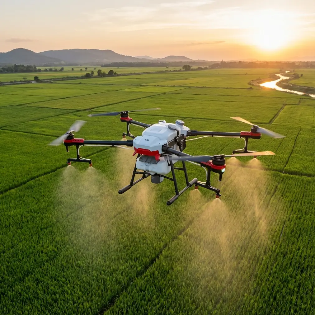
Avata Field Workflow for Coastal Solar Farm Filming: What Mapping Discipline Teaches Better FPV Results
META: A practical Avata filming guide for coastal solar farms, using aerial survey control-point discipline to improve shot planning, safety, signal reliability, and image consistency.
I’ve filmed enough reflective infrastructure to know that solar sites punish lazy habits.
Panels throw glare where you don’t want it. Coastal wind changes character by the minute. Repeating rows create a visual trap that can make even an experienced pilot lose orientation for a second longer than feels comfortable. And when you’re flying an Avata close to structures, that second matters.
What’s interesting is that one of the best ways to sharpen your Avata workflow for a coastal solar farm doesn’t come from a cinema handbook. It comes from a rural cadastral drone surveying design document. Not because you’re doing land registration work with an Avata, but because the survey logic is brutally practical: choose points carefully, preserve line of sight, document position with clarity, and avoid environmental conditions that corrupt your data. Swap “data” for “footage,” and the lesson lands immediately.
This is the field method I use when the assignment is cinematic, low-altitude, and operationally tight.
Why a survey document matters to an Avata pilot
Survey crews don’t get to rely on intuition alone. Their outputs must be repeatable, traceable, and usable later. That mentality is useful when filming a solar farm in a coastal zone because the site itself is full of variables that can quietly erode results: salt haze, metallic reflections, radio interference, wind shear around inverter stations, and endless panel geometry that makes one pass look suspiciously like another.
The reference material highlights several control-point rules that are surprisingly relevant to Avata operations.
One detail says the area around a point should be open enough for reception equipment, with surrounding obstacles creating an elevation angle of less than roughly 10° to 15° so satellite reception isn’t compromised. Another warns against placing targets close to large reflective surfaces or strong electromagnetic environments because of multipath effects. That’s survey language, but for coastal solar filming it translates into something every Avata operator should respect: your launch point, hover check location, and recovery zone are not administrative afterthoughts. They shape signal confidence, GPS behavior, and your margin for error.
A third detail is even more useful creatively. The document recommends shooting reference photos from a far view at no less than 20 meters and a mid view at no less than 10 meters, with both images clearly showing the relationship between the point and surrounding features. It also suggests avoiding shooting along linear features and instead using an angle around 45° to those lines.
That is excellent advice for filming solar arrays.
If you fly straight down the rows every time, your footage quickly becomes visually flat. The geometry overpowers the story. But when you work at an oblique angle to the lines, the panels gain rhythm, depth, and directional flow. It’s not just prettier. It also helps preserve orientation during flight because you’re no longer trapped inside a tunnel of repetitive symmetry.
Step 1: Build your “control-point mindset” before the first battery
On a coastal solar farm, I treat preflight as if I’m setting up image-control logic, even though I’m not making a cadastral deliverable.
I start by identifying three categories of reference positions on foot:
- Primary launch/recovery point
- Secondary safe hover point
- Visual orientation landmarks
The launch point should be clear, stable, and away from local signal contamination. Survey guidance specifically avoids spots near major reflective metal surfaces and transmission sources, and that matters here because a solar farm is basically a giant organized field of reflective material. Don’t set up right beside the noisiest equipment cluster if you can help it. Give yourself clean space. The more open the horizon, the better.
I also want the obstacle environment near that setup area to stay within that 10°–15° visual openness principle wherever practical. On a real site, that means avoiding tight corners beside buildings, high fencing transitions, or service structures that hem in the aircraft during takeoff. The Avata is compact and forgiving compared with larger platforms, but in wind it still benefits from a launch area that doesn’t immediately force corrective inputs.
This is where a simple third-party accessory genuinely helps. I’ve had good results using a sun hood for the goggles or mobile display setup in bright coastal conditions. It sounds minor. It isn’t. At midday near reflective panel fields, glare can undermine your read on exposure, horizon, and return path timing. A decent hood improves practical situational awareness more than many pilots expect.
Step 2: Use a photo-survey style site record to plan repeatable shots
The source document describes a smart documentation format: one full image for general position, then a crop enlarged 3x around the exact point to show detail. For survey teams, this replaces a rough sketch. For Avata work, I adapt the same idea to shot planning.
Before takeoff, I capture:
- one wide still showing the selected flight corridor in relation to access roads, panel blocks, and shoreline direction
- one tighter crop or phone zoom image centered on the intended key pass start point
- one note on wind direction and sun angle
That tiny discipline pays back later if you need to repeat a move after a battery change, cloud shift, or exposure adjustment.
Solar farm filming often fails in the handoff between “that looked great” and “can I do it again exactly enough to cut the sequence cleanly?” The answer is usually no, unless you documented the shot origin and environmental context.
The survey world solved this long ago. Broad context plus magnified detail beats memory every time.
Step 3: Don’t let the panel rows dictate every composition
The reference material explicitly advises against photographing along linear features and prefers an angle near 45°. For mapping, that helps visibility and interpretation. For an Avata, it helps motion design.
When you film coastal solar farms, the obvious move is the straight corridor run over service lanes or between panel rows. It works once. Maybe twice. After that, the repetition dilutes impact.
Flying obliquely changes the image in three useful ways:
- the rows reveal spacing and depth
- highlights spread more evenly across the frame
- your viewer can read the scale of the site faster
This is also a safer orientation strategy. Rows of nearly identical panels can mess with spatial judgment, especially when the light is hard and the coastline adds haze in the distance. An angled pass creates stronger visual separation between foreground, midground, and horizon.
The Avata’s obstacle awareness and stable close-proximity handling help here, but pilot discipline matters more than feature lists. If you’re relying on obstacle avoidance to rescue a poorly conceived line through dense structures, you’re already behind the aircraft.
Step 4: Respect interference and reflection like a surveyor would
One of the strongest operational details in the source is the warning not to choose points close to transmission corridors and not to work around major reflective environments if they can be avoided. The survey concern is GNSS quality and multipath. For a coastal solar farm, that same warning should shape your mission planning.
You’re dealing with:
- reflective panel surfaces
- inverter and electrical infrastructure
- perimeter metalwork
- occasional communication equipment
- sea-facing atmospheric brightness
None of these automatically make the site unflyable. They do mean you should test deliberately.
My routine is simple:
- short low-altitude hover
- gentle yaw check
- signal confidence check
- exposure check on the brightest likely angle
- slow first pass before any committed cinematic line
If something feels inconsistent in the first minute, I don’t press on because the client wants momentum. I relocate, reassess, or alter the shot direction.
That conservative habit is directly aligned with the survey mentality behind the reference text. Good fieldwork begins with conditions that support reliable capture. It doesn’t begin with optimism.
Step 5: Use Avata features selectively, not as decoration
The context terms around Avata often drift into feature chatter: ActiveTrack, QuickShots, Hyperlapse, D-Log. On a solar farm, each of these only matters if it serves the geometry and the brief.
D-Log for panel contrast control
If the scene has hard coastal sunlight, panel reflections and darker service roads can split exposure aggressively. D-Log gives you more flexibility in post to recover highlight behavior and maintain texture in surrounding land or maintenance assets. The operational significance is simple: it preserves grading room when the reflective field is brighter than the environment around it.
Hyperlapse for weather movement over fixed geometry
A solar site near the coast can produce beautiful cloud motion over rigid panel grids. Hyperlapse only works if your anchor composition is deliberate. This is where the survey-style location record helps again. Mark your exact setup and repeatability improves.
ActiveTrack and subject tracking
I use tracking cautiously on industrial sites. If a maintenance vehicle is part of the brief, tracking can help build context around site operations, but the panel rows and service infrastructure can create visual complexity. Don’t assume automation understands your storytelling priorities.
QuickShots
Useful for fast coverage when space is open and the brief needs social edits, but at a solar farm they’re supporting tools, not the core language of the project.
In other words, the Avata’s intelligence is helpful, yet the bigger gain still comes from old-fashioned field judgment.
Step 6: Mark critical positions physically when the site is visually repetitive
The source document notes that when suitable targets are hard to find, ground markers should be placed before aerial work begins, protected properly, and designed with good contrast against the surrounding surface. That’s survey procedure. But on some solar sites, especially large coastal ones with repetitive access lanes, the same logic is worth borrowing in a lightweight production form.
If the operator has site permission, I sometimes use temporary non-intrusive visual markers at my own standing positions or at the start of a complex pass. Not for the drone to “see” in a technical sense, but for me and the crew to confirm route setup and reset accuracy between takes.
What matters is contrast and placement. The reference text even mentions that a marker may be made slightly lower or higher than the ground to improve image interpretation. In production terms, that means your marker should actually stand out from gravel, concrete, or vegetation without becoming a site hazard.
This is especially useful if you’re coordinating with a spotter. Shared visual references reduce confusion when every service lane starts to look the same after the third battery.
Step 7: Add near, mid, and far storytelling on purpose
The document requires field photos in multiple scales: near, mid, and far. I like that because it mirrors how strong solar farm sequences should be built.
- Far view: establish the site’s relationship to coastline, terrain, and scale.
- Mid view: show row geometry, access routes, transformers, or maintenance activity.
- Near view: skim detail carefully, revealing texture, spacing, and motion through the infrastructure.
That progression gives editors options and keeps the finished piece from feeling like a string of identical FPV passes.
When I’m planning this set, I often write a three-line shot list on my phone rather than overcomplicate things. If you need help refining that kind of field workflow around your platform and accessories, I usually suggest pilots share a simple site brief first through this Avata setup chat: https://wa.me/85255379740.
Step 8: Handle elevation changes and edge conditions with measurement discipline
One very specific reference detail discusses what to do when a point lies on top of an object or at the edge of a steep break: record whether the point is above or below the edge and note the height difference, even down to 0.01 m in the surveying context.
You’re not measuring to that standard for cinematic Avata work, of course. But the principle is gold: when edge conditions change elevation perception, label them mentally and operationally before flight.
At a coastal solar farm, those edge conditions may include:
- raised cable trenches
- retaining edges
- embankments
- drainage cuts
- sea-facing grade changes
- wall ends and fence corners
FPV-style movement near these features can look smooth in the goggles and still collapse spatial margin faster than expected. If I’m planning a low sweeping line that transitions across different ground levels, I’ll walk it first and note where the visual floor rises or drops.
That one habit prevents a lot of bad decision-making.
My preferred coastal solar sequence with Avata
If I only had one battery to tell the story, I’d do this:
- High but not extreme establishing pass at an oblique angle to the panel rows.
- Mid-altitude glide following a maintenance lane with the coast held in contextual background.
- Low near-detail pass that reveals panel texture without forcing a reckless gap line.
- Short tracked movement around a service vehicle or technician if the brief includes human activity.
- Static or slow Hyperlapse setup for cloud movement over repeating geometry.
Every one of those shots benefits from the survey-derived habits above: open setup area, strong visual references, angled composition relative to linear features, and disciplined documentation for repeatability.
That’s the real takeaway.
The Avata is capable of making solar farms look dynamic, but the aircraft alone won’t solve a visually repetitive site with harsh reflective behavior. What helps is borrowing a stricter way of thinking from professional aerial mapping. Pick positions that support signal quality. Avoid interference traps. Record your references. Work obliquely to the geometry. And treat repeatability as part of craft, not admin.
That’s how you get footage that feels intentional rather than merely adventurous.
Ready for your own Avata? Contact our team for expert consultation.