Avata in Complex Terrain: What a 25-Meter Chinese UAV
Avata in Complex Terrain: What a 25-Meter Chinese UAV Program Tells Us About Smarter Solar Farm Filming
META: A practical expert look at filming solar farms in complex terrain with DJI Avata, using lessons from China’s “Jiutian” heavy UAV program, obstacle awareness, D-Log workflow, antenna positioning, and terrain-conscious flight planning.
I spend a lot of time thinking about aircraft that sit at opposite ends of the UAV spectrum.
On one side, you have compact FPV platforms like Avata, built to move through tight spaces, react quickly, and bring cinematic energy to places that would otherwise feel flat on screen. On the other, you have major industrial airframes that reveal where the drone industry is heading at a structural level. A recent example is China’s “Jiutian” program, a heavy unmanned aircraft expected to complete its first flight by the end of June 2025. With a 25-meter wingspan and a maximum takeoff weight of 16 tons, it sits far outside the class of aircraft any solar content team would ever deploy for media capture.
So why should an Avata pilot care?
Because the story behind that aircraft is not really about size. It is about systems. “Jiutian” was described as a project intended to help fill a gap in the flexible heavy-UAV market while pushing China’s drone sector toward full-chain autonomous manufacturing. Just as significant, the manufacturing side reportedly tied together design, materials, process planning, and final aircraft integration through digital systems such as PLM, CAXA process tools, and DMPP assembly workflows. For pilots and production crews working with Avata in difficult terrain, that same systems mindset is exactly what separates clean, repeatable footage from a frustrating day of signal drops, exposure mismatches, and awkward reruns.
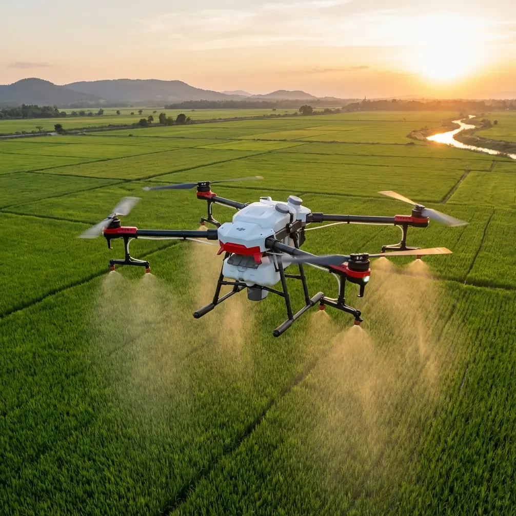
Solar farms in complex terrain expose every weak habit a pilot has.
Panels create repetitive visual texture. Access roads snake along hillsides. Tracker arrays can form geometric corridors that look simple from the ground and become disorienting in goggles. Terrain changes affect radio line-of-sight. Metal structures add reflections. Wind can funnel between rows or over ridges. And because solar developers usually want footage that feels both technical and cinematic, the pilot is often expected to fly close, low, and smoothly while preserving enough image latitude for a polished post-production grade.
That is where Avata earns its place, but only if you treat it less like a toy and more like a tightly managed capture platform.
The real problem at a solar farm is not speed. It is control under constraints.
A lot of pilots approach a site like this with the wrong instinct. They think the challenge is threading the drone through narrow spaces or getting dramatic swooping passes above the panels. Those things matter, but they are secondary. The first problem is maintaining predictable control when terrain and infrastructure are constantly trying to interfere with your signal, your visual orientation, and your image consistency.
This is where the lesson from “Jiutian” becomes useful. A 16-ton program cannot rely on improvisation. Neither should you, even when you are flying something as agile as Avata.
When I prep for a solar farm shoot, I break the job into three linked systems:
- Flight path system
- Signal system
- Image system
If one fails, the footage suffers.
1. Flight path system: design for terrain, not just composition
On hilly or irregular solar sites, your most cinematic route is often your least reliable one. Avata can fly low and weave through terrain transitions beautifully, but every ridge, inverter shelter, fencing line, and equipment cluster can become a barrier between aircraft and controller.
That means your path planning should start with terrain logic, not visual ambition.
I usually divide the site into flight zones based on elevation changes and panel orientation. Instead of trying to capture one giant hero run across the entire facility, I build smaller sequences: a contour-following pass along a slope, a reveal over a crest, a low corridor run between tracker rows, a controlled pullback that exposes the site footprint, then a higher establishing move from a clean line-of-sight position.
Operationally, this matters because Avata performs best when the pilot is not forcing it into long occluded runs. A shorter sequence with stable transmission and clean framing is worth more than a dramatic route that loses confidence halfway through.
If your terrain includes ridgelines, do not park yourself on the “wrong” side of the hill and expect the aircraft to keep a perfect link as it descends. Move with the geometry. Sometimes ten minutes of repositioning saves an hour of compromised takes.
Antenna positioning is the quiet difference between usable footage and a wasted battery
Most pilots talk about range in abstract terms. At solar farms, range is less about maximum distance and more about preserving a strong, stable connection through changing terrain angles.
My advice is simple: point your body and your antennas toward the section of airspace where the aircraft will spend most of the shot, not where it starts.
That sounds obvious, but in practice many pilots lock onto launch position rather than flight position. On a terrain-heavy site, Avata may begin close and then dip behind a subtle rise or skim down into a panel-lined corridor. If your antenna orientation is optimized for takeoff but not for the route’s critical midpoint, your signal quality can fall right where you need precision most.
A few habits help:
- Stand on slightly elevated ground whenever possible.
- Avoid parking yourself directly beside vehicles, metal containers, or dense electrical infrastructure.
- Rotate with the aircraft during lateral runs instead of freezing in place.
- Keep the strongest line-of-sight through the most signal-vulnerable phase of the shot, usually the low or descending section.
- If a route moves behind a terrain feature, relocate before the take rather than hoping the link holds.
For teams working across a large site, I often recommend a simple communications plan so the visual observer or ground assistant can help call out line-of-sight concerns before the pilot commits. If you want a practical workflow discussion for site-specific antenna setup, this direct WhatsApp flight planning line is useful for quick coordination.
Obstacle awareness on Avata is most valuable when it shapes your shot design
People love to reduce obstacle sensing to a yes-or-no feature checklist. That misses the point.
At a solar farm, obstacle awareness is useful not because it allows careless flying, but because it influences how confidently you can build repeatable motion near equipment, support posts, perimeter fencing, and uneven terrain. Avata’s protective design and close-in handling make it well suited for dynamic infrastructure footage, but the real win is that it lets you think in tighter spatial layers.
For example, when I fly a panel-row corridor, I do not just think about avoiding contact. I think about margin. How much lateral room do I have if wind drifts the aircraft? How fast will visual texture from repeating panel surfaces affect depth perception? Where is the exit if I need to climb cleanly? Obstacle management is not a last-second save. It is part of the route architecture.
This also applies to shots near combiner boxes, cable runs, and service roads. The smoother the route geometry, the less likely the footage will look nervous. In post, viewers may not know why one pass feels polished and another feels slightly unsettled. Usually, it comes down to whether the pilot built enough spatial tolerance into the move.
Subject tracking and ActiveTrack are not the stars here, but they still have a role
For solar farm work, the “subject” is often not a person. It may be a utility vehicle moving along a service road, a technician crossing a row, or a maintenance convoy entering the site. This is where subject tracking tools and ActiveTrack-style features can contribute, but only if used selectively.
In complex terrain, I treat tracking as a support tool, not a substitute for manual judgment.
Why? Because panel geometry and elevation changes can confuse the visual structure of a scene. A moving truck may briefly disappear behind rows or merge visually with reflective surfaces. If I want a dependable reveal of operations activity, I usually establish the route manually first, then decide whether a tracking-assisted segment is worth attempting in a cleaner section of the site.
Operational significance matters here. A solar developer often wants footage that shows not just scale, but function. Tracking a maintenance vehicle through the site can communicate asset access, operational readiness, and circulation logic far better than a static wide shot. But if the route is cluttered or topographically messy, controlled manual flight is usually the better call.
QuickShots and Hyperlapse only work when the site geometry supports them
These modes are often dismissed by experienced pilots, which is a mistake. Used carefully, they can be excellent for secondary deliverables, especially social edits, project teasers, or investor-facing content that needs visual variety without an extra half-day on location.
The issue is that solar farms can trick automation.
Repeating panel rows and reflective surfaces may make a move look flatter than expected unless the camera path includes enough vertical or angular separation. A Hyperlapse from a gentle hillside, for instance, can show tracker movement, changing light across the array, and the site’s relationship to surrounding terrain. That can be more informative than a dramatic low run if the client wants a sense of environmental integration.
QuickShots are most useful when there is a clearly isolated focal structure: an operations building, substation edge, or a distinct row transition. In dense panel fields, generic automated movements can feel visually noisy. The shot needs structure.
D-Log matters more on solar sites than many pilots expect
Bright panel surfaces, pale service roads, dark equipment housings, and shifting sky conditions create a surprisingly demanding exposure environment. If you are shooting for a serious production workflow, D-Log is not just a colorist’s preference. It is protection.
The challenge with solar footage is that reflectivity can push highlights harder than the scene feels to the eye. You can look at the site and think the light is manageable, then get home and realize parts of the panel surface clipped earlier than expected. D-Log gives you more room to balance sky detail, metallic structure, and the darker support elements underneath the arrays.
This is especially useful when your edit needs to intercut different flight types: low passes, elevated reveals, and ground-based gimbal footage. The flatter capture profile gives you a better chance of creating a unified final look.
My practical rule: if the footage is headed for a serious project deck, stakeholder film, or brand asset package, I shoot with grading in mind from the start. That means consistent white balance decisions, restrained exposure, and flight timing that avoids the ugliest overhead glare unless the reflection itself is the point of the shot.
Why the “full-chain” manufacturing story actually matters to Avata operators
The “Jiutian” report highlighted something bigger than a single aircraft: a move toward all-around manufacturing control, from process design to final integration. That has direct relevance for professionals using compact drones in commercial environments.
When the industry matures, reliability no longer comes from isolated features. It comes from integration. Design, software behavior, image pipeline, transmission performance, and operator workflow all need to fit together. That is exactly how Avata should be used on a solar assignment.
Not as a collection of features.
As a system.
- Obstacle awareness shapes route confidence.
- Antenna positioning protects link quality.
- D-Log preserves post flexibility.
- Tracking features support operational storytelling when terrain allows.
- QuickShots and Hyperlapse expand deliverables if geometry is right.
That integrated thinking is what makes small drones valuable on industrial sites. The aircraft itself may be compact, but the workflow cannot be casual.
A better way to approach your next complex-terrain solar shoot
If I were advising a pilot heading to one of these sites tomorrow, I would keep it tight:
Arrive early enough to study the terrain in relation to panel alignment. Identify where line-of-sight will degrade before the drone is airborne. Build shots in short modules. Use antenna orientation actively, not passively. Avoid overcommitting to long low runs behind ridges or dense infrastructure. Capture a mix of manual hero passes and safer utility shots. Protect your highlights with a grading workflow that respects reflective surfaces. And remember that the best footage on industrial projects usually feels intentional rather than flashy.
That is the hidden thread connecting a heavy Chinese UAV program with an Avata on a solar farm. The aircraft are worlds apart physically, yet the operational lesson is the same: the outcome depends on how well the system is thought through before the flight begins.
A 25-meter-wingspan platform built for a first flight in June 2025 makes headlines because of scale. Avata earns its keep for a completely different reason. It lets a skilled pilot work close to infrastructure, adapt to terrain, and produce motion that still feels immersive in spaces where larger platforms would be cumbersome.
But only when flown with discipline.
Ready for your own Avata? Contact our team for expert consultation.