Avata Field Report: Inspecting Urban Venues Under a Shared
Avata Field Report: Inspecting Urban Venues Under a Shared Airspace Network
META: A field-based look at using DJI Avata for urban venue inspection in coordinated city airspace, with practical notes on antenna positioning, obstacle awareness, D-Log capture, and event-site operations.
Kansas City’s decision to stand up a regional drone coordination and counter-UAS platform ahead of the FIFA World Cup says something bigger than event preparation. It signals where urban drone work is heading: tighter coordination, more shared visibility, and far less tolerance for improvised flying around dense venues.
For anyone inspecting stadiums, fan zones, transit corridors, and temporary event structures with an Avata-class aircraft, that shift matters immediately.
I’m looking at this through the lens of venue imaging and pre-event inspection, not spectacle flying. When a city deploys a shared airspace awareness system built by Airspace Link with regional public safety agencies, the operational environment changes before the propellers ever spin up. The flight itself may still be short, but the planning layer above it becomes much more structured. That is especially true in an urban setting where steel, concrete, temporary rigging, RF congestion, pedestrian movement, and overlapping stakeholders all compress the margin for error.
Kansas City is one of the first U.S. regions to deploy this kind of integrated platform, and officials have already indicated they expect it to outlive the World Cup and support future urban drone operations. That one detail is easy to skim past, but it carries real significance for Avata pilots doing civilian inspection work. This is not a one-off security bubble. It is a preview of the operating norm in high-value city airspace.
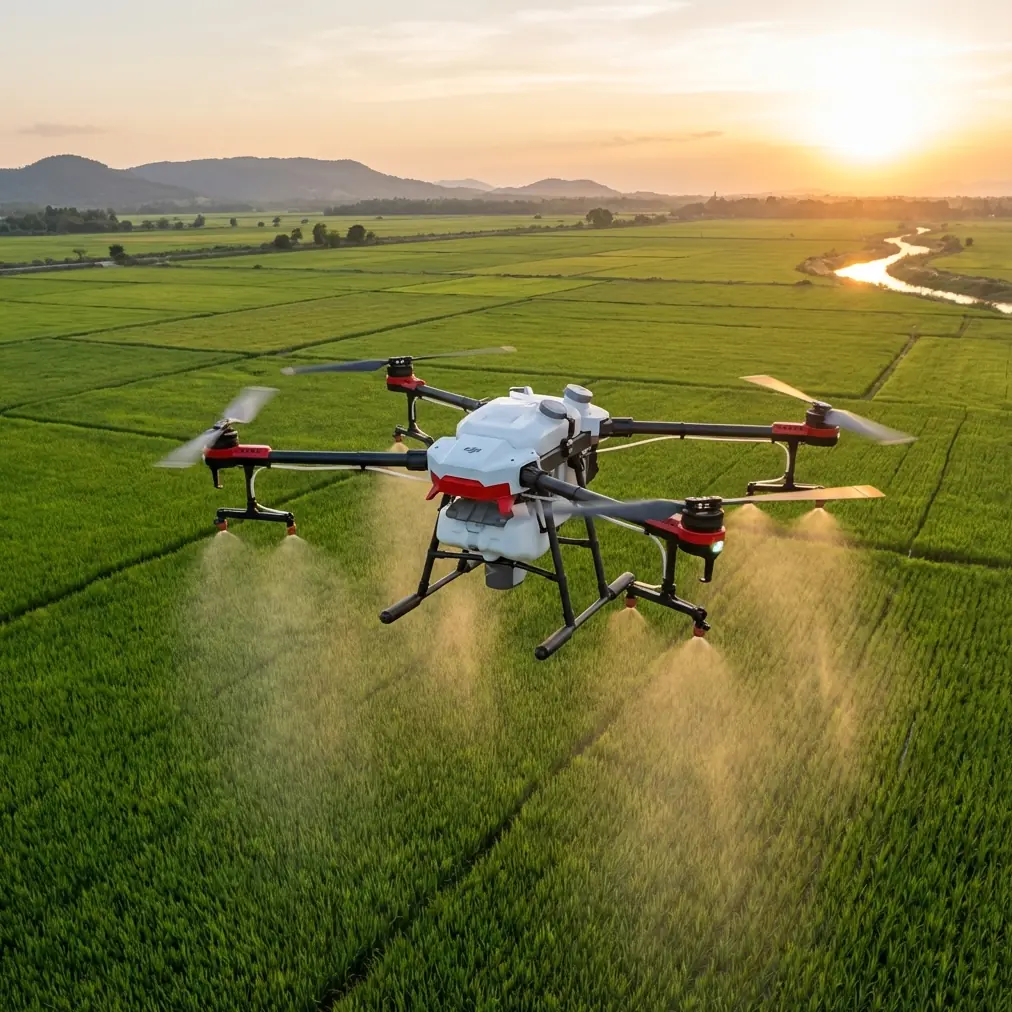
Why Avata fits venue inspection better than many pilots expect
Avata is often discussed as an immersive flying platform, but in venue inspection its real strength is confidence in tight space. Concourses, façade overhangs, gate structures, lighting trusses, rooftop mechanical zones, pedestrian bridges, and exterior signage corridors all reward a drone that can hold a deliberate line at low altitude and close range.
That matters in a city preparing for a major international event. Shared airspace management is designed to improve drone coordination and overall awareness, which means your mission is no longer just about “Can I fly here?” It becomes “Can I complete a specific inspection task predictably, with minimal airspace footprint, while fitting into a broader managed environment?”
Avata’s compact form factor helps with that. So does obstacle awareness, even if the smartest pilots treat sensing as a backup rather than a permission slip. Around venues, structural geometry gets tricky fast. Ticketing canopies can hide support members. Decorative cladding can distort depth perception. Temporary event builds appear where your satellite map showed empty pavement a week earlier. In those conditions, a platform that encourages slow, close, controlled movement is often more useful than one optimized for sweeping wide-area capture.
What Kansas City’s network changes for inspection crews
The Kansas City deployment was intended to support World Cup security operations through better shared airspace awareness and drone management. For a venue inspection crew, that phrase translates into a few practical realities.
First, expect visibility. Flights near sensitive event infrastructure are more likely to sit within a coordinated picture seen by multiple stakeholders. That does not remove legitimate commercial or documentation work, but it does raise the standard for discipline. Sloppy launch locations, vague mission descriptions, and unstructured flight paths stand out more in a managed environment than they do on a quiet suburban roof survey.
Second, expect constrained timing windows. A shared platform often means airspace access is tied to who else needs the same sky. If your task is to inspect a stadium exterior before crowd ingress, your real job is not just image capture. It is image capture inside a narrow operational slot.
Third, expect the city to keep building on this model after the tournament. Officials have said the network is planned for future urban drone operations beyond the event itself. That is the real long-term takeaway. Venue inspections will increasingly live inside coordinated digital frameworks rather than isolated pilot decisions.
For Avata operators, this is actually good news. A well-defined mission flown by a small, precise platform becomes easier to justify than broad, ambiguous loitering near crowded infrastructure.
Field workflow: how I would approach an Avata venue inspection
On a dense urban venue job, I break the operation into four layers: airspace coordination, RF strategy, capture logic, and exit discipline.
1. Airspace coordination comes first
When a city is using a regional drone coordination platform, I treat preflight paperwork and stakeholder alignment as part of the camera setup. The inspection objective has to be specific. Are we documenting façade condition? Roof drainage obstructions? Banner mount integrity? Lighting or cable routing around a fan entry corridor? The tighter the mission definition, the easier it is to fit the flight into a managed urban environment.
This is where the Kansas City model matters operationally. A system designed for shared awareness and drone management creates a framework where “inspection” must mean something concrete. If you can define your path and task, you are easier to accommodate.
2. RF strategy matters as much as battery strategy
Urban venues are noisy RF environments. You are dealing with public communications infrastructure, temporary event systems, Wi-Fi saturation, media gear, and complex reflective surfaces. Range on paper means very little if your signal path is poor.
The simplest antenna positioning advice is still the advice most often ignored: do not point the antenna tips directly at the aircraft. The strongest part of the transmission pattern is generally off the sides, so you want the broad face of the antenna orientation working toward the drone, not the narrow end.
In practical terms, if I’m inspecting around a stadium perimeter with Avata, I position myself to maintain the clearest possible line of sight and then adjust controller antenna orientation as the aircraft moves laterally, not just outward. In urban inspection, range failure is often not about distance. It is about geometry.
A few habits make a measurable difference:
- Launch from a spot with physical elevation when possible, even a modest rise or parking structure edge with legal access.
- Avoid standing directly under steel awnings, signage frames, or dense roof-edge equipment.
- Keep your body from blocking the controller’s signal path during sideways passes.
- Re-orient as the drone rounds corners. Stadiums create signal shadows quickly.
- Do not chase “maximum range” thinking in venue work. Chase maximum link quality over the shortest necessary route.
That last point is the one that protects both data quality and operational compliance. Around urban venues, the best flight is rarely the farthest one.
Capturing useful inspection footage, not just dramatic footage
Avata can produce compelling visual motion, but venue inspection is not a reel. It is evidence collection.
That is where D-Log becomes especially useful. On mixed-light urban sites, you can move from sunlit concrete into shaded service corridors in seconds. D-Log gives more flexibility in grading and recovering tonal detail later, which matters when the purpose of the flight is to examine condition, contrast, material wear, or installation quality. If a stadium façade has staining, seam irregularities, or mounting issues around graphics and wayfinding, preserving information across highlights and shadows is more valuable than making the footage look punchy in-camera.
I also think people misuse automated movement tools in inspection scenarios. QuickShots and Hyperlapse have a place, but only when the output supports context. A Hyperlapse sequence of pre-event build activity can be useful for progress documentation. A QuickShot may help create a wide establishing visual for a site file. But those modes should serve the inspection record, not replace deliberate, repeatable passes over the asset.
Subject tracking and ActiveTrack require even more caution in urban venue work. They can help when following a slow moving maintenance vehicle, documenting pedestrian flow mockups in a controlled setting, or keeping a visual lock on a known inspection target. But dense structures, poles, banners, fencing, and temporary rigging can confuse any automated behavior. I treat tracking as an assistive tool only in open, predictable segments of the site.
The pilot still owns the route.
How obstacle awareness helps when the site is changing by the day
Venue environments are rarely static in the weeks before a major event. Temporary fencing appears. Broadcast compounds expand. Sponsor structures go up. Lighting and speaker towers multiply. Delivery routes shift.
That is why obstacle awareness has operational significance beyond simple collision prevention. It helps preserve pace. In inspection work, confidence is not just safety. It is continuity. If the pilot can move smoothly through constrained spaces without abrupt overcorrection, the footage becomes easier to review, compare, and archive.
Still, no sensing system fully understands event infrastructure. Thin cables, netting, transparent materials, and irregular temporary builds can create false comfort. On Avata jobs near urban venues, I reduce speed before every transition from open space into structural clutter. The drone may be capable of more, but inspection quality improves when the aircraft arrives at each critical detail already stable.
A realistic stadium-adjacent mission profile
Let’s say your assignment is to inspect exterior wayfinding, upper façade banner alignment, rooftop HVAC screening, and crowd-flow barriers around a stadium district preparing for international traffic. The city has a shared drone management picture in place because of a high-profile tournament. This is exactly the kind of context suggested by Kansas City’s World Cup-era deployment.
Here is where Avata earns its keep:
- Short, deliberate passes along façade lines
- Controlled movement under overhang edges
- Close visual checks on temporary installations
- Stable low-altitude work in pedestrian infrastructure zones
- Fast relocation between micro-objectives without bringing a larger aircraft profile into the site
What changes because of the regional coordination network is not the camera angle. It is the discipline of the mission. You fly fewer speculative paths. You collect what the venue team actually needs. You stay predictable.
That is also where communication matters. If you are coordinating with event managers, facilities staff, or site contractors and need a direct planning channel before deployment, use this inspection coordination line to align the task list and site constraints ahead of time.
The bigger lesson from Kansas City
The headline around Kansas City naturally emphasizes security, but the more lasting story for civilian drone professionals is infrastructure. A regional platform developed with public safety agencies to improve shared airspace awareness is really a signal that cities are preparing for routine drone presence, not occasional exceptions.
And that changes how Avata should be used professionally.
It should not be treated as a novelty flyer brought in to get dynamic footage around a venue. In a managed urban environment, its value is precision, agility, and low-footprint documentation. The best Avata operator on these jobs is the one who can explain exactly why each flight segment exists, how it fits into coordinated airspace, and what inspection outcome it delivers.
Kansas City’s model also hints at a future where venue districts, transit-linked event corridors, and downtown public spaces operate under shared drone awareness systems long after major tournaments end. If that future arrives as expected, pilots who already know how to work inside structured urban coordination will have an advantage over those who only know open-area flying.
Final field notes
If you are inspecting venues in urban settings with Avata, do not let the aircraft’s agility tempt you into loose planning. The tighter the site, the more the basics matter.
Maintain line of sight. Orient antennas for signal geometry, not habit. Use D-Log when tonal recovery matters. Treat ActiveTrack and QuickShots as selective tools, not default modes. Respect obstacle awareness, but never delegate judgment to it. And when a city introduces a shared drone coordination network like the one Kansas City deployed ahead of the FIFA World Cup on 2026-05-20, read that as a sign of the next operational standard, not a temporary exception.
The pilots who adapt early will produce cleaner data, cause fewer conflicts, and fit more naturally into the urban inspection workflows cities are clearly building toward.
Ready for your own Avata? Contact our team for expert consultation.