Avata Field Report: Vineyard Inspection in Extreme
Avata Field Report: Vineyard Inspection in Extreme Temperatures
META: A field-tested look at using DJI Avata principles for vineyard inspection in harsh temperatures, with lessons drawn from DroneDeploy’s survey case: faster data capture, automated processing, and practical handling of interference on site.
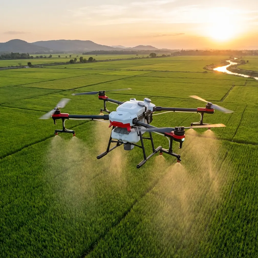
I’ve spent enough time around agricultural drone operations to know that vineyards expose weak workflows fast. Heat shimmer, cold morning batteries, narrow rows, trellis wire, reflective irrigation hardware, and patchy signal conditions all turn a clean desktop plan into a messy field day. That is why the most useful way to talk about Avata for vineyard inspection is not as a spec sheet exercise, but as an operational story.
The most relevant lesson here actually comes from an older survey case involving DJI hardware and DroneDeploy. In that project, Hover Visions used an Inspire 1 to inspect a 73,000-square-meter construction site with four oil storage tanks. The aircraft flew a preset route at roughly 100 meters and gathered 66 images in 15 minutes. According to the case, the resulting dataset was more complete and precise than what a crewed helicopter might collect over several hours, and the processing pipeline produced a viewable result in about one hour after landing.
Those details matter far beyond construction. They expose the real value chain of drone inspection: not just flying, but compressing the time between “problem exists” and “decision made.” In a vineyard facing extreme temperatures, that compression is often the difference between catching a stressed block early and discovering the issue after quality has already slipped.
Why this matters for Avata users in vineyards
Avata is not a traditional broad-acre mapping aircraft. It is a different tool. But vineyards rarely need only one kind of aerial view. They need context from above and close-range visual truth from inside the rows. That is where Avata becomes unusually useful.
If you are inspecting vines during extreme heat or cold, you are often looking for things that don’t present well from a high, distant pass:
- canopy gaps hidden by row angle
- trellis damage after wind or thermal expansion stress
- irrigation leaks near emitters
- localized sunburn or frost impact
- blocked access lanes
- worker safety hazards around posts, wires, and equipment
A platform like Avata can move through these constrained spaces with more intimacy than a larger survey drone. The operational lesson from the DroneDeploy case is that speed only counts if the workflow stays automated. Parrish’s process worked because he preplanned the route, flew efficiently, and then moved the imagery into a processing engine without wasting time on manual sorting. The same discipline applies in a vineyard.
Avata’s role is not “replace every mapping aircraft.” Its role is to gather high-value visual evidence where maneuverability matters and where fast interpretation is more useful than a giant pile of footage nobody reviews.
Extreme temperatures change inspection priorities
Vineyards in severe heat and cold punish hesitation. In high heat, your biggest enemies are battery performance drift, midday turbulence, operator fatigue, and image distortion from shimmering air. In cold conditions, batteries sag early, fingers lose dexterity, and startup routines slow down just when you want to move quickly.
That is why a short, deliberate flight profile matters so much.
The DroneDeploy case showed a practical benchmark: 15 minutes of disciplined capture produced actionable coverage. That should shape how Avata operators think in vineyards. Don’t aim for a cinematic marathon. Build several tight missions around specific questions:
- Is the western block showing irrigation inconsistency?
- Did the frost pocket near the lower rows damage shoot growth?
- Are end posts near the access road shifting?
- Is there visible stress clustering around one lateral line?
Short flights reduce thermal strain on batteries and airframe, simplify review, and let you swap packs while conditions are still stable. In agriculture, useful answers beat long flights almost every time.
The hidden advantage: getting inside the rows
This is where a field report becomes more honest than a brochure.
In a vineyard, the glamorous overhead shot is not usually the shot that solves the problem. The real money shot is often the low, stable pass that shows one row behaving differently from the next. Avata’s compact form and protected design philosophy make it better suited to this kind of close work than larger aircraft that need more open air around them.
Obstacle-rich environments are normal in vineyards. Trellis systems, foliage encroachment, support wires, netting, utility fixtures, and uneven terrain all create a corridor where pilot confidence matters. Features associated with the Avata ecosystem, such as obstacle awareness behaviors, can reduce workload in these settings, though no pilot should confuse that with permission to get careless around wire or dense vegetation. In practice, the benefit is mental bandwidth. When the aircraft helps manage spatial pressure, the operator can spend more attention on the crop itself.
That same logic extends to subject tracking and ActiveTrack-style workflows where appropriate. In a vineyard inspection context, the point is not flashy autonomous filming. It is repeatability. If you need a consistent moving perspective along a row, guided tracking behaviors can help maintain framing for comparative review. Repetition is valuable when you are checking whether a stress pattern is expanding week over week.
EMI is real in vineyards, and antenna handling is not optional
One thing the reference material does not discuss directly, but every field operator eventually learns, is that signal reliability can deteriorate in places that seem deceptively open. Vineyards may look simple from a distance, yet they can contain irrigation control infrastructure, pumps, buried lines, nearby utility corridors, metal equipment, and reflective geometry that complicates transmission.
I’ve had days where the issue wasn’t the aircraft at all. It was antenna orientation.
When electromagnetic interference starts nibbling at your video link or control confidence, the instinct some operators have is to blame the drone or the weather. Often the fix is more basic: stop, reassess your line, and adjust the antenna plane so it is correctly presented to the aircraft’s path instead of vaguely pointed “toward the vineyard.” That small correction can stabilize the link enough to finish the row without pushing risk.
In vineyard work, especially between long parallel rows, the aircraft can slip into positions where foliage, posts, and terrain create partial masking. If you then add EMI from nearby infrastructure, your margin shrinks. The operational significance is straightforward: antenna adjustment is not a technical footnote. It is part of flight discipline. A pilot who understands how to maintain link geometry will extract more reliable footage than a pilot who treats reception as luck.
Why automation still wins, even with a close-range aircraft
The strongest insight from the DroneDeploy case is not the airframe. It is the workflow design.
Parrish reportedly used the app to define the route before takeoff, flew the mission, uploaded the images through a browser, and had processed outputs ready in about an hour. That is a textbook example of removing friction between capture and analysis. For vineyard teams, especially in extreme weather windows, that approach is gold.
Here’s why.
If a grower or operations manager has to wait a day or two for someone to sift through disconnected clips, the inspection loses value. Heat stress moves. Irrigation failures spread. Labor schedules shift. A field report needs to become operational guidance while the situation is still current.
Avata users should build the same kind of discipline into their inspections:
- define the question before launch
- capture only what supports that question
- keep each flight segment structured
- label footage immediately by block or row
- review and share findings the same day whenever possible
The agricultural version of “processing in one hour” is not necessarily full 3D modeling. Often it is a concise visual package that a vineyard manager can act on before the next temperature swing.
Imaging style matters more than people admit
Many operators either overshoot or undershoot agricultural footage. They come back with either endless cinematic clips or sterile fragments with no continuity. Avata offers creative tools, but in vineyard inspection those tools should serve interpretation.
D-Log can be genuinely useful when you are flying in punishing contrast, such as bright exposed rows next to shaded canopies. If your goal is to compare leaf condition or detect subtle color shifts, preserving tonal flexibility helps. The key is consistency. If one day’s inspection is baked into a high-contrast look and the next day’s is flatter and more neutral, side-by-side comparison gets messy.
QuickShots and Hyperlapse also have a place, just not in the way casual users think. A brief automated reveal can establish the broader condition of a block before you drop into row-level passes. A controlled Hyperlapse over repeated intervals can show labor movement, irrigation progression, or changing cloud cover affecting stress visibility. These are not gimmicks when used sparingly. They are context builders.
The rule is simple: if a feature helps a vineyard manager understand condition faster, it belongs. If it only makes the footage prettier, it belongs somewhere else.
A practical vineyard inspection rhythm with Avata
In extreme conditions, I prefer a three-layer approach.
First, establish the block. Get the wider visual layout and identify where to focus. Second, move into the rows for targeted passes. Third, capture one or two reference angles that can be repeated on future visits from roughly the same path and height.
That repeatability is what turns flying into inspection.
The 2016 case from Hover Visions emphasized completeness and precision over simply being airborne. That distinction is critical. In the construction project, they weren’t just admiring the tanks; they needed progress reporting accurate enough to support decisions. In vineyards, “progress reporting” becomes “crop condition reporting.” The same standard applies. A pretty pass is not enough. The footage has to support action.
If your team needs a practical discussion about configuring that kind of workflow in the field, you can message us directly here.
What Avata can realistically do better in this scenario
For vineyard inspection in harsh temperatures, Avata stands out in four practical ways.
It reduces spatial hesitation.
Flying close to trellis structures demands confidence. A compact aircraft with protected design characteristics lets trained operators inspect tighter spaces with less setup overhead.
It supports targeted capture.
Rather than blanketing acres with generic footage, you can focus on the rows and assets that actually need attention.
It improves communication.
Managers and crews often understand low-altitude visual evidence better than abstract reports. Seeing a damaged emitter line beside stressed vines closes the loop fast.
It complements larger survey workflows.
The reference case demonstrated the power of automated image collection and processing at site scale. Avata fits beside that model as the close-range verification tool. Broad survey flags the issue; Avata shows the issue.
The real takeaway from the DroneDeploy case for Avata operators
The story from Oklahoma was not really about one aircraft versus a helicopter. It was about operational compression. A drone flight of 15 minutes, collecting 66 images, on a 73,000-square-meter site became useful intelligence quickly because the workflow was structured from start to finish.
That is the lesson worth carrying into vineyard inspections.
When temperatures are extreme, time matters. When rows are dense, maneuverability matters. When signal conditions wobble, antenna handling matters. When managers need answers before the next irrigation cycle or weather swing, fast processing matters.
Avata is most valuable in vineyards when it is flown with that mindset: not as a toy, not as a cinematic indulgence, and not as a replacement for every other aerial tool, but as a precise close-range inspection platform inside a disciplined workflow.
That is how you turn footage into field decisions.
Ready for your own Avata? Contact our team for expert consultation.