Inspecting Dusty Vineyards With Avata: A Field Report
Inspecting Dusty Vineyards With Avata: A Field Report on Navigation Confidence, Signal Resilience, and Cleaner Decision-Making
META: A field report on using Avata for dusty vineyard inspection, with practical insight on obstacle avoidance, D-Log capture, and why new low-altitude navigation advances like centimeter-level anti-interference systems matter.
I used to think the hardest part of inspecting vineyards by drone was the flying itself.
It wasn’t.
The real friction showed up in the moments around the flight: weak confidence near trellis lines, dust hanging in the air, inconsistent positioning when trying to revisit the same row, and those stretches where surrounding infrastructure made the aircraft feel less settled than the spec sheet promised. Vineyards look open from a distance. Once you drop low enough to inspect canopy shape, irrigation alignment, edge damage, and access lanes, they become a maze of repeating geometry.
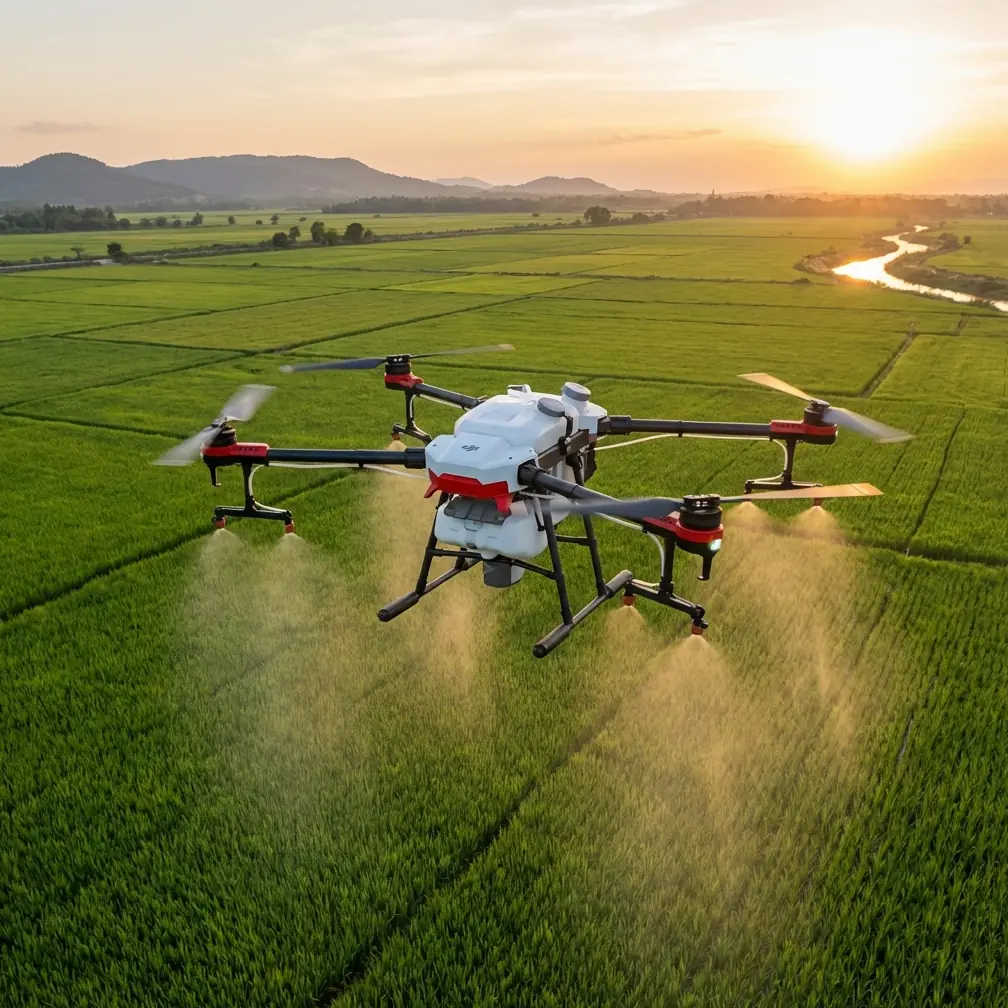
That is where Avata became genuinely useful for me—not as a headline drone, but as a practical aircraft for close-range visual work in places where movement, framing, and pilot confidence matter more than raw scale.
Lately, I’ve been thinking about that field reality alongside a recent development from Anhui’s aviation sector. A project led by 安徽省通航控股集团 was selected for the 2025 Anhui provincial science and technology innovation program, centered on a BeiDou anti-interference, high-precision intelligent navigation system for low-altitude flight. On paper, that sounds far removed from a dusty vineyard inspection. In practice, it cuts straight to one of the biggest operational constraints for drones like Avata when used in commercial fieldwork: low-altitude navigation has to remain trustworthy in messy environments, not just ideal ones.
That project is aiming at three things that matter to anyone flying near crops, structures, and access roads: strong anti-interference capability, centimeter-level precision, and high reliability. Those aren’t abstract engineering goals. They describe the exact qualities that determine whether a drone helps you build repeatable inspection habits—or just delivers attractive footage with gaps in usable evidence.
Where Avata Fits in Vineyard Work
Avata is not the first platform many people imagine for agricultural inspection. Fixed workflows in agriculture often point toward mapping aircraft, multispectral systems, or larger drones built around endurance and standardized survey patterns. That’s fine if the assignment is broad acreage analytics.
But vineyard inspection often has another layer. You need close visual confirmation.
You may need to move down a row and check whether dust accumulation is masking a stress pattern you saw from another platform. You may need to inspect vine spacing near a road, look at post alignment, assess wind damage on edge sections, or create visual references for a manager who doesn’t want a spreadsheet first. In those cases, Avata’s value comes from agility, proximity, and the way it lets the operator work through tight visual corridors without feeling like every small correction is a negotiation.
In dusty conditions, that agility becomes more than convenience. It lets you reduce the time spent hovering indecisively in one spot, which tends to compound visibility issues and can make any inspection less clean. Shorter, more deliberate passes are often better than lingering.
The Navigation Problem Nobody Notices Until It Costs Time
Most people discussing vineyard drone work focus on camera quality, battery planning, or obstacle avoidance. All fair topics. But navigation integrity is the hidden layer underneath everything else.
The Anhui project specifically targets a weakness that low-altitude operators already understand from experience: in complex electromagnetic environments, navigation can be vulnerable to interference and insufficient precision. That phrase matters. Vineyards can sit near roads, utility corridors, operational buildings, pumping systems, communications equipment, and mixed terrain edges. Even when none of those create a dramatic failure, they can still erode confidence.
For inspection work, confidence changes behavior.
If you trust the aircraft’s positional stability and its ability to hold a predictable path, you fly cleaner lines. You repeat angles more accurately. You spend less time overcorrecting. You capture footage that can actually be compared over time. If you don’t trust those things, you hedge. You back off. You widen your passes. You miss details hidden in the geometry of the vines.
That is why the centimeter-level precision ambition in the Anhui project is operationally significant. In a vineyard, repeatability is everything. A grower may not care how elegant the technology sounds. They care whether you can return to the same problem section and show whether the gap, sag, stress patch, or access issue has changed since last week. Centimeter-grade positioning, if delivered reliably in the low-altitude layer, would shrink one of the biggest weak points between a “nice drone flight” and a defensible inspection record.
Dust Changes the Way You Fly
Dusty vineyard work rewards restraint.
When I first started doing low passes for visual checks, I flew as if smooth cinematic movement was the goal. It looked good, but it wasn’t efficient. Dust taught me to simplify. Lower drama, tighter objectives, fewer unnecessary corrections.
Avata helped because it encourages a more direct style of flying. You can enter a row, frame the question, capture the evidence, and move on. For vineyard managers, this is usually more valuable than a polished orbit. They want clarity around practical issues: blocked access paths, foliage density inconsistencies, damaged support structures, standing water traces after irrigation, or vehicle ruts affecting service routes.
Obstacle avoidance also matters here, though not in the simplistic “it saves you from crashing” sense. In vineyards, obstacle awareness changes what kind of inspection is feasible at all. Trellis systems, wires, poles, perimeter trees, and shed edges compress the safe envelope. A drone that gives you more confidence around these boundaries lets you get the shot from the angle that explains the issue. Without that, operators tend to default to higher, safer, less informative footage.
Why Anti-Interference Research Matters Even for an Avata User
The Anhui initiative is not about Avata specifically. But it does speak to the broader direction of low-altitude operations that Avata users should be watching.
The project brings together Anhui General Aviation Holding Group, research institutes connected to the Chinese Academy of Sciences, Anhui University, and Yujiang Technology, and it advanced through expert review. That kind of cross-disciplinary collaboration matters because low-altitude navigation is no longer just a hardware conversation. It is a systems conversation involving satellite navigation, anti-interference algorithms, intelligent sensing, and low-altitude operational management.
For someone inspecting vineyards, that translates into a simple benefit: fewer unknowns between takeoff and the final usable deliverable.
Today, when I plan a field report with Avata, I still think in layers:
- visual objective
- route through the vines
- dust behavior
- line-of-sight discipline
- signal confidence
- revisit needs for later comparison
What this new research direction suggests is that future low-altitude workflows may become less fragile in exactly the places where commercial users currently lose efficiency. A more interference-resistant navigation foundation would not just help long-range logistics or urban air mobility—the applications named in the project. It would also benefit close-range inspection work by making low-altitude positioning more dependable where precision and consistency matter most.
That is the overlooked connection.
A Better Inspection Workflow for Vineyards
My own workflow with Avata changed after one particularly frustrating afternoon in a dusty vineyard block. I had enough footage, technically speaking. But when I reviewed it later, some of the most important passes were hard to compare against earlier flights. The angles drifted. The distance from the row varied. What looked obvious in the field became ambiguous in post.
Since then, I’ve treated Avata less like a flying camera and more like a note-taking instrument.
I’ll typically build the inspection around short segments:
- approach and establish row context
- low pass for canopy and support-line visual condition
- lateral check near edge transitions
- detail clip for any anomaly
- exit line that preserves orientation for the next revisit
This is where features like D-Log and controlled motion earn their place. D-Log gives me more room to handle harsh contrast later, especially when pale dust, bright soil, and dark canopy are all fighting in the same frame. In vineyard environments, that flexibility helps separate genuine plant or infrastructure issues from lighting noise. It’s not about cinematic grading for its own sake. It’s about making evidence clearer.
I use automated features selectively. QuickShots and Hyperlapse can add context, especially when documenting terrain relationship, road access, or the movement between blocks. But for actual inspection, I rarely want the drone making aesthetic decisions for me. The useful footage is usually slower, closer, and more intentional than people expect.
As for ActiveTrack or subject tracking, I treat it as situational. In vineyard operations, tracking can be useful for following a vehicle along access lanes or documenting movement around a service route, but not as a substitute for deliberate inspection passes. Rows are repetitive, dusty, and full of visual traps. Human judgment still matters more than automation.
The Bigger Story Behind a Small Drone
The reason the Anhui navigation project caught my attention is that it reflects a mature understanding of what low-altitude aviation now needs. The project is aimed at supporting drone logistics, emergency response, and urban air mobility, but the technical challenge it identifies—navigation vulnerability under interference and inadequate precision—shows up in quieter civilian tasks too.
Vineyard inspection is one of those quieter tasks.
No headlines. No spectacle. Just repeated low-altitude flying in an environment where small inaccuracies accumulate into wasted time and weak reporting. If the industry can deliver high-reliability, anti-interference, intelligent navigation at low altitude, then drones like Avata become easier to deploy as part of a repeatable commercial method rather than as a skilled operator’s improvisation tool.
That distinction matters to growers, consultants, and visual inspectors. Repeatability scales. Improvisation does not.
Practical Advice If You’re Flying Avata in Dusty Vineyards
A few habits made the biggest difference for me:
First, inspect with a question in mind. Don’t launch just to “look around.” Decide whether you’re checking canopy uniformity, edge damage, row access, support structures, or irrigation-adjacent conditions.
Second, keep your paths simple. Dust punishes indecision. Short, purposeful segments are easier to review and easier to repeat.
Third, use obstacle awareness as a planning asset, not a panic backup. The point is to unlock better angles near trellis geometry, not to fly carelessly.
Fourth, capture context and detail separately. A broad establishing pass tells the story of location. A tighter pass explains the problem.
Fifth, if you’re building a recurring inspection routine and want to compare notes on setups, field handling, or Avata-specific workflow choices, I’ve found it useful to continue the conversation directly here: message me on WhatsApp.
What Made Avata Easier for Me
The honest answer is not speed or novelty.
It made one old problem easier: getting close enough to see something meaningful without turning the flight into a stress exercise. In vineyards, especially dusty ones, that is the threshold that decides whether you come home with actionable material or just footage.
And the more the low-altitude industry invests in the kind of navigation backbone highlighted by Anhui’s new provincial-level project, the more useful platforms like Avata become in real civilian fieldwork. Strong anti-interference performance means fewer shaky assumptions about the environment. Centimeter-level accuracy means better return-to-scene consistency. High reliability means a workflow you can trust when the inspection itself is the job, not the flying.
For me, that’s the story.
Avata is at its best in vineyard work when you stop treating it like a showcase drone and start using it as a precise visual instrument. Dust, wires, repeating rows, awkward angles—those are not edge cases. They are the assignment. And the future of low-altitude navigation now being pushed through formal innovation programs will shape how well drones handle exactly those assignments.
Ready for your own Avata? Contact our team for expert consultation.