Avata in Dusty Field Mapping: What Rotor Control Theory
Avata in Dusty Field Mapping: What Rotor Control Theory Teaches Us About Real-World Stability
META: A technical review of using Avata for dusty field mapping, with practical insight on vibration control, hovering accuracy, controller stability, and how changing weather affects flight performance.
Dust is where spec sheets stop being useful.
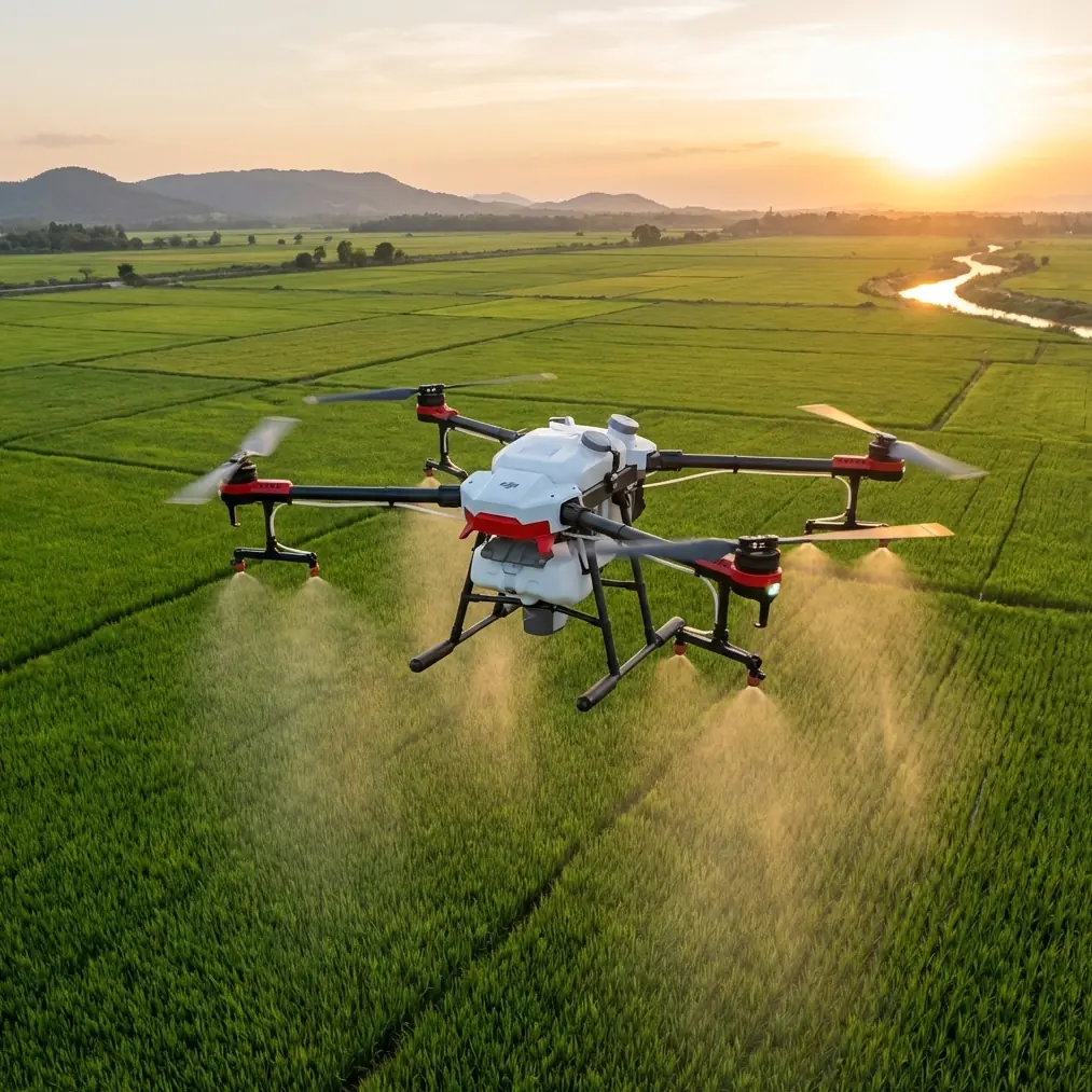
On paper, field mapping sounds orderly: launch, trace a route, hold altitude, capture clean footage or image data, come home. In a dry agricultural environment, that neat picture falls apart quickly. Fine particulate matter lifts off the ground during takeoff, crosswinds build without warning, and every small vibration gets amplified when the aircraft is working close to the surface. For anyone evaluating Avata for mapping fields in dusty conditions, the real question is not whether it flies. It is whether it can stay stable enough, long enough, to produce usable results when the environment turns messy.
That is why an older academic design study on a hex-rotor aircraft is unexpectedly relevant here. The paper does not discuss Avata directly, but it isolates two issues that matter enormously in field operations: controller architecture and vibration management. Those are not abstract engineering topics. They decide whether your aircraft holds a clean hover over a reference point, whether it keeps tracking a planned path when weather shifts mid-flight, and whether sensor data remains trustworthy when the airframe is being shaken by rough air and rotor-induced dust.
The study describes a small VTOL unmanned aircraft using six rotors arranged into 3 groups of coaxial rotors, and it outlines a control scheme built around three main controllers: position, height, and attitude. It also proposes a combined approach to reduce gyroscope and accelerometer noise caused by vibration, using both mechanical anti-vibration methods and an alpha-beta digital filter. Finally, it points to practical flight validation through hovering tests, anti-interference tests, and signal-tracking experiments.
Those details matter more than they first appear.
Why this research matters for an Avata operator
Avata sits in a very different product category from a university-built hex-rotor. It is more compact, more integrated, and designed around a specific flight experience. But if your job is mapping dusty fields, the underlying flight problems are strikingly similar.
A mapping mission demands repeatability. You need stable altitude. You need predictable attitude control. You need the aircraft to resist disturbances without overcorrecting. And you need onboard sensing to remain clean enough that the flight controller is not reacting to false motion.
The Harbin Institute of Technology project is useful because it frames these tasks as separate but linked layers: position, height, and attitude. In practical terms, that means one control problem should not be allowed to contaminate another. If the aircraft pitches unexpectedly during a gust, attitude correction has to happen fast. But if the altitude loop is weak, the drone may recover orientation while still drifting vertically. If the position loop is too aggressive, a correction for lateral drift can create oscillation and ruin image consistency.
That logic is directly applicable when evaluating Avata in agriculture-adjacent mapping work.
Dust changes the control problem
Pilots often think of dust mainly as a visibility issue or a maintenance issue. It is both, but in mapping it also becomes a control issue.
The moment Avata takes off from a dry field edge, the downwash can create a localized cloud. Near the surface, that dust plume changes visual contrast, introduces turbulence from recirculating air, and adds a layer of unpredictability during the most delicate phase of the flight. If your mapping run starts low and slow, especially around uneven terrain or crop rows, every vibration source becomes more consequential.
This is exactly why the study’s focus on gyroscope and accelerometer noise is operationally significant. A drone does not “feel” instability the way a pilot does. It infers it from sensors. If vibration contaminates those signals, the aircraft can appear to be moving or rotating differently than it really is. Then the controller responds to noise instead of reality.
The paper’s solution was twofold: first, reduce vibration physically through mechanical anti-vibration design; second, smooth sensor output with an alpha-beta filter. That pairing is smart because filtering alone cannot rescue a badly vibrating platform. If the raw signal is poor, software ends up compensating too late or too aggressively. On the other hand, mechanical isolation without proper signal conditioning leaves performance on the table.
For an Avata operator in dusty mapping work, the takeaway is simple: stable data starts before capture. Prop condition, frame integrity, mounting security, and takeoff surface selection all affect how cleanly the aircraft senses the world. A dusty field is not just hard on optics. It can degrade the entire control loop if the platform is repeatedly exposed to vibration and debris.
Mid-flight weather is where good control reveals itself
The most revealing field tests are never the calm ones.
On a recent dusty-field scenario, conditions shifted halfway through the mission. The first pass was uneventful: low-altitude movement over a dry section, clean line of sight, manageable airflow. Then the weather changed. A crosswind started building from one side of the field, and the surface loosened enough that each correction near the downwind edge threw more dust back into the air.
This is where a drone’s smoothness either holds or unravels.
A weaker control system often reacts in a chain. The aircraft yaws slightly off line, then overcompensates laterally, then adjusts pitch to recover track, and finally gives up clean altitude hold while doing all three. The pilot sees “drift,” but the deeper issue is poor separation of control tasks.
The design study’s three-controller model helps explain why some aircraft remain composed in this situation. Attitude control handles the immediate orientation response. Height control protects vertical consistency while the aircraft is being disturbed. Position control works on the larger route objective rather than chasing every micro-disturbance. When those layers are balanced properly, the drone can absorb changing weather without turning the footage or mapping path into a jittery correction exercise.
That matters for Avata because dusty mapping is often done under time pressure. You may only have a small weather window before light changes or wind intensifies. An aircraft that stays composed through a mid-flight shift lets you finish a segment instead of scrubbing the run and restarting.
Hover performance is not just a nice benchmark
The paper explicitly references hovering tests used to prove controller accuracy. That might sound basic, but for mapping it is one of the most telling indicators.
A stable hover is not merely a demonstration that the aircraft can sit still. It confirms that the control stack is managing tiny disturbances continuously without visible hunting. In dusty field work, that translates to cleaner starts, safer pauses for orientation checks, and more confidence when repositioning at low altitude near uneven ground.
If Avata can maintain a disciplined hover despite low-level airflow variation and surface dust, it tells you something valuable about the aircraft’s internal decision-making. It is handling small deviations before they grow. That is exactly what you want when stitching together a methodical flight pattern over agricultural land.
The same goes for the study’s anti-interference testing for controller stability. In practice, “interference” is not limited to electronics. Field conditions create their own interference profile: gusts, thermals above dry soil, visual distraction from drifting dust, and airframe vibration from repeated low-level acceleration. A drone that behaves consistently under disturbance is more likely to deliver usable mapping material instead of forcing heavy cleanup later.
Avata’s practical strengths in this use case
Avata is often discussed through cinematic flight, but dusty field mapping shifts the evaluation criteria. Here, the useful traits are not flashy. They are discipline, responsiveness, and recoverability.
Obstacle awareness helps when field edges include poles, fencing, irrigation hardware, or scattered trees. Subject tracking and ActiveTrack are less central for strict mapping than for documentation passes, but they can still support ancillary capture around machinery, site activity, or inspection targets after the main route is complete. QuickShots and Hyperlapse are not mapping tools in the technical sense, yet they can provide context visuals for landowners, agronomists, or project stakeholders who need an overview beyond raw survey coverage.
D-Log becomes relevant when the environment is harsh and contrasty. Dusty fields under shifting weather often produce flat haze in one direction and hard glare in another. A flatter recording profile preserves more flexibility for analysis and presentation later, especially if the mission includes both technical capture and client-facing deliverables.
But none of those features compensate for poor stability. The foundation remains control quality under disturbance. That is why the academic reference is so useful. It reminds us that a drone succeeds in difficult field conditions not because it has a long list of intelligent features, but because the underlying loops governing motion are robust.
Operational lessons for dusty mapping flights
The design paper does not give a field checklist for Avata, but it strongly suggests one.
First, treat vibration as a first-order risk. Inspect props carefully. Launch from a surface that minimizes recirculated dust. Keep the aircraft physically clean enough that sensor performance is not being undermined by buildup. The study’s emphasis on both mechanical anti-vibration design and digital filtering supports this layered approach: prevent what you can, then let software refine what remains.
Second, evaluate hover quality before starting the full route. The paper’s reliance on hovering tests is a good reminder that early instability usually gets worse, not better, once the route begins. If the aircraft cannot hold confidently in the launch area, the field pass will not magically improve.
Third, watch how the aircraft behaves when the weather changes, not just whether it remains airborne. The signal-tracking experiments cited in the study matter because path fidelity is the real measure of controller maturity. In mapping, being slightly off line on every pass compounds into coverage inconsistency.
Fourth, separate mission goals. Use the main route for disciplined capture. Then use Avata’s creative tools, if needed, for supplemental visuals. Mixing cinematic impulses into a precision field task often invites unnecessary low-altitude risk in already dusty conditions.
If you are comparing setups or need a second opinion on configuring an Avata workflow for harsh agricultural environments, a quick field mapping discussion here can save a lot of trial and error.
The bigger takeaway
What makes the Harbin study valuable is not the airframe itself. It is the engineering mindset behind it. The researchers did not assume stable flight. They proved it through controller structure, noise mitigation, and flight experiments. They tested hover accuracy. They tested stability under interference. They tested signal tracking.
That same mindset is the right one for evaluating Avata in dusty field mapping.
Do not ask whether the drone is advanced. Ask whether it remains coherent when dust, vibration, and changing weather begin stacking on top of each other. Ask whether altitude hold still looks deliberate when the wind picks up. Ask whether the aircraft tracks cleanly enough that the data or footage remains worth using. Ask whether onboard sensing appears calm or overworked.
Dusty agricultural environments are unforgiving because they expose weak assumptions. A platform that performs well there is not just convenient. It is technically credible.
And that is the real link between a university hex-rotor study and an Avata field mission. Different aircraft, same truth: usable aerial results depend on how well the machine manages motion when the air is no longer cooperative.
Ready for your own Avata? Contact our team for expert consultation.