Avata in Dusty Power-Line Mapping: What Actually Matters
Avata in Dusty Power-Line Mapping: What Actually Matters in the Field
META: A field-focused look at using DJI Avata for dusty power-line mapping, with practical insight on obstacle avoidance, D-Log, tracking features, and why edge AI developments matter for future UAV workflows.
Dust changes everything.
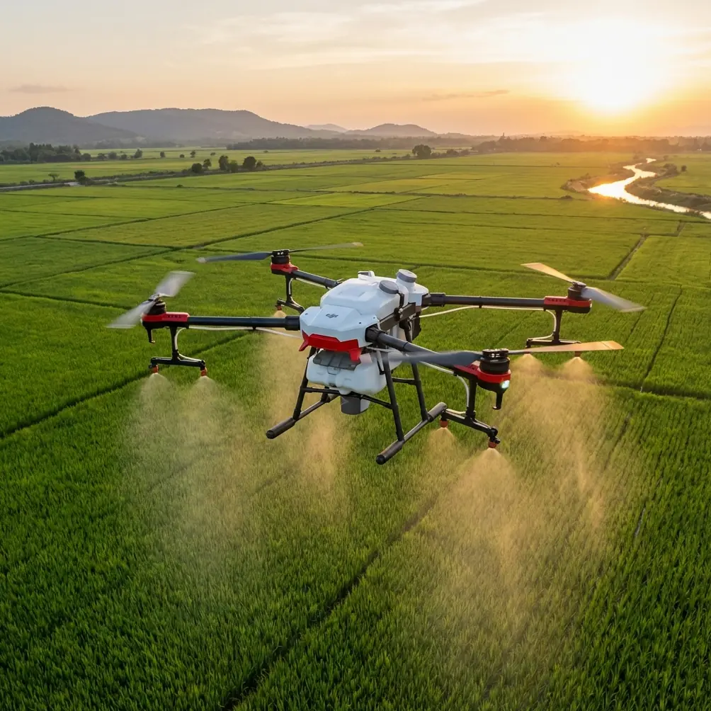
On paper, mapping power lines sounds straightforward: fly the corridor, maintain visual consistency, capture enough overlap, document poles, insulators, vegetation encroachment, and hardware condition. In the real world, especially in dry utility corridors, dust becomes part of the mission. It hangs low near access roads, gets kicked up during takeoff, softens contrast, and turns a clean visual inspection into a stop-start exercise in patience.
That is where Avata becomes interesting.
Not because it is a textbook mapping platform. It isn’t. And not because every buzzword attached to modern drones suddenly turns a difficult inspection environment into an easy one. That also isn’t true. Avata matters here because it solves a very specific operational problem: getting close, stable, repeatable visual access in constrained, messy environments where larger aircraft often become harder to trust.
I learned this the hard way on a utility job in a dry service corridor where the original plan relied on a more conventional inspection setup. The route itself was not especially technical. The challenge was environmental. Fine dust near the ground made launch and low-altitude repositioning frustrating, and the line corridor had enough poles, guy wires, brush, and uneven terrain to punish any sloppy approach. What looked manageable from the truck became a sequence of micro-decisions once airborne. Every obstacle mattered. Every gust near the structures mattered. Every second of visual uncertainty mattered.
That is the kind of scenario where Avata’s design starts to earn its keep.
The real problem with dusty power-line work
Dust does more than make footage look flat. It affects confidence.
When a pilot is inspecting power infrastructure, the job is not just to fly from point A to point B. The job is to maintain situational awareness while collecting usable visual data. In dusty conditions, pilots often lose some of the visual clarity they depend on for judging spacing around crossarms, conductors, vegetation, and support hardware. Even when visibility is still acceptable, the mental workload climbs fast.
For corridor work, that usually leads to one of two bad outcomes. Either the pilot becomes too conservative and misses the close angles needed to inspect details properly, or the pilot presses in too aggressively and turns a routine pass into a high-risk maneuver near infrastructure.
Avata sits in a useful middle ground. Its compact form factor and protected design make it more comfortable to operate near cluttered assets than many larger multirotors built around broad, exposed geometry. That does not remove risk, but it changes pilot behavior in a meaningful way. When confidence improves, capture quality usually improves with it.
Why obstacle awareness matters more than marketing language
In a dusty power-line corridor, obstacle avoidance is not a luxury feature. It is operational breathing room.
Power-line inspections are full of depth-perception traps. A leaning pole, a line of trees behind conductors, shadows across terrain, and swirling airborne dust can distort distance judgment even for experienced crews. Avata’s obstacle-related flight support helps reduce the number of corrective inputs the pilot has to make when working close to structures and terrain transitions.
That matters because mapping and inspection accuracy often depend on consistency, not just resolution. If the aircraft is constantly making abrupt positional corrections because the pilot is overloaded, the resulting imagery becomes harder to compare across spans and poles. Stable movement gives maintenance teams a better visual record and makes repeat missions more useful.
This is also where the conversation around AI in drones becomes relevant, even if the headline that inspired it came from outside the Avata product line.
On 2026-04-28, DroneLife reported that ideaForge Technology Limited signed a strategic Memorandum of Understanding with Tokyo-based Digital Media Professionals Inc. to co-develop next-generation AI drones. Two details from that report stand out. First, DMP is expected to provide edge AI silicon for integration into the drones. Second, the partnership centers on next-generation AI drone development rather than a simple component supply arrangement.
For civilian utility work, that distinction matters.
Edge AI silicon means more decision-making can happen on the aircraft itself instead of relying on off-board processing after the flight. In practical terms, future drone workflows for infrastructure inspection could become faster at recognizing anomalies, classifying components, or stabilizing autonomous behavior in visually messy environments. For dusty power-line mapping, onboard intelligence has obvious value: identifying poles, hardware zones, vegetation intrusions, or repeatable inspection points without adding latency or requiring a perfect data link.
Avata today is valuable because it gives pilots highly controllable access. The direction the industry is moving, highlighted by that ideaForge-DMP agreement, suggests tomorrow’s field workflows will increasingly combine that close-access flying with onboard interpretation. Not just recording. Understanding.
Avata is not replacing a dedicated corridor mapping aircraft
This is where a lot of content gets lazy. Avata is often discussed as if one drone should do everything.
That is not how serious utility programs work.
If your mission requires long linear coverage, tightly controlled survey-grade outputs, or broad-area asset inventory over many kilometers, you will still look at platforms built specifically for corridor mapping. Avata is better understood as a gap-closer. It excels where the job shifts from general mapping to high-confidence proximity capture.
For example, once a utility team has identified a problem section—say a pole with suspicious hardware alignment, insulator contamination, conductor clearance concerns, or vegetation pressing too close—Avata can be the aircraft that gets in and documents it cleanly. Its value is in turning a flagged issue into a visually clear record that engineers can actually use.
That is the difference between data volume and decision-grade evidence.
Dust punishes weak footage. D-Log helps preserve options.
Anyone who has reviewed inspection footage from a dusty site knows the frustration. The scene often looks washed out even when the subject is technically visible. Browns and grays dominate. Reflective hardware can clip highlights while the surrounding terrain drops into dull midtones. Once that happens, small details disappear.
This is why D-Log deserves a practical mention here.
D-Log is not there to make your footage look cinematic for its own sake. In a utility workflow, its real advantage is preserving more flexibility during post-processing so crews can recover contrast, manage highlights, and separate asset details from a flat, dusty background. If you are trying to examine the condition of fittings or visually distinguish fine structural elements against a low-contrast scene, that latitude matters.
Operational significance is simple: better source files can reduce the need for costly re-flights.
That is a field benefit, not an editing luxury.
Tracking tools are useful, but only in the right slice of the mission
Features like ActiveTrack and subject tracking are often discussed as universal solutions. They are not.
For power-line work, you should think of them as situational tools rather than the backbone of the mission. Tracking can help when documenting a moving ground crew vehicle along an access route, following a maintenance team for training footage, or maintaining a smooth visual relationship with a non-hazardous subject in open space. But around dense infrastructure, pilots still need disciplined manual control and a clear understanding of line geometry.
The same applies to QuickShots and Hyperlapse.
These are not the primary reason to use Avata on a technical utility mission. Still, they can serve a purpose. QuickShots may help create consistent orientation clips for reporting packages or stakeholder updates. Hyperlapse can be useful for documenting changing environmental conditions around a corridor, particularly when dust movement, traffic, or worksite progress needs to be shown over time. The key is not to confuse presentation tools with inspection tools.
A professional workflow knows the difference.
Why Avata makes training easier in difficult corridors
There is another reason I keep returning to Avata for dusty, obstacle-rich environments: training progression.
Some platforms are technically capable but psychologically unforgiving. Newer pilots become tense around wires, poles, and uneven terrain. That tension shows up in overcorrections, rushed passes, and poor framing. Avata’s controllability and protected build make it a more approachable platform for developing confidence in close-range visual inspection tasks, especially in staged or lower-risk utility training environments.
That matters more than people admit.
Power-line work is not just about having the right aircraft. It is about building a repeatable crew standard. If a platform helps less experienced operators learn spatial discipline without immediately overwhelming them, it can raise the quality of the whole operation. Better training leads to cleaner inspections. Cleaner inspections lead to fewer ambiguous findings. Fewer ambiguous findings mean faster maintenance decisions.
For teams refining that workflow, a quick message through our field coordination channel can help clarify whether Avata belongs in the inspection stack or in the training lane.
The AI angle is not abstract anymore
The ideaForge and DMP announcement is easy to dismiss if you focus only on the part about expansion into Japan. For commercial readers, the more revealing detail is the hardware strategy: edge AI silicon going directly into drone systems. That points to a broader industry shift that utility operators should pay attention to now, not later.
Why? Because power-line inspection generates a lot of visual data but often suffers from a bottleneck in interpretation.
If next-generation AI drones can process visual cues at the edge—onboard, in near real time—they can eventually assist with tasks like identifying repeated component types, flagging inconsistent structures, tracking inspection completeness, or marking probable defects before the aircraft even lands. In dusty environments, where visual ambiguity slows both the pilot and the analyst, that kind of onboard filtering could save real time.
Avata is not the headline in that particular news item, but it belongs in the same industry conversation. Today, Avata helps solve access and control challenges in difficult visual environments. Tomorrow, the platforms that win this category will likely combine those flight characteristics with increasingly capable edge processing.
That is why this kind of partnership matters beyond the companies involved. It signals where drone utility operations are headed: less separation between capture and analysis.
Where Avata fits best on a dusty utility job
If I were building a practical mission profile around Avata for dusty power-line work, I would not force it into the role of a pure survey machine. I would use it where its strengths are clearest:
- close visual inspection around poles and structures
- follow-up documentation on anomalies found by broader survey platforms
- pilot training for obstacle-rich utility environments
- repeatable short-range capture in areas where larger drones feel cumbersome
- visual reporting where stable, immersive proximity footage improves understanding
That framing keeps expectations honest.
Avata is at its best when the problem is access, clutter, confidence, and visual context. Dust amplifies all four. A platform that helps the pilot stay composed near infrastructure is not a novelty in that setting. It is a productivity tool.
And as the drone industry moves toward onboard AI—exactly the direction implied by ideaForge’s MoU with DMP and the planned use of edge AI silicon—the value of stable close-access aircraft will likely rise, not shrink. Better onboard intelligence only becomes useful if the aircraft can first get the right view, at the right distance, with enough stability to make the data meaningful.
That is the part people tend to skip.
The future of utility drone work is not just smarter software. It is smarter software paired with aircraft that can handle ugly field conditions without turning every inspection into a negotiation. In dusty power-line corridors, Avata already makes that negotiation easier.
Ready for your own Avata? Contact our team for expert consultation.