Avata: Mapping Solar Farms in Extreme Heat
Avata: Mapping Solar Farms in Extreme Heat
META: Discover how the DJI Avata handles solar farm mapping in extreme temperatures. Expert tips on flight altitude, thermal management, and workflow optimization.
TL;DR
- Optimal flight altitude of 30-50 meters balances panel detail capture with efficient coverage in extreme heat conditions
- The Avata's compact design and 20-minute flight time requires strategic battery rotation during high-temperature operations
- D-Log color profile preserves critical shadow detail for identifying panel defects and hotspots
- Pre-dawn and post-sunset mapping windows extend operational capacity while reducing thermal stress on equipment
The Challenge of Solar Farm Mapping in Extreme Temperatures
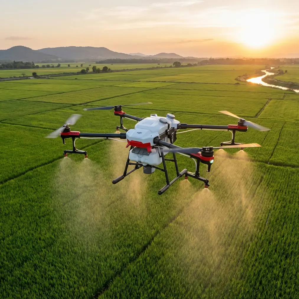
Solar farm inspections present a unique operational challenge. Temperatures at ground level regularly exceed 45°C (113°F) during peak summer months, while reflective panel surfaces can push localized heat readings even higher.
The DJI Avata brings a different approach to this demanding environment. Its FPV-style design and cinewhoop form factor weren't originally conceived for industrial mapping. Yet operators across the American Southwest and Middle East have discovered its surprising utility for solar infrastructure documentation.
This case study examines real-world deployment strategies, thermal management protocols, and workflow optimizations that transform the Avata into a capable solar mapping platform.
Why the Avata Works for Solar Farm Operations
The Avata's design philosophy centers on immersive flight experiences. This translates into practical advantages for solar farm work that larger inspection drones can't match.
Compact Form Factor Benefits
Traditional mapping drones struggle in the tight corridors between panel rows. The Avata's 180mm diagonal wheelbase allows navigation through confined spaces that would challenge larger platforms.
Key dimensional advantages include:
- Propeller guards protect against accidental contact with panel edges and mounting structures
- Low profile reduces wind resistance during gusty conditions common in desert environments
- Lightweight 410g body minimizes thermal mass, allowing faster cool-down between flights
- Quick-release propellers enable rapid field replacement without tools
Flight Characteristics in High Heat
Extreme temperatures affect drone performance in predictable ways. Air density decreases as temperature rises, reducing lift efficiency and motor performance.
The Avata compensates through its aggressive power-to-weight ratio. Even at 45°C ambient temperatures, the platform maintains responsive handling characteristics essential for precise panel inspection work.
Expert Insight: Flight altitude selection becomes critical in extreme heat. Operating at 30-50 meters provides the optimal balance between image resolution for defect detection and coverage efficiency. Lower altitudes capture finer detail but dramatically increase flight time requirements and battery consumption.
Thermal Management Protocols for Extended Operations
Battery performance degrades significantly in extreme heat. The Avata's 2420mAh Intelligent Flight Battery requires careful thermal management to maintain safe operation and longevity.
Pre-Flight Battery Conditioning
Never deploy batteries directly from a hot vehicle. Internal cell temperatures exceeding 40°C trigger protective throttling that reduces available flight time by up to 35%.
Effective conditioning strategies include:
- Store batteries in insulated coolers with ice packs during transport
- Allow 15-minute acclimation period before charging or flight
- Rotate between minimum three battery sets to prevent thermal accumulation
- Monitor battery temperature indicators through the DJI Fly app before each launch
In-Flight Thermal Considerations
The Avata's obstacle avoidance sensors require consistent calibration to function accurately. Extreme temperature differentials between shaded and sun-exposed areas can cause temporary sensor drift.
Mitigation approaches:
- Calibrate sensors in conditions matching operational environment
- Avoid rapid transitions between temperature zones during critical mapping passes
- Allow 30-second hover stabilization when moving between shaded and exposed areas
Pro Tip: The Avata's Subject tracking features can lock onto specific panel rows, maintaining consistent framing even when thermal updrafts create turbulence. Enable ActiveTrack on a panel edge to ensure straight-line passes regardless of wind conditions.
Optimal Camera Settings for Solar Panel Documentation
The Avata's 1/1.7-inch CMOS sensor captures 48MP stills and 4K video at 60fps. Proper configuration maximizes data quality for post-processing analysis.
D-Log Configuration for Maximum Dynamic Range
Solar panels create extreme contrast scenarios. Highly reflective surfaces sit adjacent to deep shadows beneath mounting structures. Standard color profiles clip highlights and crush shadows, losing critical defect indicators.
D-Log preserves approximately 10 stops of dynamic range, capturing:
- Subtle discoloration indicating cell degradation
- Hairline cracks visible only in specific lighting angles
- Hotspot signatures that precede panel failure
- Mounting hardware corrosion in shadowed areas
Recommended Camera Parameters
| Setting | Value | Rationale |
|---|---|---|
| Color Profile | D-Log | Maximum dynamic range preservation |
| Resolution | 4K/60fps | Sufficient detail for frame extraction |
| Shutter Speed | 1/120s minimum | Reduces motion blur during passes |
| ISO | 100-400 | Minimizes noise in shadow recovery |
| White Balance | 5600K fixed | Consistent color for defect comparison |
| Hyperlapse Mode | 2-second intervals | Creates time-compressed overview footage |
QuickShots for Automated Documentation
The Avata's QuickShots modes automate complex camera movements that would otherwise require extensive pilot skill. For solar farm documentation, Dronie and Circle modes prove most valuable.
Dronie creates ascending reveal shots that contextualize individual panel sections within the broader installation. Circle mode documents mounting structures and inverter stations from multiple angles without manual stick input.
Flight Planning for Maximum Coverage
Solar farm mapping demands systematic coverage patterns. Random exploration wastes battery capacity and creates gaps in documentation.
Grid Pattern Optimization
Calculate coverage requirements before deployment:
- Panel row spacing determines minimum altitude for complete coverage
- Overlap requirements (typically 70-80%) ensure photogrammetry software can stitch images
- Wind direction influences optimal flight path orientation
- Sun angle affects shadow length and reflection intensity
The Avata's 10m/s maximum speed in Normal mode allows efficient transit between mapping zones while maintaining stable footage capture.
Altitude Selection Strategy
Altitude directly impacts both image resolution and coverage efficiency. This table illustrates the tradeoffs:
| Altitude | Ground Sample Distance | Coverage per Battery | Best Use Case |
|---|---|---|---|
| 15m | 0.4cm/pixel | 2-3 hectares | Detailed defect inspection |
| 30m | 0.8cm/pixel | 5-7 hectares | Standard mapping passes |
| 50m | 1.3cm/pixel | 10-12 hectares | Overview documentation |
| 80m | 2.1cm/pixel | 18-22 hectares | Site-wide assessment |
For most solar farm applications, 30-50 meter altitude provides sufficient resolution to identify common defects while maximizing coverage per battery cycle.
Common Mistakes to Avoid
Operators new to extreme-temperature solar mapping frequently encounter preventable problems. Learning from these common errors accelerates proficiency.
Battery Mismanagement
Deploying overheated batteries remains the most frequent operational failure. Symptoms include:
- Reduced flight time (sometimes below 12 minutes)
- Unexpected low-battery warnings
- Sluggish throttle response
- Automatic landing triggers
Always verify battery temperature reads below 35°C before launch.
Inadequate Sensor Calibration
The Avata's obstacle avoidance system requires recalibration when operating temperatures differ significantly from storage conditions. Skipping this step causes:
- False obstacle warnings during clear passes
- Missed actual obstacles due to sensor drift
- Inconsistent altitude hold performance
Calibrate IMU and vision sensors in the operational environment before beginning mapping work.
Ignoring Thermal Updrafts
Solar panels create localized thermal columns that affect flight stability. Pilots often fight these conditions rather than adapting flight patterns.
Effective approaches:
- Plan passes perpendicular to prevailing wind direction
- Reduce speed when crossing panel edges
- Increase altitude slightly over large panel arrays
- Schedule flights during lower-temperature windows when possible
Overlooking Firmware Updates
DJI regularly releases firmware updates that improve thermal management algorithms and sensor performance. Operating on outdated firmware sacrifices these optimizations.
Check for updates before each deployment, particularly after extended storage periods.
Frequently Asked Questions
Can the Avata replace dedicated thermal imaging drones for solar inspections?
The Avata's standard RGB camera cannot detect thermal signatures directly. It excels at visual documentation, defect identification through discoloration patterns, and site overview capture. Pair it with dedicated thermal platforms for comprehensive inspection programs. The Avata handles rapid visual documentation while thermal drones focus on hotspot detection.
How does extreme heat affect the Avata's obstacle avoidance reliability?
Obstacle avoidance performance remains consistent up to approximately 40°C ambient temperature. Beyond this threshold, sensor accuracy may decrease slightly due to thermal expansion affecting calibration. The infrared sensors used for obstacle detection can also experience interference from highly reflective hot surfaces. Recalibrate before operations and maintain awareness of potential sensor limitations in extreme conditions.
What's the maximum continuous operation time before the Avata requires cool-down?
The Avata itself handles continuous operation well, but batteries require rotation. Plan for three complete battery cycles (approximately 60 minutes of flight time) before allowing the aircraft to rest in shade for 20-30 minutes. Motor temperatures and ESC components benefit from this periodic cooling, extending overall equipment lifespan and maintaining consistent performance throughout extended mapping sessions.
Maximizing Your Solar Mapping Investment
The Avata proves surprisingly capable for solar farm documentation when operators understand its thermal limitations and optimize workflows accordingly. Strategic battery management, proper altitude selection, and systematic flight planning transform this FPV platform into a productive mapping tool.
Success depends on preparation. Condition batteries properly, calibrate sensors in operational conditions, and plan flight patterns before launch. These fundamentals apply regardless of ambient temperature but become critical when heat stress compounds operational challenges.
Ready for your own Avata? Contact our team for expert consultation.