Avata at Altitude: A Field-Driven Approach to Solar Farm
Avata at Altitude: A Field-Driven Approach to Solar Farm Mapping Near Power Infrastructure
META: Learn how Avata can support high-altitude solar farm mapping when GPS stability, tower offsets, and route changes around power infrastructure are handled with disciplined field methods.
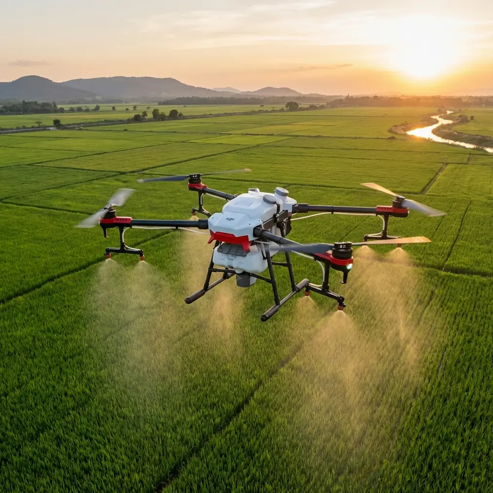
High-altitude solar farm mapping sounds clean on paper. Wide rows. Repeating geometry. Plenty of open sky. Then you arrive on site and the real variables start showing up: uneven terrain, nearby transmission structures, shifting wind, and the kind of electromagnetic noise that can quietly degrade positional confidence if the crew gets lazy.
That is where disciplined field practice matters more than marketing specs.
For readers evaluating Avata for civilian energy-site documentation, training, and close-quarters visual inspection support, one overlooked lesson comes from a technical guideline for unmanned helicopter line inspection. The document is not about Avata specifically, but its operating logic is highly relevant to any pilot trying to collect dependable location data around towers and lines. And when you adapt those lessons to high-altitude solar farm work, Avata becomes much more interesting—not as a one-aircraft answer to everything, but as a precise visual tool that performs best when the mission design respects the site.
I say that as a photographer first. Images and footage are never just images and footage on infrastructure jobs. They become evidence, reference layers, planning inputs, and communication tools for engineering teams who were not standing beside you when the data was captured.
The real problem: mapping accuracy breaks down before the aircraft does
On mountain or plateau solar sites, crews often focus on the obvious flight risks: thinner air, battery behavior, ridge gusts, and line-of-sight management. Those are real. But around substations, collector lines, and transmission structures, a quieter problem can undermine the whole mission: bad reference-point collection.
The field guidance in the source material is unusually practical. It requires the operator to enter the collection zone, observe the tower and surrounding line environment, then choose a relatively open area based on the pre-planned route. That sounds basic until you apply it on an actual solar site. “Relatively open” is not just about takeoff convenience. It is about reducing local interference, improving satellite reception quality, and keeping your GPS reference point from being corrupted by nearby structural clutter or terrain effects.
The guideline goes further. It states that when collecting GPS data, the equipment should be left in place for ten minutes, and recording should only happen once the final data fluctuation is no greater than 10. Operationally, that is a big deal. It means the workflow assumes positional trust must be earned, not assumed. On a high-altitude solar farm where crews may be tempted to move quickly between strings, inverter pads, and line crossings, that ten-minute stabilization step can be the difference between footage that aligns with planning layers and footage that turns into a headache during review.
Avata users should pay attention here.
Avata is excellent at getting visual access where larger mapping platforms feel cumbersome. It can move through tighter spaces, work low and close for contextual inspection visuals, and capture directional movement that makes large energy sites easier to interpret. But if your ground reference discipline is weak, the aircraft’s agility will not save your dataset. Fast flying does not fix bad control points.
Why the tower offset rules matter even on a solar project
The source document gives two positional details that deserve more attention than they usually get.
First, the GPS coordinate collection point must be positioned at a 45-degree diagonal from one corner of the tower.
Second, that collection point should be within 15 to 20 meters of the tower.
These are not arbitrary numbers. They are a way of standardizing geometry around a structure so flight planning and positional interpretation remain consistent. In practical terms, a 45-degree offset gives a clean, repeatable relationship between the reference point and the structure. Staying within 15–20 meters keeps that relationship close enough to be operationally useful without crowding the base.
For a solar farm mapping crew using Avata near transmission supports, string combiner corridors, or substation edges, this kind of repeatable offset method can help in three ways.
1. It improves route repeatability
When revisiting the same site for progress tracking or defect documentation, repeatable reference positioning makes it easier to recreate the same approach lines. That matters for comparing panel-row conditions, access-road erosion, fencing changes, or vegetation encroachment over time.
2. It reduces confusion when multiple teams touch the same site
A photographer, a surveyor, and an operations engineer often use the same site data for different reasons. If the capture crew uses a consistent diagonal offset reference near structures, later teams can understand where the visual records were anchored. This is especially helpful on large solar farms where repeating layouts can make one corridor look much like another.
3. It helps separate visual flying from interference-prone positioning
Near energized infrastructure, pilots may see odd behavior in telemetry confidence long before they see anything dramatic in flight handling. A structured reference-point method gives you a better basis for deciding whether the issue is environmental interference, poor collection location, or simply bad setup discipline.
Avata’s role: not the survey mule, but the site intelligence aircraft
Let’s be honest about platform fit. If the mission is pure orthomosaic production across hundreds of hectares, Avata is not the first aircraft most professionals would deploy. But that misses the point.
Avata shines in the layers around the map.
It is the aircraft you use to capture terrain transitions at altitude, visualize drainage patterns around panel blocks, document edge conditions near roads and fences, inspect hard-to-approach structures visually, and produce close-range contextual footage that explains what the top-down map cannot. On high-altitude solar farms, where access routes can be rough and visual verification can eat up hours, that role has real value.
Features often discussed in consumer terms—obstacle avoidance, subject tracking, QuickShots, Hyperlapse, D-Log, ActiveTrack—need a professional reinterpretation here.
- Obstacle avoidance matters less as a comfort feature and more as a risk buffer when flying low near support structures, cable runs, or terrain breaks.
- D-Log matters because high-altitude sunlight can be harsh and contrasty. Preserving tonal information helps when teams need to inspect details in bright panel fields and dark equipment shadows.
- Hyperlapse can be surprisingly useful for showing weather movement, construction progression, or access-path activity across a site.
- QuickShots are not the main event for engineering work, but controlled automated moves can produce consistent stakeholder visuals for reporting.
- ActiveTrack and subject tracking are less relevant for panel mapping itself, yet can support training scenarios or moving-vehicle site logistics documentation where safety protocols allow.
The key is not to force a cinematic feature into a technical workflow. Use only what improves clarity.
Handling electromagnetic interference: small adjustments, big payoff
The reference material emphasizes placing collection equipment in an open position to avoid local environmental interference. That principle applies directly when operating Avata around solar and electrical infrastructure.
Interference around towers and power equipment is rarely something you “beat” through stubbornness. You manage it through spacing, orientation, and observation.
One practical habit I recommend is antenna adjustment before blaming the aircraft. If you are near a transmission support or substation edge and telemetry confidence starts looking inconsistent, do not stand fixed in one bad spot and hope software sorts it out. Shift your body position. Re-orient the controller antennas for a cleaner relationship to the aircraft. Move laterally into a clearer open area if possible. Often, the difference between a noisy control link and a stable one is not dramatic distance—it is line quality and orientation.
That aligns with the source guidance in spirit: choose a relatively open collection area, keep the equipment away from localized environmental disturbance, and do not record or proceed until the data behavior settles.
On a high-altitude solar farm, that discipline also helps with another issue: fatigue-based decision making. Thin air, long walks, repetitive rows, and bright light can all push crews toward shortcut logic. Antenna adjustment and repositioning sound minor, but they are exactly the sort of minor corrective actions that prevent bigger workflow errors later.
Route conflicts are normal. Replanning is part of the job.
One of the strongest lines in the source document says that if the actual tower situation conflicts with the planned route, the route should be replanned according to on-site conditions.
That is not just permission to improvise. It is a reminder that pre-planning is provisional.
This matters on mountain solar projects because desktop route design often underestimates slope breaks, maintenance traffic, temporary staging areas, newly placed equipment, fencing changes, and the visual effect of elevation on safe approach paths. Avata’s compact format can make pilots overconfident here. They assume that because the aircraft can physically fit, the route is acceptable. Not always.
A good replanning mindset asks:
- Is the original line still safe with current wind direction?
- Has a terrain shoulder created an unexpected blind zone?
- Is the intended path now too close to energized structures?
- Is the visual objective still achievable from a better angle with less risk?
- Has electromagnetic clutter changed the best takeoff or hover point?
The source also notes that the starting GPS collection point should be closer to the front side of the tower, while the remaining points should be toward the rear side. Even if you are not replicating that exact method for every solar task, the underlying principle is valuable: sequence matters. Entry geometry matters. Where you begin influences the quality and safety of everything that follows.
A practical Avata workflow for high-altitude solar sites
Here is how I would apply the source logic to an Avata-supported solar farm mission near power infrastructure.
Pre-entry observation
Before powering up, walk the intended capture area and study the tower, line corridor, panel rows, and terrain transitions. Look for reflective surfaces, slope changes, and control-link weak spots.
Choose the open reference area first
Do not pick your standing point based only on convenience. Pick the spot that is relatively open and least likely to create localized GPS or signal distortion.
Let reference data settle
Borrow directly from the source discipline: if collecting GPS reference information, allow enough time for stabilization. The document specifies ten minutes and recording only when fluctuation is no greater than 10. That patience is operationally smarter than rushing airborne.
Use repeatable structure offsets
When documenting features near towers, use a consistent diagonal offset approach. The source calls for a 45-degree direction and a 15–20 meter distance from the tower for GPS collection. Even if your exact site protocol varies, consistency here improves revisits and cross-team interpretation.
Watch link quality and adjust antennas early
If interference is suspected, reposition before launching farther into the problem. Antenna orientation and pilot stance can materially improve control stability.
Replan without ego
If the live site conflicts with your route sketch, update the route. The source is explicit on this point, and it is one of the best safety habits any infrastructure crew can adopt.
Capture visuals that explain, not just impress
Use D-Log when lighting is severe. Use smooth pathing to show grade changes, drainage issues, access constraints, and equipment context. If your footage would confuse someone who has never visited the site, capture again.
Where expert crews separate themselves
The best Avata operators in industrial environments are not the fastest stick pilots. They are the ones who build reliable context around the flight.
They record the height difference between the collection point and the tower base because elevation relationships affect interpretation. They compare data when possible rather than trusting a single reading blindly. The source document even recommends having at least two devices of the same model for data comparison. That is not overkill on complex infrastructure sites. It is a quality-control mindset.
And they leave the environment as they found it after collection. The source mentions restoring the area to its original condition when leaving the collection zone. That may seem like a small procedural note, but it reflects a professional standard that matters on active commercial sites: no unnecessary disturbance, no loose footprint, no mess for the operations team to deal with after you leave.
That is the kind of discipline that makes Avata footage useful beyond the day it was shot.
If your team is refining workflows for energy-site capture and wants a practical discussion around field setup, route geometry, or interference handling, this direct project chat link is an easy place to start.
Avata can absolutely earn its place on high-altitude solar projects. Just not by pretending to be something it is not. Use it as a nimble visual intelligence platform. Pair it with rigorous reference-point habits. Respect the geometry around towers and lines. Let the site overrule the spreadsheet when conditions demand it.
That is how you get footage and location context you can actually trust.
Ready for your own Avata? Contact our team for expert consultation.