Avata at the Edge of Sensitive Airspace: A Field Report
Avata at the Edge of Sensitive Airspace: A Field Report from a Windy Solar Farm
META: A field report on using DJI Avata around windy solar farms near sensitive airspace, with practical insight on low-altitude inspection flying, changing weather, and why new FAA-DoD airspace rules matter.
I spent part of last week on a solar site where the job looked simple on paper and messy in the air. The brief was straightforward: document panel rows, identify drainage trouble along the perimeter, and capture low-altitude visual references that a conventional mapping pass had missed. The complication was location. This particular solar farm sat in a corridor where airport traffic, critical infrastructure concerns, and controlled airspace planning all shaped what was possible before the first battery ever went in.
That is exactly why the latest news from XPONENTIAL matters to Avata operators, even if they never fly anywhere near a runway threshold. According to the recent DroneLife report, the FAA and the U.S. Department of Defense are now actively working on rules for drones operating near sensitive airspace. The effort is not limited to small aircraft alone. It also includes counter-UAS systems and airports sharing the same airspace safely. That detail changes the conversation for civilian operators because it signals a future where access, approval, situational awareness, and operational discipline are going to be more tightly connected than many pilots expect.
For anyone using Avata in commercial fieldwork, including solar inspection support, the lesson is immediate: agility in the air is no substitute for maturity on the ground.
Why Avata even belongs on a solar farm
Avata is not the first aircraft most people associate with mapping. If the mission is pure orthomosaic production over hundreds of acres, there are more specialized tools for that. But solar work is rarely just one mission type. On a live project, you often need two different kinds of aerial data.
The first is systematic coverage. The second is close, human-readable context.
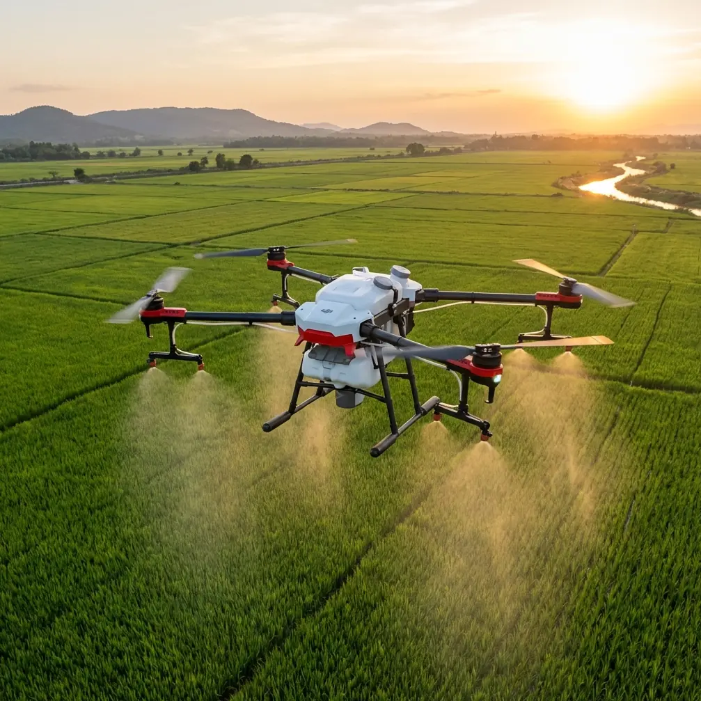
That second category is where Avata earns its place. It can move low along panel lanes, inspect fence lines, check access roads, and gather visual evidence from angles that are awkward for larger aircraft or too slow to capture on foot. On solar sites with uneven terrain, equipment clusters, inverter pads, drainage cuts, and reflective surfaces, a compact FPV platform can tell the story behind anomalies that a top-down dataset only hints at.
This is especially useful in wind. Not because wind becomes irrelevant, but because low-level controlled passes between rows or along sheltered edges can still deliver usable footage when higher and broader routes become less efficient. The trick is flying with a purpose instead of treating Avata like a cinematic toy.
The day the weather turned
By mid-morning the site looked manageable. Wind was present, not extreme, but steady enough to require more planning around panel rows and open sections. The first passes focused on the south block, where the client suspected minor settlement near cable runs and standing water patterns after recent rain. At low altitude, Avata gave us something the desktop review had not: a clear relationship between panel alignment, runoff channels, and maintenance access bottlenecks.
Then the weather changed.
It did not arrive as a dramatic front. It started with shifting gust direction and uneven turbulence spilling across open rows. That matters on a solar farm because long, repetitive geometry can make the site feel visually predictable while the air behaves very differently from one section to the next. Wind that feels acceptable over gravel can become twitchy over heated panel arrays and then break oddly around inverter housings or perimeter vegetation.
Avata handled the shift better than many people assume a small platform can, but only because the flight profile changed with it. Instead of stretching for broad sweeping lines, we shortened routes, lowered exposure time in the windiest corridors, and used obstacle-aware positioning to keep each segment deliberate. This is where obstacle avoidance becomes operational rather than promotional. Around solar infrastructure, it helps the pilot maintain safer spacing from rows, fencing, utility hardware, and unexpected protrusions when gusts start pushing the aircraft off its intended line.
The practical value is not just collision reduction. It preserves mission continuity. In changing wind, the difference between finishing a site visit and aborting one often comes down to whether the aircraft can support controlled repositioning in tight spaces without forcing the pilot into aggressive manual correction every few seconds.
Sensitive airspace is no longer a background issue
A lot of commercial drone teams still think of sensitive airspace as a niche concern reserved for airport-adjacent jobs or restricted federal zones. The DroneLife report suggests that view is aging out fast. The FAA and DoD effort is being driven by expanding drone operations around airports, military installations, and critical infrastructure. The key phrase there is expanding drone operations.
Solar facilities, substations, transmission-adjacent sites, and utility-scale energy assets increasingly sit inside broader airspace and security conversations. Even when your flight area is legal and your mission is entirely civilian, you may be operating in an environment where airspace stakeholders are watching for more than just cooperative traffic. The fact that the current rule-building effort includes counter-UAS systems is especially significant. It means future operations near sensitive areas may involve not only authorization requirements, but also new layers of detection, coordination, and behavior expectations.
For an Avata crew, that has direct consequences.
First, preflight airspace review becomes more than a checkbox. If a site is near airport influence, critical infrastructure buffers, or other sensitive overlays, the operator needs a clear understanding of not just where the aircraft can fly, but how the flight might be interpreted by nearby stakeholders.
Second, low-altitude FPV-style work needs stronger documentation. Avata flights often look dynamic from the outside. That visual signature can be misunderstood if observers have no context. A well-documented mission plan, client purpose, operational boundary, and communication trail can make a major difference when working near areas of concern.
Third, site selection for takeoff, recovery, and observation matters more than ever. Sensitive-airspace rulemaking tends to reward predictability. Organized ground control, visible safety practices, and disciplined flight geometry are not cosmetic. They are becoming part of professional access.
What Avata does well on inspection-style solar work
On this job, Avata was not replacing a survey aircraft. It was solving three narrower problems.
1. It exposed context between assets
Top-down imagery can tell you that something is off. Avata helps explain why. Flying laterally along rows revealed subtle washout patterns and maintenance route wear that were nearly invisible from a pure overhead viewpoint. For solar asset managers, that kind of contextual footage can support faster field decisions.
2. It worked through variable wind by staying task-specific
When the gusts stiffened, broad visual ambitions had to go. We stopped chasing elegant long runs and concentrated on evidence collection. Short route segments, repeated visual confirmation, and conservative energy management kept the operation productive. That is the real strength of a compact aircraft in bad-but-workable conditions: not heroics, just adaptability.
3. It captured footage that translates well for non-pilots
Clients do not always want raw inspection terminology. They want visual proof they can understand and circulate internally. This is where color workflow matters. Shooting in D-Log can be useful if the footage needs grading headroom for later analysis or presentation, especially on high-glare sites like solar farms where contrast can swing hard between reflective panels and darker ground features. A more controlled image pipeline helps preserve detail that might otherwise wash out under midday conditions.
A note on automation features in the real world
There is always a temptation to discuss features like ActiveTrack, subject tracking, QuickShots, or Hyperlapse as if they automatically improve every mission. On a solar farm near potentially sensitive airspace, that is the wrong mindset.
Subject tracking can help in benign training environments or tightly controlled asset-follow scenarios, but inspection work around dense rows and gusting conditions still demands pilot judgment first. QuickShots and Hyperlapse have their place when documenting site scale or progress updates, yet they should stay secondary to the mission objective. The client came for usable infrastructure insight, not social-style motion effects.
That said, there is operational value in knowing these tools exist. A short Hyperlapse sequence can show cloud movement and shifting shadow behavior across a section of the farm if environmental context matters. A measured tracking shot of a service vehicle route can help explain access limitations to project managers. The point is not feature use for its own sake. It is choosing the right capture method for the question being asked on site.
The human factor: composure beats speed
Mid-flight weather changes reveal more about an operator than calm-day footage ever will. When the wind shifted at this site, the mission did not become dramatic. It became narrower. That is usually the correct response.
We reduced unnecessary movement. We rechecked return logic. We used the aircraft for close, high-value passes instead of trying to “finish the shot list” by force. That discipline matters doubly in the context of the FAA-DoD rulemaking story. As agencies build frameworks for drones, airports, and counter-UAS systems to share airspace safely, the industry is moving toward a model where professionalism is judged not by how boldly a drone can fly, but by how intelligently the operator limits risk.
That is good news for serious Avata users.
Why? Because Avata tends to attract two very different crowds. One sees it as an expressive flight platform. The other sees it as a precise low-altitude tool. The second group is likely to benefit most from the next phase of regulation, because their operations are easier to justify, document, and integrate into structured airspace expectations.
What this means for solar mapping teams right now
If you are deploying Avata on windy solar sites, especially anywhere near airport influence or critical infrastructure sensitivity, a few takeaways stand out.
Build Avata into the mission as a complementary aircraft, not the whole plan. Use it for close-quarters visual intelligence, edge inspection, route verification, and explanatory footage.
Treat changing weather as a trigger for mission redesign, not stubborn continuation. On the day I flew, shortening the operational envelope preserved both safety and data quality.
Assume future access near sensitive airspace will depend on cleaner procedures. The XPONENTIAL panel highlighted growing cooperation between civil and military agencies on drone traffic management and airspace security. Operationally, that means even civilian crews should expect more emphasis on accountability, coordination, and flight predictability.
And if your team is trying to build a repeatable inspection workflow for sites with airspace complexity, it helps to compare notes with operators who live in this world every week. If that would be useful, you can message the field team here.
The bigger picture
The most interesting part of the DroneLife report is not that regulators are paying attention. That was inevitable. The interesting part is what they are trying to solve together: drones, airports, and counter-UAS systems sharing the same airspace safely. That is a layered problem. It recognizes that the future of commercial drone work will not be defined by aircraft capability alone. It will be defined by compatibility.
For Avata operators in civilian industry, especially in energy, inspection, and site documentation, that is the real transition underway. The aircraft can still be nimble, immersive, and visually powerful. But the mission environment is becoming more structured. Flights near critical infrastructure and airport-adjacent zones will increasingly reward teams that can combine precise flying with strong planning, clear purpose, and a calm response when conditions shift.
That windy solar farm drove the point home better than any conference panel could. Avata was useful not because it ignored the complexity of the environment, but because it worked within it. Low altitude. Tight objectives. Shorter passes when the gusts changed. Better footage where overhead maps lacked explanation. And all of it shaped by an airspace landscape that is clearly entering a more coordinated era.
If you fly Avata for real commercial work, that is the mindset worth keeping.
Ready for your own Avata? Contact our team for expert consultation.