Expert Monitoring With Avata: A Forest Case Study on Range
Expert Monitoring With Avata: A Forest Case Study on Range, Signal Discipline, and Safer Low-Altitude Flight
META: A field-tested Avata case study for remote forest monitoring, covering antenna positioning, obstacle avoidance, D-Log workflow, ActiveTrack limits, and practical tactics for more reliable flights.
Remote forest monitoring asks a lot from a small drone. You are dealing with broken sightlines, uneven terrain, dense canopies, moisture in the air, and a signal environment that changes every few meters. In that setting, DJI Avata stands out for a specific reason: it is not simply a camera platform or a fast FPV toy. It is a compact aircraft that can work well in tight spaces when the pilot understands what it does best and where it needs help.
I have used Avata-style flights as a photographer and field operator in places where a conventional flight path looks good on a map and then falls apart the moment trees start swallowing the radio link. That is why the most useful conversation around Avata for forest work is not about headline specs. It is about how to actually complete a mission without losing image quality, signal confidence, or situational control.
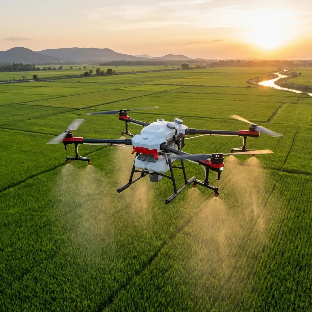
This case study focuses on a realistic use case: monitoring a remote forest corridor after wind damage and seasonal water movement. The goal is simple on paper. Capture low-altitude visual documentation along a narrow route, identify canopy breaks, inspect understory access lines, and come back with footage usable for both field review and stakeholder reporting. The challenge is that the route sits in a place where obstacle density is high, GPS confidence can vary under the canopy edge, and direct line of sight disappears quickly.
Avata is well suited to this kind of assignment if the operator stops trying to fly it like an open-field cinematic rig. Its ducted design changes the risk profile. It is more comfortable near branches and narrow passages than many exposed-prop aircraft, and that matters when your route is defined by forest geometry rather than clean airspace. Just as important, Avata’s obstacle sensing and braking behavior can add a margin of safety in forward motion, especially when you are managing visual clutter and subtle terrain rise at the same time. In practical terms, that means the aircraft can help reduce the chance of a bad decision turning into a branch strike during low-level inspection work.
That said, one of the most misunderstood parts of flying Avata in remote woods is range. People tend to think of range as a single number. In forest monitoring, range is really a chain of conditions. The aircraft might be capable of maintaining a strong link in open terrain, but once trunks, ridgelines, and canopy mass start interrupting the path between controller and aircraft, your useful operating distance shrinks fast. The fix is rarely a bigger claim on paper. The fix is usually pilot discipline, starting with antenna positioning.
Here is the field rule I keep coming back to: point the broad face of the controller antennas toward the aircraft, not the tips. That sounds basic, but it is the difference between a clean link and a fragile one. Many pilots unconsciously aim the antenna ends at the drone as though they were laser pointers. Radio energy does not behave that way. For maximum practical range, especially in a forest corridor, you want the flat sides oriented toward the aircraft’s path. If the drone is dropping lower into a valley or moving laterally behind tree cover, adjust your own body position and controller angle before you blame the aircraft.
That single correction has operational significance because Avata missions in forests often fail at the same moment the pilot transitions from open edge to partial cover. When the signal line is already compromised by vegetation, poor antenna orientation compounds the problem. A pilot who keeps the controller aligned properly can often preserve a stable feed long enough to complete a pass or execute a cleaner return path. It is not glamorous advice, but it is the sort of detail that determines whether monitoring footage is usable or interrupted.
The second major factor is route architecture. In this case study, the smartest way to inspect the forest corridor was not a straight push into dense growth. It was a segmented flight plan built around recovery windows. Instead of driving deep into the worst signal area immediately, I would fly from one clear pocket to the next: a service track opening, a washed-out gap, a creek bend with lower branches, a break in the canopy edge. Each of these became a visual and radio checkpoint. That matters because Avata can feel deceptively confidence-inspiring in the goggles. The immersive view encourages continuation. Forest monitoring rewards restraint. When the image is good and the aircraft is responsive, that is the exact moment to think two turns ahead.
Obstacle avoidance also deserves a realistic reading here. In open marketing language, people often talk about automated protection as if it replaces judgment. In forest work, obstacle sensing is useful, but it is not a permission slip to thread every gap. Branches, thin twigs, leaf clusters, and changing light create a messy environment. What matters operationally is that obstacle-aware braking behavior can help during forward inspection runs where terrain undulates and visual depth is hard to judge. It reduces some risk in complex scenes. It does not eliminate the need to slow down before entering layered vegetation or shaded transitions.
For readers thinking about subject tracking, this is where expectations need adjustment. ActiveTrack is a valuable concept in many drone workflows, but a forest-monitoring mission is rarely about locking onto a moving subject the way you would with a cyclist or vehicle in a cleaner environment. In wooded terrain, the more relevant discipline is target reacquisition. You may identify a damaged stand, a blocked trail, or a drainage issue, then circle back manually for a steadier inspection line. Avata can absolutely support that style of work, but the operator should be prepared for partial occlusion, shifting contrast, and frequent interruptions to automated tracking logic. Knowing when not to rely on automation is part of expert use.
The camera workflow is where Avata becomes more valuable than many people expect. For environmental monitoring, the footage has to do more than look dramatic. It has to preserve detail across difficult lighting. Forest scenes often combine bright sky gaps with deep green shadow, and standard profiles can clip highlights or crush texture in dark areas. Shooting in D-Log gives you more flexibility to recover tonal information in post. That is not an abstract benefit. It can be the difference between clearly seeing a washed-out root system under a fallen tree and ending up with a muddy dark patch that tells the reviewer nothing. If your output includes reports for land managers, conservation staff, or infrastructure teams, that added grading latitude matters.
I would also separate useful capture modes from distracting ones. QuickShots and Hyperlapse are excellent tools in the right project, but in remote forest monitoring they are secondary. A Hyperlapse can help show broad environmental change around a clearing, access road, or river margin. A QuickShot can produce a concise overview of a site entrance or a damaged opening in the canopy. Still, the primary value of Avata in this scenario is controlled, repeatable, low-altitude observation. Fancy motion patterns should only come after the documentation pass is secured. The footage that protects a mission is usually the simple footage.
One of the most effective habits during this assignment was choosing launch sites based on signal geometry, not scenery. A beautiful overlook is not always the best control point. What you want is a place where your body, controller, and aircraft maintain the cleanest possible relationship during the critical first part of the route. That might mean standing on a rough service track instead of a scenic ridge shoulder. It might mean taking three extra minutes to relocate so the aircraft enters the corridor with a stronger link and a better angle through the trees. Those decisions pay back immediately.
Another practical note: altitude discipline matters more than bravado. In a forest setting, flying lower is not automatically safer, and flying higher is not automatically clearer. There is often a middle band where Avata performs best: above immediate brush interference, below windier open air, and close enough to the target area for detail capture. Finding that band takes small adjustments, not aggressive runs. The operator should treat each pass as a measurement exercise. If the image feed softens, the link quality dips, or foreground clutter starts masking the route, reset early.
That mindset also helps when using the goggles. FPV-style immersion is one of Avata’s biggest strengths because it allows precise reading of a corridor, especially around bends and broken terrain. But immersion can narrow judgment if the pilot becomes absorbed in the path directly ahead. For monitoring work, I recommend brief mental check cycles every few seconds: signal status, exit path, branch density, light change, and return line. It sounds tedious. In practice, it becomes second nature and keeps the aircraft from drifting into a situation that looked manageable two seconds earlier.
If you are building a forest-monitoring workflow around Avata, keep your communications equally practical. Decision-makers do not always need a cinematic reel. They need footage that answers questions. Can a trail crew get through? Has canopy damage widened since the last storm? Is erosion threatening a service route? This is where Avata’s compact size and stable close-quarters handling can outperform larger setups that are more cumbersome to deploy in remote areas. The best aircraft is often the one that actually gets launched from a difficult site and returns with interpretable footage.
For teams setting this up for the first time, I usually suggest starting with a short validation mission rather than a full corridor run. Pick a 150 to 300 meter segment with mixed cover, establish your signal behavior, test your antenna orientation discipline, and review the footage before scaling up. A small rehearsal can reveal whether your launch point is poor, whether your D-Log exposure needs adjusting, and whether your intended inspection line is too ambitious for the site conditions. If you want to compare notes on a real deployment plan, send your route details through this field support chat.
So where does that leave Avata in the bigger picture of remote forest monitoring? Not as a one-drone answer to every mission, and not as a novelty platform. Its real value is more specific. Avata excels when the job requires controlled movement through constrained spaces, strong operator awareness, and footage that benefits from close visual engagement rather than distant overhead mapping alone. It is especially effective when paired with disciplined signal management, realistic use of obstacle avoidance, and a camera workflow built around D-Log rather than quick out-of-camera punch.
That is the operational lesson from this case study. Forest work punishes sloppy assumptions. Avata rewards pilots who respect terrain, understand radio fundamentals, and prioritize clean documentation over flashy flight. Get the antenna orientation right. Use obstacle protection as a buffer, not a crutch. Treat ActiveTrack and automated modes as optional tools, not the backbone of the mission. Capture footage with grading headroom. Build routes around recovery points. Those are not abstract best practices. They are the difference between a confident monitoring run and a compromised one.
Ready for your own Avata? Contact our team for expert consultation.