Avata Monitoring Tips for Urban Highways: The Pre
Avata Monitoring Tips for Urban Highways: The Pre-Flight Step That Protects Your Footage and Your Flight
META: Practical Avata monitoring tips for urban highways, including obstacle avoidance prep, camera cleaning, D-Log workflow, and safer low-altitude flight planning.
Urban highway monitoring sounds simple until you actually launch.
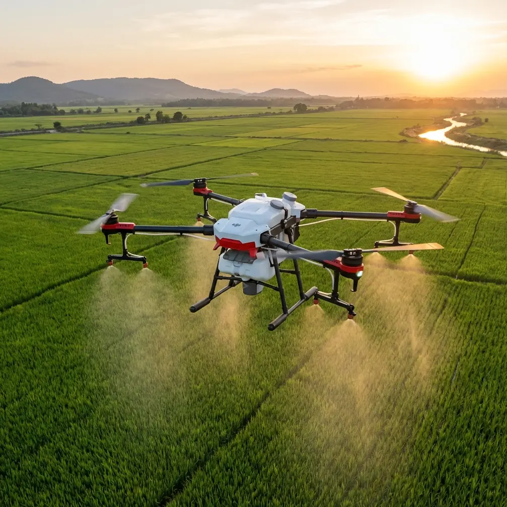
You are dealing with concrete walls, sign gantries, overpasses, merging traffic, reflective surfaces, wind tunnels between structures, and a constant stream of moving subjects that can confuse both pilot judgment and onboard sensing. In that environment, the DJI Avata is not just a flying camera. It is a compact FPV platform that can gather dynamic roadway visuals from angles a traditional inspection workflow often misses. But the margin for error shrinks fast when grime, bug residue, or city dust interfere with the aircraft’s safety systems.
If I were flying Avata over or alongside an urban highway corridor, the first thing I would emphasize is not a camera preset or a cinematic move. It is a cleaning step before takeoff.
That sounds minor. It is not.
The problem: urban highways are hostile to sensors
Highway environments contaminate drones quickly. Exhaust particulates, dust thrown by heavy vehicles, fine grit from road shoulders, and moisture kicked up from tires all settle onto the front-facing optics and sensing surfaces. If the aircraft came out of a car trunk, a backpack, or a roadside setup table, chances are it already picked up residue before the props even start spinning.
For Avata pilots, that matters because urban monitoring often relies on a tight combination of pilot input, obstacle awareness, and camera clarity. A lens smudge degrades image quality. A dirty sensor window can also reduce the reliability of systems people tend to trust without thinking twice, especially obstacle avoidance behavior in close quarters.
On an urban highway route, “close quarters” is the whole mission. You may be skimming near barriers, following the curve of an interchange, or documenting congestion patterns around an underpass where visual perspective changes every second. If the aircraft is interpreting a dirty surface instead of the scene ahead, the result may be hesitation, false confidence, or poor positional behavior at exactly the wrong moment.
That is the hidden risk: not dramatic failure, but subtle degradation.
The solution: make sensor cleaning part of mission planning
Before flight, clean the camera lens and every relevant sensing surface deliberately, not casually. Use a blower first to remove grit. Then use a clean microfiber cloth designed for optics. If you need a fluid, use one intended for lenses and apply it to the cloth rather than directly to the drone.
This is not cosmetic housekeeping. It is a flight safety measure.
For urban highway monitoring, I would treat this the same way I treat prop inspection. The objective is to preserve two things at once: image integrity and system awareness. Avata’s operational value depends on both. If your footage is meant to help review traffic behavior, lane transitions, bottleneck buildup, shoulder conditions, or roadway geometry, then visual consistency matters. If your route includes low-altitude, near-structure movement, then clean sensing surfaces matter just as much.
A lot of pilots obsess over battery percentages and forget that one fingerprint can do more damage to the mission than a missing extra minute of flight time.
Why this matters specifically for Avata
Avata occupies an unusual space in the UAV market. It is compact, agile, and built to capture immersive motion in environments where larger airframes feel cumbersome. That makes it attractive for roadway documentation in dense urban settings, especially when the goal is to understand how traffic flows through physical infrastructure rather than just capture a top-down overview.
But the same strengths that make Avata useful also tempt pilots to fly close. Close to barriers. Close to signage. Close to bridge columns. Close to moving vehicles, while maintaining legal and safe standoff distances.
That is where obstacle avoidance awareness becomes operationally significant, not just a spec-sheet talking point. In a highway setting, obstacle avoidance is not there to rescue reckless flying. It helps reduce the workload when visual complexity spikes. Clean sensor windows give that system the best possible chance to interpret the environment correctly.
This is also where pilots need discipline. Obstacle sensing is an aid, not permission to push into every narrow gap. On an urban highway assignment, I would plan the route as if no automated protection exists, then let the aircraft’s safety features serve as a secondary layer rather than the primary defense.
Build the flight around roadway behavior, not drone behavior
One mistake I see often is planning a drone mission around what the aircraft can do rather than what the road network is doing.
Highways in urban areas have predictable instability points: on-ramps, off-ramps, choke points under overpasses, lane merges, toll transitions, elevated curves, and service road intersections. Avata can reveal those patterns well because its perspective feels embedded in the environment rather than detached from it.
That is where ActiveTrack and subject tracking ideas become tempting, but highway monitoring requires judgment. Tracking a moving vehicle may produce a visually strong sequence, yet the real value usually comes from showing interaction: how one vehicle stream compresses another, how spacing changes before an interchange, or how congestion ripples backward from a merge.
If you use ActiveTrack in this context, use it selectively and with clear intent. It can help maintain framing on a lead subject when you need a consistent visual reference, but urban highways are full of occlusions, variable speeds, and competing moving objects. A manually controlled pass is often safer and more useful than handing too much authority to tracking logic in a cluttered corridor.
Operationally, that means deciding what the “subject” actually is before takeoff. Sometimes it is a vehicle. Sometimes it is not. It may be the lane geometry, the signage visibility, the bottleneck zone, or the relationship between an overpass and traffic density below it.
Camera settings that support analysis, not just aesthetics
Avata footage for highway monitoring should still look good, but beauty is not the main job. Clarity is.
That is why D-Log can be valuable here. If your mission spans bright concrete, deep shadows under bridges, reflective vehicle roofs, and changing sun angles, a flatter recording profile gives you more latitude in post-production. You can recover highlight detail on pale road surfaces and retain more information in darker structural zones.
This has direct operational significance. When reviewing footage for roadway conditions or traffic patterns, it helps to see into both extremes of the scene. Harsh contrast can hide lane markings, signage edges, or vehicle separation. A flexible profile like D-Log gives an editor or analyst more room to balance those exposures cleanly.
At the same time, not every mission needs a heavy grading workflow. If the output is a quick operational brief, standard color may be the better choice. The point is to match the recording approach to the final use. Avata is capable of cinematic output, but urban monitoring often benefits more from controlled, readable footage than from dramatic color treatment.
Use QuickShots and Hyperlapse carefully
QuickShots and Hyperlapse both sound attractive for infrastructure storytelling, and they can be useful if used with restraint.
QuickShots can establish context at the start of a report. A short automated reveal of an interchange or elevated section of roadway can give viewers orientation before you move into tighter passes. But on an active urban highway, automated movement modes should only be used in open, well-assessed airspace with a clear understanding of surrounding obstacles.
Hyperlapse is different. It can be surprisingly effective for showing traffic buildup or dissipation over time, especially around repeat congestion points. If you need to illustrate how flow changes across several minutes, compressing that sequence can make roadway behavior instantly legible. For planners, editors, or stakeholders, that kind of visual evidence often communicates faster than a spoken summary.
Still, neither feature replaces careful route planning. In a constrained corridor, simple controlled flight paths usually outperform flashy automation.
The pre-flight sequence I would actually use
For highway work with Avata, my own order would be practical and repetitive:
First, inspect props and frame for transport damage.
Second, clean the lens and sensor surfaces.
Third, confirm home point and signal conditions.
Fourth, review wind behavior at launch level and near elevated structures.
Fifth, define a route with hard no-fly proximity rules around poles, signs, and bridge supports.
Sixth, decide whether the mission calls for manual framing, ActiveTrack, QuickShots, or none of them.
Seventh, set the color profile based on whether the footage is for fast delivery or post-processed review.
That second step is the one too many pilots rush. It takes less than a minute. In a complex urban setting, it can preserve the entire mission.
If you want to compare route ideas or operational setups with another pilot before flying, I would use a quick field briefing through direct flight planning chat rather than improvising on location.
What photographers often miss when flying infrastructure
As a photographer, I understand the instinct to chase the most dramatic angle. Avata encourages that instinct. It feels alive in the air, and it rewards movement better than many aircraft in its class.
But infrastructure monitoring is not only about drama. It is about repeatability.
Can you fly the same corridor next week and match the perspective? Can you document the same merge zone under similar framing? Can your footage show whether a new traffic pattern is improving flow or making it worse? Can your visuals support decisions instead of merely impressing viewers?
Those are the standards that separate a stylish clip from useful aerial documentation.
For that reason, obstacle avoidance, subject tracking, D-Log, QuickShots, Hyperlapse, and manual FPV handling should all be treated as tools inside a system. The system starts on the ground. It starts with preparation. And one of the most overlooked pieces of preparation is simply making sure the aircraft can see clearly.
A final practical note on safety and legality
Urban highways are not forgiving places to experiment. Any Avata mission near roads must follow local airspace rules, traffic safety requirements, operational restrictions, and common-sense separation practices. You should also account for pedestrians, adjacent buildings, emergency vehicles, and the fact that GPS and signal behavior can change around dense infrastructure.
That is another reason the cleaning step matters. Anything that improves predictability before takeoff reduces reliance on split-second correction later.
In this kind of environment, small details are rarely small. A dirty lens softens evidence. A dirty sensor window can compromise confidence. A rushed launch can turn a useful monitoring session into a short, expensive lesson.
Avata is a strong platform for urban highway observation when used with discipline. Not because it makes complex environments easy, but because it gives a skilled operator a compact, agile way to document them well. The pilots who get the best results are usually not the ones chasing the boldest moves. They are the ones who remove avoidable problems before the drone ever leaves the ground.
Ready for your own Avata? Contact our team for expert consultation.