Avata in Extreme Highway Heat and Cold: A Field Case Study
Avata in Extreme Highway Heat and Cold: A Field Case Study on Range, Camera Discipline, and Safer Monitoring
META: A practical case study on using DJI Avata for highway monitoring in extreme temperatures, with antenna positioning advice, obstacle avoidance considerations, D-Log workflow notes, and real-world operating tips.
I’ve used cameras in enough bad weather to know that temperature changes don’t just affect batteries. They affect judgment, visibility, workflow, and the small setup habits that decide whether a flight feels smooth or compromised. That matters on a highway job, where the objective is rarely “get cinematic footage” and almost always “capture usable information without wasting time.”
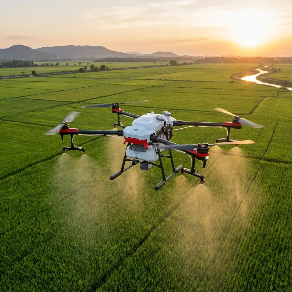
For this case study, I’m looking at the DJI Avata through the lens of a very specific civilian assignment: monitoring highway conditions in extreme heat and cold. Not mapping in the strict survey sense, and not a pure creative shoot either. Think visual inspections of traffic flow pinch points, roadside drainage behavior after weather swings, construction-zone progress, shoulder degradation, snow buildup, heat shimmer over asphalt, signage visibility, and documentation of changes along fixed corridors. In those environments, the Avata has a particular value that is easy to miss if you only think of it as an FPV aircraft.
The real advantage is controlled proximity.
On a highway monitoring job, you’re often dealing with overpasses, barriers, sign gantries, poles, embankments, vehicles entering and exiting frame unpredictably, and wind patterns that change dramatically around concrete structures. A compact, ducted platform like Avata is not a replacement for a large-area mapping drone. It’s the tool you choose when you need to move through constrained spaces with precision and maintain visual context close to infrastructure.
That changes how you plan the mission from the start.
Why Avata Fits a Highway Monitoring Role
The temptation with any drone article is to make the platform sound universal. Avata isn’t universal. It shines when a monitoring team needs to inspect specific segments and structures, especially where a standard orbit or top-down pass doesn’t tell the whole story.
For highway work in extreme temperatures, three things stand out.
First, obstacle awareness matters more than headline speed. Around overpasses, retaining walls, sign supports, and roadside vegetation, obstacle avoidance is not just a convenience feature. It reduces the workload during repeatable, close-range observation runs. In practical terms, that means the pilot can spend more attention on framing road-surface condition, drainage movement, barrier damage, or shoulder encroachment instead of constantly correcting for nearby structures.
Second, Avata’s stabilized FPV perspective is useful for operational storytelling. A road authority, contractor, or infrastructure team often needs more than a still image. They need footage that shows how vehicles merge into a narrowed lane, how wind pushes debris toward a shoulder, or how melted runoff moves across a damaged section. That kind of evidence is stronger when captured from a forward-moving, low-altitude perspective.
Third, the camera workflow is more valuable than many pilots admit. If you’re documenting roads in brutal summer light or icy low-contrast winter scenes, D-Log gives you room to recover highlights and maintain consistency between sorties. That operational significance is simple: highway managers need footage they can compare over time. If one day’s sun-baked noon pass is wildly different in tone and exposure from another day’s overcast winter inspection, trend analysis becomes less reliable.
The Temperature Problem No One Solves with Specs Alone
Extreme temperatures expose weak habits fast.
In heat, the issue is not just whether the aircraft can fly. The issue is whether the pilot launches with a workflow that minimizes unnecessary hovering, repeated setup cycles, and battery exposure on hot pavement. Highway shoulders and staging areas can radiate heat aggressively, especially in mid-afternoon. Asphalt can be much hotter than ambient air, and that affects how long you want equipment sitting idle before takeoff.
In cold, the opposite problem appears. You may have enough visibility for a mission, but sluggish battery behavior, reduced hand dexterity, and lower contrast in the landscape make precision work harder. A pilot wearing gloves and standing near a windy roadside shoulder has less margin for clumsy setup.
This is where Avata’s simplicity helps. A fast deployment profile is underrated in infrastructure monitoring. If the mission is to record a bridge approach, check snow drift accumulation near median barriers, or verify the condition of a drainage outlet beyond a guardrail, getting airborne quickly matters. Shorter setup time means less thermal stress on the system and fewer opportunities for operator error.
Antenna Positioning Advice for Maximum Range
Range discussions often become abstract, but on a highway job they’re deeply practical. Long corridors create a false sense of openness. People think, “It’s just a road, so signal will be fine.” In reality, overpasses, trucks, reflective surfaces, concrete walls, roadside metal, and elevation changes can interfere with signal quality or make it inconsistent.
The biggest avoidable mistake is poor antenna orientation.
For maximum range and a more stable connection, don’t point the antenna tips directly at the drone. The strongest part of the signal pattern is typically broadside to the antenna, not off the narrow end. In plain language: aim the flat face or side of the antenna pattern toward the aircraft’s expected flight path. If you’re working a linear highway corridor, position yourself so the drone stays in front of you with the controller or goggle antennas oriented perpendicular to the route rather than “spearing” the drone with the ends.
That matters operationally because highway monitoring often involves repeated straight-line passes. If your antenna orientation is wrong, signal quality may look acceptable at launch and then degrade during the exact portion of the route where you need continuity. That’s usually the moment you’re moving under or near structures, where you can least afford distractions.
A second point: elevation and body position matter. Don’t stand immediately behind a large vehicle, close to a metal barrier, or tucked under a structure if you can help it. Even a modest step to a clearer position can improve link consistency. On field teams, I’ve seen pilots troubleshoot the drone when the real problem was simply that they were standing in the worst possible place.
If you want help planning a practical Avata setup for corridor flights, this direct WhatsApp contact is an easy starting point.
A Summer Monitoring Pass: Heat Shimmer, Hard Light, and Fast Decisions
One of the more revealing highway tasks in hot weather is checking how road texture, expansion joints, lane markings, and shoulder edges appear during peak sun. Heat shimmer can distort the view from conventional ground photography, especially over long distances. With Avata, you can close that gap and inspect from a lower forward angle that makes certain defects or visual hazards more legible.
But summer light punishes poor exposure control. White lane paint, reflective signage, pale concrete, and vehicle roofs can clip quickly. This is where D-Log becomes more than a colorist’s luxury. It preserves more flexibility when reviewing footage for operational details. If your client needs to compare glare conditions near an interchange or determine whether a sign remains readable under intense afternoon sun, retaining highlight detail matters.
QuickShots and Hyperlapse also have a place here, though not in the obvious promotional sense. Used carefully, they can support periodic documentation. A Hyperlapse from a fixed observation pattern can reveal traffic density shifts around a work zone or show how shadows from overhead structures affect lane visibility at certain times of day. QuickShots are less central to inspections, but in training and stakeholder reporting they can provide consistent, repeatable visual summaries of a location.
The key is discipline. Automation should support standardization, not distract from the mission.
A Winter Monitoring Pass: Low Contrast, Wind, and Spatial Awareness
Cold-weather highway monitoring asks different questions. You may be trying to observe plow effectiveness, snow drift formation, slush migration, icy shoulder buildup, blocked drains, or reduced visibility around barriers and ramps. The challenge is that the landscape can flatten visually. White, gray, and muted surfaces compress depth cues. That’s exactly when obstacle awareness becomes operationally significant.
Around guardrails, signposts, utility lines, and bridge understructures, limited contrast can make manual depth judgment less reliable. Avata’s obstacle-related flight support helps keep the aircraft manageable during close inspection runs, particularly where the mission requires repeated passes from similar angles. For infrastructure teams trying to compare conditions over time, repeatability is everything.
This is also where subject tracking concepts enter the conversation, even though the highway itself is not your “subject” in the consumer sense. Features like ActiveTrack can be useful in controlled civilian contexts when documenting moving maintenance vehicles or following a predictable support convoy at a safe, lawful distance on adjacent non-sensitive routes. The operational significance is continuity: instead of manually re-framing a vehicle involved in road treatment or inspection, the pilot can maintain more consistent footage for review. That said, fixed infrastructure observations are often better handled with planned flight lines than with automated tracking.
What Avata Does Better Than a Generic Inspection Drone in This Scenario
The biggest misconception about highway work is that wider coverage always wins. It doesn’t.
A corridor is not just a line on a map. It is a chain of problem areas. Drainage transitions. Merging lanes. Crash barriers. Overhead signs. Pavement joins. Erosion near culverts. Temporary barriers around construction. Snow piled where wind channels through open spans. Heat stress near dark resurfaced patches.
Avata is strong when you need to show how those elements relate to one another spatially. The aircraft’s style of movement gives stakeholders an intuitive understanding of “what the driver would encounter” while still keeping the flexibility of an aerial viewpoint. That is different from a top-down orthographic mindset.
For training crews, this matters even more. New inspectors and project managers often understand issues faster when they can see an approach sequence rather than a collection of disconnected stills. A smooth FPV-style pass under controlled conditions can communicate risk points, maintenance needs, and traffic interaction patterns with unusual clarity.
Operational Limits You Should Respect
Avata is not the aircraft for every mile of road. If the task requires broad-area surveying, high-precision mapping outputs, or long-duration corridor capture at scale, another platform may be more efficient. Extreme temperatures also make conservative planning essential. Short, purposeful flights are usually better than trying to squeeze every possible minute from a battery in harsh conditions.
You should also think carefully about launch and recovery zones. Highway environments are busy, noisy, and full of visual clutter. A compact drone helps, but site selection still decides whether the operation feels controlled. Pick a spot with a clear signal path, clean takeoff area, and minimal reflective or obstructive structure between pilot and aircraft.
And on the imaging side, avoid overcomplicating the mission. D-Log is useful when you have a post-production workflow that supports analysis and consistency. If the footage is needed immediately for a simple field decision, a more direct color profile may be the better operational choice. The right answer depends on how the information will be used.
The Real Lesson from Extreme Temperature Highway Work
After enough roadside assignments, you stop dividing drones into “creative” and “practical” categories quite so neatly. Avata sits in the overlap. It can produce dramatic motion, yes, but that same motion is exactly what makes it effective for certain monitoring tasks. It shows infrastructure as a system of connected moments rather than isolated defects.
In extreme heat, it helps you get close, work efficiently, and preserve detail where light is harshest. In winter, it helps maintain spatial awareness where contrast drops and structure proximity matters more. Obstacle avoidance reduces pilot workload in constrained areas. D-Log supports consistent review across difficult lighting conditions. And something as simple as antenna orientation can determine whether a straightforward corridor pass stays clean and usable from start to finish.
That is the difference between owning a drone and operating a tool well.
Ready for your own Avata? Contact our team for expert consultation.