Expert Monitoring with Avata: A Mountain Power Line Case
Expert Monitoring with Avata: A Mountain Power Line Case Study
META: A field-based case study on using DJI Avata for mountain power line monitoring, with practical lessons on obstacle sensing, pre-flight cleaning, route limits, and why delivery-drone numbers matter in real operations.
I’ve spent enough time around aircraft and cameras to know that the glossy promise is never the whole story. A drone spec sheet can sound perfect right up until you put the machine in a cold mountain corridor, point it toward a string of power poles, and ask it to deliver stable visual intelligence around wires, rock faces, wind shifts, and changing light.
That is why the most useful way to talk about Avata for infrastructure work is not as a feature parade, but as a field story.
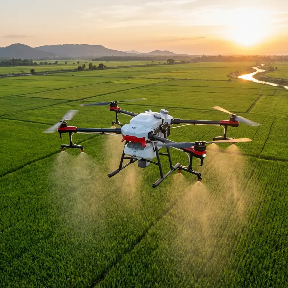
This case study centers on a mountain power line monitoring scenario: a utility team needs visual checks along transmission and distribution assets running through uneven terrain. The brief sounds simple. It never is. On these routes, getting a human inspector to every angle can take hours. Even when access roads exist, the best visual line on insulators, crossarms, vegetation encroachment, and terrain-related risks often does not.
Avata enters this kind of job from an unusual angle. It is not a traditional enterprise inspection platform built around long-range corridor mapping. Its value is more tactical. It can slip into tighter visual spaces, move through terrain contours with confidence, and give operators a more intuitive view when they need close-in observation around difficult topography. In mountain monitoring, that matters.
Why a delivery-drone news story actually matters here
A recent report about Amazon’s small delivery drone tests offers a useful reality check for anyone thinking about UAV operations in the real world. The company outlined a future service model with delivery in 30 minutes, serving customers within a 16-kilometer radius of a warehouse, carrying parcels of about 2.27 kilograms. That weight class reportedly covers 86% of its package volume. On paper, those numbers are compelling because they tie aircraft capability to operational scale.
But the same report makes the more serious point: full deployment still faces legal, technical, safety, and social barriers.
That is not just a delivery-drone story. It is an operations story. And it applies directly to using Avata in mountain utility work.
Why? Because the gap between “can fly” and “can be used reliably in a mission environment” is where most drone programs either mature or fail. The lesson from that delivery model is not speed. It is systems thinking. If a lightweight aircraft can theoretically solve a large portion of a logistics problem because it fits the dominant payload profile, then a compact aircraft like Avata can also solve a meaningful slice of inspection work when the mission profile is right. The key is understanding where it fits, and where it does not.
For mountain power line monitoring, Avata is not replacing every inspection workflow. It is solving the short-range, close-proximity visual segment that larger platforms may handle less gracefully.
The mission profile: short, deliberate, terrain-aware
In our scenario, the utility team was not asking Avata to patrol a massive corridor end to end. That would miss the point. They used it in focused segments: problem areas near steep slopes, spans crossing ravines, and sections where vegetation growth or rockfall risk demanded a closer look.
This is where the numbers in the Amazon report become operationally relevant. A 16-kilometer radius sounds broad until you remember how quickly terrain, regulation, line-of-sight constraints, and risk controls compress actual workable airspace. Mountain monitoring has the same truth. The planning map always looks cleaner than the field.
So the team designed the operation around tactical launch points rather than one long push. Hike or drive to a safe staging area. Inspect a limited section. Recover. Reposition. Fly again.
That workflow suits Avata far better than trying to force it into a corridor model it was never meant to own.
The overlooked safety step: cleaning before takeoff
The most valuable lesson from this job was also the least glamorous: pre-flight cleaning.
Not the airframe in a cosmetic sense. The safety and vision systems.
Mountain routes are dirty environments for small aircraft. Dust from access tracks, moisture from fog banks, pollen, fine grit, and fingerprint smears on forward-facing surfaces all degrade the information the drone relies on. If your operation depends on obstacle awareness around poles, branches, and terrain edges, a dirty sensor window is not a minor oversight. It changes the margin.
Before each launch, the crew performed a deliberate wipe-down of the camera lens and the relevant sensing surfaces using proper non-abrasive materials. They also checked for debris around ducts and propulsion areas. This sounds basic because it is basic. Yet it directly affects obstacle avoidance behavior, image readability, and pilot confidence.
In mountain power line work, you are often threading a visual path near uneven ground while trying to maintain awareness of suspended wires and nearby structures. A clean optical surface supports better interpretation by both the aircraft systems and the human operator viewing the feed. If you want one practical habit that improves outcomes immediately, start there.
Why obstacle awareness matters more in mountains than on open sites
The context seed for this article included obstacle avoidance, and that is exactly where Avata earns attention in this use case.
Power lines are inherently difficult environments for any drone. Wires can be visually subtle, backgrounds can be cluttered, and mountain settings introduce slope compression that distorts distance judgment from the pilot’s perspective. Add changing sunlight and gusts wrapping around ridgelines, and the task becomes less about pure flight and more about controlled positioning.
Avata’s compact form and protected design make it well suited for close visual work in constrained spaces, especially when the operator is navigating around terrain contours rather than blasting through open sky. But that only helps if the pilot respects the mission geometry. The team in this case never treated obstacle sensing as permission to fly carelessly. They treated it as an additional layer in a broader safety stack: route planning, conservative speed, stable approach angles, visual observer support, and clean sensors.
That combination proved more useful than any single feature in isolation.
ActiveTrack and subject tracking: useful, but not a shortcut
The brief also mentioned subject tracking and ActiveTrack. For mountain power line monitoring, these tools are best understood as support functions, not autonomous inspection logic.
Utilities do not need the drone to “follow” a wire the way a creator might follow a cyclist. What the team found useful was the underlying benefit of intelligent framing and stable orientation cues when documenting repeatable vantage points around towers and poles. In practical terms, that can help an operator hold cleaner visual composition while evaluating hardware, vegetation proximity, or access path conditions.
Still, there is a hard line here. Subject tracking features do not remove the need for manual judgement around electrical infrastructure. The environment is too complex, and the consequences of a misread are too high. Avata works best when the pilot remains fully engaged and uses smart assistance sparingly.
QuickShots and Hyperlapse in a utility workflow?
At first glance, QuickShots and Hyperlapse sound out of place in an inspection discussion. For strict defect documentation, they often are. But mountain utility work involves more than identifying damaged components.
The operations manager on this case wanted communication assets for internal reporting: terrain context, access difficulty, vegetation trends, and before-and-after visuals after maintenance visits. That is where automated cinematic tools become unexpectedly practical.
A carefully planned Hyperlapse sequence can show the relationship between a ridgeline, a service road, and a line segment far more effectively than a static image. QuickShots, used cautiously and away from infrastructure conflict points, can create visual overviews that help non-pilot stakeholders understand the site. This is not marketing fluff. It is operational communication.
The rule is simple: use these modes in safe, open segments to support context gathering, not in the tight inspection envelope itself.
D-Log and why image latitude helps inspection storytelling
D-Log also deserves a place in this conversation. Mountain inspections are often shot under punishing contrast. Bright cloud breaks, dark tree cover, reflective hardware, and shaded valleys can push standard profiles into losing detail where you most want it.
Shooting in D-Log gives the team more flexibility in post-processing to recover tonal information and produce balanced footage for review. That matters when the footage is not just for aesthetics, but for extracting meaning. You want the maintenance engineer, field supervisor, and management team to see the same problem clearly. Better dynamic range handling supports that goal.
Jessica Brown, the photographer perspective behind this article, is relevant here for a reason. People who come from visual storytelling understand that a technically accurate image still has to be readable. In power line monitoring, readable means the viewer can distinguish terrain shape, vegetation density, component outline, and environmental risk without fighting exposure limitations.
What Avata did well on this job
The strongest contribution Avata made in this mountain scenario was confidence in near-terrain observation.
Not blind confidence. Usable confidence.
It allowed the team to inspect awkward visual angles near slopes and around structures where larger aircraft would have felt less comfortable or demanded more stand-off distance. It also reduced the need to place personnel in precarious positions just to gain line of sight on certain assets. That is a serious operational advantage.
Its small footprint helped with transport between staging points. In mountain work, every piece of gear has to justify being carried. Lightweight systems get used more often because they are easier to deploy quickly.
And because the mission was segmented into short observation tasks rather than overextended into a corridor endurance role, the drone remained in the zone where it delivered value instead of friction.
Where the limitations showed up
The Amazon delivery article was right to highlight that technology alone does not settle an operation. Legal, technical, safety, and social constraints remain real. In utility inspection, the list changes shape but not substance.
Line-of-sight management in mountains is never trivial. Wind can shift abruptly. Access points can force compromised launch positions. Public perception matters when flying near communities or visible infrastructure. Internal safety procedures may be stricter than the drone’s own capability envelope.
Avata also demands discipline around mission scope. This is not the aircraft to assign every power line task just because it performs well in close visual segments. If the objective is broad-area mapping, long corridor coverage, or highly specialized sensor payload work, the team should choose accordingly.
Good drone programs are built on fit, not enthusiasm.
The bigger takeaway
The most revealing link between a retail delivery drone headline and a mountain inspection flight is this: percentages and promise matter only when tied to the right task design.
Amazon’s test concept says a lightweight drone carrying around 2.27 kilograms could address 86% of a certain package profile, yet still face years of real-world deployment hurdles. Avata creates a similar lesson for infrastructure teams. It can address a meaningful percentage of close-range, terrain-sensitive visual inspection needs, but only when operators respect the surrounding framework of safety, workflow design, and environmental reality.
That is why the pre-flight cleaning step stayed with me more than any headline feature. It represents the mindset that separates hobby-style flying from dependable field operations. Clean sensors. Clean lens. Conservative route. Defined objective. Human judgement first.
If your team is exploring whether Avata fits mountain utility inspection, start with one question: are you trying to replace everything, or solve one hard visual problem well?
The second approach is where this aircraft proves itself.
If you want to compare deployment ideas for your own terrain and inspection workflow, you can message the field team here and discuss practical setup questions rather than generic specs.
Ready for your own Avata? Contact our team for expert consultation.