Avata Guide for Coastal Power Line Monitoring
Avata Guide for Coastal Power Line Monitoring: A Practical Workflow That Starts Before Takeoff
META: Learn how to use Avata for coastal power line monitoring with a field-ready workflow focused on image stability, overlap planning, low-altitude operations, and pre-flight sensor cleaning.
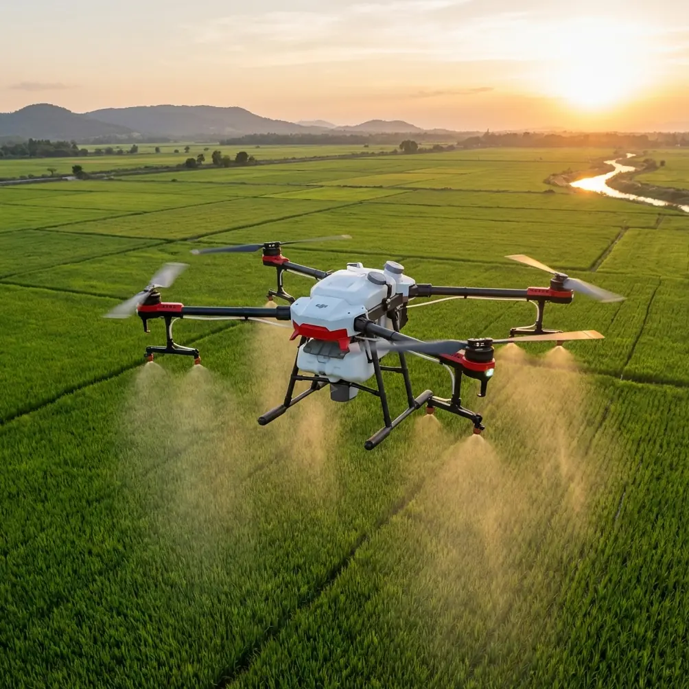
Coastal power line inspection is unforgiving work for any drone. Salt hangs in the air. Wind shifts quickly. Light bounces off water, metal, and wet insulators in ways that can ruin otherwise usable footage. If you are thinking about using Avata in this environment, the real question is not whether it can fly the route. The real question is whether your workflow can produce stable, traceable, high-quality visual data under low-altitude field conditions.
That distinction matters.
A drone can complete a mission and still fail the job. For utility monitoring, successful output means imagery that is clear enough to support review, repeatable enough to compare over time, and organized enough to be processed quickly after landing. The reference material behind this article, drawn from a UAV pipeline inspection solution, gets one thing exactly right: the aircraft is only part of the system. The value comes from how the flight platform, sensor control, flight parameters, and data handling work together.
For Avata operators monitoring coastal power lines, that system thinking should shape every step.
Start with the part most teams rush: cleaning the vision system
Before batteries, before route review, before checking the weather, clean the lenses and safety sensors.
That sounds basic, but in a coastal environment it is one of the highest-value pre-flight habits you can adopt. Salt spray, fine grit, and moisture film can accumulate on exposed surfaces faster than many pilots expect. If the aircraft’s obstacle-sensing elements or camera glass are dirty, the problem is not only cosmetic. A thin film can reduce contrast, create glare, and interfere with how the aircraft interprets its surroundings. On a route that may run near poles, conductors, crossarms, and vegetation, that margin matters.
Use a soft lens-safe cloth and inspect each optical surface in good light. Do not just wipe the main camera. Check every vision-related window and look for residue along the edges where salt can dry nearly invisible. In coastal work, I would treat this as mandatory, not optional.
It also ties directly into one of the strongest principles from the reference document: remote sensing quality depends on controlled sensor performance. If the sensor system is compromised before takeoff, every other setting becomes less meaningful.
Understand what Avata is actually doing well in this role
Avata is often discussed as a cinematic FPV aircraft, which can make some utility operators dismiss it too quickly. That would be a mistake. In a constrained corridor environment, especially where access is difficult and where low-altitude observation is useful, Avata’s compact form and agile flight profile can be valuable.
But this does not mean it should be flown like a freestyle machine.
For power line monitoring, think of Avata as a close-range visual inspection tool operating inside a disciplined capture plan. You are not chasing dramatic reveals. You are collecting stable, reviewable imagery around assets that run through coastal terrain and often sit in awkward wind channels.
That is where the operational logic from the source material becomes relevant. The document emphasizes that remote sensing sensor control should respond to preset photography points, scale, overlap, and real-time flight data such as altitude and speed. Even if you are not building a full survey product from Avata, the principle still applies: your image capture should be tied to a repeatable flight structure, not to improvisation in the air.
In practical terms, that means deciding before launch:
- which towers, spans, joints, and insulator strings need close visual coverage
- what distance you want to maintain from the asset
- how much visual overlap you need between passes
- what speed still gives you motion clarity
- how you will record location and orientation context for later review
Those decisions turn a drone flight into an inspection workflow.
Use low-altitude planning to your advantage
One detail from the reference data is especially useful for this kind of operation: below 1000 meters, the airspace registration and application environment is generally more accessible. For a coastal utility team, that matters because line inspection missions are usually conducted at much lower altitudes anyway. You are not trying to gain height for broad-area mapping. You are trying to stay in the corridor and read condition details.
Low-altitude flight also improves your chance of getting actionable visual data in a marine atmosphere. Haze, sea reflection, and shifting cloud layers all reduce image quality over distance. Staying lower and closer to the subject can preserve the clarity needed to inspect hardware, attachment points, corrosion signs, and nearby encroachment.
The source document also points out that UAV systems can fly below cloud and adapt to required ground resolution. That is a practical advantage in coastal work where weather windows may be short. If your team can mobilize quickly, launch with minimal site setup, and capture under the cloud base, you can often complete a meaningful inspection before conditions deteriorate.
Avata fits this quick-response model well. It does not require a large launch footprint, and that matters when your access point is a narrow service road, rocky shoreline approach, or substation edge.
Stability is not a luxury. It is the difference between footage and evidence.
One of the most operationally significant facts in the source material is the recommendation to use a three-axis stabilization platform when the UAV itself has weak wind resistance or limited flight stability. The reason is simple: if the platform is being pushed around, the sensor must compensate enough to preserve clear and stable imagery.
This principle is critical in coastal power line work.
Wind near shore is rarely uniform. It bends around structures, accelerates across gaps, and changes direction around embankments and tower geometry. Even if Avata remains controllable, the airframe may still experience enough micro-movement to degrade inspection footage if your capture method is sloppy.
So what do you do with that?
You fly slower than you think you need to. You avoid aggressive yaw inputs. You build inspection passes that favor smooth lateral and forward movement. You maintain a predictable standoff distance. And you review stabilization performance before committing to the full route.
Do a short test segment on the first structure. Look at the playback. If detail is soft, jittery, or obscured by glare, do not assume the rest of the mission will improve. Adjust speed, angle, and timing before moving on.
This is also the point where the popular feature set often gets misunderstood. Obstacle avoidance can help with situational awareness, but it does not replace route discipline. Subject tracking and ActiveTrack are useful in some civilian visual tasks, yet power infrastructure is not a moving athlete on an open field. The goal is not autonomous following. The goal is deliberate observation. Use automation sparingly, and only where it clearly improves consistency.
QuickShots and Hyperlapse can be helpful for stakeholder communication or documenting corridor context, but they are secondary outputs. Inspection-grade capture comes first.
Borrow a survey mindset, even if you are not producing a map
The source document includes a very specific photogrammetry detail: for stereo imaging success, forward overlap should be 55% to 65%, with at least 50%, and side overlap around 30%. That guidance was written in the context of aerial imaging and mapping, but the logic translates surprisingly well to structured visual inspection.
You may not need classic stereo pairs from Avata for every power line mission. Still, overlap is what saves you when one angle is lost to glare, motion blur, conductor shimmer, or a bird crossing the frame. Overlap is also what allows a reviewer to compare a clamp or insulator from multiple perspectives without sending a team back out.
For coastal line monitoring, I recommend thinking in terms of inspection overlap rather than survey overlap:
- Make one primary pass along the line side that gives the cleanest view of hardware.
- Add a second pass or partial return leg that changes the angle enough to expose hidden surfaces.
- At key structures, capture short controlled orbits or stepped side views rather than one sweeping cinematic arc.
- Pause briefly at predefined observation points to lock in sharp detail.
That last point matters. The reference material stresses pre-set photography points combined with real-time altitude and speed data. For Avata operators, this can be implemented as a repeatable checklist of capture positions per structure type. End pole. Tangent pole. Angle structure. Coastal crossing. Treat each as a mini-template.
Consistency beats creativity.
Record more context than you think you need
Another detail from the source material deserves more attention than it usually gets: position data and attitude data should be recorded and stored in real time to support processing and improve efficiency.
That is not academic language. It is a field productivity rule.
When a maintenance engineer reviews your footage two days later, they need to know where the issue was seen and from what angle. If your data package lacks structure, your inspection turns into a scavenger hunt through files and memory cards.
Build your mission log around these basics:
- asset ID or pole number
- date and local time
- weather and wind notes
- battery used for each segment
- flight direction for each pass
- observed anomalies with timestamp references
- notes on any missed areas requiring re-flight
If your team wants to tighten that workflow, create a simple template and tie it to your media naming convention. The source document’s emphasis on fast remote sensing data processing is really about this exact outcome: reducing the delay between capture and usable interpretation.
A drone team that gathers footage quickly but organizes it poorly is only moving the bottleneck downstream.
Camera profile choices should serve inspection, not style
D-Log has value if your team needs grading flexibility under difficult contrast, and coastal routes often present exactly that problem. Bright sky, reflective water, dark structure components, and backlit hardware can all appear in one frame. If your post-processing pipeline is mature, D-Log can preserve more recoverable detail.
If it is not, keep things simpler.
A clean, well-exposed standard profile that your reviewers can use immediately is often more useful than a flatter image that requires correction before anyone can judge condition. This is one of those places where drone culture and inspection reality diverge. The best file is the one your maintenance team can evaluate without delay.
Build the route around environmental timing
Coastal inspections punish poor timing. Midday glare can flatten conductor detail and wash out corrosion cues. Early morning may offer better contrast, but only if moisture buildup is under control. Late afternoon can produce excellent side-light on structures, though wind may increase depending on local terrain and shoreline orientation.
That means your “how-to” is not complete without a timing plan.
Scout the route and identify where the sun will sit relative to each line section. Plan your first legs around the hardest-to-read assets. If one crossing section always reflects light off nearby water, fly that segment when the reflection angle is least disruptive. This is the kind of judgment that separates useful inspection footage from attractive but operationally weak video.
Keep your communication channel ready in the field
Inspection work often raises questions on-site that are easier resolved immediately than after demobilization. If your team needs a direct line for coordination on Avata workflow, payload setup, or field troubleshooting, keep a quick operations contact here as part of your mission toolkit.
That is not about convenience. It is about shortening the time between uncertainty and a safe, workable decision.
A practical coastal Avata workflow
Here is the condensed version I would actually hand to a field team:
1. Pre-flight clean and inspect
Clean camera glass and all vision-related surfaces. In coastal air, salt film is assumed until proven otherwise.
2. Define the capture plan
List structures, fault-prone components, and required viewing angles before launch. Do not improvise the whole mission.
3. Set low-altitude, corridor-focused passes
Stay close enough for detail, but maintain safe standoff from line infrastructure and surrounding obstacles.
4. Fly for stable imagery
Use smooth control inputs and lower speeds. Review test footage early, especially in gusty shoreline conditions.
5. Capture overlap intentionally
Use repeated angles and second-pass views. The source guidance of 55% to 65% forward overlap and roughly 30% side overlap is a useful mindset for structured visual redundancy.
6. Log position and orientation context
Tie footage to structure IDs, pass direction, timestamps, and notes so maintenance staff can act without guessing.
7. Process fast while memory is fresh
Review and tag anomalies immediately after landing whenever possible. The longer footage sits unorganized, the less useful it becomes.
The real lesson from the source material
The reference document was not written about Avata specifically, yet it offers a better operating philosophy than many model-specific guides. Its central idea is that high-resolution remote sensing is not created by the aircraft alone. It is created by coordination between the aircraft, the sensor, the flight path, the overlap logic, and the data workflow.
That is exactly how Avata should be used for coastal power line monitoring.
Not as a gadget. Not as a cinematic toy. As a compact aerial observation platform that becomes valuable only when paired with disciplined capture planning, stable low-altitude operation, and rigorous data handling.
If you get those pieces right, Avata can contribute meaningfully to utility inspection in places where access is awkward, weather windows are short, and visual detail matters.
Ready for your own Avata? Contact our team for expert consultation.