Monitoring Power Lines in Remote Corridors With Avata
Monitoring Power Lines in Remote Corridors With Avata: A Field Report
META: Field-tested insights on using DJI Avata for remote power line monitoring, with practical tips on obstacle awareness, image capture, and accessory setup inspired by DJI’s 2025 Matrice 4 Series push toward multi-angle aerial operations.
Remote power line work has a way of exposing every weakness in an airframe, every bad workflow habit, and every assumption made back at the desk.
On paper, the assignment sounds simple: follow a corridor, inspect poles and hardware, document vegetation encroachment, and come back with usable footage. In the field, it is rarely clean. You deal with narrow access tracks, uneven terrain, dead zones, tree cover, shifting light, and infrastructure that often sits exactly where conventional vantage points are worst. Some sections are straightforward. Others are tucked into ravines, crossing ridgelines, or running through stretches that feel built for hiking boots rather than trucks.
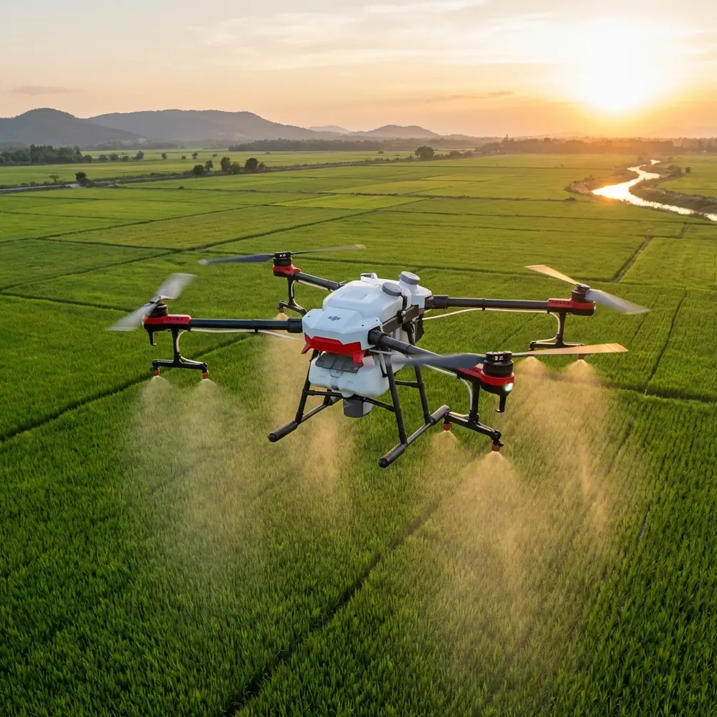
That is why a small FPV-style platform like Avata keeps finding a place in remote infrastructure work. Not because it replaces a larger enterprise inspection drone. It does not. The real value is that it gives a pilot a different way to get eyes on assets when the corridor is awkward, constrained, or simply “for roads less traveled,” to borrow the language DJI used when it introduced the Matrice 4 Series in January 2025. That launch was centered on a bigger idea than one aircraft family: daily aerial operations are moving toward more intelligent capture and better data gathered from multiple angles. For utility monitoring, that is exactly the right framing.
I have seen this firsthand on remote line checks where the goal was not cinematic flying and not broad-area mapping, but targeted visual confirmation. We needed to understand the condition of selected spans, inspect approach paths around structures, and verify whether surrounding growth was becoming a clearance problem. A larger platform may still own the formal inspection brief, especially when sensor payloads and repeatable reporting matter. Yet Avata can be remarkably effective as the forward scout and close-access visual tool.
Why Avata makes sense in remote power line work
The first advantage is obvious the moment you step out of the vehicle. Avata is compact, quick to deploy, and less demanding when the launch point is improvised. In remote corridors, that matters more than spec-sheet debates. You may be operating from a dirt shoulder, a cut through brush, or a small clearing with limited options for takeoff and recovery. Reducing setup friction means more time evaluating assets and less time nursing logistics.
The second advantage is flight perspective. Power infrastructure is full of awkward geometry: poles offset on slopes, insulators partially obscured by branches, hardware sitting behind crossarms, and spans that are visually confusing from only one side. DJI’s Matrice 4 Series announcement put real emphasis on collecting data from multiple angles. Even though that message belongs to a different product line, the operational lesson applies directly here. Single-angle observation misses things. Multi-angle observation exposes context.
That is where Avata earns its keep. A careful pilot can approach a structure from below the line of sight, offset laterally, then arc to a safer side-on view without needing the broad standoff distance that larger aircraft often prefer. The resulting footage can reveal conductor spacing, bracket condition, pole-top clutter, and vegetation relationship in a way that ground photos often fail to capture.
The operational boundary that matters most
Let’s be precise. Monitoring power lines with a small drone is not the same as performing energized technical inspection procedures. Utilities have strict safety frameworks, and pilots need to work within them. Avata is best treated as a visual assessment platform for civilian infrastructure monitoring, condition awareness, and route documentation.
That distinction shapes how you fly it.
You are not “threading” the aircraft through tight gaps to prove a point. You are not pressing close just because an FPV platform can create that temptation. You are using mobility and viewpoint control to improve situational awareness while maintaining conservative separation from conductors and structures. The aircraft’s obstacle awareness can help in cluttered environments, especially around trees and terrain transitions, but no pilot should confuse that with immunity near complex utility hardware. Around linear infrastructure, judgment outranks automation every time.
A real workflow: scout first, inspect second
The most productive remote corridor missions I have run with Avata followed a two-stage pattern.
First, use the drone as a corridor scout. Fly the access route and structure approach lines. Look for blocked tracks, unstable ground, overgrowth, and terrain pinch points. In mountainous or wooded areas, this alone can save a crew a significant amount of time. You are essentially building an aerial route brief for the people on the ground.
Second, shift to asset-focused capture. Instead of racing along the line, slow down and treat each structure as its own visual problem. Approach from a safe offset. Record a clean pass from one side. Reposition for the opposite angle. If glare is bad, change your height and angle rather than forcing a low-quality shot. Again, the Matrice 4 Series messaging around daily operations and multi-angle data collection is relevant because utility monitoring lives or dies on repeatable visibility. One pass is rarely enough.
With Avata, that often means flying shorter, more deliberate segments and landing between them. That may sound inefficient until you review the footage. Shorter segments are easier to label, easier to match to structure IDs, and easier for downstream teams to use.
Where obstacle awareness helps — and where it does not
Remote line corridors create a strange contrast. The line itself may run through open space, but the access environment is often cluttered. Branches, deadwood, uneven rises, guy wires, and isolated structures all appear at the edges of the route. Avata’s obstacle avoidance characteristics are most useful here: low-speed repositioning near trees, navigating around terrain features, and exiting a launch area with limited clearance.
That said, power line monitoring punishes overconfidence. Thin branches can be hard to judge. Utility environments contain fine, visually complex elements. Pilots should think of obstacle systems as a buffer, not a flight plan. The safe practice is still to maintain standoff, keep movements intentional, and avoid drifting into visual traps created by depth compression in goggles or on-screen view.
One habit I strongly recommend is pausing after every angle change. Do not roll directly from a lateral pass into a rising orbit around the structure. Stop. Reassess. Confirm where the conductors sit in relation to your intended path. This sounds basic. It is also the kind of discipline that prevents preventable incidents.
Camera settings that hold up in utility documentation
Utility teams do not need flashy footage. They need footage that survives scrutiny.
That is where some of the more creative-sounding features people associate with Avata need a reality check. QuickShots and Hyperlapse are useful in the right context, but for line monitoring they are secondary at best. Hyperlapse can help document long corridor segments for planning presentations or route-change visualization, yet it is not the primary capture mode for component assessment. QuickShots are similar: occasionally handy for contextual overviews around substations or access roads, not the core method for inspecting poles and spans.
The settings that matter more are the ones that preserve detail and grading flexibility. D-Log is worth using when the light is harsh, especially in remote corridors where bright sky and dark vegetation force high contrast into the same frame. Shooting in a flatter profile gives you more room to recover detail in pole hardware and surrounding vegetation during review. If your team works from still grabs pulled from video, this can materially improve whether a borderline image is usable or not.
For moving shots, resist the urge to fly too fast. A slower pass with stable framing beats a dramatic run every single time. Inspectors reviewing footage want enough dwell time to assess what they are seeing. If they need to pause every half-second, the pilot went too aggressive.
Subject tracking and ActiveTrack: use with caution
The LSI crowd loves to stuff terms like subject tracking and ActiveTrack into every drone article, but remote power infrastructure is not where you hand over judgment lightly.
Could tracking tools have a place? Possibly, for following a maintenance vehicle along an access track, documenting a cleared corridor, or supporting training footage where the “subject” is a crew moving through non-sensitive terrain. But for direct structure monitoring, manual control remains the better choice. Utility assets are static, while the hazards around them are not. You need deliberate framing, angle management, and constant awareness of separation.
In other words, Avata’s intelligence features can support the mission around the edges. They should not define the core inspection pass.
The accessory that changed the day
The most useful enhancement on one of our remote power line sessions was not exotic. It was a third-party high-brightness tablet monitor mount and sunhood setup paired to the controller for the visual observer and field engineer. Avata is often flown in a way that privileges the pilot’s immediate view, which is fine for control. But infrastructure work is collaborative. The person who understands the asset condition may not be the one on the sticks.
Adding that external viewing setup changed the whole workflow. The engineer could call for a slight yaw adjustment, request a second look at a tie point, or tell us immediately when a shot was good enough to move on. That reduced duplicate passes and improved note accuracy on site. For remote work, where every battery cycle and every hike to a new launch point costs time, that kind of accessory earns its place quickly.
If you are trying to build a similar field kit, it helps to compare mounting options and observer display setups with someone who works with practical configurations rather than generic bundles. I’ve shared suitable options for crews through this WhatsApp line when teams needed a quick recommendation before heading into the field.
Building a usable deliverable, not just a flight log
One of the biggest mistakes in remote drone operations is treating the mission as complete once the aircraft lands. For power line monitoring, the output needs to be structured around decisions.
That means naming clips by corridor section or structure number. It means separating broad route footage from close visual checks. It means noting wind, glare, and any points where vegetation or terrain blocked a complete angle. This is another reason the “daily aerial operations” positioning behind the Matrice 4 Series matters. Intelligence in aerial work is not just onboard capability. It is also operational discipline: gather the right data, from enough angles, in a format the next person can actually use.
Avata slots into that system best when the pilot thinks like a field technician rather than a content creator. Clean coverage. Predictable labeling. Repeatable routes where possible. Honest acknowledgment of what was seen and what was obscured.
When Avata is the right tool — and when it isn’t
For remote monitoring, Avata is strong in five situations:
- Access is difficult and rapid deployment matters.
- The objective is visual awareness rather than formal sensor-heavy inspection.
- Terrain or vegetation makes multi-angle close-context viewing valuable.
- The crew needs a nimble scout for route and structure approach checks.
- Training teams want to document corridor conditions and safe access paths.
It is less suitable when the mission depends on specialized payloads, high-precision repeatability, or broader enterprise reporting standards. That is where larger operational platforms come in.
This is not a weakness. It is clarity. Small drones become far more useful when teams stop asking them to be everything.
Final field note
What stood out to me after DJI announced the Matrice 4 Series on 2025-01-08 was not simply the release of another aircraft line. It was the wording around its purpose: support daily aerial operations, gather data from multiple angles, and serve work in hard-to-reach places. That is the reality of remote power line monitoring in a sentence.
Avata fits into that reality as a nimble, practical tool for seeing what the ground cannot see easily. Used well, it shortens uncertainty. It improves route awareness. It helps crews understand structures in context. And in remote corridors, context is often the difference between a useful flight and wasted batteries.
Ready for your own Avata? Contact our team for expert consultation.