DJI Avata for Windy Power Line Monitoring
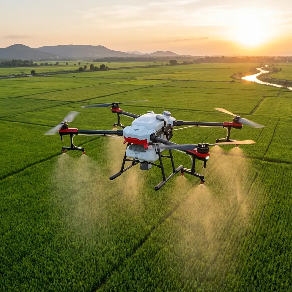
DJI Avata for Windy Power Line Monitoring: A Practical Workflow for Cleaner 3D Results
META: Learn how Avata can support windy power line monitoring workflows, and why better image capture, texture correction, and Smart3D/DP Modeler outputs matter for usable 3D inspection data.
Power line monitoring in wind exposes a weak spot in many drone workflows: capture is easy to start, but hard to finish well. You can collect a lot of imagery and still end up with a model that looks decent from far away yet falls apart when you zoom in on poles, crossarms, rooflines near corridors, or surrounding structures. That gap between “we flew it” and “we can use it” is where Avata becomes interesting.
Not because it is a conventional corridor mapping aircraft. It isn’t. And not because every cinematic flight feature translates directly into infrastructure inspection. It doesn’t. The real value comes from how Avata can be used as a close-in visual collection tool in difficult airflow, especially around built environments and oblique viewing angles, then fed into a modeling chain that is designed to squeeze more geometry and texture value out of multi-angle imagery.
That modeling chain matters here. The reference material behind this discussion is not generic drone marketing. It points to a very specific production logic: real-scene 3D reconstruction based on TIN mesh automatic texture mapping, output in practical formats like OBJ and OSGB, and post-processing in DP Modeler when automated results need human correction. For anyone monitoring power lines in windy conditions, that is the part worth paying attention to.
Why windy inspections break simplistic workflows
Wind changes more than flight comfort. It changes the quality of image overlap, the consistency of viewing angles, and the reliability of textures captured on narrow, repeating, reflective, or partially obstructed surfaces. Power assets are full of exactly those problems.
A pole line crossing through mixed terrain can include towers, distribution poles, guy wires, insulators, vegetation encroachment, buildings, access roads, and nearby retaining structures. Vertical imagery alone won’t tell the whole story. The source material makes this clear in another context: vertical images capture top structures, while oblique images provide side facade information. For utility work, that principle is operationally significant. If you want a usable 3D scene rather than a flat record, side information is not optional.
Avata fits this niche because it can gather close-range oblique perspectives where larger mapping platforms may be less comfortable or less efficient, particularly near complex structures or in areas where wind eddies around terrain and built objects. That does not replace broader survey aircraft. It complements them.
The real lesson from Smart3D and DP Modeler
The most useful detail in the reference data is not the software names by themselves. It is the production philosophy behind them.
Smart3D can automatically texture a TIN mesh using real imagery, producing a high-resolution realistic 3D model that aims to restore the scene as closely as possible to reality. Then it can export in compatible formats including OBJ and OSGB (OSG), which makes it easier to move the model into mainstream viewing and application platforms. It also supports multi-level pyramid models for smoother browsing.
That sounds technical, but the practical meaning is simple: a field team can collect imagery once and still have options later. If the line owner, engineering group, or vegetation management contractor uses a different platform, the model is less likely to get trapped in one ecosystem.
For power line monitoring, that interoperability matters because the audience is rarely one department. Asset managers want context. Field crews want visual confirmation. Planning teams may need terrain products. Contractors may only need selected structures or corridor segments. A model exported in common formats is easier to put to work.
The second operationally significant detail is what happens after the automatic model is generated. The source notes that Smart3D can directly output high-precision DEM and TDOM data for corresponding blocks, with standard outputs such as .tif and .dem. That is a serious advantage when the job goes beyond visual review. Wind-related risk around power lines is often tied to terrain access, drainage, slope stability, and vegetation growth patterns. If your 3D workflow can also deliver terrain and orthographic derivatives, one flight campaign can support more than one team.
Where Avata helps the capture stage
Avata’s role in this kind of workflow is not to mimic a large-format photogrammetry aircraft. Its value is in collecting useful oblique visual data in places where traditional top-down capture leaves gaps.
Think about a common windy inspection problem: a utility corridor passing close to buildings, roadside structures, or slope cuts. The top-down pass may record rooftops and broad ground context, but it often misses the side surfaces and the subtle geometry that later explains why a model looks warped or incomplete. The reference material explicitly states that multi-angle observation helps achieve complete alignment between the model and the imagery, giving the model precise 3D coordinate information. That is the core reason oblique imagery matters.
Avata is especially useful when the task calls for:
- Close visual access to side surfaces
- Short-range passes around poles or adjacent structures
- Supplemental capture in areas where the automatic model looks thin
- Fast revisits after wind creates changing conditions, such as vegetation shifts or visible hardware movement
This is also where obstacle awareness and controlled flight behavior matter more than flashy autonomous features. In a corridor environment, you are dealing with poles, branches, service drops, fences, and uneven wind behavior around terrain. A pilot using Avata for utility documentation needs stable, intentional pathing and disciplined framing. Features like QuickShots, Hyperlapse, or even broad consumer tracking modes are not the center of the workflow. In this context, they are secondary at best.
D-Log, however, can be relevant if your team wants more flexibility in balancing difficult lighting across bright sky and darker side surfaces. Better tonal control can improve the usefulness of texture source imagery, especially when trying to preserve detail on structures that later feed into textured 3D reconstruction.
A field workflow that makes sense
Here is the tutorial-style workflow I recommend when using Avata as a supplemental capture tool for windy power line monitoring.
1. Start with the modeling end in mind
Before flying, decide what the deliverable must be. If the downstream platform expects OBJ or OSGB, plan coverage that supports a full textured 3D scene. If the engineering team also wants terrain outputs, think about where your broader survey data will come from and where Avata’s close-range oblique passes can fill structural gaps.
The source material emphasizes that Smart3D can produce realistic textured 3D models and output DEM and TDOM products. That means your flight plan should separate “must-have geometry” from “nice-to-have cinematic footage.” In this use case, those are not the same thing.
2. Capture both vertical context and oblique structure
The reference text points out a key photogrammetry principle: vertical imagery captures top structure, while oblique views reveal the sides. For power infrastructure, side information is often what determines whether a scene is actually interpretable.
With Avata, focus on:
- Pole sides and crossarm approaches
- Adjacent walls, retaining faces, and structures near the right-of-way
- Terrain breaks that may influence access or erosion
- Vegetation masses that wrap around assets rather than simply sit below them
Wind makes this harder, so repeat critical angles rather than trusting a single pass.
3. Expect automatic textures to need cleanup
This point from the source deserves more attention than it usually gets. Automatic texture mapping is efficient, but it can leave flaws. The reference explicitly notes that automatically mapped textures may contain imperfections, and that the software can directly call Photoshop for texture correction, after which the saved texture can be reloaded without having to manually locate it.
That is not a minor convenience. It is a production saver.
For utility monitoring, texture errors can hide or distort edges around structures that operators need to read correctly. If a close visual review is part of the mission, your workflow should assume some level of correction. Having a direct texture-edit loop means you can clean problem areas without rebuilding the whole project or wasting time hunting files.
4. Use DP Modeler where automation falls short
The source material is candid about the limitation of highly automated mesh generation: close viewing may reveal defects, deformation, and twisting. It specifically positions DP Modeler as a way to refine results from automated triangulated mesh outputs.
That is highly relevant for windy inspections. Wind can introduce subtle inconsistencies in imagery, especially in close-range oblique capture. When the resulting mesh is viewed at inspection scale, those small issues become large workflow problems.
DP Modeler’s strength, according to the source, is fast and precise 3D modeling from multiple images, with the major advantage that multi-angle observation can make the model fully align with the imagery and preserve accurate 3D coordinates. In practice, that means a utility team is not stuck choosing between speed and correctness. You can let automation do most of the work, then selectively improve areas that matter.
5. Build for smooth review, not just raw delivery
The source also mentions multi-level pyramid models for smooth platform browsing. This matters because infrastructure review rarely happens in one sitting on one workstation. Engineers, planners, and field supervisors need to move through large scenes quickly.
If your corridor model stutters, or if it only behaves well at one zoom level, adoption drops. Smooth browsing is not cosmetic. It directly affects whether the 3D product becomes part of the routine asset review process.
A note on accessories
A third-party accessory can genuinely improve this kind of Avata workflow. One example is an upgraded ND filter set from a specialist accessory brand. In windy, bright conditions, better shutter control can help maintain more consistent image quality across repeated oblique passes, especially when lighting shifts between open sky and shadowed corridor edges. That does not replace disciplined capture, but it can tighten the results.
If your team is trying to decide which Avata add-ons make sense for utility documentation rather than casual flying, you can message a drone workflow specialist here.
What to avoid
A few common mistakes show up again and again in windy corridor work:
First, treating Avata footage as if any visually pleasing clip is automatically modeling-grade data. It isn’t. Consistency beats drama.
Second, relying only on top-down views. The source material effectively explains why that fails: the side structure lives in the oblique images.
Third, assuming the software’s first texture pass is the final answer. The reference explicitly warns that automatic texture mapping can produce flaws. Planning for refinement is part of a mature workflow.
Fourth, ignoring interoperability. If the end user cannot open the result in their platform, the technical quality of the model matters far less.
Where this leaves Avata
Avata is not the entire power line monitoring stack. It is a tactical tool. In windy conditions, that can be exactly what a team needs.
Its best role is as a close-range visual capture platform that supports a stronger reconstruction workflow downstream. Pair it with software logic like the one described in the reference material—automatic realistic texture generation on a TIN mesh, exports such as OBJ and OSGB, DEM and TDOM outputs, and refinement in DP Modeler—and you move from simple drone imagery to data that multiple teams can actually use.
That is the difference between an inspection flight and an operational asset record.
Ready for your own Avata? Contact our team for expert consultation.