Avata for Solar Farms in Complex Terrain: A Field Case Study
Avata for Solar Farms in Complex Terrain: A Field Case Study
META: A practical case study on using DJI Avata to monitor solar farms in uneven terrain, with insights on obstacle avoidance, stabilized FPV flight, D-Log workflow, and safer close-range inspection.
I’ve spent enough time around solar sites to know that the easy part is seeing the array on a map. The hard part starts when the farm is built into the kind of land developers could secure, not the kind pilots wish they had.
That usually means terraced hillsides, drainage cuts, fence lines that don’t run straight, inverter stations tucked behind elevation changes, and rows of panels that create repeating visual patterns from almost every angle. On paper, the inspection route looks simple. In the field, it becomes a constant negotiation between terrain, line of sight, wind exposure, and the need to capture footage that is actually useful to operations teams.
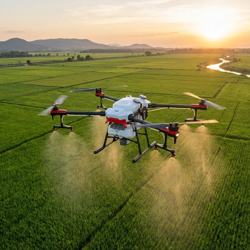
That was the backdrop for one of the more frustrating monitoring jobs I dealt with before compact cinewhoop-style platforms became part of the toolkit. The site was a solar farm spread over uneven ground with access roads twisting between sections. We needed visual confirmation of panel conditions, mounting integrity in select rows, vegetation encroachment near perimeter zones, and a clearer sense of how water was moving after rainfall. A larger conventional drone handled broad overhead mapping well enough, but it was clumsy whenever the mission moved close to structures or dipped into irregular terrain.
That is where Avata changed the workflow.
Why Avata fits this kind of site
Avata is not the aircraft I would reach for if the assignment were pure corridor mapping or broad-acre orthomosaic capture. That would be forcing the wrong tool into the wrong role. Its value on a solar farm comes from something else: controlled close-range situational flying in spaces where terrain and infrastructure create visual and physical complexity.
On a solar site with elevation changes, a drone has to do more than stay airborne. It has to remain stable near rows, behave predictably when the ground rises under it, and help the pilot maintain confidence when flying through constrained gaps or around equipment clusters. Avata’s design is well suited to that environment. The ducted propeller layout matters in practical terms. Around solar infrastructure, that extra margin is not an abstract safety bullet point. It changes how comfortable a pilot can be when inspecting around mounting structures, service pathways, combiner boxes, and vegetation edges.
Its obstacle sensing is another reason it earns space in the case-study conversation. When people hear “obstacle avoidance,” they often think of it as a universal shield. It isn’t. On a solar farm, obstacle awareness is most helpful as part of a disciplined inspection method, especially when the site has changing elevation and mixed obstacles that appear quickly in an FPV-style route. The operational significance is straightforward: it reduces the workload in moments when the pilot is already balancing terrain, narrow flight lanes, and the reflective visual clutter created by panel rows. That doesn’t replace planning. It makes close inspection more manageable.
The specific problem: repeat visibility in broken terrain
The site that convinced me had a simple recurring problem. Our asset team wanted more than top-down views. They needed repeatable low-altitude passes that showed edge conditions and selected hardware zones from angles the maintenance contractor could actually use.
The challenge was that several sections of the farm sat on stepped terrain. From a higher-altitude platform, you could see the layout, but not the nuance. From the ground, you could inspect individual issues, but not understand how one local problem connected to adjacent rows or drainage paths. The missing layer was an aircraft that could move low, smoothly, and with enough precision to collect inspection footage without turning each pass into a stress exercise.
Avata gave us that middle layer.
Because it is built for immersive, controlled flight rather than just static overhead capture, it can trace the shape of a site in a more intuitive way. On sloped installations, that matters. Flying parallel to panel rows while terrain rises and falls beneath the aircraft is one of those tasks that sounds routine until you actually do it in changing wind and light. Avata’s stabilized FPV behavior made those passes far more consistent than the improvised methods we had used before.
What changed on site
The first noticeable difference was confidence around proximity work.
On solar farms, useful footage often comes from flights that stay close enough to reveal detail without becoming reckless. You might need to skim alongside row edges, inspect aisle conditions, look beneath the visual horizon of one terrace to understand what sits behind it, or approach inverter and cable routing zones from an angle that tells a maintenance supervisor something meaningful. With Avata, those flights felt less like compromise and more like intentional capture.
The second improvement was route continuity. On this site, one monitoring run involved moving from an upper section of arrays, dropping along a service path, rounding a fenced equipment pocket, then returning along a lower terrace to compare vegetation growth near panel edges. A larger multirotor could do pieces of that mission. Avata could make it one coherent sequence. That continuity is valuable because operators and site managers do not think in isolated frames. They think in relationships: this row to that drainage cut, this inverter zone to that erosion line, this vegetation patch to the adjacent array.
The third change was visual communication.
A lot of drone footage looks impressive and says very little. Solar farm operators need imagery that answers field questions. Avata’s ability to capture smooth, close-range motion made it easier to produce footage that maintenance teams could review without guessing what they were looking at. Instead of abrupt position changes and awkward transitions, they got a cleaner sense of spatial context.
Obstacle avoidance in real solar-farm conditions
This is one area where generic articles often stay too vague, so let’s make it concrete.
A solar farm in complex terrain presents a layered obstacle environment: support structures, cable runs, isolated poles, perimeter fencing, scrub growth, service vehicles, and terrain itself. Add panel reflectivity and repetitive geometry, and pilot perception can get busy fast.
Avata’s obstacle awareness helps most when you are transitioning between open segments and constrained ones. Think about descending from a broad overflight into a narrower inspection lane along an equipment corridor. That is exactly the sort of moment where a pilot is processing multiple references at once. The practical significance is not just “avoid crashing.” It is smoother tempo. Fewer abrupt corrections. Better footage. Less pilot fatigue over repeated passes.
That matters on a large monitoring day because consistency is what allows comparison over time. If every flight path is uneven, every review session becomes slower and more subjective.
ActiveTrack, subject tracking, and what actually matters here
Since the broader conversation around Avata often includes ActiveTrack and subject tracking, it is worth putting those ideas in the right context for solar farms.
For this kind of mission, you are usually not tracking a fast-moving subject in the cinematic sense. The more relevant use is controlled following of moving maintenance vehicles or personnel along service roads during site audits, training captures, or operational walkthroughs, where maintaining context around terrain and infrastructure is useful. When handled carefully and within site safety procedures, tracking tools can help document how teams access specific farm sections, how ground routes interact with array placement, and where bottlenecks exist in rough terrain.
That operational significance is easy to overlook. On a complex site, inefficiency often hides in movement patterns. If one inverter block is consistently awkward to reach after rain, or one service route forces unnecessary detours around terrain breaks, a well-captured follow sequence can reveal it faster than a spreadsheet ever will.
QuickShots and Hyperlapse are not just “marketing modes”
I’ve seen pilots dismiss QuickShots and Hyperlapse as features for social clips. That misses the practical angle.
For solar asset owners, stakeholder reporting often needs more than evidence. It needs clarity. A short, repeatable automated sequence can show the relation between topography and array layout far better than a still image dropped into a slide deck. Hyperlapse, used selectively, can document cloud movement, shadow progression, access activity, or weather-driven changes in site conditions over time. On uneven solar sites, that perspective can help non-technical decision-makers understand why one section behaves differently from another.
QuickShots, when used with restraint, can also support before-and-after reporting around maintenance works, vegetation clearing, drainage improvements, or row repairs. The point is not to create flashy output. The point is to compress context into a format busy teams will actually review.
Why D-Log matters in inspection communication
One of the most underappreciated parts of drone work on industrial sites is color consistency.
Solar farms are visually harsh environments. Reflective panels, bright sky, dusty service roads, scrub vegetation, metal hardware, and sudden contrast changes between terraces can make footage difficult to interpret if the image profile falls apart in highlights or shadows. That is where D-Log becomes useful.
The value of D-Log is not that it sounds technical. The value is that it gives more room in post-production to balance exposure across scenes with extreme contrast. Operationally, that means the final review footage can preserve more detail in the panel field while keeping surrounding terrain legible. If your job is to show edge encroachment, standing water traces, hardware anomalies, or structural context under mixed lighting, that flexibility matters.
In the case of our hillside site, D-Log helped us bring consistency to footage gathered at different times of day. That made side-by-side review more reliable. For teams assessing site condition over weeks or months, consistency beats drama every time.
The human factor: reduced friction for repeated missions
The biggest reason Avata earned a place in the workflow was not a single specification. It was the reduction in friction.
That may sound soft compared with a checklist of features, but it is what determines whether a drone becomes a real operational tool or just an occasional novelty. When a platform lets you capture close-in terrain-aware footage with less setup friction and better route confidence, teams use it more often. When they use it more often, monitoring quality improves.
On this site, the drone was no longer just for broad overviews or one-off visuals after a storm. It became useful for recurring checks: vegetation progression, access-path condition, edge-of-array inspection, drainage observation, and maintenance documentation in sections where ground perspective alone was too limited.
That is the threshold that matters. Not whether a drone can fly over a solar farm once, but whether it can integrate into a repeatable monitoring routine without becoming a burden.
Where Avata does and does not belong in a solar workflow
Used properly, Avata is excellent for:
- close-range visual inspection in constrained or uneven sections
- terrain-following observation along service paths and row edges
- contextual footage for maintenance planning
- operational storytelling for internal reporting
- training captures that show how crews move through the site
It is less suited to:
- high-precision survey replacement
- large-scale mapping as a primary mission type
- specialized thermal analytics by itself
- jobs where long-range broad-area efficiency is the only objective
That distinction is healthy. The best drone programs are built on role clarity, not wishful thinking.
A practical takeaway for solar operators
If your solar farm sits on flat, open land and your only need is periodic overhead review, Avata may be supplementary rather than central. But if your site includes terraces, broken ground, equipment pockets, access complications, and inspection points that benefit from low, controlled, close-in visual flight, it can solve a very specific problem that larger aircraft often leave partially unanswered.
That was my experience. The breakthrough was not spectacular footage. It was useful footage gathered with less strain in a place that had always made close aerial inspection harder than it looked.
If you are evaluating whether that kind of workflow fits your site, it helps to discuss the terrain, inspection routine, and reporting needs before choosing a flight method. If you want to compare setups for solar monitoring, you can message the team directly here.
Avata works best when you stop asking it to be everything. On a complex solar farm, it doesn’t need to be everything. It just needs to be the aircraft that finally makes the difficult middle distance easy to inspect.
Ready for your own Avata? Contact our team for expert consultation.