Monitoring Windy Solar Farms With DJI Avata
Monitoring Windy Solar Farms With DJI Avata: A Field Report From Mapping Conditions That Don’t Forgive Sloppy Flights
META: Field-tested insights on using DJI Avata around windy solar farms, with practical notes on stable flight planning, image quality, overlap discipline, antenna handling, and why survey-grade habits matter.
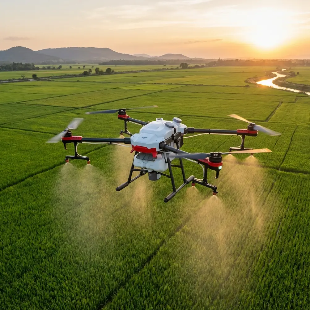
Solar farms look simple from the access road. Long rows. Repeating geometry. Open sky. Little shade. In practice, they can be one of the more deceptive environments to fly.
I’ve spent enough time around large photovoltaic sites to know that wind does not move through them evenly. It tunnels between panel rows, curls around inverter stations, and changes character as soon as the terrain drops or rises. Add reflective surfaces, metallic structures, and the occasional electromagnetic disturbance near equipment clusters, and a routine drone flight can become a test of discipline.
That is where the Avata becomes interesting.
Not because it replaces a dedicated fixed mapping platform. It doesn’t. And not because every feature in the marketing sheet matters on a solar inspection day. Most of them don’t. What matters is how a compact FPV-style aircraft behaves when the environment is messy, the visual scene is repetitive, and the operator needs stable, usable imagery rather than dramatic footage.
This report is built around a technical surveying reference for rural cadastral aerial mapping. At first glance, that may sound far removed from a wind-exposed solar farm. It isn’t. The reference contains the kind of tolerances and image discipline that separate pretty flight logs from operationally useful results. When you apply those principles to Avata work, the aircraft becomes far more useful for civilian inspection and monitoring.
The real challenge is not just wind
Wind is obvious. The harder issue is consistency.
On a solar site, you are often trying to compare one flight period against another. That could mean checking vegetation encroachment, spotting storm damage, documenting panel soiling patterns, or reviewing drainage changes along access lanes. If the aircraft path, image angle, altitude behavior, and lighting control are sloppy, the comparison loses value fast.
One of the most useful details from the survey reference is the insistence on tight control of aircraft height variation. It states that on the same flight line, the altitude difference between adjacent images generally should not exceed 30 meters, and the difference between the highest and lowest altitude generally should not exceed 50 meters. It also says the difference between actual and designed altitude generally should not exceed 50 meters.
Those numbers come from mapping practice, but the operational significance carries directly into solar monitoring. If you let height drift badly over panel fields, your image scale changes too much from one section to the next. That makes defects harder to compare and complicates any attempt to build a reliable visual record over time. With Avata, especially in gusty air, that means resisting the temptation to “ride” the terrain loosely when the mission calls for consistent observation. Small aircraft invite casual flying. Solar assets punish it.
Why image angle matters more than many Avata pilots expect
The source document also specifies that nadir-looking image tilt generally should not exceed 2°, and the photo rotation angle generally should not exceed 7°, with the note that this should not persist for three consecutive photos. Again, these are survey constraints, but the underlying lesson is sharp: geometry matters.
On solar farms, repeated module rows create a visual pattern that can fool the eye into thinking footage is good because it looks cinematic. But if your camera angle wanders too much, row alignment becomes difficult to assess, panel edge detail loses consistency, and repeat inspections become less trustworthy.
Avata is agile, and agility is a double-edged tool. It lets you hold unusual lines in turbulent air and get close where larger drones feel clumsy. It also encourages unnecessary motion. For monitoring work, especially when capturing straight inspection passes above panel arrays or along fencing and drainage channels, the best Avata pilots fly in a way that feels almost restrained. Stable horizon. Predictable yaw. Minimal tilt drift. Boring, in the best sense.
That discipline gives obstacle avoidance a more practical role than many people realize. Around panel rows, cable trays, weather stations, and perimeter structures, obstacle sensing is not there just to save the aircraft. It helps preserve the quality of the pass. A flight that avoids sudden corrective inputs is often a flight that produces cleaner inspection media.
Timing is not a detail; it decides whether the data is usable
The reference document is unusually clear on flight timing. It recommends flying when vegetation and other cover have minimal impact on mapping, and when there is less cloud, less haze, no dust, and good atmospheric transparency. It also notes the need for sufficient illumination while avoiding excessive shadow.
That is exactly right for solar work.
A wind-swept site after maintenance traffic has stirred up dust can look acceptable through goggles and still produce weak imagery for analysis. Thin haze softens contrast across rows. Harsh low-angle sun exaggerates shadows beneath panel edges and support structures, making it harder to interpret what is dirt, what is structural shading, and what is just geometry.
This is one place where photographers have an advantage. You start to read the site not just as airspace, but as a surface of changing reflectance. Solar glass can flare unpredictably, and rows can alternate between clean readable texture and mirror-like glare depending on sun angle. If I’m flying Avata for monitoring rather than promotional work, I care much less about dramatic light than about controlled light.
D-Log can help preserve tonal flexibility in difficult scenes, especially when bright reflective panel surfaces sit next to darker service roads or vegetation. But no profile fixes bad timing. If the air is dusty and the shadows are ugly, reschedule if you can. The reference’s emphasis on atmospheric clarity is not bureaucratic fussiness. It is image survival.
Electromagnetic interference is manageable if you act early
Solar farms bring their own quiet complications. Inverter blocks, transformers, power collection systems, communications equipment, and metallic infrastructure can create local signal weirdness. Usually it is not dramatic. More often it appears as a momentary control hesitation, inconsistent video transmission, or an area where the link feels less comfortable than the open site around it.
This is where fieldcraft matters more than product specs.
If I notice a suspicious link behavior near equipment clusters, I do not push deeper and hope it clears. I adjust my position and the antenna orientation first. Often that means stepping laterally to reopen a cleaner line between controller and aircraft, raising the controller angle slightly, and avoiding standing directly beside metallic structures that can complicate the signal path. On a windy solar farm, that small pause can make the difference between a clean inspection segment and a ruined one.
The point is not that Avata is unusually vulnerable. The point is that a compact FPV platform demands active signal awareness. In a repetitive industrial landscape, pilots sometimes fixate on obstacle avoidance and forget radio geometry. If your team wants a practical workflow for Avata operations around interference-prone utility sites, share the mission details through this field coordination chat before the flight day and sort out where the likely signal trouble spots are.
Overlap discipline translates surprisingly well to solar monitoring
The source document calls for high image overlap: 85% to 90% forward overlap and 80% to 85% side overlap. That is a classic survey standard, and obviously the Avata is not the first tool most people would choose for full orthomosaic production at scale. Still, the principle is valuable.
On a windy solar farm, overlap gives you margin.
If one segment picks up motion blur from a gust, if one pass suffers from glare, or if a panel row briefly occludes a detail you need, dense visual redundancy can save the dataset. Even if you are not building a formal map, repeated and overlapping coverage improves your chances of detecting subtle anomalies later. For documentation flights, many pilots under-collect because they are thinking like filmmakers. Inspectors should think like archivists. Gather enough visual continuity that the site can be reread after the aircraft is packed away.
This is also where features like QuickShots and Hyperlapse need context. They are useful for communication, not diagnosis. A Hyperlapse can reveal cloud movement, traffic flow, or maintenance progress around a site over time. A carefully framed automated shot can help stakeholders understand layout. But neither replaces disciplined linear capture when the goal is asset monitoring. On operational days, the smartest use of these modes is selective and secondary.
Subject tracking is less relevant than path repeatability
People often ask whether ActiveTrack or subject tracking has a place here. For solar farms, usually not in the way consumer pilots imagine.
You are not chasing a moving athlete. You are trying to repeat lines across static infrastructure under unstable wind. If there is a moving subject worth following, it is more likely to be a maintenance vehicle or a technician convoy traversing the site for workflow documentation. In that case, tracking can add context. But for panel inspection logic, repeatable path geometry matters far more than autonomous subject following.
That said, the technologies behind subject tracking and stabilization still matter indirectly. Anything that helps the aircraft hold its intended framing in a crosswind contributes to more useful footage. The operational test is simple: can you fly the same lane twice and get comparable media? If not, no smart feature list will rescue the mission.
Survey-grade thinking improves even non-survey flights
The reference document also specifies control-point precision of ±20 mm in both planimetric and elevation relation to nearby control points. Avata is not the platform you choose when you need that class of survey output. But those numbers are still worth mentioning because they define the culture behind reliable aerial work: error is measured, constrained, and understood.
For solar monitoring teams, the lesson is not to pretend Avata is a cadastral mapping aircraft. The lesson is to import the same seriousness about tolerances. Decide what “good enough” means before takeoff.
Is the mission for visual change detection across access roads after heavy rain? Then lock a repeatable altitude, camera angle, and time-of-day window.
Is it for structural overview of tracker rows after high winds? Then prioritize line continuity, side visibility, and conservative speed.
Is it for stakeholder reporting? Then capture your clean inspection set first and only then use cinematic passes for presentation.
That mindset is what turns Avata from a fun aircraft into a reliable working tool.
Where Avata genuinely fits on windy solar sites
Avata works best on solar farms when the mission sits between pure cinematic capture and full-scale survey mapping.
It is particularly useful for:
- close visual runs along panel corridors
- post-weather condition checks
- documenting perimeter fencing, drainage, and service routes
- collecting low-altitude context around inverter pads and support infrastructure
- training new visual inspection teams to read aerial perspectives in complex row layouts
Its compact size and nimble handling help when wind is present but not extreme, and when the site includes obstacles or narrow corridors that make larger aircraft awkward. Its value drops when the job depends on broad-area, highly uniform mapping efficiency over very large acreage. That is not a criticism. It is proper tool matching.
The more interesting point is that Avata can inherit good habits from formal aerial survey practice. Hold altitude tightly. Keep the camera geometry controlled. Fly in clear atmospheric conditions. Avoid excessive shadow. Build overlap margin. Watch for signal irregularities near electrical infrastructure and respond with position and antenna adjustment rather than optimism.
Those are not glamorous skills. They are the reason the footage remains useful a month later.
Final field note
The strongest Avata operators on industrial sites are usually not the ones doing the flashiest flying. They are the ones who understand that a solar farm is a measurement environment, even when the output is “just” visual monitoring. The rows are repetitive, the wind is uneven, and the site can trick you into accepting mediocre capture because everything looks similar from above.
Do the opposite. Fly with intent. Borrow the rigor of mapping, even when you are not producing a map.
That is where Avata earns its place.
Ready for your own Avata? Contact our team for expert consultation.