Avata for Solar Farm Recon in Extreme Temperatures
Avata for Solar Farm Recon in Extreme Temperatures: A Technical Review from the Mapping Side
META: A field-driven technical review of using Avata around solar farms in extreme temperatures, with lessons from UAV mapping systems, ground control, low-altitude imaging, and practical workflow upgrades.
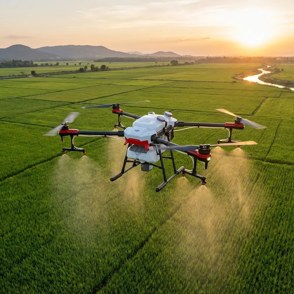
Solar farms look simple from the road. Long rows. Repetition. Clean geometry. In practice, they are demanding inspection environments. Heat shimmer can ruin visual clarity, wind behaves differently above panel arrays than over open soil, and site managers often need fresh situational awareness fast, not after a slow traditional survey cycle. That is where the conversation around Avata gets interesting.
Most people frame Avata as an FPV aircraft for immersive flying. That misses part of the picture. In the right civilian workflow, especially for quick site reconnaissance and visual condition assessment, its low-altitude agility can be genuinely useful. Not as a replacement for every mapping aircraft. Not as a one-tool answer. But as a highly responsive platform for close-range observation where time, access, and terrain complexity matter.
The most useful way to judge Avata for solar farm scouting is not by hype around FPV flight, but by principles that have already been established in unmanned aerial surveying. A 2015 Chinese technical article on UAV use in modern mapping still holds up on the fundamentals. It argued that UAV mapping systems had already become important infrastructure for emergency surveying support, and it described a point that many operators still underestimate: the key part of UAV flight control is the ground control system.
That matters more for Avata than many casual users realize.
Why the Ground Control Idea Still Matters for Avata Operations
In the source material, the ground control system is described as more than a simple monitor. It includes a portable computer, omnidirectional antenna, power system, and monitoring software, all working together to set flight parameters and process navigation signals and aircraft dynamics in real time. The article specifically calls out continuous calculation of pitch, roll, yaw, position, speed, altitude, and airspeed so the aircraft can stay on its planned path and collect information at designated points.
Even if your Avata workflow does not mirror a classic survey rig one-for-one, the operational lesson is clear: successful aerial data work is built on disciplined control, not just camera quality.
At a solar farm in extreme heat, that principle becomes practical immediately. The aircraft is only one part of the job. The real system includes preflight planning, battery temperature management, observer coordination, signal stability, live visual interpretation, and post-flight organization of imagery into something maintenance teams can use. If the operator treats Avata like a freestyle toy, the result is cinematic footage with weak diagnostic value. If the operator treats it like a compact remote sensing node, the output becomes far more useful.
This is where features like obstacle avoidance become operationally meaningful rather than promotional. Solar sites are full of repetitive structures, fencing, inverter stations, cable runs, poles, access roads, and occasional vegetation encroachment. In extreme temperatures, the pilot is also managing personal fatigue and reduced concentration over time. Any system support that reduces collision risk and stabilizes close-proximity flying around infrastructure can improve both safety and inspection consistency.
Low Altitude Is Not a Limitation Here
One of the most striking details in the source article is the note that UAV operations often fly below 1000 meters, which lowers site requirements and supports flexible, rapid-response work. For solar farm scouting, that is not a drawback. It is the whole point.
You do not need a high-altitude overview every time. Often, you need to answer narrower questions:
- Is there visible soiling concentrated in one block?
- Are perimeter roads washed out after weather stress?
- Is vegetation creeping into access corridors?
- Are there obvious signs of cracked glass, debris, pooling water, or loose hardware?
- Is a thermal follow-up mission justified in a specific section?
Avata is strongest when those questions need fast visual confirmation at low altitude and close range. It can move along rows, inspect access gaps, and provide immediate perspective under conditions where larger mapping aircraft may feel less practical for a quick-response check.
The same article also emphasizes that lower flight altitude enables acquisition of large-scale, high-precision imagery and gives UAVs a major advantage in local information capture. That applies directly to solar farms. A site manager usually does not just need “an image of the property.” They need local detail. They need to know what is happening in one troublesome corner, one row cluster, one drainage edge, or one equipment pad. Avata’s style of flight lends itself to that kind of local intelligence.
Extreme Temperatures Change the Mission Profile
Solar farms in very hot or very cold climates create a different operational rhythm. In heat, electronics and batteries are under stress before takeoff. Air density shifts aircraft behavior. Surface glare from panels can be intense. Midday sunlight can flatten contrast even while ground temperatures rise to punishing levels. In cold conditions, battery chemistry and pilot dexterity become the concern.
This is where the source article’s broader message about timely and accurate information becomes especially relevant. It states that UAV-based image acquisition improves timeliness, relevance, accuracy, and reliability of collected information. For solar assets spread across large areas, those four qualities are not abstract. They define whether maintenance can act before small issues become production losses.
Avata is particularly good at generating immediate, clear, intuitive visual information from angles people on the ground simply do not have. That “intuitive” part is easy to overlook, but the source paper highlights it well: high-resolution digital imaging from UAV platforms can provide real-time, clear, direct, accurate, and dependable imagery. For O&M teams under pressure, a clear visual answer from the field can be more actionable than a dense batch of delayed files waiting for processing.
That does not turn Avata into a full photogrammetry platform for every site deliverable. It does make it a strong aircraft for first-look reconnaissance, post-weather inspections, route familiarization, and targeted visual follow-up in harsh conditions.
What Avata Does Well Around Panel Arrays
FPV aircraft can reveal problems conventional overhead passes sometimes miss. The value is in perspective and movement. A pilot can work low, read site geometry in three dimensions, and inspect awkward transitions where terrain, structures, and equipment meet.
For solar farms, that usually means:
1. Fast route scouting before a larger mission
If a site is large and conditions are unstable, Avata can be the first aircraft up. It can identify no-go zones, dust-heavy sections, soft access roads, standing water, animal intrusion points, or construction changes before a more structured mapping or thermal job begins.
2. Localized visual verification
When monitoring data suggests underperformance in a section, teams often need visual context. Avata can quickly inspect around combiner boxes, inverter areas, fencing, drainage paths, or row edges to establish whether there is visible damage or obstruction.
3. Safer look-ins around constrained spaces
Its compact form factor and guarded prop design make it more comfortable for close inspection around non-open areas than many larger platforms, especially for trained pilots who need visual access without overcommitting a bigger aircraft.
4. Training and site familiarization
New site teams can use Avata footage to understand layout, hazards, and maintenance routes. That is a civilian use case with real value. The source article framed UAV systems as an important support tool for emergency surveying and dynamic geographic information. Training sits naturally beside that. Better familiarity means fewer wasted trips and sharper response when weather or equipment issues emerge.
The Third-Party Accessory That Actually Helps
A lot of accessories add clutter. One category does the opposite: anti-glare and lens protection solutions built for harsh light. On solar farms, reflected light can be brutal. A good third-party ND filter set can improve shutter control, manage highlights, and produce footage that is easier to review for actual conditions instead of being distracted by glare and uneven exposure.
That sounds like a filmmaker’s concern until you review inspection footage in bright conditions. Controlled exposure is not just aesthetic. It can preserve detail in panel surfaces, row edges, and surrounding ground features that might otherwise wash out. For this kind of work, an ND filter set is not decoration. It is one of the more practical upgrades you can make.
A sun hood for the viewing device can help too, but if I had to mention one accessory that materially enhanced field capability, it would be quality third-party ND filters used with discipline.
What About Subject Tracking, QuickShots, Hyperlapse, D-Log, and ActiveTrack?
These terms get thrown around loosely, and not all of them are equally relevant in a technical solar workflow.
- D-Log matters if you want more grading latitude and better highlight management in punishing sunlight. It can help preserve visual information in high-contrast conditions, especially when documenting broad site context.
- Obstacle avoidance has direct value around fixed infrastructure and repetitive rows where pilot fatigue can creep in.
- QuickShots are less central to serious inspection, though they can be useful for producing clear stakeholder overviews without manually flying repeatable reveal movements every time.
- Hyperlapse can help document environmental movement, weather approach, or construction progress over time, but it is niche for routine scouting.
- Subject tracking and ActiveTrack should be approached carefully in a solar farm context. For infrastructure inspection, manual control is usually preferable. Automated tracking can be useful in some training or vehicle-follow support scenarios on access roads, but it should not replace deliberate pilot judgment near dense assets.
That is the difference between a feature list and an operational workflow. The right feature is the one that reduces ambiguity on the job.
Why This Fits the Mapping Mindset
The source article was not about Avata specifically. It was about UAV systems in modern surveying. Still, its logic fits this use case almost perfectly.
It argues that expanding UAV mapping applications is an urgent need for stronger emergency support, more current surveying outputs, and better access to dynamic geographic information. Replace “surveying outputs” with “asset condition awareness” and you have the modern solar farm challenge in one sentence.
Site conditions change quickly. Dust, erosion, storm debris, thermal stress, vegetation growth, and access issues do not wait for a scheduled annual review. Managers need current field intelligence. Avata’s value is that it can gather that intelligence quickly, visually, and from a low-altitude perspective that often exposes local site realities better than a high-level overview.
The article also highlights high-overlap imaging as a reliability advantage in downstream processing. While Avata is not the first aircraft many teams would choose for a formal corridor-style mapping block, the principle still applies: consistency matters. If you use Avata for recurring site recon, standardize your routes, altitude bands, camera settings, and review procedure. Repeatability is what turns footage into operational evidence.
A Practical Workflow for Solar Farm Recon
Here is the workflow I recommend for teams evaluating Avata in extreme environments:
- Use Avata for the first visual pass, especially after weather events or when SCADA flags an abnormal zone.
- Fly low and intentionally, focusing on row edges, drainage, perimeter fencing, inverter pads, and terrain transitions.
- Use ND filters and stable exposure settings to preserve field detail under high reflectivity.
- Keep the ground segment organized, because the source material is right: the control system is central. Monitor flight parameters closely and log observations while still on site.
- Tag imagery by block or fault area immediately so maintenance crews can act without replaying the entire mission.
- Escalate to specialized thermal or mapping platforms when needed, once Avata confirms where the problem is likely concentrated.
That division of labor is where Avata shines. It shortens the distance between suspicion and visual confirmation.
Final Verdict
For solar farm scouting in extreme temperatures, Avata is most effective when treated as a precision recon aircraft, not a do-everything survey machine. The old surveying literature still gives the best framework: low-altitude UAVs are valuable because they respond quickly, capture detailed local information, and deliver timely, reliable imagery when conditions on the ground are changing fast.
Two details from that source deserve to stay front of mind. First, the ground control system is the key part of flight control because it continuously manages parameters like pitch, roll, yaw, position, speed, and altitude. Operationally, that means disciplined mission control is what turns Avata footage into dependable inspection output. Second, low-altitude UAV imaging can provide high-precision local detail and improve the timeliness of geographic information. In a solar farm environment, that translates directly into faster diagnosis, better maintenance prioritization, and fewer blind spots across sprawling assets.
If you are building a civilian workflow around Avata for harsh-site reconnaissance and want to compare accessories, control setup, or deployment ideas, you can message the field team here.
Ready for your own Avata? Contact our team for expert consultation.