Avata: How I’d Scout a High-Altitude Solar Farm When Fast
Avata: How I’d Scout a High-Altitude Solar Farm When Fast Coverage Matters More Than Hype
META: A practical expert guide to using Avata for high-altitude solar farm scouting, with lessons drawn from real drone delivery constraints, obstacle avoidance checks, D-Log capture, and pre-flight cleaning for safer operations.
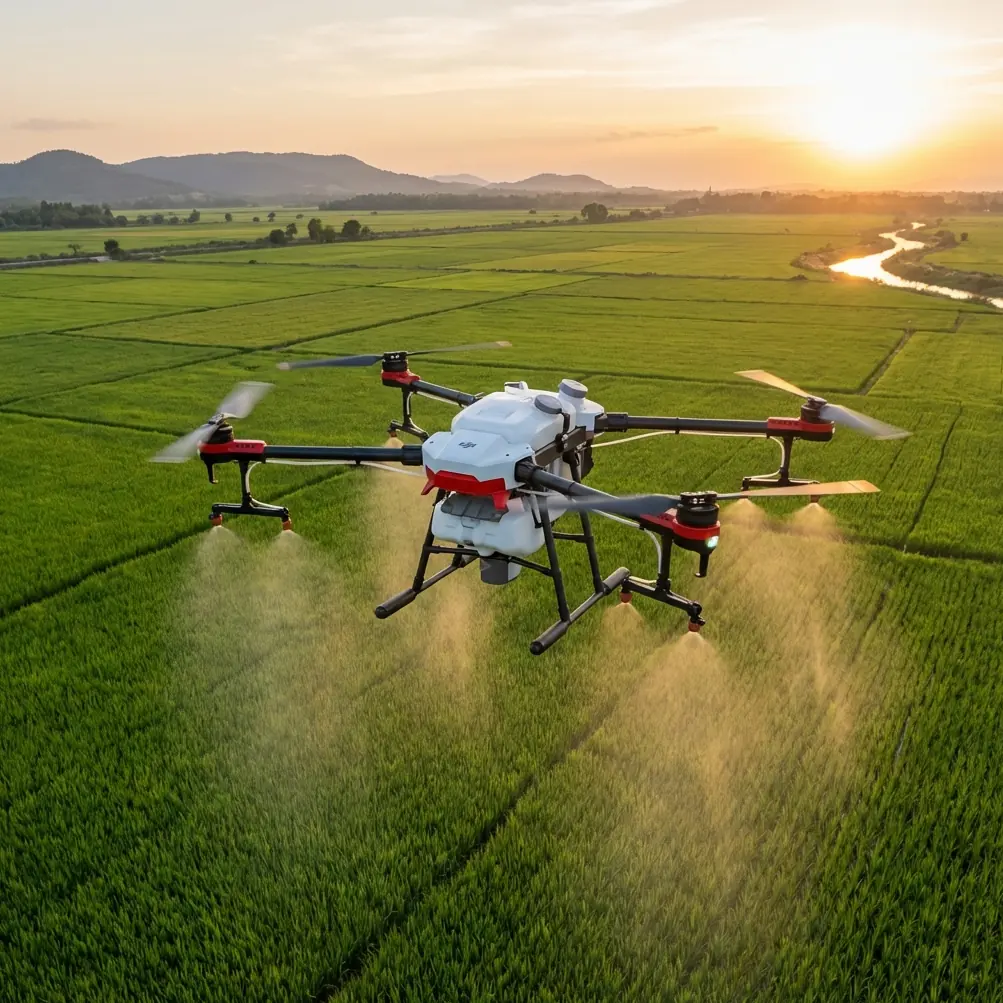
High-altitude solar sites have a way of exposing every weak assumption in a drone workflow.
Thin air changes handling. Wind comes over ridgelines in ugly bursts. Reflective panels can confuse your eyes and flatten depth perception. And when the site is large enough, the real challenge is not simply getting airborne. It is getting useful visual intelligence quickly, safely, and repeatedly.
That is where the conversation around Avata gets interesting.
Not because Avata is a delivery drone. It is not. But because the most public drone promises in recent years have trained people to focus on headline speed instead of operational reality. One high-profile reference point is Amazon’s long-discussed package drone concept: the idea was delivery within 30 minutes for customers inside a 16-kilometer radius of a warehouse, carrying parcels of about 2.27 kilograms, a weight bracket said to represent 86% of its package volume. On paper, those numbers are persuasive. In practice, the same source also acknowledged the real blockers: law, technology, safety, and social acceptance.
That gap between promise and field reality is exactly why Avata deserves a more grounded discussion—especially for solar scouting at elevation.
For a photographer’s eye, Avata is not a spreadsheet machine. It is a site-reading machine. It lets you understand terrain, spacing, access roads, inverter areas, fencing, vegetation encroachment, snow remnants, and maintenance paths in a way that static reports often miss. For a solar operations team, that means faster visual triage before sending people deeper into the field.
This article is about how I would actually use Avata for scouting a high-altitude solar farm, with one habit I never skip: cleaning the aircraft before takeoff so the safety systems can do their job.
Start with the right mission: scouting, not proving a concept
A lot of drone content gets distracted by what a platform might do in theory. Solar work benefits more from clarity.
If I am bringing an Avata to a high-altitude site, I am not asking it to replace a mapping rig or carry tools between arrays. I am using it for fast, close-range reconnaissance in areas where line-of-sight interpretation matters:
- checking array rows after weather events
- scouting access paths before a ground crew moves in
- visually inspecting perimeter conditions
- identifying obvious debris accumulation zones
- reviewing terrain transitions around drainage and service roads
- capturing directional footage for planning crew movement and follow-up inspection priorities
That is a very different job from parcel transport. And that distinction matters.
The Amazon delivery model depended on a predictable service radius, payload assumptions, and autonomous navigation around obstacles like buildings and wires. Solar scouting at altitude flips the equation. Payload is usually light, but visual awareness, route discipline, and environmental judgment are everything. You do not need to move 2.27 kilograms of goods. You need to move your camera perspective into the right place without losing margin to wind, glare, or rushed decision-making.
Why Avata makes sense on a solar site
Avata’s value on a solar farm is not about cinematic novelty. It is about access and confidence in tight, visually complex spaces.
Solar installations create repeating geometry. Long reflective rows can become visually monotonous from the air, particularly in bright alpine conditions. A drone that lets you fly lower, read edge detail, and maintain a stable sense of orientation is useful because the job often comes down to noticing what breaks the pattern: one damaged section, one blocked corridor, one washout near a service route.
This is where obstacle awareness and deliberate low-altitude movement matter more than raw top speed. The LSI terms people often search for—Obstacle avoidance, Subject tracking, QuickShots, Hyperlapse, D-Log, ActiveTrack—should not be treated as a checklist. On a working solar site, each one either helps the mission or becomes a distraction.
My priorities would be:
- obstacle awareness around posts, fencing, cabling corridors, and nearby structures
- controlled cinematic capture only when it helps document site conditions
- D-Log when the light is harsh and I need more grading flexibility to recover detail in bright panels and darker terrain edges
- selective tracking tools only when following a clearly identified ground vehicle or walking inspector on a safe path
The biggest mistake is assuming every smart feature should be switched on just because it exists.
The pre-flight cleaning step that actually protects your safety features
Here is the habit that sounds minor until it saves you trouble: before every high-altitude scouting flight, clean the sensors and camera surfaces.
Not casually. Intentionally.
Dust, pollen, moisture spots, and fine grit build up fast on solar sites. At elevation, you can also get dry particulate that is easy to miss until the light hits it. If your obstacle-sensing surfaces or vision-related components are smeared, you are reducing the reliability of the very systems meant to help you around infrastructure.
My sequence is simple:
- Power down and move to a stable prep area away from blowing dust.
- Inspect the camera lens and protective surfaces under angled light.
- Check the aircraft body around sensing areas for dirt, bug residue, or dried moisture.
- Use the correct cleaning tools—nothing abrasive.
- Recheck before takeoff after battery installation, because windy staging areas can undo your prep quickly.
Operationally, this matters for two reasons.
First, obstacle-related systems depend on clear input. Around solar arrays, a misread is not theoretical. You are often near rigid edges, narrow service corridors, support hardware, and occasional utility obstacles. A dirty sensor surface can reduce the margin you thought you had.
Second, image quality is part of the inspection value. Bright panels and high-altitude sun exaggerate flaws in the optical path. If you are planning to review footage later for condition cues, dust haze and smearing can strip away useful contrast.
People love talking about advanced autonomy. I would rather start with a clean aircraft.
Building a flight plan that respects thin air and reflective terrain
High-altitude operations reward restraint.
Even when the aircraft feels capable, I fly the first battery like a survey of conditions rather than the main mission. That means using the opening minutes to answer practical questions:
- How aggressive are the gusts near the ridge-facing side of the site?
- Where does glare become strongest relative to my intended headings?
- Are there maintenance vehicles or personnel movements I need to avoid?
- Which sections create the most visual compression from the air?
- Are there birds, loose debris, or thermal currents affecting stability?
A solar farm can look open from the parking area and become deceptively complex once airborne. Repeating rows compress depth. Narrow service lanes tempt low passes. If the site sits within mountain terrain, wind may be manageable in one section and unruly one row over.
This is another reason the Amazon comparison is useful. The delivery vision emphasized range discipline inside a 16-kilometer service area and navigation around common suburban obstacles like wires and buildings. In a solar environment, your radius may be much smaller, but the local complexity can be higher because every pass needs to produce readable information. You are not trying to maximize route coverage. You are trying to maximize interpretation quality.
How I’d actually fly Avata for solar scouting
1. Begin with a perimeter read
I start outside the densest panel area and work the edge. This gives me a clean orientation pass: fencing, gates, drainage routes, access tracks, and any obvious encroachment.
The first objective is not hero footage. It is site logic.
2. Use low, deliberate lines over access corridors
Rather than weaving aggressively between rows, I prefer following service lanes and maintenance paths where available. This creates footage that a site manager can immediately understand later.
A clean corridor pass tells a better operational story than a flashy orbit.
3. Capture oblique angles, not just top-down perspectives
At solar farms, straight overhead views can flatten the scene too much for scouting use. Oblique passes reveal panel alignment, terrain undulation, and relationship between equipment zones.
This is where Avata can shine. It allows for immersive directional footage that helps ground teams understand how one site segment connects to the next.
4. Reserve QuickShots and Hyperlapse for documentation, not decoration
There is a place for QuickShots and Hyperlapse, but not as filler.
A short automated reveal can establish the scale of a ridge-top installation. A controlled hyperlapse can show how weather and cloud movement affect site visibility across a window of time. But if those modes are used, they should support decision-making or stakeholder communication, not dilute the mission with unnecessary motion.
5. Shoot in D-Log when light is fighting you
High-altitude solar fields often produce brutal contrast: bright reflective surfaces, dark equipment shadows, pale sky, and dry ground textures. D-Log can help preserve more usable tonal information for later review, especially when you need to inspect details at the edges of glare-heavy frames.
For a photographer, that is not just an aesthetic choice. It is how you keep useful visual data from washing out.
6. Be selective with ActiveTrack or subject tracking
ActiveTrack and related subject tracking tools can be practical when documenting a maintenance vehicle route or following a walking technician along a safe corridor. But on a dense solar site, I do not treat tracking as a substitute for judgment.
Reflective repetition can challenge visual interpretation. Add wind and elevation, and manual oversight becomes non-negotiable.
Why the delivery-drone numbers still matter to an Avata operator
At first glance, Amazon’s old delivery figures may seem unrelated to a solar scouting article. They are not.
Those numbers highlight a useful truth: drone missions succeed when the mission profile matches the aircraft’s operational envelope.
Amazon’s concept centered on three hard constraints:
- 30-minute fulfillment expectations
- a 16-kilometer service radius
- a package class around 2.27 kilograms
Each number forces tradeoffs in navigation, reliability, safety, and public acceptance. And the source openly recognized that legal, technical, safety, and social barriers made short-term rollout difficult.
For Avata operators, the lesson is simple. Respect constraints early.
Do not overload a scouting mission with mapping expectations it was not designed for. Do not assume obstacle systems excuse poor route planning. Do not expect one battery to answer every question across a mountain site. And do not confuse smooth footage with completed inspection value.
The best drone workflows in solar are rarely the most dramatic. They are the ones that convert flight time into action.
What clients and site teams actually care about
When I hand over footage or observations from a high-altitude solar scout, the most useful outputs are usually practical:
- Which rows or sectors need closer inspection?
- Are access paths clear for trucks or foot teams?
- Did weather leave visible debris or pooling concerns?
- Are there perimeter vulnerabilities?
- Which areas deserve follow-up with a dedicated inspection platform?
That is the business case for Avata in this setting. Fast visual context. Better crew preparation. Fewer blind walks into difficult terrain.
If your team is developing a site-specific workflow for these kinds of missions, it helps to compare notes with operators who understand both drone behavior and solar field realities. If you want to talk through setup choices or scouting methods, you can message an experienced UAV team here.
Final field advice: fly for decisions, not for spectacle
High-altitude solar scouting is a discipline of small advantages.
A clean sensor surface gives your safety features a better chance to read the environment correctly. A thoughtful route avoids confusing, low-value footage. D-Log preserves detail that might matter later. Manual restraint around tracking tools prevents false confidence. And a realistic understanding of drone limitations keeps the mission useful.
That is the real thread connecting Avata and the better-known delivery-drone story. The technology may look futuristic from a distance, but results are won in the details: route design, environmental judgment, aircraft prep, and mission fit.
For solar work, that is enough. More than enough, really.
You do not need a grand promise about airborne logistics to justify bringing Avata to a mountain solar site. You need clear objectives, disciplined pre-flight habits, and footage that helps people decide what to do next.
Ready for your own Avata? Contact our team for expert consultation.