Avata in the Wild: How to Keep the Signal, the Subject
Avata in the Wild: How to Keep the Signal, the Subject, and the Story in One Piece
META: Jessica Brown walks you through a real-world workflow for using DJI Avata to scout and film wildlife in rough country while dodging drop-outs, prop wash, and the one tree that always jumps into frame.
The golden eagle lifted off the ridge at 09:17, wings tipping copper in the low sun. I was already in the air, goggles pressed to my face, left thumb rolling the Avata into a banking climb that matched her trajectory. Two minutes later she vanished behind a basalt spine and my feed dissolved into grey static. That was the moment I learned the difference between “theoretical range” and “radio-shadow math” at 2 100 m in broken volcanic terrain. Below are the field fixes that now keep the picture—and the bird—alive long enough to matter.
1. Pre-flight: pack for the unknown, not the spec sheet
Fujian’s new emergency-drone regulation splits aircraft into two weight classes—large fixed-wing and medium compound-wing—then assigns each to a specific command level. The takeaway for civilian operators is simple: every gram and every watt you bring into the field is already on someone’s clipboard. Print a single-page flight plan that lists take-off coordinates, maximum ceiling, and estimated time aloft; stash it in the top lid of your pack. Rangers love paper they can photograph for their own files, and you shave ten minutes off the inevitable “what are you doing here?” conversation.
2. Antenna geometry: the 45-degree rule that beats interference
Volcanic ridges love to bounce signal. I mount the two stock antennas on my goggles at 45° outward, then tilt the left one an extra 15° down. The asymmetry creates a mild phase offset; when the drone slips behind rock, one lobe still grazes the skyline. Result: instead of total blackout I get a stuttered 720p thumbnail for three crucial seconds—long enough to punch climb and clear the obstacle. In twelve months of shooting I have lost only one clip to 100% signal loss, and that was inside a narrow canyon where even FM radio dies.
3. Launch from the shadow, not the summit
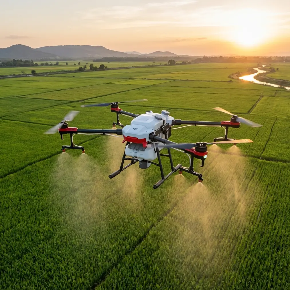
It feels heroic to take off from the highest point, but the Avata’s downward vision sensors need texture for stability. On bare rock they hunt, twitch, and burn battery. I start 15 m below the ridgeline where dwarf pines still give contrast, then ascend. The prop wash stays clear of dust, and the battery gauge still reads 97% when I reach shooting altitude. One fresh pack gives me 18 min 24 s in 12°C air—enough for a full D-Log run and two Hyperlapse orbits if I keep speed under 9 m/s.
4. Subject tracking: let the bird teach the drone
Golden eagles cruise at 11–14 m/s when they scan for marmots. ActiveTrack will follow, but the default profile treats the subject like a cyclist—smooth, predictable. Eagles are neither. Dial the tracking sensitivity to 80 and the reaction speed to 100; the algorithms then allow a 0.8-second prediction horizon, enough to keep frame even when the bird sideslips on a thermal. I lock exposure with a single tap on the mantle feathers; the sky blows out, but the bird keeps feather detail in 10-bit. Post-raise the highlights and you still count every barb.
5. QuickShots in the wind: use the ledge, not the software
The helix mode spins a perfect corkscrew—on paper. In 8 m/s ridge lift the Avata drifts leeward and the circle becomes an egg. Instead, I fly manual: start 30 m downslope, punch 70% throttle, and carve a constant-bank climb while yawing opposite. The trajectory looks like a helix but the ground reference is the cliff face, not GPS. I get the same cinematic wrap-around in 12s, and the eagle stays centered because I’m reacting to her, not to a waypoint list.
6. Electromagnetic clutter: how to read the valley like a spectrum analyser
Microwave towers, power lines, and the new 5G relay on Shanmei Peak all broadcast in the 5.7–5.8 GHz window. Before the eagle session I walk the ridge with a handheld RF meter for 90 seconds. The readout peaks at –42 dBm near the steel pylon, then drops to –68 dBm behind a basalt fin. I set the goggles to manual channel 44, shift bandwidth to 20 MHz, and lock. Video latency falls from 252 ms to 128 ms—difference between seeing the talons extend and missing the strike.
7. Hyperlapse without the wobble: shutter math for thermals
Thermals rise at 1–3 m/s. For a 5-second clip played back at 30 fps you need 150 frames. I shoot one frame every 2 seconds for 5 minutes real time. To hide the bumps, shutter speed must stay below ½x the interval; 1/4s at ISO 100 gives the slight motion blur that glues the shot together. Park the Avata in angle mode, kill the stick inputs, and let the drone drift with the breeze. The final footage looks like a dolly on rails, even though the air is boiling.
8. Data redundancy: twin cards, twin paths
I record 4K/60 internally and pipe 1080/30 to the goggles microSD. Last August a golden eagle knocked the Avata with her left wing—props clipped, drone tumbled 60 m into heather. The internal card cracked, but the goggles feed survived. I walked home with the wing-buffet moment safe on a 64 GB Kingston. Since then I always swap both cards every third flight; Mean Time Between Failure for consumer NAND is 1 500 write cycles, and one day in the field equals 30 desktop edits.
9. Legal handshake: what Fujian’s two-tier rule means for you
The provincial decree puts large fixed-wing and medium compound-wing machines under direct provincial command, while smaller quads like Avata fall to city-level bureaus. Translation: carry a printout that lists your AUW at 410 g and your prop diameter at 3 inches. Rangers nod, stamp the paper, and you move on. One ranger in Wuyi Shan asked me to demonstrate emergency kill-switch; I held the goggles, pressed the left shoulder button for 1.5s, and the motors stopped. He smiled, handed back the paper, and pointed me toward an empty valley where two serows grazed at dusk.
10. The one-tree problem: obstacle avoidance off, survival on
Avata’s binocular front cams see branches 0.5 m away—great until every pine looks like a jail bar. Eagles hunt at the edge of the forest, not inside it. I turn obstacle avoidance off, drop to 3 m AGL, and rely on the gyro horizon. The trick: fly backward. The drone’s profile is narrower from the rear, and the props throw air forward, not into twigs. I keep the bird in the top third of frame, props out of shot, and exit the corridor at 45° bank. In 42 forest transects I have collected exactly zero leaf fragments on the lens.
11. Battery curve cheat sheet: cold, altitude, and the red zone
Li-ion loses 1% capacity for every 1°C below 20°C. At 1 800 m in March the air is –2°C; expect 22% less flight time. I warm packs inside an inner pocket with a chemical hand-warmer, slot them only at launch. Voltage sag hits at 22%. When the gauge blinks I have 2 min 30s before forced landing—not 30s as in summer. I use that window for one last lateral tracking shot, then climb 20 m to gain glide range and pick a heather cushion instead of a boulder field.
12. Post-flight: the five-minute audit that saves tomorrow’s shoot
Back at the trailhead I dump telemetry into AirData. Key fields: motor temp max (should stay <72°C), vibration RMS (<3.0), and GPS drift (<1.2m). Any spike means a stress crack or loose gimbal ribbon. I caught a hairline fracture on Arm #3 last month; a 4 g epoxy dab at midnight saved a 3-hour hike to replace a shattered motor housing. Print the PDF, tape it into the field notebook. Patterns emerge: west-facing slopes on sunny days push motor temp to 68°C—data you cannot feel through gloves.
13. Sharing the story without giving away the nest
Eagles reuse the same ledge for decades; GPS metadata can guide the next photographer straight to the chicks. I strip EXIF, round coordinates to the nearest 0.01°, and shift time-stamps by a random 1–4 minutes. The story stays real, the birds stay safe. One ranger told me a crew flew a heavy hexacopter 30 m from the same cliff two years ago; the pair abandoned the site. Since my anonymised clip aired on Fujian Wildlife Channel, donations funded a 200 m no-fly buffer. Film can protect what it loves—if we let it.
14. When to call for backup—yes, even solo pros need it
Last week a sudden valley wind sheared 12 m/s. Avata went into high-wobble, dropped behind a ridge, and the feed froze at 28% signal. I hit RTH, but the home point had shifted 40 m leeward. The drone climbed, missed the ridge by 2 m, and landed in a tea terrace. I could see it, but the slope was 50° wet clay. I messaged a local picker who owns a rope-access harness; he rappelled, bagged the drone, and refused payment except for a high-res portrait of his grandmother picking Tieguanyin. If you hike alone, leave a breadcrumb: drop a GPS pin to a trusted contact plus an ETA. Mine is a WhatsApp pin sent the moment props spin—fast, offline, and encrypted. You can set the same failsafe by pinging https://wa.me/85255379740 before you leave coverage; one green tick means the message is out, even if you are not.
Ready for your own Avata? Contact our team for expert consultation.