Avata in Harsh Coastal Work: What a New Drone Licensing
Avata in Harsh Coastal Work: What a New Drone Licensing Shift Means When the Weather Turns Mid-Flight
META: A practical expert look at Avata operations in dusty coastal environments, with insight on China’s new independent small and medium UAV license test pilots and what they signal for training, compliance, and safer field work.
The romantic version of drone flying dies quickly on a coastline job.
Salt hangs in the air. Dust lifts off service roads and embankments. Wind looks manageable from the ground until it rolls off the water and starts changing direction in hard, uneven pulses. If the task involves spraying support, site observation, route checks, or visual documentation around coastal operations, the gap between a smooth demo flight and a reliable field workflow becomes obvious fast.
That is where the conversation around Avata gets interesting.
Not because Avata is a heavy industrial spraying platform—it is not. And not because one aircraft solves every coastal problem—it does not. The real value is narrower and more practical: in messy, close-range, high-attention environments, Avata can serve as a nimble visual tool for training, inspection support, operator familiarization, and pre-operation reconnaissance when conditions demand precision and situational awareness rather than broad-area coverage.
A recent policy move from China’s civil aviation side adds weight to that point. The Civil Aviation Administration’s Northeast Regional Administration announced three pilot units for independent test sites for small and medium UAV licenses. That is a specific detail, but it matters far beyond the exam room. When a regulator authorizes three separate pilot entities to run independent examination points for small and medium unmanned aircraft licensing, it signals a maturing framework around operator qualification, standardized evaluation, and localized access to certification pathways.
For anyone using Avata around demanding civilian tasks, that development is not abstract bureaucracy. It points to a more structured future for pilot readiness.
The real problem on coastal jobs is not distance. It is instability.
People often assume coastal drone work is defined by range or image quality. In practice, the hardest variable is instability. Conditions change by the minute. One section of shoreline may be calm while the next is hit by crosswind from a breakwater gap. Dust from vehicle movement can suddenly reduce visibility near launch points. Fine particulate can settle on equipment. Light can flatten the scene, then bounce harshly off the water ten minutes later.
I have seen this happen during what should have been a routine visual support flight near a coastal work zone. The plan was simple: get a low-altitude view of access paths, check how close equipment was operating to embankment edges, and capture reference footage for the team before a larger operation began. The first leg was clean. Then the weather shifted mid-flight.
The wind did not become dramatic all at once. It started with small yaw corrections, then more aggressive buffeting as air rolled inland from the water. Dust that had been sitting low began lifting into the flight path near the service track. In a larger aircraft built for endurance, you may absorb that with mass and power. In a compact platform, handling discipline matters more.
This is where Avata’s appeal in confined or complex environments becomes clear. Its form factor and close-in controllability make it useful when the goal is not to cover acres, but to understand a space intimately: gaps between structures, edge conditions, equipment positioning, and human movement patterns before operations scale up.
Why licensing reform matters even for a compact drone like Avata
The announcement from the Northeast Regional Administration was about three independent test-site pilot units for small and medium UAV licenses. That sounds procedural, but the operational significance is deeper.
First, three pilot units mean access. More test points can reduce friction for operators seeking formal qualification within the approved trial scope. In a country as geographically large and operationally diverse as China, decentralizing testing is not a small administrative tweak. It can shorten the path between training and lawful deployment.
Second, the policy is focused on small and medium UAV license testing. That matters because many real-world civilian workflows are built around precisely those classes of aircraft. The category includes the kinds of platforms commonly used for imaging, inspection, training, site documentation, and operational support. When regulators create dedicated testing structures for these aircraft groups, they are recognizing the breadth of actual commercial demand.
Third, independent examination points can help standardize competence around tasks that are easy to underestimate: airspace awareness, operational judgment, emergency handling, and site assessment. With Avata, especially in tight or visually complex environments, pilot skill is not a formality. It is the difference between useful close-proximity footage and a rushed flight with poor margins.
That is why this licensing story belongs inside an Avata discussion. A compact aircraft invites confidence. A formal licensing culture forces discipline. Those two things need each other.
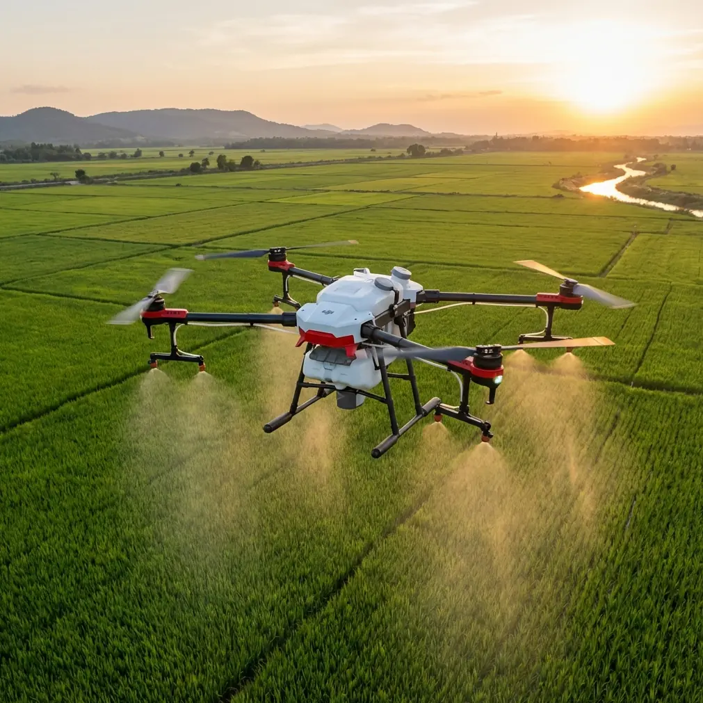
Avata’s best fit in dusty coastal operations
Let’s be precise. If the reader scenario is “spraying coastlines in dusty” conditions, Avata is not the primary spraying aircraft. The best use case is as a support platform around the operation.
That distinction matters because it keeps workflows safe and realistic.
Avata can contribute before, during, and after a coastal treatment or maintenance task in several practical ways:
1. Pre-operation route scouting
Before larger aircraft or field teams move in, Avata can check access lanes, identify loose debris zones, verify distances around obstacles, and confirm whether changing wind is creating turbulence around built structures. In a dusty coastal setting, this early look can prevent wasted time and unnecessary repositioning.
2. Training and pilot familiarization
A compact platform is often better suited for repeated procedural drills than a larger asset used directly in production. If licensing access improves through the newly announced independent test-site pilots, organizations can align Avata-based training with a broader culture of formal qualification. That creates better habits: structured pre-flight checks, environmental risk assessment, and disciplined stick management.
3. Close-range inspection support
Breakwaters, shoreline barriers, fencing, drainage edges, and temporary work areas often need detailed visual review rather than long-range mapping. Avata’s agility can be especially useful where larger aircraft would feel excessive or less comfortable near obstacles.
4. Incident review and workflow refinement
After an operation, Avata footage can help teams understand vehicle positioning, pedestrian flow, equipment spacing, and environmental interference. That makes future missions smoother, especially where dust and wind repeatedly affect launch or staging areas.
The feature set only matters if it reduces workload
Avata discussions often drift into feature-name territory. That is useful only if we connect those functions to field conditions.
Take obstacle avoidance. In a coastal work zone, obstacle risk is rarely limited to obvious structures. You have poles, cables, temporary fencing, machinery, uneven terrain transitions, and sometimes visual clutter caused by blowing dust or flat light. Obstacle avoidance is operationally significant because it reduces the pilot’s cognitive load when flying near infrastructure during support or scouting work. It does not replace judgment, but it can preserve margin when weather shifts and attention gets divided.
Subject tracking and ActiveTrack can also be relevant, though not in the casual lifestyle sense people often associate with them. In training or process review, tracking a moving utility vehicle, a shoreline maintenance team, or a route inspection path can create a cleaner record of how a workflow actually unfolds. The value is not cinematic novelty. It is repeatable observation.
QuickShots and Hyperlapse may sound less industrial, but they can still serve a documentation purpose. A repeatable short automated movement or time-compressed environmental sequence can help supervisors compare dust movement, surf-driven spray drift, traffic around a work area, or changing sky conditions across a shift. Again, the key is controlled use. Features become useful when they support a decision.
D-Log matters for a different reason. Coastal environments are notorious for difficult contrast: bright reflective water, pale sky, darker machinery, and shaded ground features all competing in one frame. A flatter recording profile gives more room to recover detail in post when the goal is analysis or polished reporting, not just social-ready footage.
What happened when the weather changed
On that coastal flight I mentioned earlier, the turning point was not a dramatic gust. It was a subtle sequence. A clean pass along the access road. Then a roughening over the open side. Then dust rising just enough to interfere with visual comfort near the return path.
The pilot did what trained operators should do: stop trying to “finish the shot.”
That decision is worth emphasizing. In unstable conditions, discipline beats persistence. The aircraft was brought back with shorter line choices, wider margin from ground clutter, and a simpler recovery path. Any advanced feature is secondary to that judgment. But aircraft handling and obstacle support helped keep the workload manageable during the shift.
This is exactly why stronger licensing systems matter. A regulated exam framework is not about making drone work look official. It is about normalizing the instinct to abort, reposition, or simplify when conditions stop matching the plan.
The Northeast administration’s move to designate three independent pilot test units is meaningful because it supports that culture at the pipeline level. Better access to testing can produce more operators who understand that successful missions are not defined by completion at all costs.
A smarter Avata workflow for coastal teams
If you are using Avata around shoreline maintenance, environmental observation, spraying support logistics, or site documentation, the most effective workflow is usually the least glamorous one.
Start with a weather threshold, not a creative goal. Coastal winds behave differently around embankments, berms, and built barriers. Define your stop conditions before launch.
Use Avata early in the day for reconnaissance rather than late-stage improvisation. The compact platform is strongest when helping teams understand the site before heavier movement begins.
Treat dust as a workflow issue, not just a cleanliness issue. Launch location, landing surface, vehicle movement nearby, and team positioning all affect air quality around the aircraft.
Build training around repeatable scenarios. The regulatory signal from the newly announced test-site pilot units suggests the market is moving toward more formalized skill validation. Field teams should mirror that trend internally with documented drills, emergency return practice, and condition-based go/no-go decisions.
And keep communications simple. When multiple teams are involved, fancy terminology creates friction. A short shared plan for route, altitude, fallback path, and abort trigger is usually enough. If your operation needs a second opinion on setup logic or training structure, a quick field-oriented discussion can often help more than a long spec sheet; one practical way to start is through this direct operations chat.
Why this small news item deserves attention
Some industry updates look minor until you place them next to daily operations. This is one of those cases.
The Civil Aviation Administration’s Northeast Regional Administration did not announce a new aircraft or a flashy capability. It announced three pilot units for independent small and medium UAV license examination points. On paper, that is an administrative move. In the field, it points to something more valuable: infrastructure for competence.
For Avata users, especially those working in challenging civilian environments like dusty coastlines, structured qualification matters because the aircraft’s usefulness depends heavily on pilot judgment. Tight-space flying, close-range visual work, obstacle-rich environments, and fast-changing weather all reward trained restraint more than boldness.
That is the thread connecting the policy story and the aircraft story.
Avata can be an excellent tool for support, scouting, training, and detailed documentation in places where larger platforms are less nimble. But the better the aircraft fits close-range operations, the more seriously the operator needs to treat preparation and decision-making. Expanded testing access and clearer licensing pathways can only help.
And when the weather shifts mid-flight—as it often does near the coast—that professionalism is what shows first.
Ready for your own Avata? Contact our team for expert consultation.