Avata Field Report: What Windy Coastline Work Teaches You
Avata Field Report: What Windy Coastline Work Teaches You About Altitude, Sensing, and GPS-Denied Discipline
META: A field report on using Avata-style flight logic for windy coastline operations, with practical altitude guidance, obstacle awareness, and lessons drawn from new GPS-denied payload integration trends.
Wind along a coastline exposes every weak habit a pilot has.
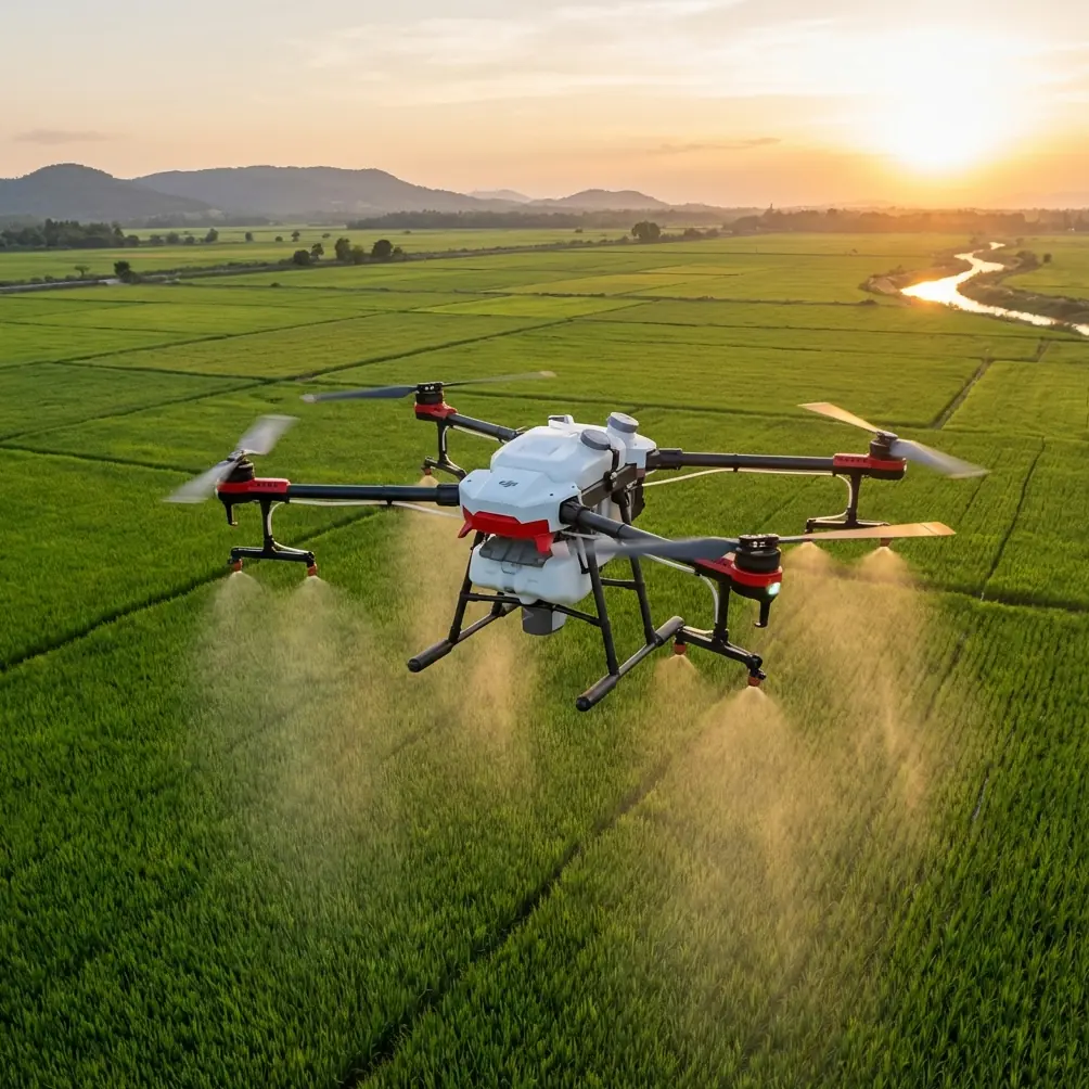
It changes direction around rock faces, rolls over dunes, accelerates through gaps in sea walls, and creates low-level turbulence that can turn an easy pass into a messy one. If your focus is civilian spraying work near coastal edges, the Avata is not a spraying aircraft in the conventional sense. Still, the way it handles proximity, obstacle-rich environments, and visually complex terrain makes it a useful reference point for how pilots should think when operating in these places. That matters because coastline flying is rarely about raw speed. It is about control, judgment, and holding a stable working line when the air is trying to push you off it.
The most interesting recent industry signal comes from outside the Avata family itself. On 2026-04-28, DroneLife reported that Teledyne FLIR Defense expanded its Third-Party Payload Integration Program to include Emesent’s Hovermap LiDAR payload, with the integration announced at Modern Day Marine 2026. Two details stand out. First, the Hovermap system combines LiDAR mapping with radiation detection. Second, it is designed for both air and ground platforms in GPS-denied operations.
That sounds far removed from an Avata flying near a windy shoreline. It is not.
Those facts point to a larger operational reality: the next standard in professional drone work is not just flight. It is resilient sensing when positioning is unreliable and the environment is cluttered, reflective, or confusing. Coastlines create exactly those conditions on a smaller civilian scale. Wet rock, moving surf, glare, sea mist, vertical structures, vegetation, and irregular terrain all challenge pilot perception and aircraft positioning. If you are flying an Avata in this kind of space for site scouting, training, visual inspection support, shoreline documentation, or pre-mission route rehearsal for broader spraying operations, you should be thinking less like a casual camera pilot and more like an operator in a semi-denied environment.
That shift starts with altitude.
The most useful altitude range in windy coastline work
For this scenario, the sweet spot is usually 4 to 8 meters above the immediate working surface when conducting close-range observational passes, and 10 to 15 meters when transitioning between segments or crossing uneven shoreline geometry.
Why that range?
Below about 3 meters near a coastline, rotor wash and local wind interference become harder to read consistently. You are also more exposed to abrupt turbulence generated by wave rebound, rock ledges, fencing, embankments, and scrub vegetation. In practical terms, the aircraft can feel “sticky” one second and loose the next. That is not where you want to build a repeatable line.
Above roughly 15 meters, you gain some clearance, but you start giving away the close environmental reading that makes Avata-style flight useful in the first place. You also expose yourself more fully to broader crosswinds that may be smoother but stronger. For precision observational work around coastline edges, especially where the mission is to understand drift risk, obstacle spacing, or visual access before another aircraft handles the actual application task, too much altitude can disconnect you from the microterrain that matters.
So the operational rule is simple: fly high enough to smooth out the worst surface-level chaos, but low enough to read the terrain honestly.
On many coastlines, that means beginning with a reconnaissance pass at 10 to 15 meters, identifying gust funnels and visual hazards, then dropping into a 4 to 8 meter band only where the air feels predictable and the route is clean. If a section contains sea spray, updraft off rock walls, or sudden lateral wash, climb back out and reset. Discipline beats bravado every time.
What Avata gets right in this environment
Avata’s value in a windy coastal workflow is not that it can solve every difficult condition. Its value is that it encourages a tighter relationship between aircraft, pilot, and environment. The platform’s close-quarters flight character, combined with obstacle-aware operation, makes it useful for pilots who need to inspect a path rather than simply overfly it.
This is where the user-intent phrases people often search for—obstacle avoidance, subject tracking, QuickShots, Hyperlapse, D-Log, ActiveTrack—need to be treated carefully. In a coastline spraying support context, not all consumer-friendly features deserve equal trust.
Obstacle awareness matters more than automation flair
If you are tracing a shoreline edge, the real issue is not cinematic smoothness. It is staying ahead of poles, netting, warning signs, jagged rock protrusions, retaining walls, branches bent inland by salt wind, and sudden elevation changes. Obstacle awareness is operationally significant because coastal routes are full of partial obstacles: things that do not fully block a path, but do intrude enough to create rotor-risk or line deviation.
That is one reason the Hovermap news matters so much. A certified payload that brings LiDAR mapping into GPS-denied operations reflects where professional workflows are headed: richer environmental understanding, not blind confidence. Even if Avata itself is not carrying a LiDAR payload, the lesson transfers directly. In coastline work, pilots should behave as if visual uncertainty is a system limitation to be actively managed.
ActiveTrack and subject tracking are not your coastline strategy
Subject tracking sounds attractive on paper for following a shoreline vehicle or maintenance team, but windy coastal work is full of factors that can degrade the reliability of automated following behavior: shifting contrast from sun glare, breaking waves, variable shadows, and abrupt obstacles entering frame. For inspection support or scouting, manual route control usually produces a safer and more useful result.
ActiveTrack can still have a place in wide-open, low-complexity sections, but it should not define the mission. In this environment, route discipline beats feature dependence.
D-Log is more useful than people think
If your shoreline work includes documenting vegetation coverage, erosion exposure, drainage outlets, retaining structures, or treatment consistency before and after operations, D-Log has operational value beyond color grading. Coastal light is unforgiving. Bright reflective water and darker land contours can compress visible detail fast. A flatter capture profile gives you more room to review edge conditions later, especially when you are trying to assess where wind was pushing material or where access routes become hazardous.
That is not a cinematic luxury. It is a recordkeeping advantage.
Why GPS-denied thinking belongs in civilian coastal operations
The DroneLife report’s most consequential phrase is “GPS-denied operations.”
Not because a typical coastline mission is fully GPS-denied, but because shore environments often create GPS-fragile moments. Cliffs, reinforced structures, dense harborside development, bridge underpasses, and signal reflections near metal infrastructure can all complicate positioning confidence. Add wind, and the aircraft may need more active correction than a pilot expects from open inland work.
The Hovermap integration is designed for both air and ground platforms. That is another detail worth paying attention to. It suggests a workflow where aerial and terrestrial data collection support each other rather than compete. For civilian coastal operations, that model is powerful. A ground team can verify access paths, drainage points, or treatment boundaries while an aerial platform builds situational awareness from above. If GPS quality drops or air becomes unstable in a narrow section, the job does not fall apart. It shifts modes.
That is the mindset smaller teams should borrow even when using compact aircraft like Avata: build missions that are not dependent on a single positioning assumption.
Practical flight pattern for windy shoreline scouting
Here is the pattern I recommend when using Avata to support coastline spraying planning, visual inspection, or route familiarization.
1. Start with a crosswind read, not the mission line
Do one short pass perpendicular to the intended route at 10 to 15 meters. The point is not data collection. It is to learn how the aircraft is being pushed and where the gusts stack.
2. Identify false-safe zones
Calm-looking sections near rock walls or behind embankments can hide sudden shear. Mark those mentally. They are where many pilots get overconfident because the first few seconds feel easy.
3. Drop only after you understand the air
Move into the 4 to 8 meter band only when you have tested the line. This altitude often gives the best compromise between usable route detail and manageable wind disturbance.
4. Keep turns wider than you think you need
Tight shoreline turns in gusts create compounded instability. Give yourself margin, especially near vertical obstacles.
5. Use visual landmarks, not just telemetry confidence
Sea walls, path edges, drainage cuts, fence posts, and vegetation lines often tell you more about drift and track consistency than the interface does in a complex environment.
6. Abort early around spray and glare
If sea mist starts building on the lens or glare wipes out texture, you are losing situational quality. Climb, reposition, or land. Do not pretend degraded vision is “still fine.”
If you are trying to compare your site conditions with similar coastal operating patterns, I usually suggest sending a few route photos and wind notes through this direct WhatsApp line so the discussion can stay tied to terrain rather than generic specs.
Where QuickShots and Hyperlapse actually fit
QuickShots and Hyperlapse are not mission-critical in spraying support, but dismissing them entirely misses a useful secondary role. They can help with stakeholder communication.
A Hyperlapse sequence taken from a stable observation point can reveal changing wind effect across a coastline over time: moving vegetation, wave direction, mist drift, human activity windows, and access congestion. A carefully used automated shot can also help document before-and-after conditions for training or briefing non-pilots who need to understand the site quickly.
The key is keeping those features in their lane. They are communication tools, not navigation tools.
The larger takeaway from the Hovermap integration
Teledyne FLIR Defense adding Emesent’s Hovermap to its Third-Party Payload Integration Program is not just another payload announcement. It signals that certified ecosystem expansion is increasingly centered on sensor trust and mission continuity in difficult environments. The fact that the system pairs LiDAR mapping with radiation detection is striking because it shows how modern payload design is converging around layered environmental awareness, not single-purpose data capture.
For civilian operators, the immediate lesson is not to chase that exact hardware category. It is to adopt the same philosophy. When you prepare an Avata mission for a windy coastline, think in layers:
- visual line quality
- obstacle density
- wind structure by altitude
- GPS confidence variability
- ground fallback options
- post-flight image usefulness
That is how professional operations become repeatable.
My field rule for Avata near the coast
If the mission line forces you to choose between staying low for detail and climbing for controllability, choose controllability first, then rebuild detail with another pass.
Pilots often reverse that logic. They try to cling to the perfect low line because it looks efficient. On a windy coastline, that is how small deviations become hard corrections, and hard corrections become unnecessary risk near obstacles.
Avata performs best when the pilot respects the environment enough to treat every close pass as earned, not assumed.
And that brings us back to the industry news. A payload certified for GPS-denied use across both air and ground platforms is a reminder that the best operators are not the ones with the most features. They are the ones who preserve options when conditions stop being clean. Coastal work does that all the time. The air shifts. Signals get messy. Surfaces reflect. Obstacles hide in plain sight.
So if you are using Avata as part of your coastline spraying workflow—whether for route scouting, site familiarization, inspection support, or training—your biggest performance gain will not come from flying lower, faster, or flashier.
It will come from flying with a GPS-denied mindset before the environment forces one on you.
Ready for your own Avata? Contact our team for expert consultation.