Avata in the Mountains: What Actually Matters Before You
Avata in the Mountains: What Actually Matters Before You Try Precision Work on Steep Terrain
META: A field-focused look at using DJI Avata around mountain agriculture, including obstacle awareness, pre-flight sensor cleaning, multi-angle data capture, and why hard-to-access terrain changes everything.
Mountain agriculture exposes every weak point in a drone workflow.
Steep gradients compress your reaction time. Trees and ridgelines interrupt signal and sightlines. Wind behaves differently on one side of a slope than the other. And if you are working around crops in terraced or irregular plots, you do not get the luxury of wide, open flight corridors. That is why the usual drone advice falls apart in the hills. What matters on flat ground is not always what matters when the road ends and the field continues upward.
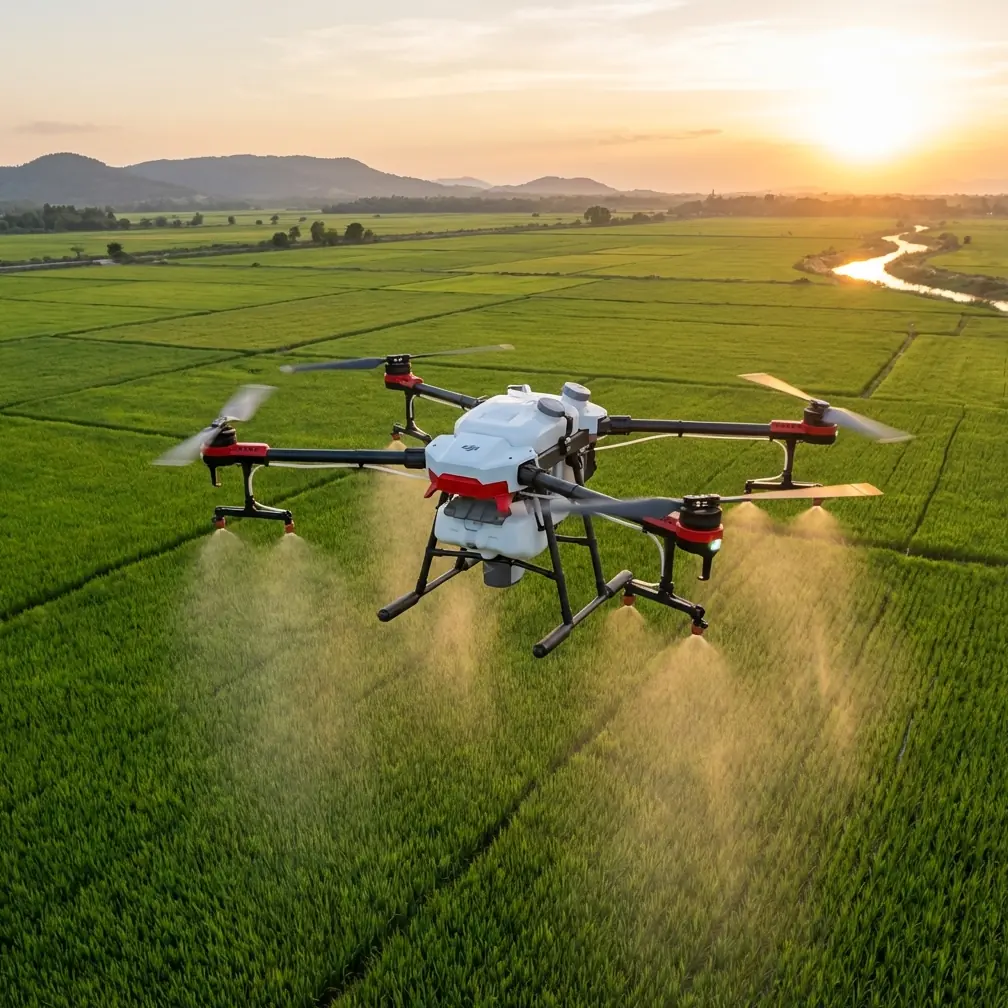
If the reader came here because of “spraying fields in mountain,” the first thing to say plainly is this: Avata is not the aircraft you choose because you want a traditional broad-acre spray platform. It becomes interesting in a different role. In mountain operations, especially where access is limited and conditions change fast, Avata can support reconnaissance, route checking, visual assessment, terrain familiarization, and close-in observation before people or larger equipment commit to a task. That distinction matters because it turns the aircraft from a blunt application tool into a precision scouting tool.
And that shift lines up with a bigger direction visible in DJI’s recent enterprise messaging. The newly announced Matrice 400 was framed around intelligent, efficient, long-endurance aerial missions, daily operational tasks, gathering data from multiple angles, and working in less-traveled or hard-to-access areas. Those phrases are not throwaway marketing. They point to a real operational truth: in difficult terrain, value comes from seeing more, from more than one angle, before making a decision on the ground.
That is exactly where an Avata-centered mountain workflow can earn its place.
The real problem in mountain field work is not distance. It is uncertainty.
On paper, steep farmland may not cover enormous acreage. But the operational burden is still high because terrain multiplies uncertainty. A footpath can disappear behind a ridge. A retaining wall can hide runoff damage. A cluster of trees can conceal a blocked approach for workers carrying equipment. A terrace edge that looks stable from below can tell a different story when viewed from above and then again from the side.
This is why “multi-angle” data capture matters so much in mountain agriculture.
The Matrice 400 announcement emphasized gathering data from multiple angles for daily tasks and for roads less traveled. Even though Avata belongs to a different class, the lesson transfers cleanly. In mountain field support, one top-down view is rarely enough. A useful mission often combines:
- a high pass to understand layout,
- an oblique pass to inspect terrace faces and vegetation edges,
- a lower, slower visual check near access paths or irrigation lines.
That sequence gives operators context instead of isolated images. Context is what reduces wasted trips, unsafe approaches, and bad assumptions.
If your end goal is crop treatment in a mountain area, the Avata’s role is not “replace all other equipment.” Its role is “prevent the wrong equipment from being sent to the wrong place under the wrong assumptions.”
That can save more time than most people expect.
Before obstacle avoidance means anything, clean the drone
Here is the unglamorous step that deserves more attention than QuickShots, color profiles, or cinematic talking points: clean the aircraft before launch, especially the vision and sensing surfaces that support safety-related functions.
Mountain flying is dirty flying.
Dust from dry access roads, moisture from morning fog, fine spray residue from nearby agricultural activity, pollen, and even fingerprint smears can all degrade what the drone sees. If you are relying on obstacle awareness in terrain where branches, wires, rock faces, and uneven elevation changes can crowd the flight path, you do not want compromised sensors. A pre-flight wipe is not a cosmetic habit. It is a risk-control measure.
This is the kind of detail experienced operators respect because it connects directly to outcomes. People talk about obstacle avoidance as if it is a permanent feature that always performs at a fixed level. It does not. It depends on conditions, lighting, surface texture, speed, and sensor clarity. In mountain settings, where shade shifts quickly and bright sky can sit directly behind dark trees or cliff edges, you are already asking the aircraft to interpret a complex scene. Starting with dirty sensors is avoidable self-sabotage.
A serious pre-flight routine for Avata in mountain farm support should include:
- Inspect the camera lens and vision-related surfaces for dust, streaks, moisture, and residue.
- Check propellers and ducts for debris, especially if the aircraft was carried on foot to the launch point.
- Confirm takeoff and landing areas are free of loose material that could be thrown upward.
- Reassess the route in current light and wind, not just based on earlier assumptions.
That first step, the cleaning step, is the one people skip when they are in a hurry. It is also the one that can protect the value of every other safety feature on the aircraft.
Why Avata can make sense on steep farms even when it is not the main workhorse
In mountain operations, the best drone is not always the biggest or longest-endurance platform. Sometimes the right aircraft is the one you can carry easily, launch quickly, and position precisely around obstacles to answer immediate questions.
Avata’s appeal in this kind of work is practical. It can help an operator inspect a narrow approach between trees, check the state of a terrace edge, review crop conditions along an irregular slope, or look ahead at hard-to-reach sections before a larger operational decision is made. That is the “roads less traveled” logic from the Matrice 400 announcement translated into a smaller-field reality. Hard access changes tool selection.
For mountain agriculture, there are three questions Avata can answer efficiently:
1. Can crews or equipment reach the target area safely?
A short aerial pass can reveal washouts, unstable footpaths, blocked turns, or overhanging branches that are not visible from the base of a slope.
2. Does the area need treatment everywhere, or only in specific pockets?
A visual reconnaissance flight can help identify whether the issue is broad or localized. On steep ground, that distinction is operationally significant because every unnecessary trip uphill costs time and energy.
3. What angle tells the truth?
Looking straight down can hide terrain relationships. Looking from the side can expose erosion, canopy density, or spacing problems. Multi-angle review often changes the decision.
That last point ties directly back to DJI’s wording around data from multiple angles. For hard-to-access terrain, angle is not a visual preference. It is decision-making leverage.
Subject tracking and ActiveTrack are useful only when used with restraint
A lot of people see subject tracking and immediately think convenience. In mountain farming support, the better word is continuity.
If you are documenting a worker path, following a piece of mobile equipment, or maintaining visual continuity along a terrace line, tracking features can reduce the mental load on the pilot. But this is not a feature to deploy casually in cluttered terrain. Steep fields create blind geometry. Objects can disappear behind vegetation or terrain folds. Lighting changes can affect visual interpretation. The aircraft may maintain a lock for a period, but the environment can still become less forgiving with almost no warning.
So yes, ActiveTrack-style functionality can help when you need consistent framing on a moving point of interest. But in mountain work, it should support operator awareness, not replace it. Use it where the path is predictable and the environment has been visually checked first. Do not treat it as a substitute for route planning.
That distinction matters because agriculture in mountain areas is already an exercise in controlled compromise. Features that work beautifully in promotional footage need more discipline in the field.
QuickShots and Hyperlapse are not just creative toys if you use them properly
Most commercial readers skip over creative capture modes because they sound irrelevant to field operations. That is too simplistic.
QuickShots are not central to mountain farm support, but repeatable motion patterns can be useful when you want a consistent visual record of the same terrace, slope face, or access route over time. Hyperlapse is even more interesting than many agricultural users assume. If your aim is to observe changes in cloud movement, fog clearance, worker flow, equipment movement, or the visual rhythm of a site over a work window, compressed time can reveal patterns that isolated stills do not.
The key is not the feature name. It is the operational question.
Can a repeatable capture method help show how conditions change on a mountain field over a morning? Sometimes yes. Can it help compare one day’s access conditions against another? Also yes. That turns a “creator” feature into a field documentation tool.
D-Log only matters if you plan to analyze what you capture
For many operators, standard footage is enough. But in variable mountain light, D-Log can give more room in post-processing to recover highlight and shadow detail. That becomes relevant when the same frame contains bright sky, reflective leaves, dark tree cover, and shaded ground.
Why does that matter for agriculture or terrain review?
Because details hidden in crushed shadows or blown highlights can affect interpretation. You may be looking for water flow paths, canopy variation, edge damage, or trail definition. Better image latitude does not create information that is not there, but it can preserve information that would otherwise be difficult to evaluate.
This is one of those features that only pays off if the workflow behind it is real. If nobody reviews footage carefully, D-Log is just extra complexity. If someone is comparing field conditions seriously, it can be worth using.
The mountain workflow that makes Avata genuinely useful
If I were building a practical problem-solution workflow around Avata for mountain field support, it would look like this:
Problem: The target field is steep, access is uncertain, and sending people uphill without a visual check wastes time and increases risk.
Solution: Use Avata as the first-look aircraft.
Start at the base or nearest safe launch point. Perform the pre-flight cleaning and inspection. Fly a short reconnaissance pattern that prioritizes access routes, terrace edges, irrigation visibility, tree encroachment, and wind-exposed sections. Capture both top-down and oblique views. If there is a moving point of interest, use tracking conservatively and only after the route is visually understood. Record enough footage to support a go/no-go ground decision.
Then stop.
That last part matters. The value is not in staying airborne for the sake of flying. The value is in making the next operational move smarter.
This is also where DJI’s “daily operational tasks” wording from the Matrice 400 release becomes useful context. The future of drone work is not just about dramatic one-off missions. It is about repeatable, workday-relevant aerial checks that remove uncertainty from routine decisions. In a mountain agriculture setting, that can mean knowing whether a section needs closer manual review, whether a path is passable, or whether a larger mission should be adjusted before launch.
Where to get help when the terrain makes setup decisions less obvious
The tricky part with mountain work is that small setup decisions compound. Launch position, time of day, lens cleanliness, route choice, return margin, and viewing angle all affect whether the flight produces something actionable or just more footage to sort through later. If you need a practical discussion around field setup and Avata workflow choices, you can message our team here.
The bigger lesson from the Matrice 400 announcement
Even though this article is focused on Avata, the most useful takeaway from DJI’s June 10, 2025 Matrice 400 announcement is strategic, not model-specific. DJI highlighted three ideas: intelligent and efficient aerial missions, data from multiple angles, and work in hard-to-access areas. Those are not separate ideas. They reinforce each other.
Efficiency comes from better angle selection.
Better angle selection matters most in hard-to-access terrain.
And intelligence in aerial operations often starts with using a drone to answer a narrow question well, not trying to make one aircraft do everything.
That is why Avata has a legitimate place in mountain agriculture support. Not as a universal solution. Not as a replacement for purpose-built application platforms. As a compact aerial observer that helps crews see what the hillside is hiding before resources move uphill.
In the mountains, that is not a minor advantage. It is often the difference between guessing and knowing.
Ready for your own Avata? Contact our team for expert consultation.