Avata in Tight Utility Corridors: A Low-Light Field Case
Avata in Tight Utility Corridors: A Low-Light Field Case Study Built From Small-Area Mapping Logic
META: A field-driven Avata case study for low-light utility corridor work, explaining why small rotary UAV design, flexible launch needs, and short-range image reliability matter in confined environments.
When people talk about the DJI Avata, they usually drift toward immersive flight or cinematic fun. That misses a more interesting question: what happens when you look at Avata through the lens of small-area field collection, where portability, tight launch conditions, and reliable low-altitude control matter more than raw size?
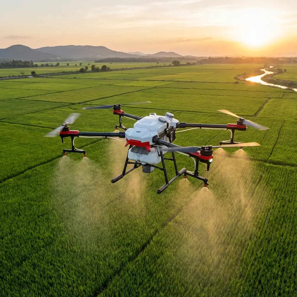
That framing becomes useful in a demanding civilian scenario: utility maintenance support in dim conditions along power-line corridors, especially where crews need to document sprayed sections, verify vegetation treatment coverage, and move in and out of awkward terrain quickly. Not the broad-acre mission of a fixed-wing survey aircraft. Not a huge industrial platform that needs a vehicle staging area. Something smaller, more tactical, and easier to deploy where the job site is inconvenient.
A Chinese ArcGIS field-collection solution document makes a point that still holds up. For relatively small acquisition areas, light rotary UAVs are often the right tool because they are easier to carry into the field, more flexible and stable at low altitude, and demand very little space for takeoff and landing. That sounds basic until you put it into practice near utility assets, on uneven ground, in low light, with crew time compressed and access constrained.
Why this old field logic fits Avata surprisingly well
The reference material was not written about Avata. It discussed lightweight multirotor selection for compact survey tasks and highlighted practical metrics from aircraft such as the Phantom 3 and Phantom 4. Yet the operational logic maps neatly onto the kind of role Avata can play when the mission is not “cover everything,” but “get in, collect what matters, and get out safely.”
The document stressed four advantages of small rotary drones for limited-area collection:
- easy to transport in the field
- flexible, stable low-altitude flight
- minimal takeoff and landing requirements
- dependable performance for short, focused missions
Those are not abstract benefits. They directly shape whether a crew can actually use a drone before daylight disappears or weather turns.
On one recent utility-side documentation job, the team was working a narrow corridor cut into rising terrain. The goal was to confirm vegetation treatment around line infrastructure after ground spraying, then capture reference footage for follow-up maintenance planning. The light was fading under heavy cloud cover. There was no clean staging area for a larger aircraft. The access track had turned slick, and the nearest flat launch spot was little more than a rough patch beside a service path.
That is exactly the kind of environment where the small-UAV reasoning in the ArcGIS document becomes operationally significant. A compact platform with low takeoff demands is not just convenient. It can be the difference between collecting usable imagery and going home with a gap in the record.
The number that still matters: 5 kilograms as a field threshold
One of the most useful details in the source material is the stated total operating-kit weight for the Phantom-style package: about 5 kilograms with aircraft, backpack, batteries, and controller. That figure matters because it captures a threshold of field practicality. Once your airframe and support kit are light enough to wear and hike with, your workflow changes.
You stop planning every sortie around vehicle access. You stop treating each launch as a mini logistics event. You start thinking in terms of short repositioning hops and fast deployment windows.
For utility corridor work in dim conditions, this matters more than people admit. Crews often have to move along rough rights-of-way, over drainage cuts, through scrub, or up embankments. If your drone package needs a trunk, a table, and plenty of setup space, you lose tempo. The ArcGIS source explicitly noted that a smaller aircraft with a backpack could still be practical even in extreme situations involving a climb before launch. That was written in a mapping context, but the principle translates directly to corridor support.
Avata, by design philosophy, belongs to that “carry-first” category. It suits teams that need mobility more than broad endurance. In low-light utility documentation, where each flight tends to be short and highly deliberate, this can outweigh the appeal of a larger platform.
Why low-altitude stability beats theoretical range in this use case
Another key source detail deserves more attention: the document cited a theoretical control distance of 3.5 kilometers for the Phantom 3 platform, but emphasized something much more grounded—that in complex interference conditions, maintaining good image transmission and control within 1 kilometer was enough for sample-area collection needs.
That is a better way to think about practical drone work. Real jobs are not won by brochure range. They are won by stable control and dependable visual feedback inside the distances you actually fly.
Spraying-adjacent inspection along power lines in low light is almost never a “send it far” mission if it is being conducted responsibly. It is a close-range, line-of-sight, carefully managed task where the aircraft must hold its composure near poles, crossarms, vegetation, and shifting terrain textures. Reliable control inside a constrained operating bubble matters more than long-distance headline numbers.
This is also where reader expectations around Avata need recalibration. Search traffic around terms like obstacle avoidance, ActiveTrack, QuickShots, Hyperlapse, D-Log, and subject tracking often comes from the camera-drone world. For a utility corridor crew, those features are only meaningful if they support usable capture in a confined environment. D-Log, for instance, can matter because low-light scenes often contain ugly contrast transitions: bright sky openings, dark tree cover, reflective hardware, shadowed ground. A flatter recording profile can preserve more grading flexibility when the team needs to compare treated and untreated sections clearly afterward.
QuickShots and Hyperlapse are much less central here. They are not the heart of a maintenance-support workflow. Controlled manual framing, repeatable pathing, and obstacle awareness are.
A wildlife moment that tested the corridor workflow
One detail from the field still sticks with me. On the third launch, as the aircraft eased along a section where the line crossed denser brush, a barn owl burst from a low perch near the edge of the corridor. It cut across the route fast, left to right, then dropped below the line into darker cover.
This was one of those moments that reminds you that low-light utility work is never just about wires and vegetation. You are sharing the airspace with wildlife that becomes more active exactly when your lighting gets worse.
The significance was not dramatic heroics. It was that the pilot had enough situational awareness, and the aircraft enough close-quarters composure, to arrest forward movement cleanly and reset the line without pushing through the owl’s flight path. In practical terms, that is where obstacle-sensing logic and disciplined flight style matter. Not as a marketing checkbox, but as a risk-reduction habit in mixed natural and built environments.
Any drone used in these corridors should be flown with conservative spacing and a clear understanding that sensors have limits, especially in low light and around fine structures. But when the aircraft platform supports precise control in tight spaces, the crew has more margin to respond well when the environment does something unexpected.
Resolution and altitude: the source’s 5 cm clue
The ArcGIS reference also included a very concrete imaging benchmark: a 12 MP camera, flown at 100 meters, could produce orthographic imagery with a ground resolution of 5 centimeters. That number is useful not because utility spraying crews are necessarily making formal ortho products every time, but because it anchors the relationship between altitude, sensor output, and actionable detail.
In corridor verification work, the question is simple: can you see enough to judge treatment results, clearance conditions, and follow-up priorities?
For broad context shots, yes, altitude helps. For checking edge growth, branch encroachment, insulator-area vegetation proximity, and spray coverage patterns near access routes, lower flight often tells the real story.
This is another place where a small, stable low-altitude platform earns its keep. The source highlighted low-altitude flexibility as a core benefit of lightweight rotary drones. That point becomes even more relevant in fading light, when staying lower can help preserve image quality and spatial awareness, provided the pilot manages obstacles properly. Avata’s appeal in such work is not that it replaces a dedicated mapping aircraft. It is that it can capture useful, close-in visual evidence where precision positioning and proximity control matter.
The real mission profile: small area, short cycles, repeated repositioning
The source document repeatedly framed the work as “sample plot” collection rather than broad-area acquisition. That distinction is critical. Some drone jobs are endurance jobs. Others are access jobs.
Utility corridor spraying support often falls into the second category. Teams are not always surveying an entire network in one sortie. They may be checking a handful of priority spans, documenting post-treatment conditions at selected points, or revisiting spots flagged by ground crews. In those cases, a longer battery is welcome, but not always decisive.
The reference noted that one battery could satisfy the collection of a single sample area, and that a longer-flight model expanded the reachable operating envelope. Operationally, that means this: if your mission can be broken into compact evidence-gathering segments, the aircraft’s job is to deliver one clean package of data per hop. Fly. Land. Move. Launch again.
That workflow aligns well with a compact drone strategy. It also reduces pressure on the pilot to stretch a flight in declining light simply because the setup was cumbersome. Easy redeployment encourages cleaner decision-making.
What Avata should and should not be expected to do here
Avata makes sense in this story when it is used as a close-in corridor tool, not a universal answer. It is well suited to:
- tight launch environments
- short-range visual documentation
- low-altitude movement through confined access corridors
- follow-up capture after spraying or trimming
- training operators to think carefully about spatial control
It is less suited to pretending it is a full substitute for a dedicated enterprise mapping stack on large acreage or long linear assets. The source material helps draw that line. It recommended lightweight rotorcraft precisely because the collection area was relatively small. That nuance matters. Right aircraft, right scope.
For organizations building a practical workflow, the smart move is to treat Avata as part of a layered toolkit. Use it where portability, fast setup, and confined-space handling have the highest value. Pair it with more specialized platforms when the mission demands larger-area orthomosaic production or heavier sensors.
A better way to evaluate “best practices” for this kind of job
If you are thinking about Avata for dim-light utility vegetation or spray verification tasks, the most useful questions are not the flashy ones. Ask these instead:
Can the full kit move with the crew without becoming the job? Can the aircraft launch from a crude field position safely? Can it hold steady at low altitude where the evidence actually is? Can the pilot maintain clear visual understanding in a cluttered corridor? Can the footage preserve enough detail for downstream assessment?
Those questions echo the field logic embedded in the ArcGIS document. Portability. Stability. Minimal launch demands. Enough battery for a discrete task. Enough control reliability inside the real operating envelope.
That is why this old reference remains surprisingly relevant to an Avata discussion. It describes a mission philosophy, not just a model comparison.
If your team is refining a corridor workflow and wants to pressure-test whether Avata belongs in it, a quick operational discussion can save a lot of trial and error. You can start that conversation through this field workflow chat.
The takeaway is straightforward. In low-light power-line corridor work, success rarely comes from the biggest platform or the longest spec sheet. It comes from matching the aircraft to the geography of the task. The source material made that case through compact field-mapping examples: around 23 to 28 minutes of theoretical flight, a manageable carry kit around 5 kilograms, and dependable short-range control in messy real-world conditions. Those are not glamorous details. They are the details that make a drone useful.
Seen that way, Avata is not interesting because it is trendy. It is interesting because the logic of small-area, low-altitude, easy-access UAV work still holds—and in difficult utility environments, that logic can be the whole job.
Ready for your own Avata? Contact our team for expert consultation.