Avata for Coastal Construction Site Surveys
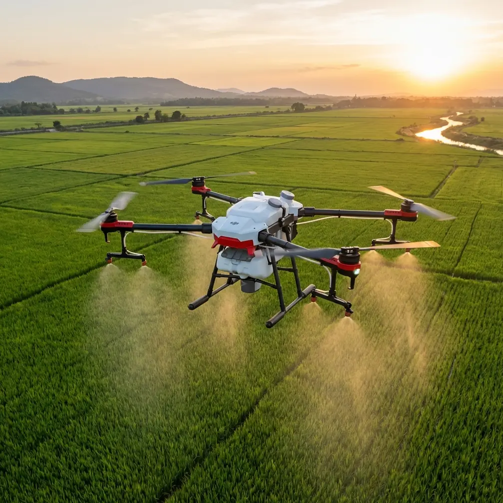
Avata for Coastal Construction Site Surveys: What the Aircraft Can Do—and Why Maintenance Capacity Matters
META: A technical review of DJI Avata for coastal construction site surveys, with expert insight on flight altitude, obstacle handling, image workflow, and why new aviation maintenance training partnerships matter for long-term operations.
Coastal construction surveying has a way of exposing weak assumptions.
Wind changes faster near open water. Salt in the air punishes exposed hardware. Reflective surfaces—glass curtain walls, wet concrete, standing water, metal framing—can confuse both pilots and sensors. Add cranes, rebar cages, temporary lifts, scaffold tunnels, and partially enclosed structures, and suddenly the “easy” drone flight becomes a very technical one.
That is where Avata gets interesting.
Most people first think of Avata as an immersive FPV platform. For construction work, especially in coastal environments, that framing is too narrow. The aircraft’s real value is not that it replaces a larger mapping drone. It does not. Its value is that it can capture the spaces larger survey aircraft often avoid: façade gaps, under-bridge sections, podium edges, service corridors, roof parapets, atriums under construction, and transition zones between indoor and outdoor work areas. In a coastal site context, those spaces often generate the documentation gaps that later become coordination problems.
Still, the more serious question is not simply whether Avata can fly the job. It is whether an operator can sustain reliable use over time—through maintenance, training, and post-delivery support. That is why a recent aviation training development deserves attention even for readers focused on a specific aircraft workflow.
On March 25, Guangdong Huitian Aerospace Technology signed a formal school-enterprise cooperation agreement with Guangzhou Civil Aviation College and unveiled the “Huitian Industry Academy.” The partnership is built around electric aviation maintenance training, including customized talent development, joint training platforms, two-way instructor exchange, and collaborative work on industry standards. The stated goal is operationally significant: reserve core technical maintenance talent in advance for continued airworthiness and after-sales support after product delivery.
That point matters more than it may seem.
For anyone deploying aircraft in professional site documentation, after-sales service is not an abstract corporate promise. It affects fleet uptime, inspection scheduling, maintenance intervals, parts replacement cycles, and pilot confidence. When the sector itself acknowledges that skilled maintenance personnel are in short supply—and the report explicitly says this shortage has become a major constraint on high-quality development in electric aviation—it reinforces a broader truth for drone operators: capability in the field is only half the equation. Supportability is the other half.
Even though Avata sits in a different product lane than crewed or larger electric aviation systems, the direction is clear. The industry is moving toward a deeper integration of training, service infrastructure, and operational readiness. Huitian’s claim that it is the first electric aviation company in its field to launch this kind of deep directional training partnership with a school is not just a branding point. It signals that the maintenance bottleneck has become serious enough to solve upstream, at the education level rather than only through internal hiring.
For coastal construction teams using compact drones like Avata, this same logic applies on a smaller but very practical scale. A drone is useful when it is available, calibrated, inspected, and trusted. If one prop strike, one sensor issue, or one corrosion-related failure stalls operations for days or weeks, the aircraft stops being a tool and becomes a risk to scheduling.
Where Avata Fits on a Coastal Construction Site
Avata works best on construction assignments that prioritize spatial awareness, progress visualization, and close-quarters observation rather than orthodox survey-grade mapping.
That distinction matters.
If the deliverable is a dense orthomosaic for volume measurement over a broad reclaimed coastal parcel, a different aircraft class is usually the better choice. If the deliverable is a visual record of façade interface work around a tower core, a pass beneath cantilevered sections, or a safe remote look into exposed structural areas near active edge protection, Avata becomes more compelling.
Its form factor is a major reason. The ducted design reduces the operational penalty of working near confined structures. Obstacle awareness and controlled low-speed movement help in tight spaces where a conventional camera drone can feel physically and psychologically too exposed. On sites with narrow access corridors, temporary roofing, and staggered vertical obstacles, that changes how often a pilot can complete a mission without repositioning or escalating risk.
The LSI terms that often show up in consumer conversations—Obstacle Avoidance, Subject Tracking, QuickShots, Hyperlapse, D-Log, ActiveTrack—need to be translated into job-site language to be useful.
- Obstacle handling matters because coastal construction sites are cluttered and constantly changing. Any drone used there must cope with non-permanent geometry: netting one week, scaffolding the next, façade panels after that.
- Tracking-style functions can be helpful for repeated observation of moving site logistics or vessel-side support activity, but only when used conservatively and with a clear visual environment.
- QuickShots and Hyperlapse are not just social-video features if used properly. For weekly stakeholder reporting, they can create standardized visual sequences that make schedule changes easier to interpret.
- D-Log matters because coastal light is harsh. Bright sky, reflective water, pale concrete, and dark voids under structures create dynamic range problems fast. A flatter recording profile gives the editor more room to recover highlights and preserve texture in shadows.
In other words, the features are only as good as the workflow built around them.
Optimal Flight Altitude for Coastal Site Surveying
For this scenario, my preferred working band with Avata is usually 20 to 40 meters above local ground level for primary progress capture, then lower targeted passes for detail.
That number is not arbitrary.
Below roughly 20 meters, you gain intimacy but lose overview. Perspective exaggeration becomes stronger, and structural relationships across the site can look more dramatic than they actually are. That is useful for issue detection, less useful for coordinated reporting. Above 40 meters, Avata can still produce useful context, but the aircraft’s real strength—proximity and spatial readability—starts to diminish compared with larger camera platforms.
So I typically separate the mission into three layers:
Context layer: 35 to 40 meters
- Use this for a readable overview of active work zones, shoreline adjacency, material staging, temporary roadways, and crane relationships.
- In coastal conditions, this height often also gives a cleaner airflow band than flying very low near corners, barriers, and partially built structures where wind turbulence rolls unpredictably.
Progress layer: 20 to 30 meters
- This is usually the sweet spot for construction storytelling.
- It reveals slab progress, façade installation status, edge protection, mechanical placement, and circulation routes without flattening the scene.
- For weekly consistency, try to repeat this altitude and path each visit.
Detail layer: 3 to 15 meters
- Use only for specific observations: façade tie-ins, roof penetrations, podium transitions, drainage elements, exposed reinforcement, underside checks.
- This is where obstacle awareness, low-speed control, and pilot discipline matter most.
Near the coast, I avoid treating altitude as the only safety variable. Wind behavior around unfinished buildings can be much more relevant than the nominal meter reading. Air spilling around corners, over parapets, and through open structural frames can destabilize a compact drone at any height. A clean 25-meter pass on one side of a structure can become turbulent chaos after a simple reposition around the corner.
Image Quality and Data Utility
Avata footage becomes genuinely useful for site teams when it answers a decision question.
Not when it merely looks dramatic.
For progress meetings, the best clips are usually steady, repeatable, and geographically legible. This is where pilots with cinematic instincts sometimes overdo it. Fast dives, aggressive yaw inputs, and stylized reveals may impress viewers, but they often make it harder for engineers, project managers, or subcontractors to extract value.
Use D-Log when the lighting range is severe, especially midday near water. Coastal projects often force exactly that combination: bright sky overhead, hard reflections off marine surfaces, and deep shadows cast by partial structures. A flatter profile can preserve enough highlight information to keep white membrane roofing, aluminum framing, or concrete edges from clipping into useless blocks of brightness.
Hyperlapse can also be practical on long-duration projects. A controlled time-compressed sequence from a repeated vantage point can show shoreline works, vertical progression, and logistics flow in a way stills sometimes cannot. The trick is restraint. Hyperlapse is best used as a repeatable monitoring tool, not a stylistic flourish.
Obstacle Management in Real Site Conditions
Construction sites are sensor-hostile environments.
Meshes, cables, rebar projections, transparent barriers, temporary markings, wet surfaces, and irregular voids all challenge autonomous logic. So while obstacle-related features are valuable, I treat them as assistance, not judgment. Avata’s real advantage is that it gives the pilot a platform suited to closer inspection with a lower consequence profile than many exposed-prop aircraft.
That said, coastal conditions add two operational complications that people underestimate:
Salt exposure
- Even if the aircraft performs normally during the flight, salt-laden air can accelerate wear over time.
- This raises the value of disciplined post-flight inspection and maintenance.
Surface glare
- Water, polished metal, and wet concrete can distort depth cues for both pilot and camera.
- This is another reason to keep progress-capture passes in a disciplined altitude band rather than improvising too close to obstacles for visual drama.
This is where the maintenance story ties back in.
The Huitian–Guangzhou Civil Aviation College cooperation was designed around a complete pathway from training and practical exercises to eventual employment. That “full system” approach matters because aviation equipment reliability depends on people who understand serviceability, not just operators who understand flight. The report also notes that the partnership includes joint work on industry standards. That is operationally significant because standard-setting affects how maintenance quality becomes repeatable across fleets rather than dependent on isolated technician skill.
For drone programs at construction firms, EPC contractors, and surveying service providers, the lesson is straightforward: stop thinking of pilot skill as the only premium resource. Technical support capacity is becoming just as decisive.
Workflow Advice for Weekly Site Reporting
If you are using Avata for coastal construction surveys, consistency beats creativity.
A strong repeatable workflow looks like this:
- Start with a fixed overview orbit or perimeter pass at roughly 35 to 40 meters
- Drop to 20 to 30 meters for standardized progress runs over key work fronts
- Finish with short low-altitude inspection passes only where the project team needs detail
- Keep camera moves slower than your instincts suggest
- Record in D-Log when contrast is severe
- Build a naming structure by zone, elevation, and date so footage can be compared week over week
If your team is building a formal inspection or reporting program and wants to compare setup options, flight profiles, or maintenance planning, you can share the job details directly through this project chat link.
Why This Matters Beyond One Aircraft
Avata is not the whole answer for construction surveying. It is a sharp tool for a specific slice of the work: close-range spatial documentation in places that reward agility more than scale.
But the deeper industry story matters just as much as the aircraft review.
When an aviation company formally partners with a civil aviation college on March 25 to create an industry academy, with customized maintenance training, shared practical platforms, two-way faculty exchange, and joint standard development, it reveals where the sector sees its pressure points. And when that same initiative is framed as preparation for sustained airworthiness and after-sales support after product delivery, the message is even clearer: deployment without support is not maturity.
For coastal construction drone operations, that should shape procurement thinking. The best platform is not just the one that gets the shot. It is the one backed by a service ecosystem, trained people, and maintenance discipline strong enough to keep getting the shot month after month, despite salt, wind, turbulence, and the everyday brutality of a live project site.
Avata can absolutely earn its place there. Just use it at the right altitude, for the right mission layer, with the right expectations.
Ready for your own Avata? Contact our team for expert consultation.