Avata Surveying Tips for Highways in Urban Areas
Avata Surveying Tips for Highways in Urban Areas: What the Low-Altitude Mapping Standard Really Means in the Field
META: A technical review of using Avata for urban highway survey support, grounded in CH/3005-2010 aerial photography standards, flight-height control, image quality, and gap reflight strategy.
Urban highway surveying punishes weak flight planning.
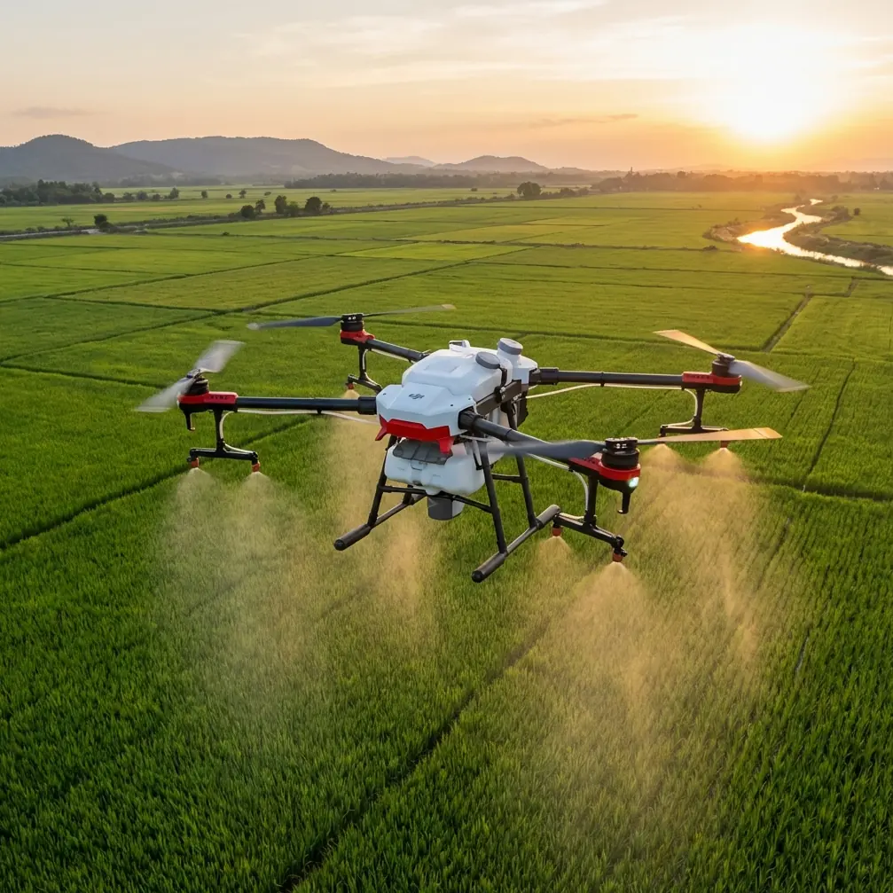
Road corridors are narrow, reflective, cluttered, and constantly interrupted by signage, overpasses, light poles, utility lines, and traffic movement. In that environment, a drone like the DJI Avata is not judged by how cinematic it looks on paper. It is judged by whether it can produce usable imagery under real low-altitude constraints, then hold that standard repeatedly across a corridor where consistency matters more than flair.
That is where the reference standard, CH/3005-2010 低空数字航空摄影规范, becomes useful. Even though Avata is often discussed through the lens of immersive flight and agile capture, the real question for survey-adjacent urban highway work is simpler: can it support disciplined image collection without breaking the logic of photogrammetric quality control?
The answer depends less on marketing labels and more on operational discipline.
Avata is not a classic corridor-mapping platform — but that is not the full story
Let’s be honest at the start. If the mission is full-scale highway corridor mapping with strict deliverable requirements, dedicated mapping drones still have structural advantages: mechanical shutters, larger sensors, highly repeatable nadir geometry, and route automation designed around survey blocks.
But that does not make Avata irrelevant. It makes Avata specialized.
In urban highway scenarios, Avata can become a strong tool for supplementary capture, constrained-space documentation, gap inspection, under-structure visual recording, and low-altitude visual context acquisition where larger platforms struggle. Its compact form factor and strong obstacle handling logic make it especially useful when the work zone is boxed in by infrastructure. That matters in cities, where the biggest limitation is often not distance but access.
This is where competitor comparison gets interesting. Many compact drones can produce good-looking imagery in open conditions. Avata tends to stand out when the route becomes physically awkward. Around ramps, retaining walls, sound barriers, interchange columns, and edge-of-carriageway structures, obstacle awareness and controllable close-proximity flight become more valuable than raw spec-sheet elegance. For this type of highway survey support, Avata’s practical edge is not just mobility. It is the ability to gather image sets in spaces that are visually complex and geometrically unforgiving.
Still, the standard reminds us that agility alone is useless if image consistency breaks down.
The 30 m rule is not a footnote — it is a warning about data stability
One of the most operationally significant details in the reference is the requirement for flight height consistency. The standard states that on the same flight line, the height difference between adjacent photos should not exceed 30 m, the difference between the maximum and minimum flight height should not exceed 50 m, and the difference between actual and designed flight height should also not exceed 50 m.
Those numbers are not bureaucratic trivia. They go to the heart of whether a road survey image set can be processed cleanly.
In an urban highway corridor, altitude fluctuation changes ground sampling conditions, object scale, overlap behavior, and the reliability of tie points. If one image is captured too high and the next too low, lane markings, barriers, bridge edges, and drainage structures stop behaving like a stable measurement surface. Reconstruction becomes uneven. Feature matching gets noisier. Control integration becomes more fragile.
For Avata operators, this has direct consequences.
Avata invites dynamic flying. That is part of its appeal. But for highway survey support, “dynamic” is often the wrong instinct. The standard’s 30 m adjacent-photo tolerance tells you that vertical discipline matters. If you are collecting a sequence along a road edge or through an interchange, smooth altitude control is not optional. It is the difference between a visually impressive flight and a technically usable capture set.
This is one place where many non-survey drones fall short in operator hands, not because the aircraft cannot fly steadily, but because the pilot flies as though the mission were cinematic. Urban road documentation needs deliberate line management. Keep height transitions gentle. Segment the route when overpasses force altitude changes. Do not improvise altitude just to clear one obstacle and then dive back aggressively. If the environment forces a step change, treat that as a new capture segment rather than pretending it is one continuous survey line.
That approach aligns Avata with the standard instead of fighting it.
Image tilt and attitude control matter more than people admit
Another key detail in the reference concerns image tilt checking. Where attitude records exist, the inspection method uses the recorded orientation elements, taking the larger of roll and pitch as the effective image tilt value.
That has serious meaning in highway work.
Road corridors are long, directional environments. They reward stable geometry and punish side-to-side inconsistency. If roll or pitch varies sharply, the imagery may still look sharp to the human eye while becoming less coherent for measurement or structured interpretation. A lane divider, crash barrier, drainage inlet, or bridge parapet captured with variable tilt behaves differently from frame to frame. That can weaken stereo interpretation and complicate any attempt to build clean models from the imagery.
For Avata, this is where pilot technique and mission design become inseparable. The drone’s agility can help you hold a line near structures, but if the aircraft is constantly banking hard or pitching aggressively, you may create imagery that is excellent for visual storytelling and poor for survey continuity.
This is why highway operators should avoid treating obstacle-rich segments as freestyle sections. Avata’s obstacle handling can reduce risk near structures, but the standard’s logic still applies: attitude consistency affects whether the imagery can support downstream work. Controlled passes beat dramatic ones.
The practical takeaway is simple. When recording a road corridor or interchange edge, fly with the end use in mind. If the image set may support measurement checks, condition documentation, or engineering review, minimize unnecessary roll inputs and abrupt pitch changes. Stable orientation is part of data quality, not just pilot style.
Gap reflight is a serious discipline, and Avata is unusually good at it
The standard also states that when there are leaks or missing coverage, supplementary photography should be carried out in time, and the reflight should preferably use the same digital camera as the previous flight. It further notes that the supplementary flight line should extend beyond the gap by two baselines.
This is one of the most overlooked parts of practical drone surveying.
In urban highway work, gaps happen all the time. A truck blocks a section. A reflective noise barrier causes poor visual texture. A bridge shadow reduces interpretability. A restricted section forces a detour. The common mistake is to patch that gap casually with “close enough” imagery.
The standard says not to do that.
Using the same camera preserves consistency in image characteristics. Extending the补摄 route beyond the missing area by two baselines helps reconnect the new imagery with the original block rather than creating an isolated patch. Operationally, that is smart photogrammetry. You are not just filling a hole. You are rebuilding continuity.
This is where Avata can genuinely outperform bulkier alternatives in tight urban conditions. If a missing section appears under an overpass edge, along a retaining structure, or beside a narrow elevated ramp, sending the same compact platform back for a controlled reflight is often easier than redeploying a larger aircraft with more clearance demands. Avata’s form factor makes targeted recovery flights efficient. That can save a survey day from turning into a rescheduling problem.
If your team needs to think through a corridor reflight plan or urban obstacle segment workflow, it can help to discuss the route constraints directly before going back into the field.
Sharpness still rules, and urban roads expose every weakness
The standard’s image-quality section is blunt: imagery should be clear, tonally layered, with suitable contrast and natural color expression; it should support recognition of fine ground objects consistent with the ground resolution; it should allow a clear stereoscopic model; and it should not contain major issues such as cloud, cloud shadow, haze, strong glare, or contamination. It also adds a crucial motion-related metric: image-point displacement caused by aircraft ground speed and exposure timing should generally be no more than 1 pixel, with a maximum of 1.5 pixels.
That threshold matters enormously in highway settings.
Urban roads are packed with thin, linear, high-contrast elements: lane stripes, curb edges, expansion joints, guardrails, utility markings, crack lines, drainage channels. These are exactly the features that reveal motion smear first. A soft-looking tree canopy may be tolerated in some visual documentation jobs. A blurred lane edge cannot.
This is where Avata’s strengths must be handled carefully. It is capable of fast, smooth forward motion, which is useful for corridor work. But speed without shutter discipline is a shortcut to weak data. On a highway-related mission, the pilot should think less like an FPV creator and more like an imaging technician. The standard’s 1 pixel / 1.5 pixel displacement guidance is a reminder that velocity must be balanced against exposure conditions. If light falls, reduce speed or adjust the capture plan. Clean detail beats rushed coverage.
The source also rejects obvious blur, ghosting, and misalignment in stitched or connected imagery. That matters because urban highway teams often want both raw frame review and later composite outputs. If the base imagery is compromised, every downstream visualization suffers.
Avata’s camera features can help — but only when used with discipline
The context around this article mentions terms like D-Log, ActiveTrack, Hyperlapse, QuickShots, and obstacle avoidance. Not all of these matter equally for highway survey support.
Obstacle avoidance is clearly relevant. In dense urban transport corridors, it is one of the practical reasons Avata deserves consideration at all. Working around bridge columns, signage gantries, walls, and vegetation demands strong spatial awareness. This feature can reduce operational stress and support safer low-altitude positioning.
D-Log can also matter, though not in the way casual users think. For engineering communication, pavement condition review, or structure inspection context, preserving tonal information can help when later examining shadow-heavy underpasses or mixed-light environments. It is less about making the footage “cinematic” and more about retaining visual information in difficult lighting.
By contrast, QuickShots and Hyperlapse are secondary for actual survey tasks. They may be useful for stakeholder presentations, corridor progress summaries, or visual reporting around a highway project, but they are not substitutes for disciplined image acquisition. They can complement a project record. They cannot rescue weak geometry.
ActiveTrack sits somewhere in the middle. For moving subject capture it is attractive, but highway surveying is usually about the infrastructure, not following vehicles. In this context, its value is limited compared with stable manual route control.
So when comparing Avata with competitors, this is the real dividing line: Avata excels not because every intelligent feature is equally useful, but because its combination of compact flight behavior, obstacle-aware operation, and controllable low-altitude capture makes it effective in difficult urban spaces where supplementary survey imagery is often hardest to collect.
A realistic workflow for urban highway teams using Avata
If I were deploying Avata on a highway-related urban job, I would not pretend it is replacing a purpose-built corridor mapping aircraft. I would use it where it creates the most value:
- targeted low-altitude image collection in confined road structures
- reflight of small gaps identified after initial data review
- visual documentation around overpasses, barriers, and retaining walls
- complementary context imagery for engineering teams
- pre-inspection route familiarization in obstacle-dense zones
And I would anchor the whole operation to the quality logic in CH/3005-2010:
- maintain height consistency, especially respecting the 30 m adjacent-photo rule as a planning mindset
- keep overall height variation controlled within the standard’s 50 m limits where the mission design allows
- watch roll and pitch behavior because tilt consistency affects downstream usability
- re-fly gaps quickly, with the same camera system, and extend the route beyond the missed area by two baselines
- protect image sharpness so motion displacement stays within the 1 to 1.5 pixel tolerance logic
- reject footage with obvious blur, glare, contamination, or visual defects that interfere with interpretation
That is how Avata becomes useful for urban highway survey support: not as a generic “best drone,” but as a precise tool used with survey-grade discipline.
The wider lesson is that standards reveal how a drone should be flown, not just whether it can fly. Avata’s hardware and handling give it unusual advantages in cramped civilian infrastructure environments. But those advantages only translate into reliable outputs when the operator respects the fundamentals of aerial image quality, route continuity, and reflight control.
Urban road work leaves very little room for sloppy capture. Avata can handle the space. The crew still has to handle the method.
Ready for your own Avata? Contact our team for expert consultation.