Avata for Power Line Surveys in Wind: A Field Case Study
Avata for Power Line Surveys in Wind: A Field Case Study From Behind the Goggles
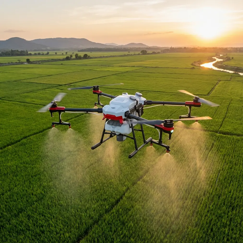
META: A real-world case study on using DJI Avata for windy power line inspections, with practical guidance on obstacle avoidance, D-Log, ActiveTrack limits, and safer low-altitude flight planning.
The first time I tried to document a wind-exposed distribution corridor with a small cinewhoop-style drone, I made the classic mistake of treating it like an ordinary scenic flight. I was thinking in terms of framing, movement, and getting smooth reveal shots. The line crew was thinking about conductor clearance, pole-top hardware, and whether the footage would actually help them make a maintenance decision.
Those are not the same mission.
That gap is exactly where the Avata becomes interesting. Not because it turns a complex utility survey into a one-button exercise. It does not. But because it changes what is practical when the job involves tight spaces, gusty air, and the need to stay close enough to capture actionable detail without flying a fragile camera platform into wires or structure.
For anyone surveying power lines in windy conditions, the Avata sits in a very specific niche. It is not the long-endurance mapping tool you would choose for broad corridor coverage. It is the aircraft I reach for when the assignment is tactical: short segments, tricky access, visual confirmation around hardware, and low-altitude runs where prop guards and stable FPV handling matter more than raw flight time.
Why the Avata fits this kind of inspection
Power line work exposes weaknesses fast. Wind behaves differently around poles, transformers, crossarms, and roadside vegetation than it does out in open fields. You can have a manageable breeze at takeoff and then hit sudden lateral turbulence near a structure or at a gap in terrain. On a traditional camera drone, that often means backing off, climbing away, or abandoning the close pass.
The Avata changes that equation because of its protected design and its ability to hold a deliberate line through disturbed air at closer range. The ducted prop layout is not cosmetic. In practical survey work, it gives you a buffer when operating near branches, guy wires, or tight approaches around poles where a light bump would end the mission on an open-prop aircraft. That matters most on days when wind forces constant micro-corrections.
I learned this on a segment where the utility team needed better visual coverage of aging hardware on poles running along a ridge. The airflow wrapped around the slope and slapped the drone sideways every time I tried to drift into the inspection angle. With the Avata, I could fly slower, stay lower, and work the corridor in controlled sections instead of trying to muscle through a long, sweeping pass. That changed the quality of the footage more than any camera setting ever could.
Wind does not just affect flight. It affects data quality.
This is the part newer operators underestimate. In power line survey work, wind is not only a handling issue. It changes whether your footage can answer the maintenance question.
If the aircraft is constantly fighting gusts, your shot timing slips. If your angle shifts at the wrong moment, insulators, tie wires, spacers, and connection points disappear behind the pole or conductor. If the aircraft yaws unexpectedly while passing a structure, the footage may still look dramatic in goggles and still be nearly useless for inspection review.
That is where Avata’s low-speed control profile becomes valuable. You can treat each pole as a discrete inspection event: approach, stabilize, orbit partially if safe, capture the exact detail needed, then exit with a clean buffer. In wind, that segmented workflow is far more reliable than trying to build one perfect cinematic line through an entire corridor.
Obstacle avoidance also deserves a realistic discussion here. Around power lines, no pilot should assume sensors will “save” the flight. Thin conductors are a difficult environment for any automated sensing system, and utility corridors create a cluttered visual field that can confuse casual operators into overconfidence. On the Avata, obstacle-related safety features are best understood as a support layer, not permission to fly recklessly near energized infrastructure.
Operationally, that means planning flights as if no automation exists. Set conservative approach paths. Keep lateral escape routes open. Avoid putting the drone in a position where a gust can push it toward wires with no clean recovery direction. The safer the geometry, the more useful the platform becomes.
The real productivity gain is confidence near structures
People often talk about drones in terms of headline features: subject tracking, QuickShots, Hyperlapse, D-Log. Useful, yes, but context matters. In a windy power line survey, the most valuable “feature” is often psychological. The Avata lets an experienced pilot work close to structures with a degree of confidence that changes behavior in the field.
That confidence is not about taking bigger risks. It is about reducing hesitation.
When pilots are uneasy about a platform’s survivability, they tend to stand off too far, rush the approach, or skip angles that might reveal a problem. The Avata encourages the opposite: slower setup, cleaner alignment, and more disciplined movement around the point of interest. That translates into better evidence.
I have seen this most clearly during repeat inspections. On one return visit to a line section after an earlier windy-day shoot with another compact drone, the original footage told us where the corridor problem probably was, but not enough about the exact hardware condition. Flying the Avata on the follow-up let me hold closer to the pole head while the wind rolled across the slope. The crew got what they actually needed: visible condition detail, not just attractive motion footage.
That distinction is why this aircraft has earned a place in serious field kits.
Where features help — and where they do not
Let’s deal with some of the search-heavy terms honestly.
ActiveTrack and subject tracking: These features sound attractive on paper, but power line surveying is not the environment where I would build a workflow around automated subject following. Utility structures are repetitive, the corridor geometry is unforgiving, and the inspection target is rarely moving in a way that justifies tracking logic. If you are documenting a crew vehicle moving along a service road as supplemental coverage, maybe. For close structure work in wind, manual control remains the safer and more precise option.
QuickShots: These can help gather context footage around a site before or after the inspection segment. For example, a clean establishing clip of a pole line crossing a ridge can help stakeholders understand terrain exposure and wind patterns. But QuickShots are not the backbone of a utility inspection mission. They are support material.
Hyperlapse: Useful for environmental storytelling or progress documentation over a fixed corridor segment, especially when you want to show how weather moves across the area. For technical review of hardware condition, it is secondary at best.
D-Log: This one matters more than many utility teams realize. If you are capturing footage in mixed lighting — bright sky, dark vegetation, reflective hardware — D-Log gives you more room to recover detail in post. That operational significance is straightforward: better tonal flexibility can make it easier to see subtle wear, corrosion contrast, or attachment details that might get crushed or clipped in a baked-in look. For teams archiving footage or handing it off for technical review, that extra grading latitude is worth having.
In other words, not every marketed feature is equally relevant. For windy power line work, control discipline, stability, and image flexibility beat novelty every time.
My field workflow with Avata on windy utility corridors
When the mission is short-range visual survey rather than broad mapping, I break the job into four phases.
First, I walk the line section from the ground if access allows. I want to know where the wind is channeling, where vegetation narrows the escape route, and which poles have the most useful approach side. This matters more than any on-screen telemetry. Air behaves strangely near terrain breaks and hardware clusters.
Second, I set a shot priority list. The biggest time-waster in inspection flying is deciding in the air what matters most. For me, that means identifying whether the mission is looking at insulators, conductor attachment points, crossarm condition, spacing around vegetation, or general visual context. The Avata is efficient when given a narrow brief.
Third, I fly short passes with deliberate resets. Wind rewards humility. If a pole approach does not feel clean, I back out and take it again. The Avata makes this practical because it is designed for closer, more controlled flight than many larger camera drones. Reattempting a pass is often smarter than salvaging a bad angle.
Fourth, I review key clips on site. Not every clip. Just the mission-critical ones. This is where the aircraft saves time. If I know I have stable visual confirmation before packing up, the crew does not need to send me back later for another look.
If you want to compare notes on how I structure those windy-day flights, I keep a simple field checklist here: message me directly.
Limits that matter before you put Avata on a utility job
This is not a universal replacement for larger enterprise inspection platforms. It is a specialist.
If your mission demands long linear coverage over many miles, high-resolution zoom inspection from standoff distance, or thermal analysis, Avata is not the lead aircraft. If the weather is severe enough that maintaining precise separation from conductors becomes uncertain, the right decision is not “push through because the drone is protected.” The right decision is to stand down.
Battery strategy also matters more than people admit. Wind eats margin. A flight plan that looks comfortable on a calm day can feel compressed once the aircraft is fighting return legs or holding position near structures. For power line work, I treat reserve planning more conservatively with wind than I do on normal visual capture jobs.
And there is a legal and procedural layer that professionals cannot ignore. Utility corridors are not playgrounds. Depending on jurisdiction, company policy, and the infrastructure involved, inspection operations may require coordination, clearances, or specific stand-off practices. The Avata’s agility does not remove those obligations.
What changed for me after switching to Avata for these jobs
Before I started using Avata for selective utility survey tasks, windy-day assignments often turned into compromise sessions. I would come back with some usable clips, some almost-useful clips, and a handful of shots that looked great but answered nothing. The drone was technically airborne, but the mission was only partially successful.
The Avata shifted that ratio.
Not because it made me a better pilot overnight. It made a better workflow possible. I could commit to shorter, lower, more intentional inspection passes. I could work around pole hardware with more confidence. I could capture footage in D-Log when lighting was harsh and preserve details I might want later. And I stopped pretending automated tracking features were central to a job that really depends on manual precision.
That last point is worth emphasizing. In power line surveys, especially in wind, the best technology is the technology that helps you stay disciplined. The Avata supports that discipline if you use it for what it is: a close-range, tactically useful aircraft for difficult visual access, not a magic solution.
For photographers moving into utility documentation, that distinction is liberating. You do not need to force a cinematic drone workflow onto an inspection mission. You need a platform that lets you safely gather evidence in conditions that are messy, localized, and rarely graceful.
That is exactly where Avata earns its keep.
Ready for your own Avata? Contact our team for expert consultation.