Avata Case Study: Surveying Power Lines in Low Light When
Avata Case Study: Surveying Power Lines in Low Light When Conditions Turn Mid-Flight
META: A field-based Avata case study on low-light power line inspection, obstacle avoidance, D-Log workflow, and how changing weather affects real survey decisions.
Power line inspection is usually discussed as if it happens in stable light, clear air, and open terrain. That is not how most real jobs unfold.
One of the more revealing Avata flights I’ve reviewed involved a low-light survey window near dusk, a corridor of distribution lines running past trees and utility poles, and weather that shifted while the aircraft was already in the air. That combination matters because power line work is rarely just about image quality. It is about control authority, spatial awareness, and the pilot’s ability to keep collecting useful data when visibility and wind begin to degrade at the same time.
This is where the Avata conversation becomes more interesting than a generic spec-sheet recap.
The wider drone sector keeps moving toward specialized airframes for specialized jobs. A recent example came from Tokyo-based Terra Drone Corporation, which announced on May 1 the operational deployment of its Terra A2 platform alongside the Terra A1 through a joint program with WinnyLab. The Terra A2 is positioned as a long-range, wide-area platform. That detail is operationally significant because it highlights a truth professionals already know: no single aircraft owns every mission. Long-range coverage platforms solve one class of problem. Compact, agile aircraft solve another. For close-proximity infrastructure work in constrained spaces and fading light, the Avata belongs in the second category.
That distinction shaped this power line survey from the start.
The Mission Profile: Why Avata Made Sense
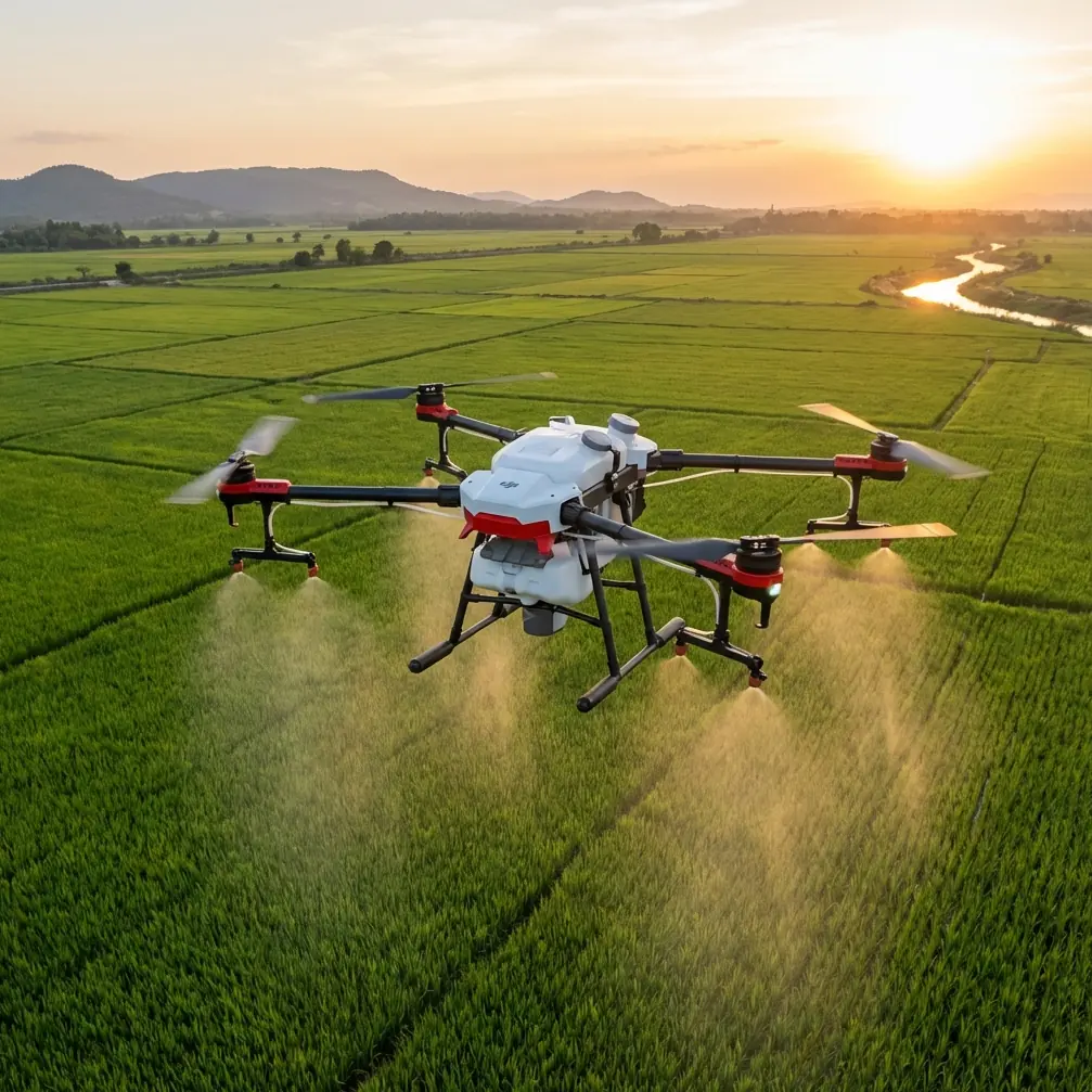
The inspection target was a semi-rural line segment with vegetation encroachment risk, crossarms partially screened by tree canopies, and several poles positioned near uneven ground where walking the route would have been slow and awkward. The brief was not to perform corridor-scale mapping. It was to collect close visual observations on line condition, attachment hardware, and tree clearance in the final light window of the day.
An aircraft built for long-range, wide-area coverage would have been excessive here. The need was precise movement, confident framing near obstacles, and a video workflow that would preserve detail well enough for later review. Avata was chosen because it can move through tighter inspection geometry while still giving the pilot enough confidence to work close to poles, branches, and line-side obstacles without turning every pass into a high-stress maneuver.
Low-light infrastructure work places unusual pressure on piloting discipline. Objects flatten visually. Depth cues weaken. The space between a line, a branch, and a pole top can look generous from one angle and disappear from another. In those conditions, obstacle awareness is not a convenience feature. It becomes part of the risk management stack.
Pre-Flight: Building the Flight Around Failing Light
The team built the sortie around three practical constraints.
First, the light level would drop fast over the tree line. That meant the most critical inspection angles had to be captured early, before contrast fell off too much around conductors and insulators.
Second, the route included clutter. Utility corridors often appear open from the road, but once you move laterally or descend to inspect hardware, side branches, guy wires, poles, and terrain all compete for attention. An agile aircraft only helps if the pilot respects those layers.
Third, the weather was unstable. The forecast suggested manageable conditions, but there was enough uncertainty to justify a shorter, segmented mission rather than one long exploratory flight.
This is one area where the Avata workflow helps. Because it is well suited to close-range visual capture, the pilot can divide the job into short, deliberate inspection blocks instead of forcing the aircraft into a broader pattern than the site really demands. That approach reduces exposure when conditions shift unexpectedly.
In the Air: Early Passes Along the Line
The first passes were clean. The pilot flew offset from the line rather than directly under it, using shallow lateral approaches to inspect pole-top assemblies and scan for vegetation proximity. In low light, this matters more than many newer operators realize. When you rush straight toward a structure, the closing speed can make poles and branches feel as though they materialize from the same visual plane. The offset approach preserves perspective and gives the pilot more time to judge distance.
Avata’s obstacle avoidance behavior was useful here, not as a substitute for skill but as a buffer against the visual compression that comes with dusk flying. Around power infrastructure, buffer management is everything. The drone does not need to touch a conductor to create a problem; getting too close to surrounding obstructions is enough to end the mission. A cautious setup with obstacle awareness enabled gave the pilot room to concentrate on framing and line-side observations.
The camera plan also mattered. Recording in D-Log gave the team more flexibility later when recovering shadow detail from dark tree lines and balancing exposure across sky, poles, and vegetation. For inspection work, the practical value of D-Log is not artistic flair. It is the ability to preserve more usable information when a scene contains both dim foreground elements and the last bright band of evening sky. On a job like this, that can be the difference between seeing line hardware clearly in review and seeing only muddy silhouettes.
The Weather Shift: Wind, Contrast Loss, and Decision-Making
About midway through the mission, the weather changed.
What started as a stable low-light window turned into a more complicated mix of rising wind and flatter contrast as cloud cover moved in. This is the point where many flight summaries become unrealistically neat. In practice, weather changes do not always force an immediate abort. Sometimes they simply narrow the margin and demand a different style of flying.
That is what happened here.
The pilot abandoned the original idea of making one more extended pass down the corridor and instead tightened the mission to a smaller set of high-priority shots around two poles with the greatest vegetation concern. This was the right call. When conditions worsen, the objective should shift from “finish everything” to “leave with the most decision-useful data.”
Avata handled the transition well because the airframe’s close-quarters character fits this kind of compressed tasking. Rather than fighting to maintain a broad route in shifting wind, the pilot could keep the aircraft working near the target structures, making shorter movements and holding safer stand-off distances. The weather did not improve the flight. It made discipline more visible.
That is an operational lesson worth underlining. Drone capability is not just what the aircraft can do in ideal conditions. It is what remains practical when the environment starts taking options away.
What Helped Most in the Moment
Three Avata-related factors stood out during the weather shift.
1. Obstacle awareness stayed relevant even as the mission narrowed
When wind picks up near trees and poles, small corrections become more frequent. In dim light, those corrections can eat into your spatial margin surprisingly fast. Obstacle avoidance did not “solve” the weather problem, but it supported a safer inspection style while the pilot worked in a cluttered corridor.
2. Stable, close-range framing beat aggressive coverage
This was not the time for cinematic distance runs. The useful footage came from measured positioning and short holds on hardware, line clearances, and branch proximity. Avata’s personality suits that kind of patient work better than many people assume from its FPV identity.
3. D-Log preserved the review value of the flight
Once the clouds rolled in, the scene lost contrast quickly. D-Log gave the editor more latitude to separate dark vegetation from hardware and maintain consistency across clips captured before and after the weather shift. For utility inspection teams, that means fewer “almost usable” files.
Where the Popular Smart Features Actually Fit
A lot of pilots ask whether features like ActiveTrack, subject tracking, QuickShots, or Hyperlapse matter on an infrastructure job.
Usually, not in the way consumer marketing suggests.
For power line survey work, subject tracking and ActiveTrack are not the main story because the “subject” is a fixed asset in a cluttered environment with serious proximity constraints. You are not chasing a cyclist down an open trail. You are trying to inspect static infrastructure while managing wires, poles, branches, wind, and light. In that context, manual control and deliberate positioning matter more than automation.
QuickShots are largely irrelevant for technical inspection. They can help create a site overview for stakeholder context, but they do not replace close assessment footage.
Hyperlapse has limited direct value for the inspection itself, though it can occasionally help document environmental context, such as cloud movement or site access conditions over time.
The more meaningful point is this: on a real power line job, the best “smart feature” is the one that quietly supports pilot awareness without pushing the flight into gimmicks. Avata is strongest when used that way.
Why This Case Says Something Bigger About Aircraft Selection
The mention of Terra Drone’s Terra A2 and Terra A1 deployment is useful here precisely because it underscores specialization. Terra Drone announced operational deployment on May 1, and the Terra A2 was described as a long-range, wide-area platform developed through a joint program with WinnyLab. Those facts point to a sector-wide pattern: mission design should drive aircraft choice.
For broad-area coverage, a long-range platform makes sense.
For close visual inspection in a narrow corridor at dusk, an agile aircraft with strong situational handling is often the better fit.
That is the operational significance. Too many drone programs still try to make one aircraft absorb every task. In infrastructure work, that usually creates compromises in data quality or safety margin. The better strategy is to match the tool to the geometry of the job. This Avata flight worked because the team did exactly that.
What the Utility Team Took Away
After review, the team identified enough visual evidence to prioritize trimming near two structures and schedule a follow-up daylight inspection on one hardware cluster that appeared serviceable but not fully conclusive in the evening footage.
That outcome is realistic and valuable. Not every low-light drone mission needs to deliver a final engineering answer. Sometimes the real win is narrowing uncertainty fast enough to direct the next field action intelligently.
The operators also adjusted their future low-light playbook in a few specific ways:
- Start with the most cluttered poles before light degrades further.
- Treat changing cloud cover as a trigger to shorten the mission, not push harder.
- Use D-Log routinely when shadow-heavy review is likely.
- Keep inspection passes compact once wind starts interacting with tree lines.
Those are small adjustments, but they are the kind that improve repeatability over time.
A Practical Word for Avata Operators in Inspection Work
If you are using Avata for utility-adjacent survey tasks, the biggest mistake is thinking of it only as a creative FPV platform. It can be much more useful than that when the job involves close observation, awkward terrain, and constrained access. The aircraft becomes especially relevant when the mission is too localized for a larger corridor platform and too obstacle-dense for a casual, high-speed approach.
The key is restraint.
Fly shorter segments. Build the mission around the best light you will get, not the light you hope will last. Let obstacle avoidance support your margins, but do not lean on it to rescue poor geometry. Capture footage in a profile that leaves room for interpretation later. And if the weather begins to move, reduce ambition before the aircraft forces the decision for you.
If you want to compare low-light inspection setups or talk through an Avata workflow for utility work, you can message the team here: https://wa.me/85255379740
That is the real lesson from this case. The Avata did not “defeat” the weather. It helped a disciplined pilot keep collecting usable inspection material after conditions deteriorated. In professional drone operations, that is usually what success looks like: not drama, not perfection, just enough control and clarity to come home with footage that moves the job forward.
Ready for your own Avata? Contact our team for expert consultation.