Avata for High-Altitude Solar Farm Surveys
Avata for High-Altitude Solar Farm Surveys: A Practical Field Method That Goes Beyond the Spec Sheet
META: A field-focused guide to using DJI Avata around high-altitude solar farms, with expert workflow tips, obstacle awareness strategy, D-Log capture advice, and when long-range LiDAR changes the planning equation.
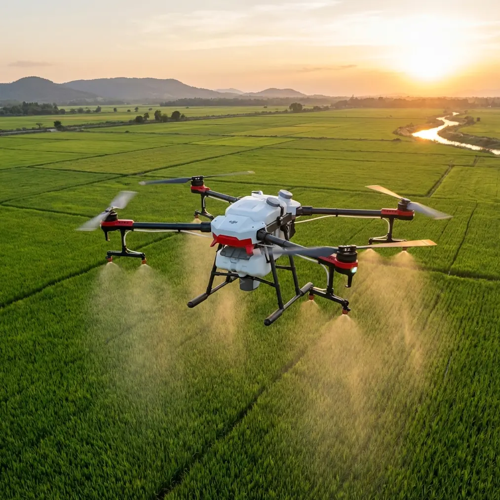
High-altitude solar farms expose every weakness in an aerial workflow.
Thin air reduces prop efficiency. Mountain light shifts fast. Panel rows create repeating visual patterns that can confuse a pilot and flatten depth perception. Wind spills over ridgelines, then drops into calmer pockets without warning. Add access roads that barely deserve the word “road,” and the survey plan that looked tidy on paper starts to unravel.
That is exactly why Avata has become such an interesting tool in this niche. Not because it replaces dedicated survey aircraft. It does not. And not because it suddenly turns a cinematic FPV platform into a full mapping rig. It does not do that either. Its value is more specific: Avata can handle close, controlled visual inspection passes in places where a larger platform is awkward, risky, or simply inefficient to deploy. For solar farms built in elevated, uneven, less-traveled terrain, that matters.
There is also a bigger industry shift worth paying attention to. DJI’s launch of the Zenmuse L3, described as its first long-range, high-accuracy aerial LiDAR system, signals where aerial data collection is heading. The launch messaging stressed two ideas that should resonate with anyone inspecting solar infrastructure in mountain environments: gathering data from multiple angles, and working effectively in roads-less-traveled field conditions. Those aren’t abstract marketing themes. They speak directly to the real-world challenge of understanding terrain, access, structures, and asset condition in places where line of sight, ground access, and elevation all complicate routine operations.
So if your reader scenario is surveying solar farms at altitude, the smart question is not “Can Avata do everything?” The smart question is “Where does Avata fit in a modern inspection stack, and how do you fly it properly so the footage is actually useful?”
That is what this guide covers.
Where Avata Actually Fits on a Solar Survey Job
Avata is best treated as a precision visual inspection aircraft for short- to mid-range tasking. On a solar farm, that means:
- close passes along panel rows
- visual checks on array alignment and mounting condition
- access-road scouting before heavier equipment moves in
- inspection of perimeter fencing and drainage channels
- follow-up observation of flagged problem areas found by other aircraft or ground crews
This distinction matters because too many teams try to force one aircraft into every role. In practice, high-altitude solar work benefits from layering tools. A larger enterprise platform may handle broad site data capture. A payload like the Zenmuse L3 makes sense when the job demands long-range sensing and high-accuracy mapping, especially in rough terrain where topographic understanding and multi-angle collection improve planning quality. Avata then fills the gap at the close-in level, where agility and proximity provide visual detail that higher-altitude collection often misses.
That combination is operationally significant.
The LiDAR side helps you understand the site at scale, especially in hard-to-reach sections and broken terrain. Avata helps you verify what those datasets mean in practical maintenance terms. One shows structure, grade, spacing, and site geometry. The other shows cable slack, debris accumulation, loose clips, panel edge condition, shade intrusion, and human-access concerns.
Different tools. Different altitude bands. Better decisions.
Why High Altitude Changes the Way You Fly Avata
A solar farm at elevation is not just a normal site with a better view. Flight behavior changes.
First, reduced air density affects how the drone generates lift. You will notice it in throttle response and in the way the aircraft holds itself during gusts. Even if the drone remains controllable, there is less margin for abrupt corrections. A pilot who is smooth at lower elevations becomes a much better pilot at altitude. A pilot who tends to jab the controls will create unstable footage and burn battery faster.
Second, the visual geometry of panel fields can be deceptive. Long repeating rows make speed feel slower than it is. Reflections can erase texture. Narrow service lanes can appear wider from the goggles than they really are. This is where obstacle avoidance awareness and disciplined route planning become more valuable than raw stick confidence.
Third, sunlight is harsher. High-altitude solar sites often produce sharp contrast between reflective panel surfaces, pale soil, and deep structural shadows. If you are documenting condition, not just making attractive footage, exposure discipline matters. D-Log becomes useful here because it preserves more grading flexibility when you need to recover detail in bright panel highlights and dark support structures.
Avata works well in this setting if you respect those constraints instead of trying to overpower them.
A Practical Pre-Flight Method for Solar Farm Inspection
Before you launch, separate the mission into three layers.
1. Site orientation
Walk or vehicle-scout the edges first. Identify:
- prevailing wind direction
- emergency landing options
- reflective hotspots at the current sun angle
- row spacing changes
- utility poles, cables, and inverter stations
- any elevation drop-offs hidden behind panel banks
This is the stage where a third-party accessory can materially improve results. One of the most useful additions I’ve seen in the field is a high-brightness anti-glare hood or sun-shield setup for the viewing interface, especially when pilots are alternating between planning screens and live observation in severe glare. Another practical upgrade is a third-party landing pad with weighted corners for rocky, dusty terrain. That sounds minor until rotor wash starts lifting grit into the aircraft at a mountain site. Small accessories often solve the problems that end flights early.
2. Wide visual reconnaissance
Your first Avata pass should not be the dramatic low run between arrays. Start higher and slower. The goal is to understand:
- turbulence zones near ridges or embankments
- where reflections are strongest
- which corridors are safe for closer work
- where maintenance vehicles or staff are moving
If you use subject tracking habits from other workflows, leave that mindset in check here. On solar sites, predictable route discipline usually matters more than following a moving object. ActiveTrack-style thinking can be helpful for maintaining framing logic around a technician or utility cart during documentation, but infrastructure inspection should lead the mission, not novelty flight modes.
3. Close inspection runs
Once the site reads clearly, move to repeatable paths:
- parallel to panel rows
- slightly offset from the array edge
- consistent altitude above the structure line
- reduced speed entering high-reflection sections
- gentle yaw only when needed for reveal or confirmation
That repeatability is what turns footage into usable documentation. Random FPV movement may look dynamic, but it is poor inspection practice.
How to Capture Useful Visual Data, Not Just Attractive Footage
A common mistake on solar farm jobs is over-prioritizing dramatic motion. Avata can certainly produce striking footage with QuickShots or Hyperlapse-style creativity, but most inspection teams need media that answers specific maintenance questions.
For example:
- Is debris collecting consistently on one section of the array?
- Are there visible signs of frame misalignment after wind events?
- Are cable runs sagging or exposed in accessible service corridors?
- Is runoff creating erosion near support footings or perimeter access lanes?
To answer those questions, fly with intent.
Use a repeatable angle set
DJI’s own Zenmuse L3 launch language emphasized collecting data from multiple angles. That concept applies just as strongly to visual inspection. On a solar site, one angle may hide a problem another angle reveals. A panel edge that looks clean head-on may show dust buildup, delamination signs, or frame distortion when viewed obliquely. A service road that appears passable from above may show rutting or washout only from a low side approach.
For Avata, that means structuring your passes:
- one elevated context pass
- one side-angle structural pass
- one lower detailed pass for suspected trouble spots
That three-angle habit makes your footage far more useful to operations teams.
Keep color workflow controlled
Shoot in D-Log when the lighting range is brutal. High-altitude environments often produce clipped reflections if you rush exposure settings. D-Log gives you more room to normalize the image later so engineers or maintenance managers can actually inspect detail. If your workflow ends with social clips or internal presentations, you can still grade for clarity first and aesthetics second.
Don’t overuse speed
Fast FPV lines compress decision time and reduce the interpretability of what you capture. Slower passes reveal more. They also reduce the risk of visual misjudgment around support posts, combiner boxes, and fencing transitions.
Obstacle Awareness Around Solar Infrastructure
Obstacle avoidance is often discussed too generally. On solar farms, the obstacle picture is very specific.
The main hazards are not always the tallest ones. They are the least visible ones:
- tensioned wires
- narrow posts
- cable transitions
- fence corners
- abrupt terrain changes between array blocks
- maintenance tools or staging materials temporarily left in service lanes
Reflective surfaces make this harder. Sun-glare can flatten the scene and make depth cues unreliable. In high altitude wind, even a modest lateral drift can narrow your clearance quickly.
The best mitigation is not a feature checkbox. It is route design.
Fly entry and exit corridors that give you room to recover. Avoid threading through panel gaps unless the mission absolutely requires it. Keep your turns outside congested zones. If a pass looks cool but leaves no margin, it is a bad inspection pass.
When Avata Is Not Enough
This is where the bigger DJI ecosystem becomes relevant.
DJI introduced the Zenmuse L3 as a long-range, high-accuracy aerial LiDAR system within the Zenmuse payload line for aerial data collection. That matters because some solar sites are simply too large, too topographically complex, or too difficult to access efficiently with visual-only close inspection methods. If the job requires terrain-aware planning, precise spatial modeling, or coverage of hard-to-reach sections across a broad footprint, long-range sensing has a different role than an agile FPV aircraft.
The “roads less traveled” positioning from the launch summary is especially relevant for mountain solar assets. Many of these sites are built where land is available and sun exposure is strong, not where logistics are easy. LiDAR-led collection can help teams understand grade transitions, service access, drainage behavior, and infrastructure context across the whole property. Avata then becomes the verification layer for specific physical observations.
That is the operational significance of the two systems living in the same discussion. Not overlap. Sequence.
Survey wide. Inspect close.
A Field Workflow That Works
If I were building a repeatable process for a high-altitude solar client, I’d keep it simple:
Use broad site data first
If available, start with enterprise data capture or existing site models to identify anomalies, access limitations, and topographic trouble areas.Plan Avata micro-missions
Break the site into manageable sectors: array edges, inverter zones, access roads, drainage paths, fencing, and recently serviced areas.Fly in low-wind windows
Morning often gives cleaner air and more consistent control, though glare direction should be checked before launch.Capture three-angle documentation
Context, side detail, and low verification pass.Grade for analysis
Use D-Log footage to preserve detail and standardize visual review.Flag action items immediately
Don’t leave notes for later. Mark locations and observed issues as soon as each sector is completed.
If you want to compare setups or field accessories with someone who understands this kind of workflow, you can message a drone specialist here.
What Makes Avata Valuable Here
Not every drone earns a place in a professional workflow simply because it can fly. Avata earns its place when the job needs intimate visual perspective in spaces that are awkward for larger aircraft and inconvenient for ground teams.
At a high-altitude solar farm, that can mean:
- checking terrain-adjacent arrays after weather events
- assessing service access before sending crews uphill
- documenting hard-to-reach perimeter issues
- collecting visual confirmation after broader site data identifies anomalies
And that circles back to the significance of DJI’s recent LiDAR direction. The Zenmuse L3 launch underlines a real market truth: aerial operations are becoming more layered, more angle-aware, and more useful in difficult field conditions. Avata is not the long-range, high-accuracy mapping tool in that picture. It is the close-range aircraft that gives context and confidence where precision visual observation still matters most.
Used that way, it stops being a toy for dramatic footage and starts behaving like a serious inspection instrument.
Ready for your own Avata? Contact our team for expert consultation.