Avata Field Report: What Shenzhen’s “Air First Responder”
Avata Field Report: What Shenzhen’s “Air First Responder” Vision Means for Remote Wildlife Survey Work
META: A field-based look at how Avata fits civilian low-altitude operations, using Shenzhen’s drone-as-public-service model to frame safer wildlife surveying, battery discipline, and practical flight workflow.
When a city starts treating drones as part of everyday public service rather than a novelty, it changes how professionals think about the aircraft in their own hands.
That is the real signal in the recent Shenzhen story about drones becoming “air first responders.” The headline sounds dramatic, but the deeper point is more useful: Shenzhen is pushing low-altitude applications beyond industry talk and into daily urban life, turning technical progress into practical convenience for ordinary people. That shift matters well beyond city logistics or emergency-adjacent public service. It tells us something about maturity. A drone platform stops being interesting merely because it flies, and starts being valuable because it can be trusted inside real operating systems.
For anyone surveying wildlife in remote areas with Avata, that distinction is not academic. It is operational.
I’ve spent enough time flying compact FPV platforms in difficult terrain to know that the wrong conversation usually happens first. People ask about speed. They ask about cinematic immersion. They ask whether QuickShots or Hyperlapse will make the footage look better. Those are fair questions, but in field survey work, the better question is this: can the aircraft translate technology into reliable, repeatable utility without creating noise, confusion, or extra risk for the mission?
That is exactly why Shenzhen’s example is worth studying through the lens of Avata.
A city-use story that reveals a field-use lesson
The source material is brief, but it carries two details that deserve attention.
First, Shenzhen is applying drones to public-service scenarios, including an “air first responder” role. Second, the city is not treating the low-altitude economy as a policy slogan alone; it is using it to improve actual daily life and make the benefits visible to citizens. Those two facts tell us that drone value is being judged in the real world by responsiveness, practical usefulness, and integration into human routines.
Wildlife survey crews face the same standard, even in remote landscapes.
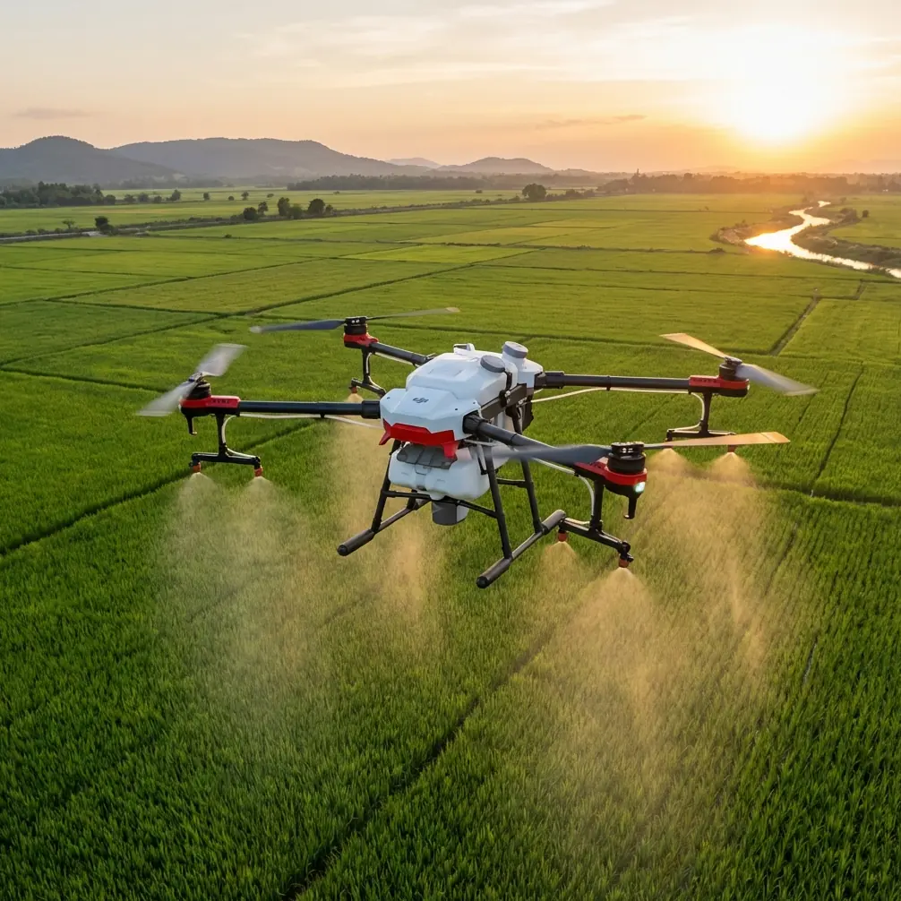
You are not flying for spectacle. You are trying to gather usable observations with minimal disturbance, often under time pressure, often in terrain that punishes mistakes. In that setting, Avata becomes interesting not because it is a traditional mapping aircraft—it is not—but because it can handle low-altitude visual access in spaces where larger platforms may be awkward, conspicuous, or poorly suited to close-quarters route finding.
The Shenzhen article is about civilian service delivery. Translate that into field biology, conservation support, or remote habitat monitoring, and the implication is straightforward: drone operations create the most value when they reduce friction between the task and the environment.
Why Avata makes sense for certain wildlife survey missions
Avata is not the aircraft I would choose for every wildlife mission. If the job is broad-acre orthomosaic mapping or corridor-level census over very large distances, there are better tools. But there is a category of wildlife surveying where Avata earns its place.
Think ravines, forest edges, rocky cut lines, riverbanks, mangrove channels, broken terrain, or areas where line-of-sight navigation around natural obstacles matters more than raw area coverage. In those environments, Avata’s compact form and controlled low-level maneuvering can produce observation angles that are difficult to achieve with more conventional airframes.
That is where obstacle awareness and route discipline matter more than headline specs.
People sometimes throw around terms like obstacle avoidance and ActiveTrack as if they are universal solutions. They are not. In wildlife work, these features are only useful when they support a clear survey objective. Obstacle handling helps when you are navigating irregular terrain, passing along canopy openings, or inspecting the edge of a nesting zone without forcing a wide, intrusive orbit. Subject tracking can help with controlled follow observations of larger visible animals in open areas, but only when local ethics, regulations, and species sensitivity allow it. The job is not to chase. The job is to observe with restraint.
That is the same design philosophy implied in Shenzhen’s low-altitude public-service push. A drone earns trust when it serves the environment it enters instead of dominating it.
The operational significance of “daily life” drone adoption
One phrase in the source stands out: Shenzhen is turning technology into daily convenience and making low-altitude use a tangible urban-life experience. That matters because routine use changes standards.
Once drones become part of normal civilian workflows, reliability expectations rise. Flights must be predictable. Procedures must be simpler. Data capture must be usable by people who were not on the sticks.
Wildlife surveying benefits from that same mindset.
With Avata, a good field workflow is less about squeezing every last second from the battery and more about building a repeatable sequence:
- pre-brief habitat sensitivity
- define no-fly buffer areas
- confirm launch and recovery points
- set visual route gates
- assign observer roles
- log battery temperature and cycle behavior
- capture footage in a format that supports later analysis
If you are recording in D-Log for post-processing flexibility, that decision should be tied to analysis needs, not aesthetics alone. D-Log is useful when lighting changes fast across cliffs, forest openings, and water surfaces, because it preserves more grading latitude for later review. In survey terms, that can help separate shadows from actual animal movement or improve vegetation contrast during desktop interpretation. The footage is not merely prettier. It is more readable.
QuickShots and Hyperlapse also have a place, though not in the way lifestyle marketing usually suggests. Hyperlapse can provide context for habitat transitions or approach corridors when building a visual record of a site over time. QuickShots are less about flair and more about standardized repeatable camera movement if you need comparative visual references from similar vantage points across multiple visits. Used carefully, these modes can reduce pilot variability between sessions.
That is the larger lesson from Shenzhen: once drone use becomes a service tool, every feature has to justify itself through utility.
A field note on batteries that has saved me trouble more than once
Here’s the battery tip I wish more pilots learned before a remote survey day.
Do not launch your first mission on the battery that looks strongest on paper. Launch on the battery that has had the most stable temperature transition into the field environment.
In remote wildlife work, batteries often move from air-conditioned vehicles or field cases into warm humidity, cold dawn air, or windy ridgelines. A pack that reads ready can still sag earlier than expected if its internal condition has not settled to ambient reality. I have had more predictable Avata sorties by letting packs acclimate in the shade, then rotating them based on temperature stability rather than simply flying the fullest one first.
My practical rule is simple: if conditions changed significantly during transport, I give the packs time to normalize and use the second-most-obvious battery first if it feels more thermally settled. That one choice can produce steadier voltage behavior during low-altitude maneuvering, especially in stop-start survey patterns where you are alternating hover checks, short pushes, and careful turns near terrain.
The second part of the tip is even less glamorous and just as useful: reserve one battery as a recovery buffer, not a mission battery. In remote habitats, landing options can change fast. Grass can hide a safe spot. Wind can shift over a ridge. Wildlife movement can force you to pause and reposition. If every battery is mentally assigned to “one more pass,” you have already made the wrong plan.
Battery discipline is what separates a satisfying flight from a reliable survey program.
Flying Avata around wildlife without turning the aircraft into the story
The ethical line in wildlife operations is clear. If the aircraft changes the animal’s behavior, your data and your judgment are both compromised.
That means Avata should usually be flown as a quiet visual access tool, not an assertive presence. Lower, slower, and closer is not automatically better. In many cases, a slightly more distant pass with stable framing yields more honest observations than a dramatic low sweep.
This is where Avata’s immersive control style can become either an advantage or a trap. The advantage is precision in constrained spaces. The trap is pilot temptation. FPV-style flying can make the route itself feel like the objective. It is not. The objective is evidence, pattern recognition, habitat insight, or species verification.
For remote survey teams, the best Avata footage often comes from boringly disciplined flights: a cautious ingress, a brief hover at an observation angle, a slow lateral drift to reveal terrain context, and an immediate exit once the necessary visual is captured.
If ActiveTrack is used at all, it should be used conservatively and selectively. Any automated follow behavior must be subordinate to species welfare, local rules, and common sense. There is a major difference between documenting movement at a respectful standoff distance and pressuring an animal into movement for the sake of cleaner footage. One is fieldwork. The other is interference.
From Shenzhen’s city model to remote conservation practice
At first glance, Shenzhen’s “air first responder” story and a remote wildlife survey with Avata seem like unrelated worlds. One is urban public service. The other is field observation in isolated terrain. But the underlying logic is the same.
In Shenzhen, drone deployment is being judged by whether innovation reaches real life and makes it better. The source emphasizes that low-altitude activity is not just an industrial concept there; it is something citizens can actually experience in practical terms. That is operational significance, not branding.
The same threshold should apply in conservation and survey work.
A drone sortie is worthwhile only if it improves the mission in tangible ways: safer access to difficult viewpoints, less time spent traversing sensitive ground, faster confirmation of habitat conditions, and cleaner visual records for later interpretation.
Avata can contribute to that workflow when the task calls for close-environment navigation, immersive line management, and high-control visual observation. It is not the universal answer. It is a specialized tool that becomes powerful when used with discipline.
That is also why crews need strong planning culture. Before every flight, I want answers to a few unromantic questions:
- What exactly are we trying to verify?
- At what point will the aircraft create more disturbance than value?
- Which route gives us visual access with the least ecological footprint?
- What battery reserve do we need for an unplanned exit?
- Are we collecting footage for immediate spotting, later review, or both?
Those questions matter more than any headline feature.
Building a better Avata workflow for remote surveys
If you are integrating Avata into a wildlife survey kit, build the system around consistency.
Use D-Log when later image interpretation matters. Use obstacle-aware route planning to avoid impulsive low passes. Use standardized camera movements instead of improvising every sortie. Use Hyperlapse sparingly for habitat context over time, not for drama. Treat tracking tools as optional aids, not mission logic. And never let battery optimism dictate route length.
The professionals getting the best results from compact drones are usually the least theatrical about them. They think like service operators. In that sense, Shenzhen has already pointed to the right model. Drone work succeeds when advanced hardware disappears into dependable public value.
That is true in a dense city trying to make low-altitude systems useful in daily life. It is also true on a remote survey line where a small aircraft helps a team observe wildlife with less ground disruption and better situational awareness.
If you are refining an Avata setup for field use and want to compare workflow notes with someone who understands practical deployment, you can message here on WhatsApp.
The aircraft is only part of the equation. The real asset is a method that stays calm under field pressure, respects the environment, and returns with footage you can trust.
Ready for your own Avata? Contact our team for expert consultation.